The Historic Kill Devil Pack Track gives trampers a rare opportunity to do a four-day walk with minimal evidence of modern interference, amid traces of the gold mining days.
The track runs from Uruwhenua to Anatoki, both in Golden Bay – or vice versa. From Uruwhenua, it’s a long, uphill zigzag for about three hours with an ever-expanding view of the Takaka Valley. Midday in summer, there is limited shade so take plenty of water.
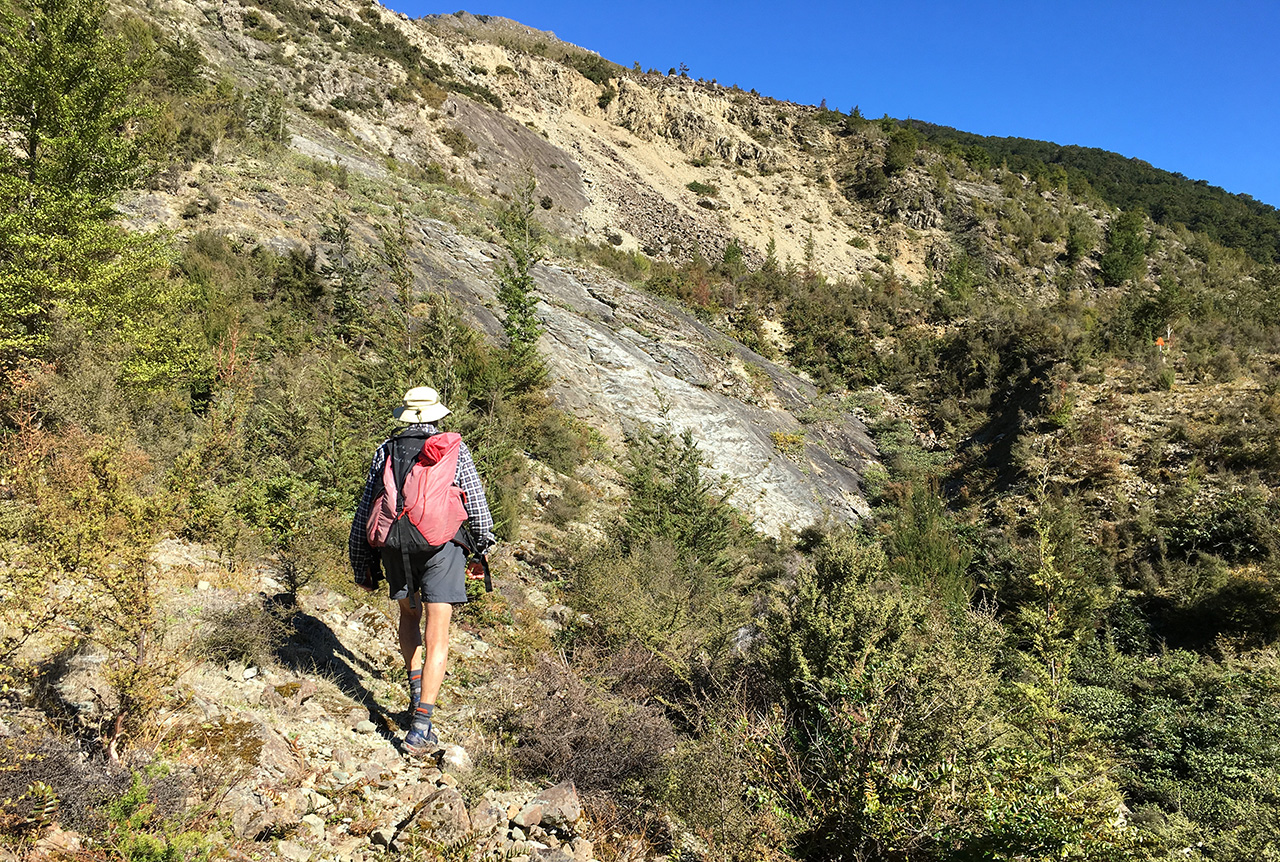
Once on the ridgeline, the track is an easy lope with far-reaching views into the Salisbury Valley – it is mountain drama of steep valleys to the Stanley River below.
After an hour along the ridge, the track reaches the turn-off to Tin Hut. Another hour and it reaches the turn-off to Riordans Hut, 15 minutes from the main track.
From here, the track descends into bush and crosses numerous creeks to the valley floor. Just before Waingaro Forks Hut, there’s a swingbridge over a small gorge and there, suddenly, in a clearing, is the hut. The river is five minutes away.
Until recently, it was seven to 10 hours to the Anatoki Forks Hut but there is now Soper Shelter about midway. Named for Frank and Berna Soper, founders of Golden Bay Alpine and Tramping Club, the shelter is a replica of tent shelters built by government deer shooters and surveyors of NZ Forest Service through the 1930s to 1970s. Its construction team included John Taylor, Wayne Sixtus, Tony Hitchcock and members of GBATC.
From Waingaro Forks Hut to Soper Shelter includes the scramble across the boulders and scree of a huge slip on the north face of Mt Snowden. It fell in the Murchison Earthquake on June 17, 1929 and blocked the Stanley River to form Lake Stanley.
In 1971, local hunters built Smokey Drip Hut on the western side of the slip but DOC removed it in 1997 due to avalanche risk – and because it was smokey and drippy. Soper Shelter replaces it.
The track is up and down, uneven and at times deviating to rock hopping up the riverbed. Shortly after the slip, the track meets the lake – a poignant view of dead trees standing in clear, gold-tinted water.
Soper Shelter is another hour away at the head of Lake Stanley. The shelter’s basic construction is four A-frames which support a central, longitudinal beam. This supports a fly over canvas walls and a smaller, inner sleeping tent. Inside is a packed earth floor and sleeping for three.
Another six hours leads to the standard, six-bunk Anatoki Forks Hut with evidence of gold mining days nearby. From here it is eight hours to the road end at Anatoki – and back to the 21st century.