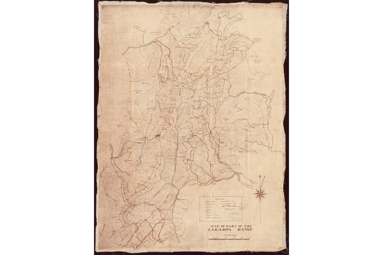
The unsigned and undated copy of Map of Part of the Tararua Range spent 25 years under tramper Linden Eagles’ bed before she donated it to the Alexander Turnbull Library (ATL) in 2021, where it was restored.
It seems the map may have been drawn by amateur cartographer W.C. Duncan prior to 1939.
Tararua Tramping Club (TTC) chief guide Paul McCredie says a copy of the same map in the club archives includes what appear to be hand-drawn annotations and ‘?1934, W.C. Duncan’ written on the back.
McCredie says former ATL map librarian Phil Barton referenced the TTC copy in an article about Tararua mapping that he wrote for the Otaki Historical Society Journal. In it, Barton attributes the map to Duncan and dates it ‘1934?’.
The words on the back of TTC’s copy were possibly added by its archivist after Barton had viewed the map and given his opinion as to its origin. This can’t be verified, as Barton died in 2010.
Barton’s article states, ‘[An] amateur cartographer of whom little is known is W.C. Duncan. His maps … cover the central and southern parts of the range.’ Barton notes another map by Duncan showed bearing angles between peaks, which suggested he may have had access to Lands and Survey department plans and field books.
About the author
Samantha Mythen
Walk Shorts writer Samantha Mythen is currently adventuring around the world, writing, hiking and cycling. She studied law but is now a journalist. She has worked for RNZ and freelanced for global publications, including Japan Today.
Mt Somers via Te Kiekie Route, Hakatere Conservation Park
Subscribe!
Each issue of Wilderness celebrates Aotearoa’s great outdoors — written and photographed with care, not algorithms.Subscribe and help keep our wild stories alive.