Escape from the capital for the day and take a walk on the wild side, with access made easy by public transport.
Although the Escarpment and Mākara tracks are common capers along Wellington’s coastline, the slightly more rugged Wairaka Walkway, between Pukerua Bay and Plimmerton, flies under the radar.
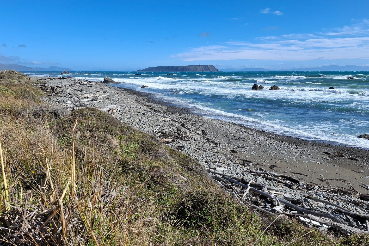
At Pukerua Bay, a pou to Tangaroa welcomes walkers. The clearly defined track soon passes through a rock arch into Pukerua Bay Scientific Reserve, home to fur seals and birds such as kōrora and matuku moana. This section also affords great views over your shoulder to Kāpiti Island and the Paekākāriki Escarpment.
Wairaka Point is less than 2km from the start and marks the edge of the scientific reserve. Navigating the rocky promontory requires the quickest of clambers and is one of the few sections that would be truly impassable at high tide or in tricky conditions. For this reason, it’s better to start at Pukerua Bay than Plimmerton, as it’s easier to turn back if needed.
The beach beyond Wairaka Point remains steep and stony, but broadens slightly. I visited during a decent swell and rising tide, and in some places there was little room to manoeuvre. There’s a sense of remoteness and wildness out here – you’d never guess a four-lane highway is on the other side of the sheer coastal hills.
The beach narrows before Haukōpua Point where it comes up against a large active slip (about 6km from Pukerua Bay). If following the beach is unsafe or feels too close for comfort, navigate up and alongside the slip. Gain 60m of vertical to a trodden path across the slip. This leads to a grassy shelf that slopes gently towards a ravine. Regain the beach at the ravine.
The walkway passes an old quarry at Haukōpua Point as it turns towards Te Rewarewa Point. The track soon becomes an obvious 4WD road. You are now looking straight across Raukawa Cook Strait, with Mana Island its northern fortress. It’s easy to see why, in the early 1820s, Ngāti Toa chief Te Rauparaha used this area as a strategic stronghold from which to gain control of Te Waipounamu.
The 4WD drive track curves into Hongoeka Bay and past the marae that takes its name. There are some nice places to sit near the end of Moana Road, where the walkway ends.
It’s now a 2km walk to Plimmerton Station. Follow Moana Road along Karehana Bay and around Taupō Point to Plimmerton Beach. It’s worth mentioning that we commemorate this place as Plimmerton after John Plimmer, the ‘Father of Wellington’, yet Taupō was a major pā site and papakāinga for Ngāti Toa and Te Rauparaha years earlier.
History aside, Plimmerton Beach is an avian haven, and the place many turn to for spotting terns.
Wairaka Walkway is well connected to frequent commuter rail services, with Pukerua Bay and Plimmerton Stations the access points.
Further information: See Metlink for timetables and updates for Kāpiti line train services.