The southern flanks of the Serpentine Range, which traverses Mt Aspiring and Fiordland national parks, include the incredible Lake Wilson and can be reached from the Routeburn Track.
Head along the Routeburn Track as far as Harris Saddle. Skirt the western shore of Lake Harris and walk north up the Valley of the Trolls.
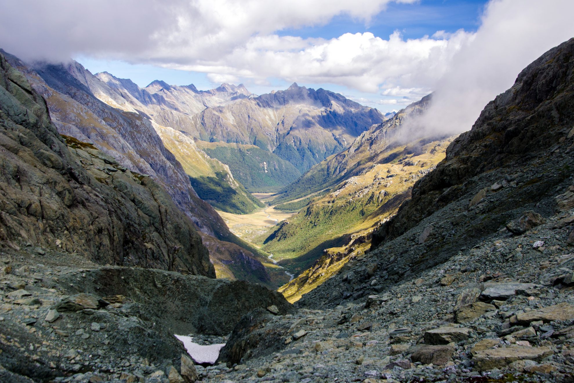
There are steep crags at the head of the valley, hemming the southern edge of Lake Wilson, 200m above. Keep right and follow the eastern stream draining Mt Xenicus to reach the head of the stream, at 1480m. The route then continues to the flat top of a spur at 1520m, where there are views of the enormous Lake Wilson basin. The lake is at the heart of a great circle of rocky peaks. The glacier-draped Darran Mountains fill the backdrop. There are camping spots above the lake.
From the lake, head north, dropping to a sidle beneath Mt Erebus. There is chunky scree towards the ridge. From the ridgetop, there are views across to the Humboldt Mountains and down into the Route Burn North Branch 900m below. The Serpentine Range can be seen ahead, winding between Fiordland and Mt Aspiring national parks. Head through tussock, rock, alpine plants and small tarns along the ridgetop, avoiding small bluffs. Moir’s Guide recommends sidling east under Pt1715. There is a rock biv part-way along this route.
There is also a sheltered tarn, just below Pt1550, which provides a good camping spot.
From this dip in the ridge, head west to climb the spur ahead. At the top of the hill at Pt1550, there is an imposing view of all the knobbly rock and steep drops towards North Col.
This is a crucial part of the route. Moir’s Guide advises avoiding this steep section by staying on the west side of the unmarked hump between points 1550 and 1555.
From there, scope out a route over the rocks and look for good handholds to reach North Col.
Descend down the valley into the Route Burn North Branch. There is an old rock biv at the bottom of the col. Walk down the Route Burn, keeping an eye out for the cairns in the scrub. There is then a vast boulder garden with a confusing number of cairns. Between huge mossy boulders there are sheltered water gardens. Route finding becomes simple again on the wide grassy flats.
There are good camping spots on the valley floor by the river. From here, continue down the valley to the Routeburn Track and back to the start of the trail.

34 years of inspiring New Zealanders to explore the outdoors. Don’t miss out — subscribe today.

Questions? Contact us