Take the Summit Track to Pinchgut Hut for a reasonably challenging trip with expansive views.
All the multiple routes to Pinchgut Hut start at the Wooded Gully Campsite. The quickest, most direct is the Ridge Track. However, the Summit Track via Mt Thomas provides a more encompassing walk and makes the most of the park’s expansive views.
This track begins alongside a forestry road before turning directly up the face of Mt Thomas and climbing steeply through pine forest. It’s simple walking but the gradient is unrelenting, and elevation is quickly gained to Pt752, which is 1km and 270m from the summit of Mt Thomas.
Near the top, there’s a forestry road from which the 1023m summit is easily reached within a few minutes. The views are expansive across Canterbury and the smaller ranges surrounding the Southern Alps.
From the summit, take a left onto Saddle Track and continue along the ridge, passing the junction to Wooded Gully Track on the left after about 1.5km. On a good day there are incredible views of the entirety of Mt Thomas Forest, Puketeraki Range, Mt Oxford and distant Mt Hutt.
A dusting of snow on the ground in winter makes this tops section a real treat as the mountains sparkle in the distance.
Continue past the junction with the Ridge Track (signposted at left) onto Bobs Camp Route and over Pt1043. The undulating ridge passes through patches of beech forest, which makes the track more unruly underfoot, and along a section of slightly exposed ridgeline. The views are marvellous, but the steeper, narrower track demands attention.
A final stint of climbing through beech forest leads to Pt953 and the Whare Route junction.
Turn right along the Whare Route. It is mostly downhill and alternates between grassy clearings and mixed beech and kānuka forest for the next 3.5km. This track is not as well worn. Midway down there is a steep section where care is essential. The rest of the route is a more agreeable gradient, and as the forest gains in height, birdsong becomes more prevalent.
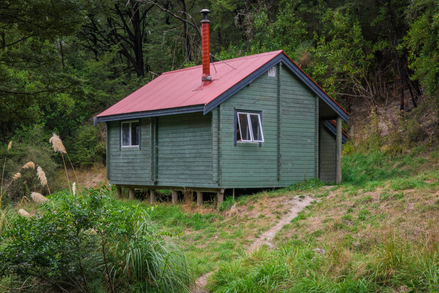
Pinchgut Hut is in a clearing on the eastern bank of Pinchgut Stream. The hut receives little sunlight in winter due to its location in the heart of the valley, but the solid wooden structure retains heat well once the wood burner gets going. The toilet was replaced in April, 2025.
Return as you came, or for a round trip take the more challenging Cattle Peak Route via Bobs Camp Bivouac.
Watch out for wasps in the area, especially during summer.