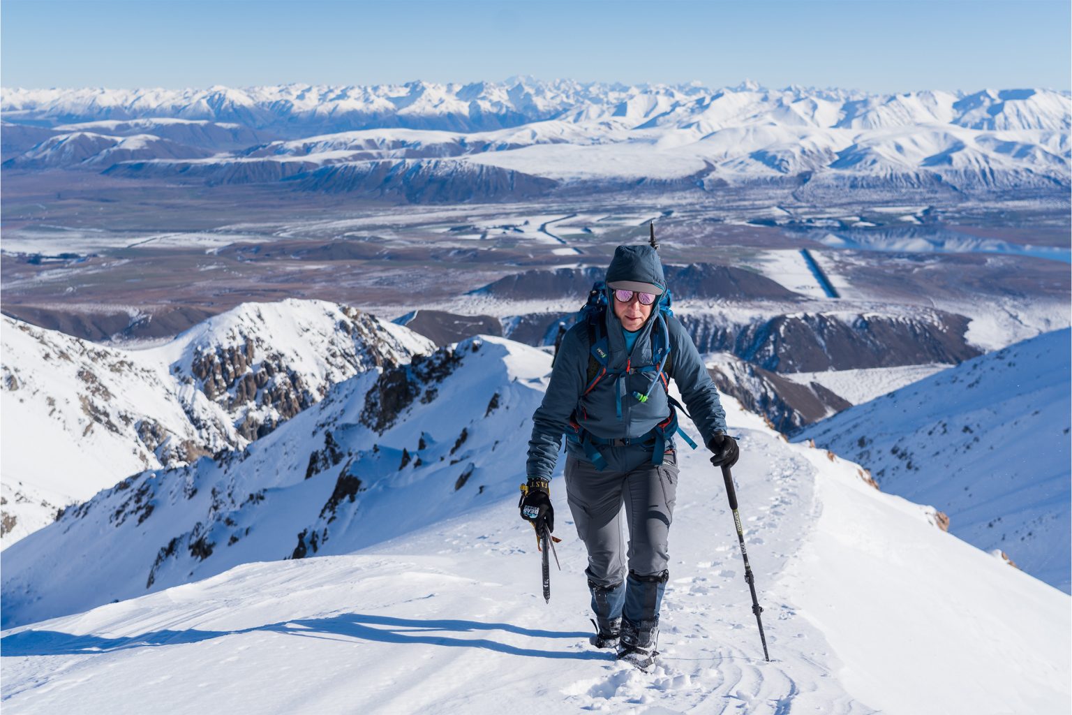
Climb the highest peak in the Canterbury foothills for outstanding views and inspiration for trips to come.
Wedged between the Southern Alps and the Canterbury Plains are the Canterbury foothills. A reminder of the constant battle between tectonic uplift and glacial erosion, these mountains offer a unique alpine experience to those willing to venture off trail.
The highest of these foothills is Mt Taylor (2333m).
Situated within Hakatere Conservation Park, this stark landscape supports a surprising level of biodiversity. Lakes, rivers and ephemeral tarns breathe life into Ōtuwharekai Ashburton Lakes, an area recognised as one of the best intermontane wetland systems in the country and one of three wetlands in the Department of Conservation’s Arawai Kākāriki national wetland restoration programme. Here you can see rare species such as kakī black stilts and ngutu parore wrybill. Ōtuwharekai also has the highest diversity of lizards in New Zealand.
The name Ōtuwharekai (‘banquet hall’) describes the richness of the area, which was an abundant mahinga kai for early Māori.
A climb of Mt Taylor offers a rewarding perspective of this unusual environment. The west ridge is straightforward and is do-able in a long day. Involving more than 1600m of height gain, the view from its summit is likely to inspire further trips into this accessible alpine playground.
From Ōtūroto Lake Heron car park, follow the Swin River Track to Double Hut. The 10km trail is easy walking (or biking) across the flats, on a vehicle track at first, then a marked and obvious track that altogether climbs 200m to Double Hut. Biking to and from the hut is quicker and also more enjoyable at the end of a long day’s climb.
The track crosses the Swin River before heading up to the hut. It is an easy crossing and likely to be only calf-deep. The route also crosses Te Araroa Trail so Double Hut can be busy. There are plenty of spots to camp at the hut or further up the west ridge.
From Double Hut, leave the track and head up the scenic South Branch of the Swin River for about 2.5km. It is rugged and gorged in places, so sticking mainly to the rocky riverbed provides relatively easy travel until reaching an obvious fork in the river at around 1060m.
Take the branch on your right (true left branch) and head upriver for about another 50m. The river is the last source of water on the climb.
From here, scramble up snow tussock on the true right (northern side) of the river. Head up and around a small rock outcrop to gain easier ground leading up to the major ridge line – the west ridge of Mt Taylor. Once on the ridge continue up moderate scree slopes to Pt1766 and Pt2062 all the way to the summit. Skirt around any rock knolls where necessary or scramble over if preferred.
The summit of Mt Taylor is at the apex of the Taylor, Old Man and Mt Somers ranges, so it offers an outstanding view of Ōtuwharekai and the inland peaks of Kā Tiritiri o te Moana. When descending, it is possible – and probably more fun – to take the broad scree slope down the northern side of the west ridge (west of Pt2084) and then follow the stream branch back to the main river junction. Arguably, Mt Taylor is best climbed in winter or spring with snow on its upper slopes (take an ice axe and crampons).
An alternative and longer climb of Mt Taylor can be done from Woolshed Creek. From the Woolshed Creek car park, head up to Woolshed Creek Hut. From the hut, gain the ridge on the climber’s left and follow it to Quaker Saddle, then continue along the ridge to the summit. Descend Taylors Stream and move back up to Peache Saddle before following Woolshed Creek back to the hut.


