From Gladstone Downs, head up the Hodder River. The narrow ravine cuts through steep, broken hinterland, hemmed in by vertiginous, crumbling walls that rise to a slash of blue sky above.
An hour upriver is the confluence where the Shin flows in. Somewhere up above is Shin Hut, but it can be hard to find.
Five hours upstream, the river requires criss-crossing the turbulent torrent as it slices through an ominous gorge. As the landscape steepens, the force of the current intensifies, so you may need to team up to tackle the most dangerous fords.
Topping out of the second gorge, there’s a waterfall, and a quirky blue plastic marker indicates a rough sidle track on the true right. This ‘up-and-over’ is steep and eroded. The track then leads to a narrow path that soon drops through a copse of totara into the river. A couple of clicks later, the twin Hodder Huts can be seen ahead, perched precariously on a grassy rib, high above the Hodder.
From the huts, the track then sidles along scree slopes above a deep slot canyon, where white water surges through, hits a wall, and bounces around a bend.
Half an hour later, hop over the Hodder to a prominent rock cairn. A solitary marker pole indicates where the track climbs above the mouth of Staircase Stream. Many parties miss this, though the route is merely a light ground trail, marked with spasmodic cairns.
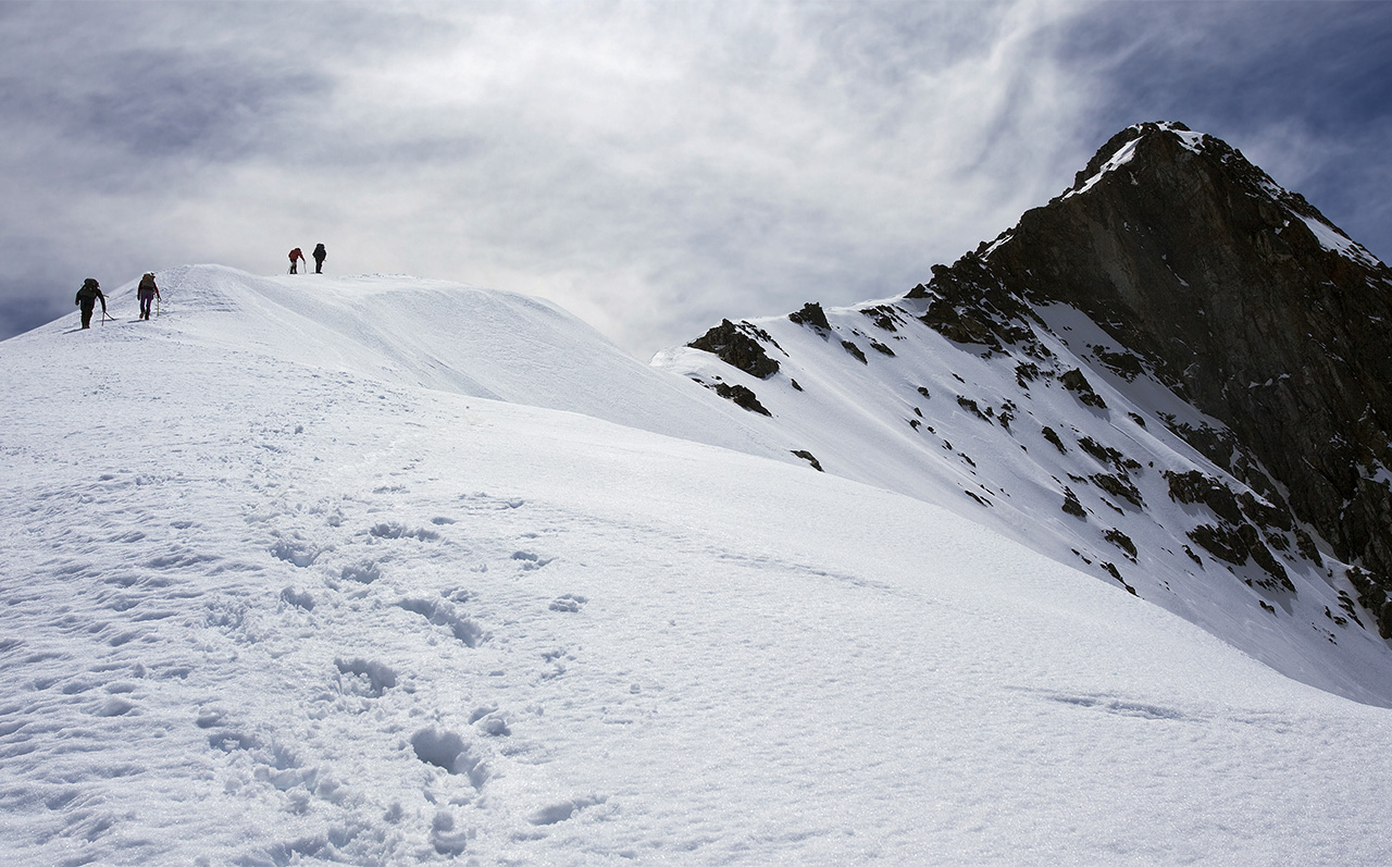
At the first snowy slope, crampons and ice axes will be needed for the zigzag up the 30-degree slope.
A broad snow plateau offers a good lunch spot, with views of the menacing north face of Mt Alarm, rearing above the head of Staircase Stream. To the west, the rock pyramid of Mitre is equally impressive, being the highest point on the Red Hills. The summit spire of Tapuae-o-Uenuku is within spitting distance, but a full hour away.
Tapuae-o-Uenuku rises in a shadowy silhouette; the angle of ascent is 45 degrees; nothing too technical.
At 2885m, this is the highest peak in New Zealand north of the Southern Alps.
It’s fast progress toward the huts, and more fording of the Hodder River before reaching safety.


34 years of inspiring New Zealanders to explore the outdoors. Don’t miss out — subscribe today.

Questions? Contact us