An easy overnighter on the edge of Whanganui National Park.
Ōmaru Hut is just a stone’s throw from the Forgotten World Highway and the Republic of Whangamōmona, at the edge of Whanganui National Park on the historic Matemateāonga Track. Its location makes this eight-bunk serviced hut a prime destination for a weekend walk.
The track starts at Kohi Saddle (Upper Mangaehu Road), an hour’s drive from Strathmore on SH43. Cross the road from the car park and clamber over a stile to follow a 4WD track for a short section to a DOC sign that marks the beginning of the Mate- mateāonga Track.
The wide and level track is a remnant of a road built in 1911 that followed an older Māori route along the Matemateāonga Range to the Whanganui River. A planned bridge to complete a link between Stratford and the main trunk line at Raetihi didn’t eventuate as World War One intervened. In 2021 the Backcountry Trust, in collaboration with DOC, engaged a team from Ruapehu WorX to restore the track, which was becoming overgrown. It is now in excellent condition, although some sections can get muddy.
The track weaves through the bush, and if you look carefully you might catch a glimpse of a shy native kōura (freshwater crayfish) in the streams. After 45min, at the junction with the track to ‘the letter boxes’ and Pute- ore Hut, continue straight to cross Tanawapiti Stream before descending to Ōmaru Hut.
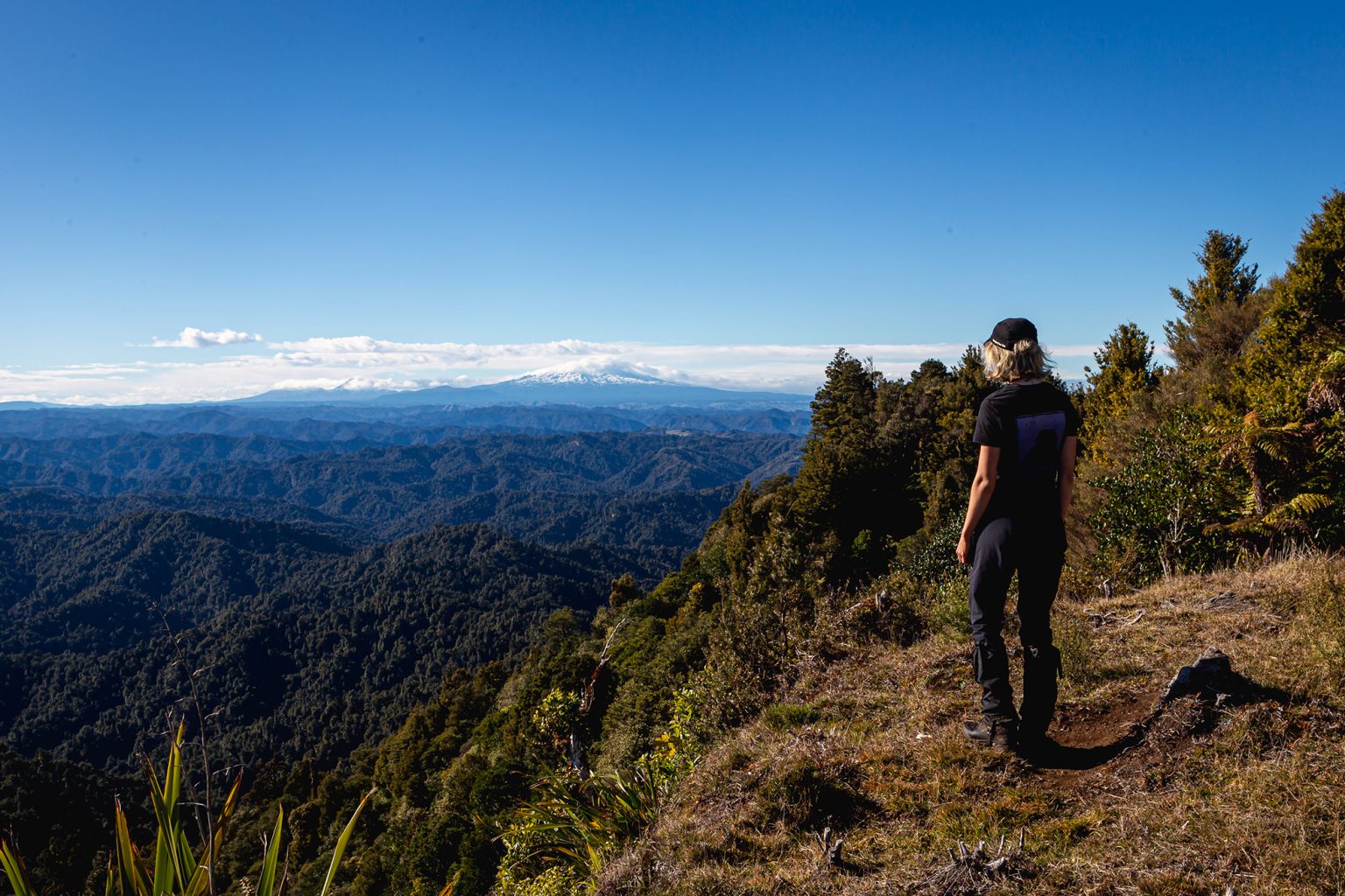
A great addition to this trip is a walk to the trig on Whakaihuwaka Mt Humphries (732m). Whakaihuwaka towers over the surrounding hill country and offers panoramic views to Taranaki in the west, Mt Hikurangi in the north and the volcanic Central Plateau in the east. The route to Whakaihuwaka begins behind Ōmaru Hut, continuing along the Matemateāonga Track as it follows the ridgeline. After about an hour (5km) the track leaves the ridge and traverses the northeastern flank of Whakaihuwaka. Bridges span small streams and Ruapehu can be glimpsed between ponga. After around 30min (2.5km) the turn-off for the Whakaihuwaka summit track is reached. Unlike the flat Matemateāonga Track, this ascends steeply through bush for 150m and passes an impressive limestone cliff studded with fossils. The track then undulates for 700m along the top of Whakaihuwaka before reaching a grassy clearing next to the trig.
Distance
14.2km to Whakaihuwaka Mt Humphries trig
Grade
Easy
Time
To Ōmaru Hut, 1.5hr; to Whakaihuwaka Mt Humphries trig, 3–4hr one way
Your device does not support GPX files. Please try a different device.
About the author
Sam Harrison
Sam Harrison is a chocolate addict who tramps on the side. When he’s not in the bush he can be found pushing paper for a government department in Te Whanganui-a-Tara. Sam graduated from the University of Otago in 2021 with a Bachelor of Law, a Bachelor of Arts, a large student loan and a love of all things tramping. He is easily identified in the hills by his oversized camera and his distinctive knack for finding type II fun.
Mt Somers via Te Kiekie Route, Hakatere Conservation Park
Subscribe!
Each issue of Wilderness celebrates Aotearoa’s great outdoors — written and photographed with care, not algorithms.Subscribe and help keep our wild stories alive.