The Raukumara Range of the North Island’s rugged East Cape is home to Aotearoa’s northernmost alpine zone and the island’s highest non-volcanic peak.
The solitary and commanding massif of Mt Hikurangi (1752m) is sacred to Ngāti Porou and is the first place in the world where the sunlight of a new day touches Earth. But for reasons beyond the anticipation of warm sunlight on your face after a cool climb in the early hours, it’s a compelling rite of passage for any keen tramper.
Some would not consider the long farm track climb to the subalpine zone of the mountain’s upper reaches to be a classic tramp, but a trip to Hikurangi is about more than immersing oneself in untamed wilderness.
Google Earth is a good place to begin to appreciate Hikurangi’s isolation from its Te Ika-a-Māui mountain cousins. This peak’s ridgeline cuts an imposing figure above the sprawling bush of the Raukumara Range and is a considerable distance from the next closest open tops, on the Kaweka Range to the south west.
Hikurangi is notable as the highest non-volcanic mountain in the North Island. If you find yourself sitting among the tussock and hebes on the summit ridge, it’s worth acknowledging that you’re surrounded by the northernmost reach of New Zealand’s unique alpine flora. The open views from this route allow plenty of time to appreciate the sharply folded hill country of East Cape.
From a parking area a short distance above Tapuaeroa River, a poled route ascends a dirt road and ridge-top farm track across the rugged farmland of Pakihiroa Station. Offering increasingly panoramic views of the surrounding ranges, the route climbs steadily to 1090m, where an impressive group of tall wooden whakairo (sculptures) stands. Representing the demigod Māui-tikitiki-a-Taranga and his family, these pou were commissioned by Te Rūnanga o Ngāti Porou to commemorate the new millennium in the year 2000. Māui is regarded as an ancestor by Ngāti Porou and tradition holds that his petrified waka, Nukutaimemeha, rests on the mountain.
Hikurangi Hut (private, permission required from Te Runanganui o Ngāti Porou) is 100 vertical metres of easy walking further on. Built in 1961 from materials hauled in by pack horses, this eight-bunk hut is showing its years but makes a welcome climbing base. From the hut it takes two to three hours to gain the summit ridge via an unformed tramping track. If the weather is clear and you have sufficient experience and lighting for a night climb, the early start required to experience sunrise from the ridge is well worth it.
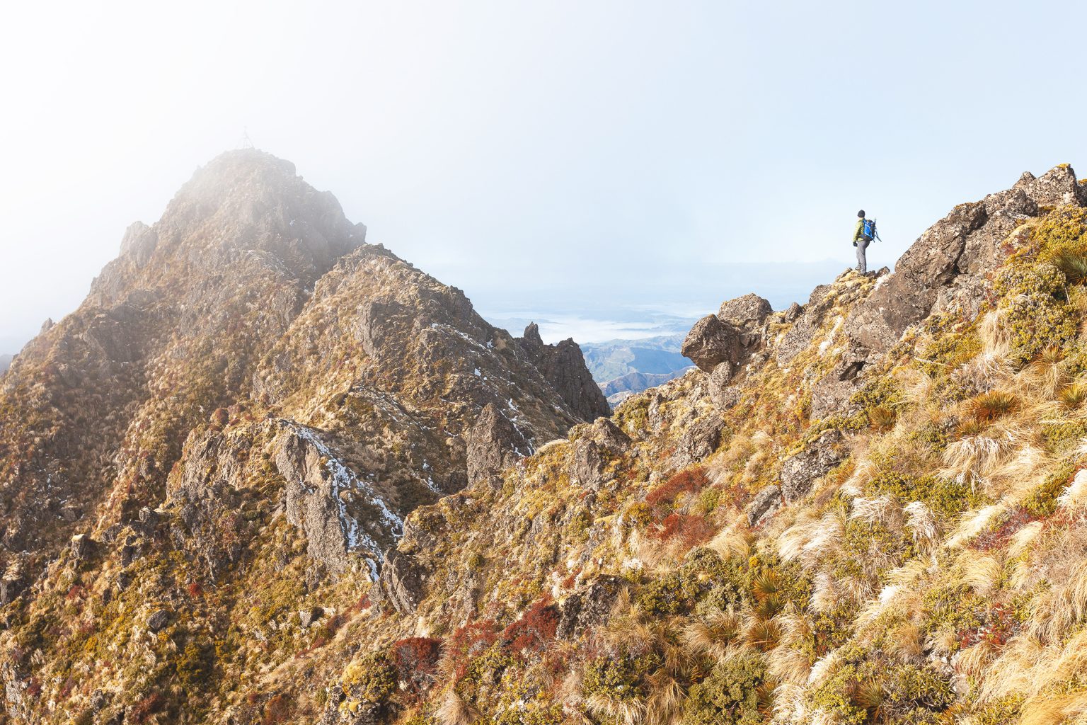
Beyond the hut the track soon departs the farmland to cross a patch of bush and emerge on the open slopes of the upper mountain. The route sidles south along a bench for about 750m at around the 1430m contour before climbing to a scree slope below the mountain’s craggy upper ramparts.
At 1540m the route enters a steep scree gully and ascends 150m to a col between Hikurangi’s twin summits. During the colder months this shady southwest-facing gully can be icy or snow covered, requiring extra caution and sometimes ice axe and crampons. The lower northern peak is a short scramble from the col and is a perfect spot to absorb remarkable views of the surrounding landscape and out to the Pacific.
— Mt Hikurangi is one of our 75 Top Trampers’ Peaks.
Further information: Public access to Hikurangi is closed from noon on 31 December to noon on 1 January for the Hikurangi Maunga Dawn Event. The track from the car park to the hut is closed every October for lambing.