Mt Alfred/Ari is a wedge-shaped monolith, formed when the Dart Glacier split into two streams, and stands more than 1000m above the surrounding valleys.
Draw a 20km circle around it and you encompass much of the Humboldt, Ailsa, Forbes and Richardson mountains. It couldn’t possibly fail to be an outstanding viewpoint.
Starting on the western side, a couple of kilometres from the Dart Bridge, the track’s job is to get you up that 1000m to the summit ridge, and it’s got just over 2km to do it, so there’s no mucking around.
It’s a steady zigzag on a benched formation for the first 45-minutes. From there, it’s pretty much a case of following the fall line until the bushline is reached in another 45-minutes.
Although there’s no marked track above the bushline, there’s a very obvious ground trail and, apart from a couple of bits that require a slither on the way down, nothing is difficult.
The 1375m summit is to the north, but if you initially head south for a couple of minutes there are more extensive views over Lake Wakatipu.
Then it’s a 20min easy walk to the north to gain the actual summit.
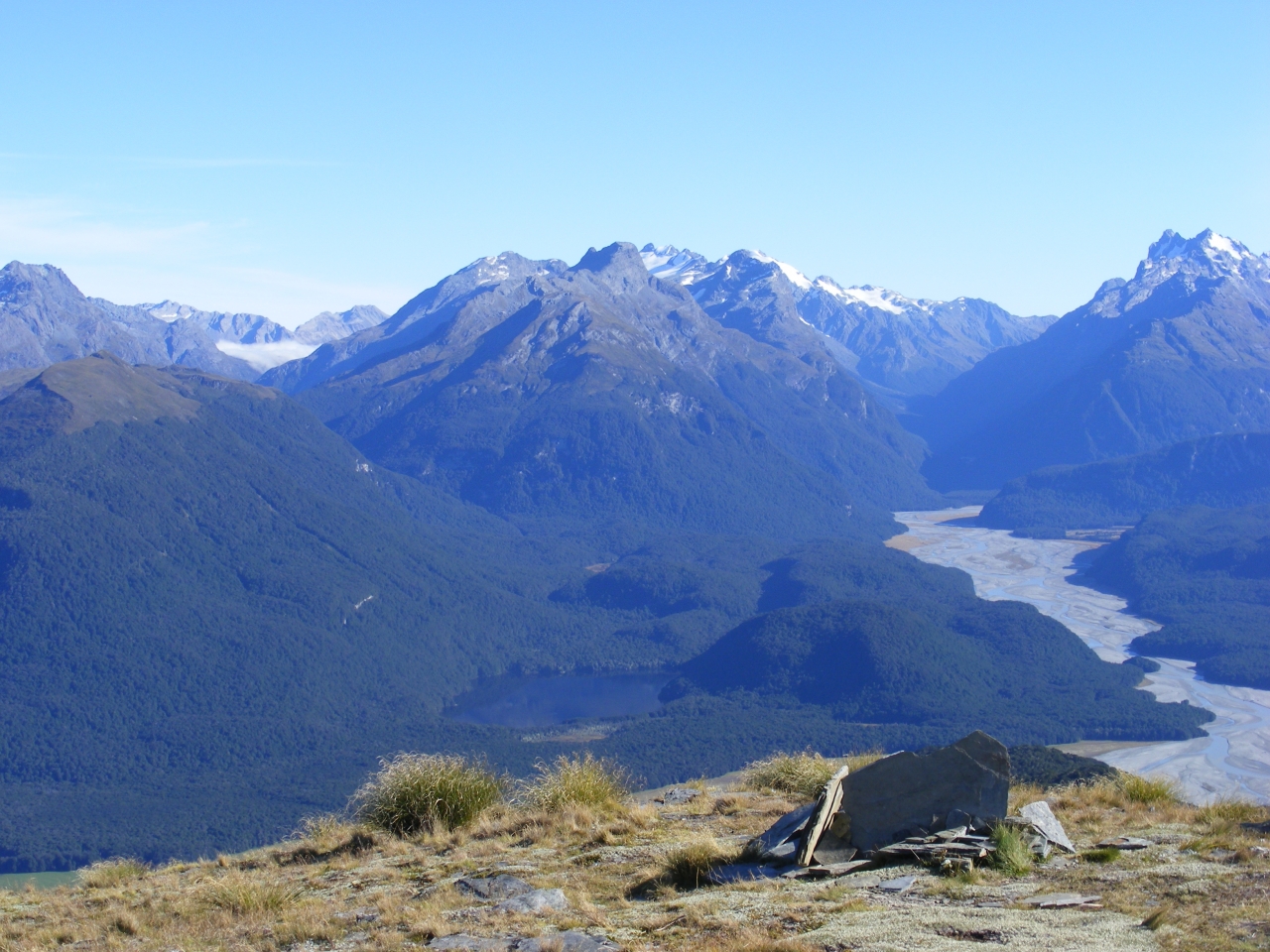
A 360-degree turn reveals many familiar valleys – Greenstone, Scott Creek, Routeburn, Rockburn, Beans Burn, Dart, Earnslaw Burn, Rees, Twenty Five Mile and more. Dominant among them all iss the glaciated southern face of Mt Earnslaw/Pikirakatahi.
NOTE: Above the bushline, permission is needed from Mt Earnslaw Station. P: 03 442 5268


34 years of inspiring New Zealanders to explore the outdoors. Don’t miss out — subscribe today.

Questions? Contact us


