Mangorewa Track, Mangorewa Ecological Area

January/February 2025

Read more from

January/February 2025

The pretty river walk meanders through lowland forest. Photo: Stuart Hill

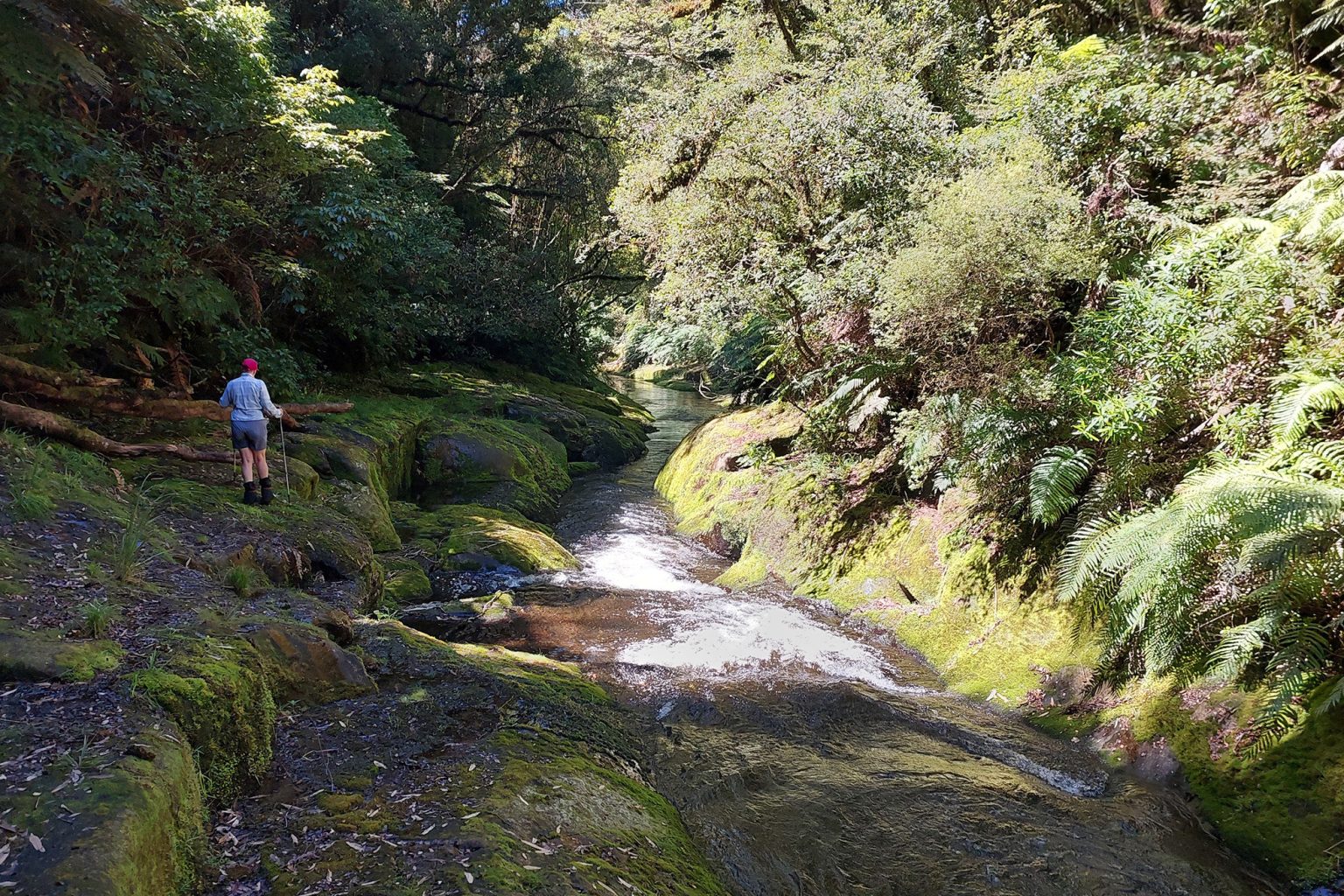
A loop of two halves – one half lowland forest, the other mossy riverbed.

This beautiful day walk can be tackled in either direction but is best done counter-clockwise. It should be attempted only in dry weather and not immediately after any significant rain. 

From the car park, walk up the road north towards the track entrance. After 500m, climb the barrier on the left and go down a marked track to the Ohaupara Stream and follow the orange track markers along the stream’s true right bank. The stream may need to be crossed, so take care as the rocks are extremely slippery.

After 400m, exit on the true right and sidle – sometimes scramble – along the slope to a small side stream. It’s then a steady climb for 250m, under an impressive bluff and overhang, to the ridge top. Follow this for 1.2km through mature trees until the track turns south, drops into a valley with a small stream and climbs back out. This is one of only a few areas of the Mamaku Plateau that hasn’t been logged, and there is a real mix of trees, abundant birdlife and, depending on the season, impressive and colourful fungi. Keep a close eye on the orange markers in the dense vegetation.

Descend approximately 400m to the Mangorewa River via a moderate slope followed by a last, short scramble to the riverbed.

Mangorewa River is relatively shallow but it has steep banks and thick bush on either side. The rest of the walk is in the riverbed, which is entered on the true left. Walking poles will be useful as it can be extremely slippery. The water is rarely more than knee deep, but you will need to edge around some channels and pools. Sometimes it’s possible to stay out of the water for short sections. 

As you head downstream, keep an eye out for springs. One, on the edge of the left bank within the first 500m, can be up to a metre high depending on the flow; it’s like a natural drinking fountain.
Keep following the large intermittent orange triangles. After about 4km in the riverbed, the track exit appears on the true right just before the road bridge. It leads back to the car park.

Distance
8.11km
Total Ascent
250m
Grade
Moderate
Time
5hr
Access
Mangorewa Track car park on SH36, 25km north of Rotorua
Map
BE37

GPX File

Mangorewa (gpx, 24 KB)

GPX File

Your device does not support GPX files. Please try a different device.

About the author

Stuart Hill

More From Trips

Related Topics

Similar Articles

New tramping scholarship for aspiring writers and photojournalists announced

Nobody wants to ban kids from reading Wilderness

Pigeon Post, January/February 2026

Tawa Hut, Waioweka Conservation Area

Pakihi Hut, Urutawa Conservation Area

Motutapere Hut, Kaimai Mamaku Conservation Park

Trending Now

Kãnuka Loop Track, Bendigo Historic Reserve

What’s the big attraction of the Old Ghost Road?

‘The hut my dad built’

Cascade Hut, Kaimanawa Forest Park

High country gold

Subscribe!
Each issue of Wilderness celebrates Aotearoa’s great outdoors — written and photographed with care, not algorithms. This Christmas, subscribe or gift a subscription and help keep our wild stories alive. It’s the perfect way to connect with friends and whānau who love the outdoors as much as you do.

Join Wilderness. You'll see more, do more and live more.

Already a subscriber?  to keep reading. Or…

34 years of inspiring New Zealanders to explore the outdoors. Don’t miss out — subscribe today.

Your subscriber-only benefits:

All this for as little as $6.75/month.

1

free articles left this month.

Already a subscriber? Login Now