Māori pounamu gatherers and, later, gold miners blazed the way up the magnificent Arahura River. Now, you can follow them.
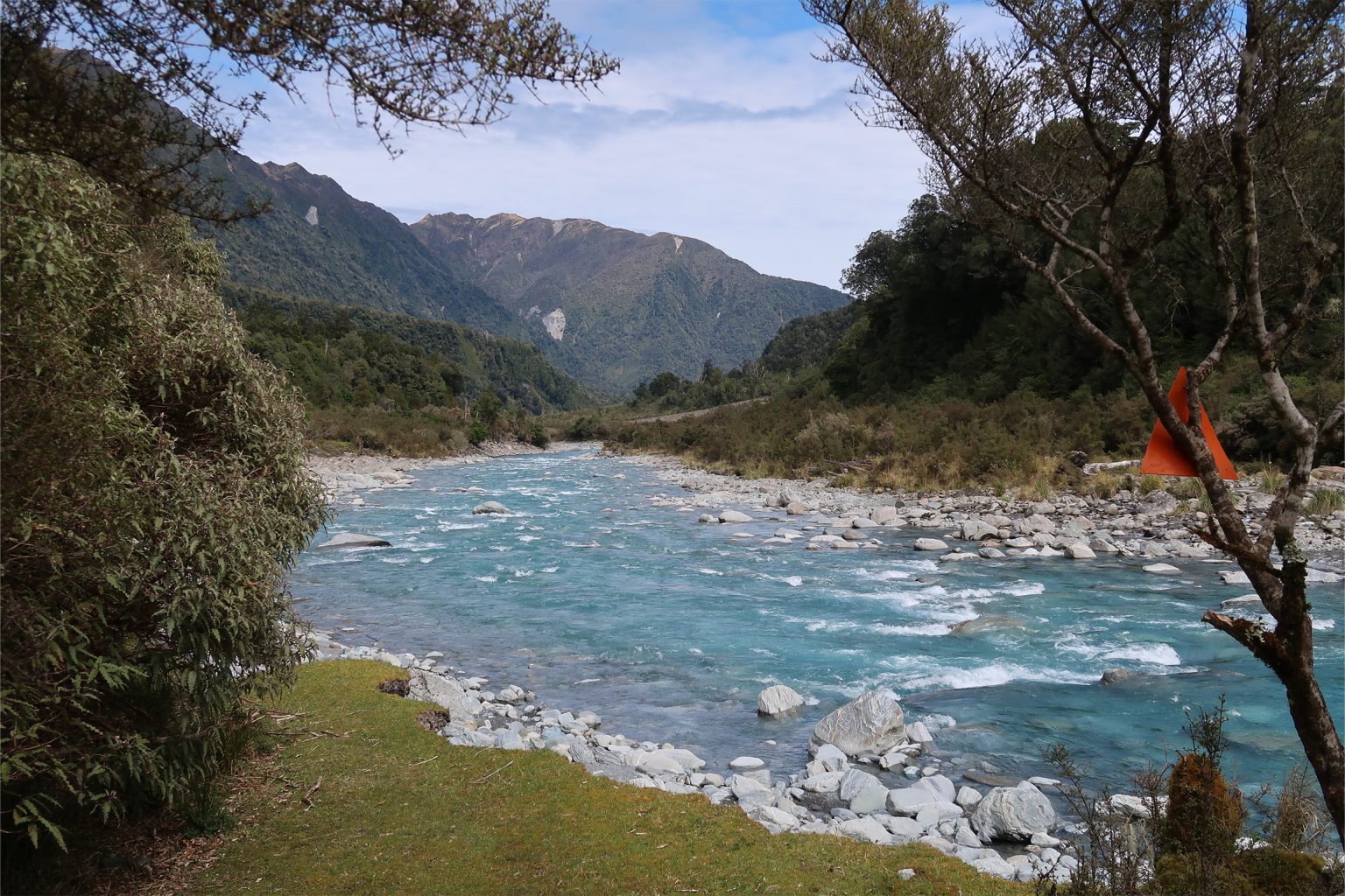
The Arahura River, renowned among Māori for its pounamu, begins its journey high up in alpine Lake Browning on the Three Pass Route. The mid- to upper reaches are part of the unique Waitaiki Historic Reserve, created in 1976 when the riverbed and catchment were vested in a Māori landowners trust, The Mawhera Incorporation. Public access to the reserve is protected, and DOC owns and maintains all huts, bridges and tracks there.
The first kilometre across farmland is also part of the West Coast Wilderness Trail, so cyclists may be encountered.
Follow river flats and an old, boggy logging road away from the river through private farmland on the true right bank of the Arahura River. There’s a swingbridge after an hour, high above the turquoise river at ‘The Cesspool’.
Cross the bridge to the river’s true left. From here, travel is an interesting mix of ancient goldminers’ road, walking on rocks beside the river and crossings of washed-out streams.
Much of the track in the Arahura Valley was constructed in the late 1860s in an attempt to connect the West Coast goldfields with the Wilberforce River in Canterbury via Browning Pass/Noti Raureka. Although some of the old benched road formation is remarkably intact and makes travel easy for short sections, much has fallen away into the river.
There are a number of side streams to be negotiated, in particular Brentnall Creek and Spencer Creek, which are within 1km of the swingbridge. These have small, steep catchments and are easily crossed in normal flow but, like many streams on the West Coast, would be difficult in heavy rain.
Lower Arahura Hut, about two and a half hours from the swingbridge, sits in a grassy clearing above the river. This six-bunker was built by DOC in 2010 to replace the old four-bunk NZ Forest Service hut on the site. Parts of the old building were to be used to construct Mt Brown Hut on the Newton Range, 10km away as the kea flies, but in the end very little was salvageable.
The track beyond the hut continues up the valley for 10km to Mudflats Hut, Harman Hut and Browning Pass. It follows the goldminers’ road and links with Styx Valley.