
Davies Track is a half-day walk to the summit of Patuha (684m) in the Kaitake Range, just outside Oakura.
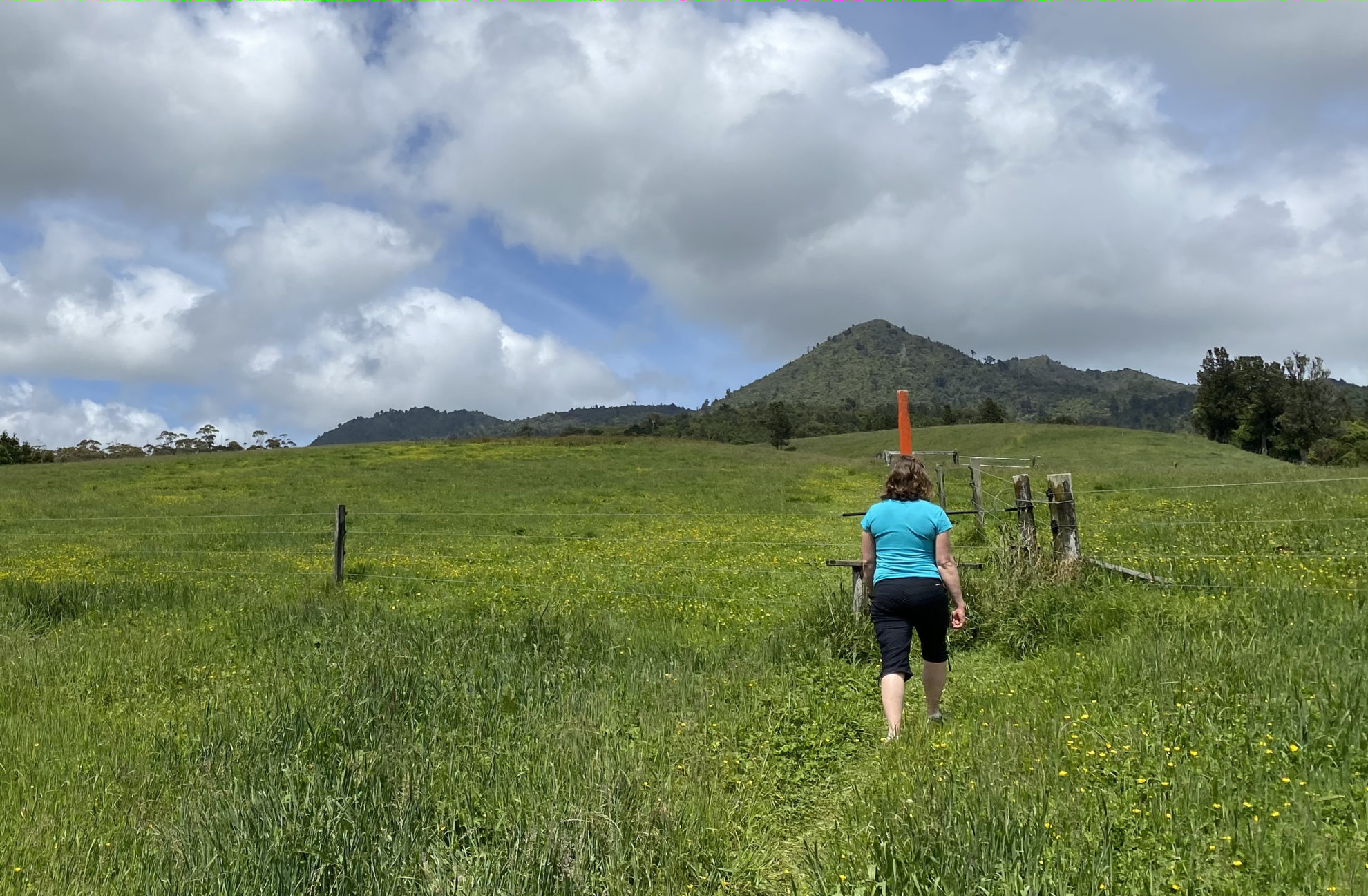
For the first 15 minutes, the trail crosses private property, over fence stiles and across paddocks.
The view from the paddocks is surprisingly good on a clear day, with the forest-clad ridges and peaks of the Kaitake Range dead ahead and the far-off summit of Mt Taranaki also visible.
The track follows the orange marker poles across the paddocks and finally climbs a stile to enter the bush.
The transition from the open, sunny paddocks to the shady bush is a sudden one. Near here is a trap box – one of more than 1000 traps set in the Kaitake Range by a local conservation group. The traps line the track all the way to the summit trig and are a good way to judge how much farther till the top as they are numbered from 0 to 31.
The trapping must be working because there were many birds on the walk – tūī, grey warbler, tomtit, kingfisher, pīwakawaka and even a shining cuckoo.
A moderate ascent through lush bush passes by a few towering rimu, tawa and pukatea. In the understory were nīkau palms, silver ferns, and some gnarled tangles of supplejack.
An hour in, a few short steps mark a change in the trail as it becomes steeper and more tricky to navigate.
After a further 15 minutes, the trail veers to the west and makes a beeline for the trig. It’s a tough climb up rooty, muddy slopes with some huge steps that take the breath away and has legs burning. It needs hands and feet at time for balance to simply keep on going.
Patuha is in a clearing and provides almost 360 degree views, from the bush-clad slopes of the Kaitake Range stretching out below to the Tasman Sea and, towering to the south-east, Mt Taranaki. There’s even a glimpse of Mt Ruapehu on the horizon.
The track continues east to join the Waimoku Track which leads to Lucy’s Gully – an option if you have arranged a car shuttle. Otherwise, return back down Davies Track.
– Mark Danenhauer
34 years of inspiring New Zealanders to explore the outdoors. Don’t miss out — subscribe today.

Questions? Contact us


