Climb through tussock-covered farmland and stay at a cosy hut on this accessible circuit.
The trackhead is accessed from SH73. Look for the Benmore Station sign 10km west of Springfield and turn left onto Benmore Road. A bridge crosses the Kowhai River and a DOC sign indicates Thirteen Mile Bush. Turn right at the T intersection and continue to the marked car park.
From the car park, the Benmore Track follows an easement through Benmore Station, so keep to the markers and leave gates as you find them. This section follows a 4WD track beside Thirteen Mile Bush Stream before reaching public conservation land.
Around the 2.3km mark the track crosses the stream; be prepared to get wet feet.
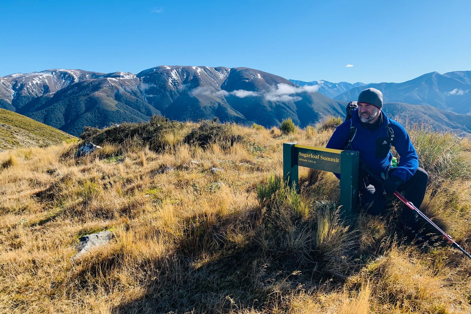
Half a kilometre on a sign gives the option to continue on the Benmore Track along Thirteen Mile Bush Stream to Benmore Hut (3.2km), or turn left and take the Annavale Track towards Sugarloaf – labelled as Pt1203 on the topo map and the highest point on the Russell Range.
The Annavale Track crosses a fence and heads away from the stream following a 4WD track onto open tussock-covered hillsides. It is steep in parts but well contoured as it gains 600m in elevation. Stop and soak in the views over the Canterbury Plains.
After about two hours the Annavale/Benmore Link Track is reached. Not shown on topo maps, this descends the western spur off the Russell Range towards Pt915 and Benmore Hut.
It’s worth continuing the climb to the summit of Sugarloaf for the views of the Torlesse and Big Ben ranges, a 60min return trip from the Link Track junction.
Back at the Link Track, turn west and descend a spur through open tussockland before entering the shelter of beech forest. The narrow trail has some steep sections and emerges after 1.6km at the orange NZ Deerstalkers Association’s Benmore Hut.
Situated in a grassy clearing surrounded by bush, the hut is one of Canterbury’s most accessible, making it ideal for newbie trampers or families with young children.
It has three bunks (one large) and a wood fire.
To complete the circuit, follow the Benmore Track, which is well marked through the bush, until you reach the Thirteen Mile Bush Stream flats. The track undulates gently as it heads away from the hut, followed by a short, steep section where it zigzags down to river flats before rejoining the 4WD track back to the car park.