(Listen to Sam read his story with a follow-up Q&A about the trip with our editor.)
Ōtaki River is the beating heart of the western Tararua Range. It flows from under the main range, fringed by dense forest and rugged peaks. Its headwaters are bounded on one side by Oriwa Ridge, a once popular traverse that faded into obscurity following the ‘big storm’ of 1936, a tropical cyclone that devastated the ridge, destroyed Waiopehu Hut and killed tramper Ralph Wood, who died of exposure on nearby Twin Peak.
Today the watershed is ringed by remote huts and paths less followed – a veritable playground for long-weekend adventures, and a wilderness calling me from the rat race of Lambton Quay and Willis Street.
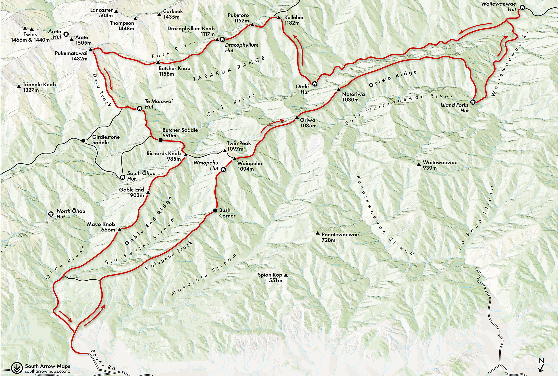
So it was that in the weeks leading up to King’s Birthday weekend I formed a plan with James, a stranger I had just met through the tramping club, to link the remote huts surrounding the Ōtaki. We would begin from Poads Road and take in Waiopehu Hut, then continue counter-clockwise down Oriwa Ridge, through Island Forks, Waitewaewae, Ōtaki, Dracophyllum and Te Matawai huts before re-emerging four days later at Poads Road.
The sun had long since set when we arrived at the road end. By torchlight the paddocks gave way to forest and then steep hillside, and soon we were battling gusts along the ridge leading to Waiopehu. Through the trees we could see the twinkling lights of Levin. It was rather beautiful, and after three hours of walking we reached the welcome shelter of Waiopehu Hut.

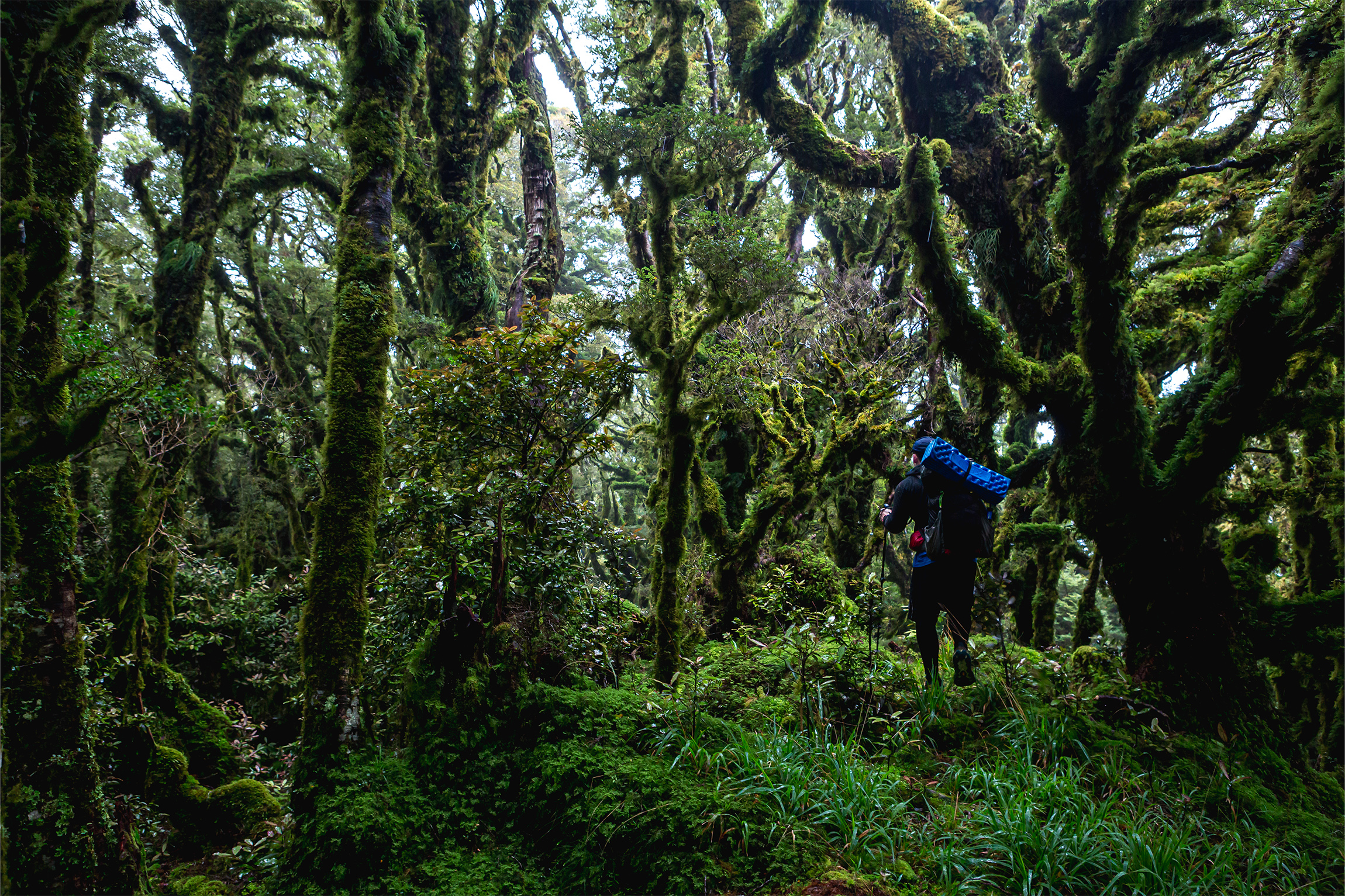
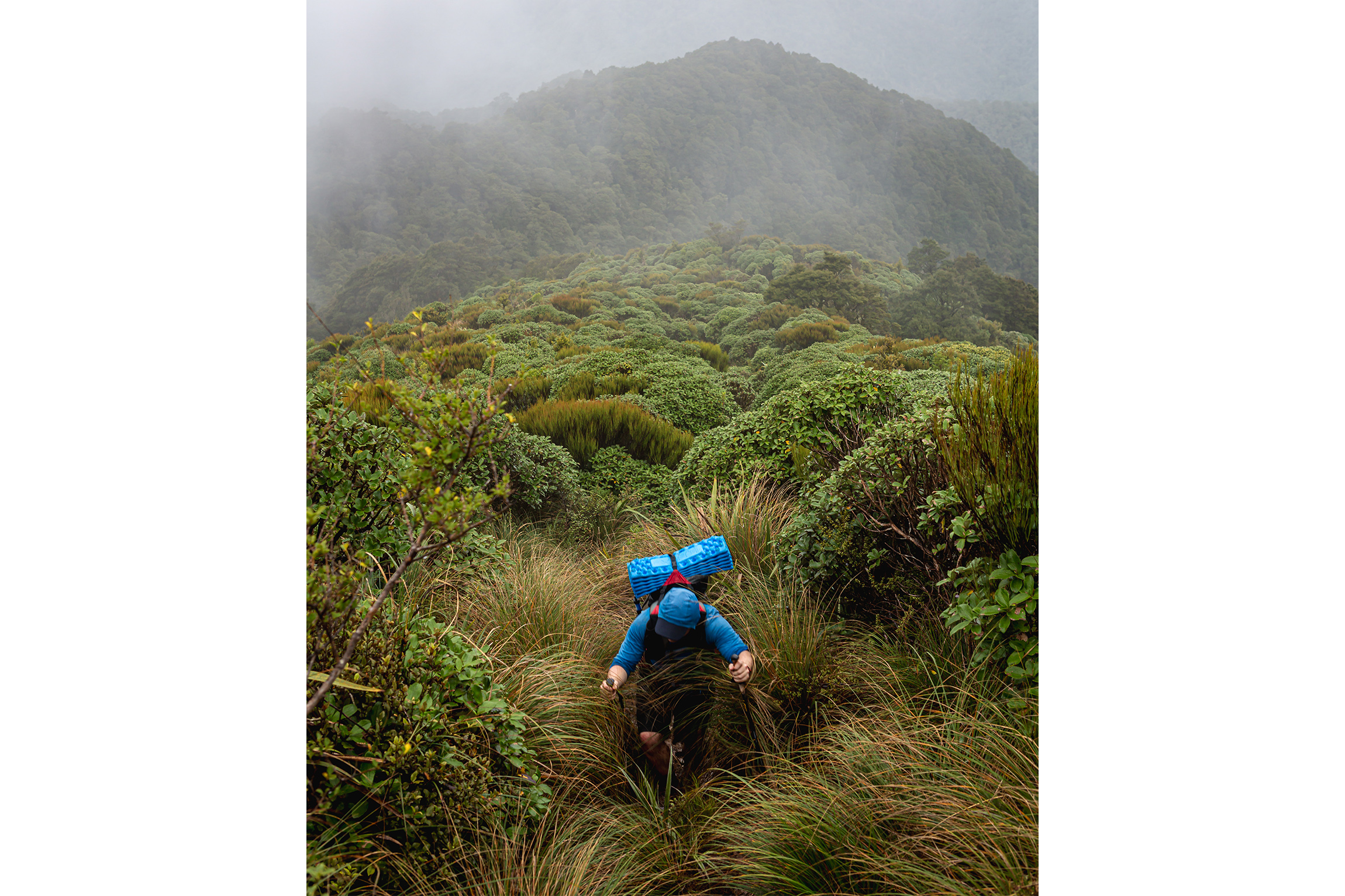
Clag and wind greeted us the following morning. From the hut we strode up through goblin forest and out onto the open tops. Nearing Waiopehu (1094m), with cloud obscuring the ridge ahead, we had a short discussion about the best approach to Oriwa, and soon found ourselves crashing through scrub, attempting to break through to the more open forest beyond the bushline. Unfortunately, our chosen point of entry led only to a vertical slope. From our new position we could just see the summit of Oriwa (1085m), partially obscured by an impenetrable wall of leatherwood. In a rare moment of clearheadedness, we retraced our steps, traversed and soon discovered a much easier path onto the ridge.The forest cloaking Oriwa Ridge was a stunted moss-covered maze. Periodic marker tape and a faint foot trail guided our way, reminding us that we were not the first to this wilderness. Oriwa Ridge was first used by Māori as a route over the Tararua into the Wairarapa. Pākehā trampers followed, and the first tramping party traversed the ridge in 1928.
It took us about two hours to reach the clearing where the NZFS Oriwa Bivvy stood until 2007. A rain collector sat in its place, and there was a hunters’ camp in the trees. A small lake in the clearing was drained by an earthquake a century ago.
From the clearing we continued along the ridgeline, slipping and sliding perilously on the slick forest floor. We marvelled at intricate moss topiary as we pushed through stands of dripping horopito. Twice we were almost punished for not paying enough attention to navigation, the first time on a spur towards Makaretu and the second heading to Murray Creek. We were thankful that the wreckage of the big storm of 1936 had long since rotted away. The storm, a spectacular deluge and gale centred on the western Tararua Range, flattened the forest along Oriwa Ridge like pick-up sticks, and for a long time the route was all but written off by trampers.
The ridge dragged on, but the further we went the more open the bush became. At the ridge’s end we headed to the northwest, picking up a good ground trail along the spur towards Island Forks. The spur led us to a terrace above the river, and from there we headed downstream, emerging behind Island Forks Hut. The hut was neat and tidy but the surroundings were dank. James and I sat on the petite porch and debated our next move. We had intended to stay here, but with two hours of daylight left, Waitewaewae Hut called. Much to the dismay of my feet, I stood up, jammed my mouth full of Sour Squirms and shouldered my pack.
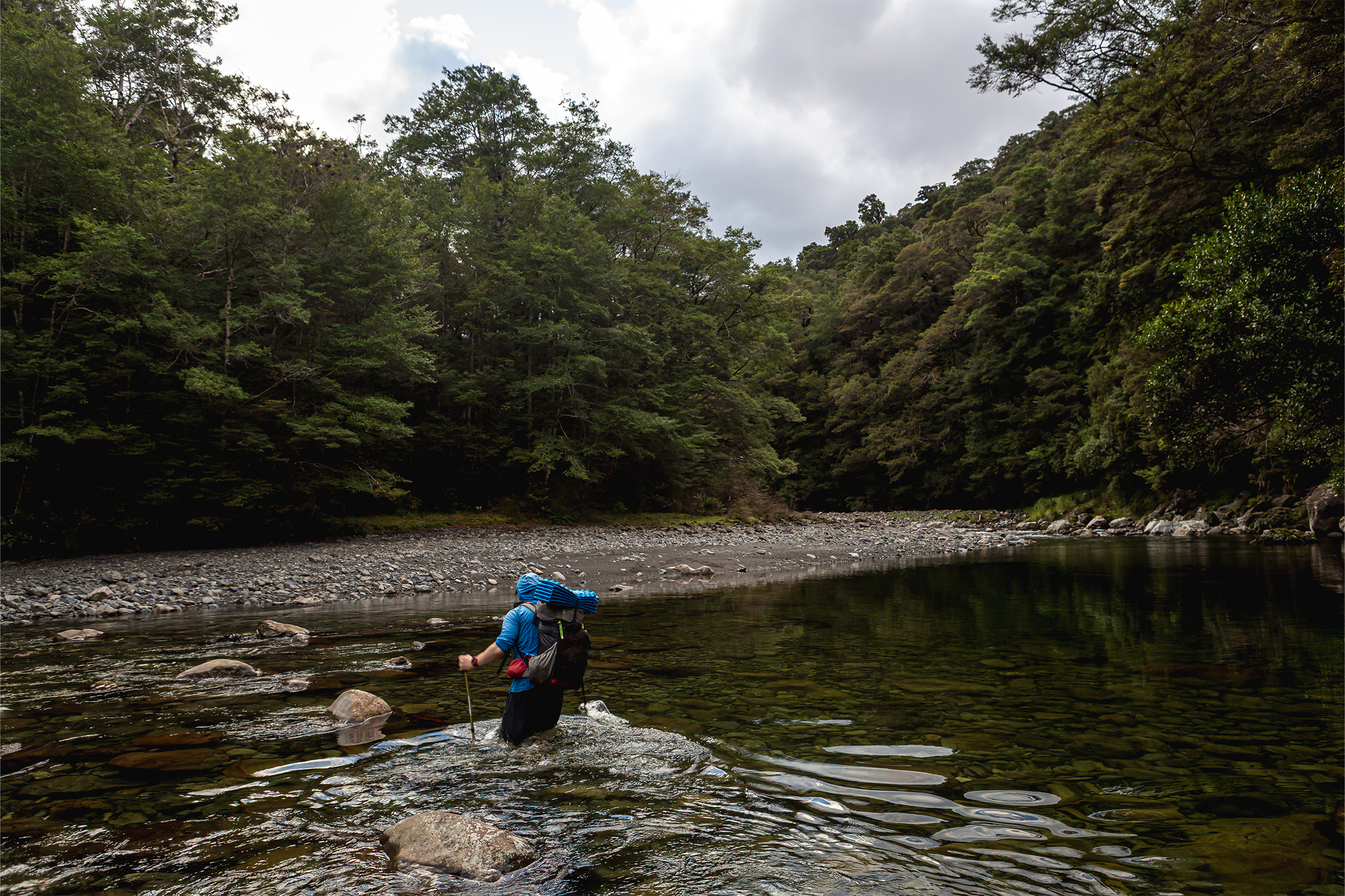
Our route followed Waitewaewae River, the water surprisingly warm for mid-winter – luckily, as there were only a few hundred river crossings. The banks were slippery and the river full of deep pools. Concentration was paramount. For such a short traverse, the Waitewaewae Gorge was memorable for its waist-deep wades, trout tickling and shin-to-rock action. We left the gorge at Chaney Creek, the river widening with stony banks perfect for ambling. We crossed the swingbridge to Waitewaewae Hut in twilight and stumbled along the track in the dark till we came upon the hut.
The following day we set off just as the sun was beginning to think of rising. We sauntered up the track and back along the river, retracing our steps. Rather than walking up to the Waitewaewae Ōtaki Forks, we ducked into the bush to hunt for any vestiges of trail. Much to our delight we found blue triangles, which we followed deeper into the bush, slowly climbing to the 320m contour. This trail was easy enough to follow until the second creek draining Shoulder Knob, where a plethora of markers exploded in every direction, all terminating in dead ends.
Eventually we gave up any hope of following a marked trail and decided to venture out alone in the general direction of a big marked slip in the riverbank. The discovery of the odd rusty tin lid reaffirmed that we had made the right decision. At about 8.30am we emerged near the slip, at a high bluff above the Ōtaki, and walked downriver a short distance before finding a spot where we could scramble down to join it.
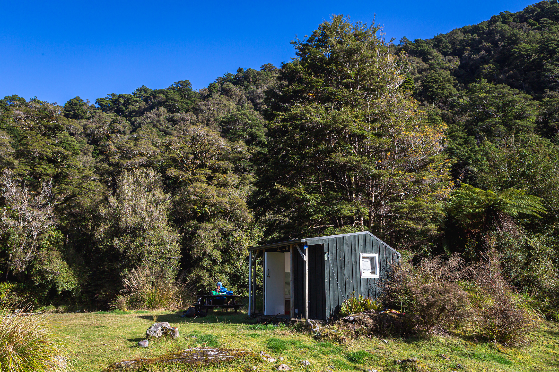
The travel up the Ōtaki from here was pleasantly free of windfall but came with other challenges. Alternating between banks, we tried our best to keep our fresh undies dry. For the most part this could be achieved by scooting through open forest on either bank. At one particularly challenging section of river, however, I climbed down to the water and discovered the only way forward was to clamber around a rocky outcrop that ended in a deep pool. With a bit of luck, I thought, maybe I could avoid a swim by jumping onto a submerged rock. I was surprised when this acrobatic feat did not end in doggy paddle. James was not so lucky; misjudging his jump, he ended up in the river. The sun shone kindly, and as he dried we passed Kelleher Creek and the river began to mellow with widening banks. A few trout gave us a wary passing gaze. We soon found ourselves outside Mid Ōtaki Hut, which would have been idyllic if the air were not filled with the odour of a decaying deer carcass left carelessly close to the hut. Holding our noses, we didn’t let this ruin an enjoyable lunch in the sun at the hut’s picnic table.
There used to be a blazed route up the spur to Kelleher (1182m), and this was our intended way to the tops. We departed around midday, first heading up a foot-trail behind the hut before entering the bush to begin our climb. There was the odd marker, but for the most part we were simply following a faint footpad up the hill. The hill steepened until we were pushing through dwarf trees to stay on rocky pinnacles. These pinnacles offered our first views, out over Oriwa Ridge and the scene of our exploits of the day before.
The forest eventually succumbed to the altitude and the main range stretched out before us. Pukematawai seemed impossibly distant to the north, while Nichols to the south looked much larger than it had on the map. We had a relatively easy climb to the summit of Kelleher and from there dropped steeply to join the main range track, a section of Te Araroa Trail. Even with the rude undulations and mud, we were quite happy to have a track after several days of forging our own path.
Dracophyllum Hut was guarded by one last stiff climb, which we conquered before collapsing outside the door around 3.30pm. Despite the early hour we did not hesitate with dinner plans, and while we waited for this to rehydrate, we sat in front of the little hut admiring the sky as it lit up with the sunset, the twisted forest around us illuminated in a most otherworldly way.
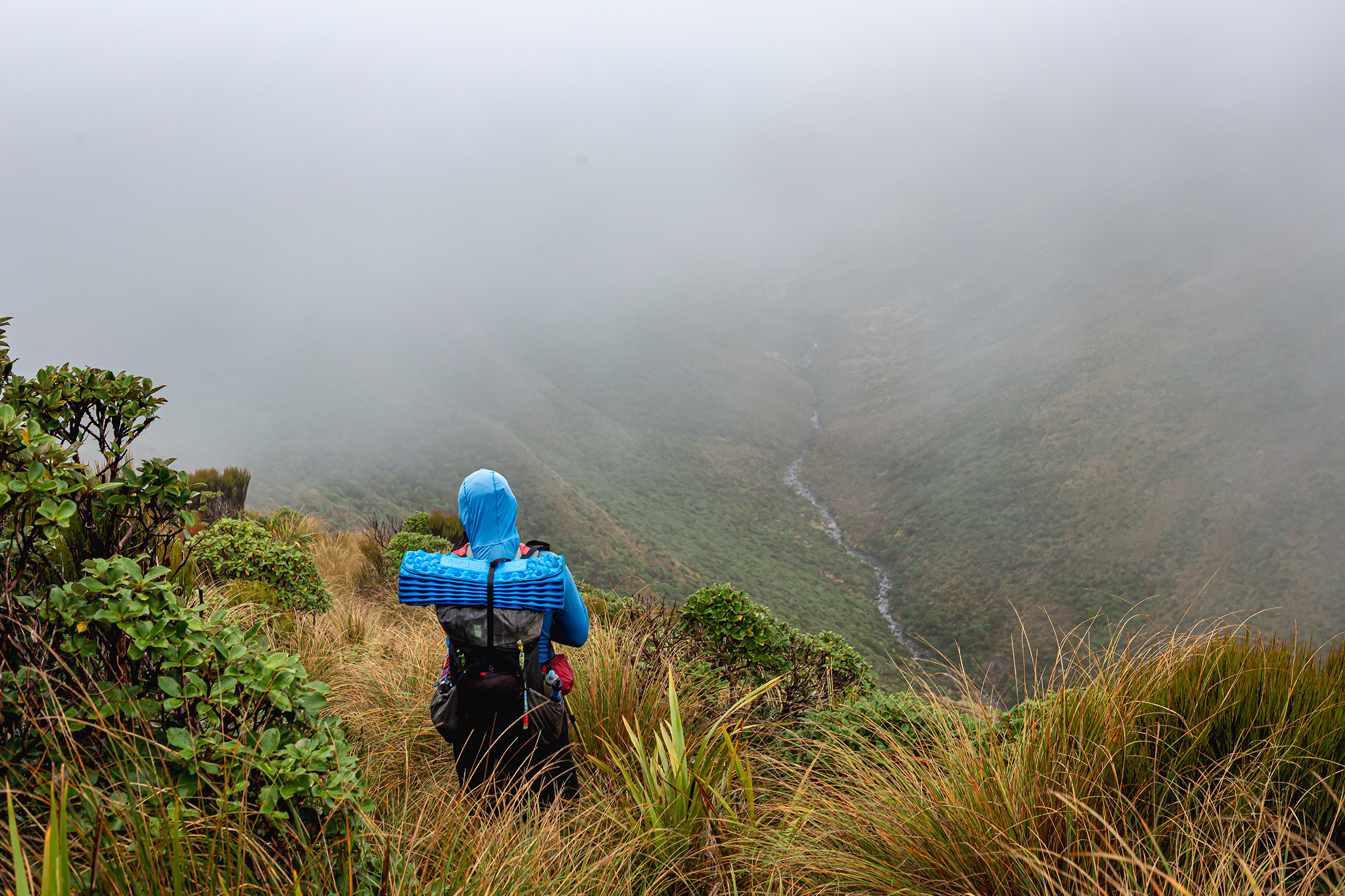
By the time we left the hut around 7.30am next morning, the overnight rain had halted its assault but the wind raged on. Clag clung to the ridge tops with an iron grip. Our route to Pukematawai (1432m) began with a muddy stomp through goblin forests following a series of never-ending knobs. The weather teased improvement, even offering a tentative view of Te Matawai Hut, though this proved short-lived. As we gained elevation, our world became enveloped in grey with only the occasional view down into Park Valley to give us our bearings. This hostile climate soon stripped us of our inhibitions and we embraced the madness, singing our voices hoarse as our glutes screamed. By the time we were nearing Pukematawai I had lost all feeling in my fingers. We huddled under a rock near the summit to put extra layers on, scoffing some Sour Squirms before working up the strength to move on. Quickly passing over the (almost) summit of Pukematawai, we stumbled down the Dora Track, rapidly losing the elevation for which we had fought so hard. It was a full hour of rocks and mud before we finally graced the porch of Te Matawai Hut just before midday. We slumped on the bench outside and demolished the last of our snacks, including a bag of nachos that James had babysat for the best part of three days.
From Te Matawai we continued in search of Butcher Saddle and Richards Knob. By this point we had both lost a bit of our sparkle, our minds firmly fixed on a hot shower and a mattress we wouldn’t stick to. There was a sense of relief once we broke above the treeline again, sloshing our way up to crest the knob. At the track junction we had a decision to make: mud-fest down Gable End or more climbing to go down the ‘easy way’ via Waiopehu. We flipped a metaphorical coin.
Gable End came out on top. My track notes simply read ‘MUD’. Being so close to home we powered through the morass, boosting our way down the ridge and into the forest. We stopped for one final snack when we reached the Ōhau River Track. Imagine our delight when we discovered that the gorge track had recently received some TLC and the slips were freshly benched.
At 3.30pm we caught sight of the green pasture around Poads Road: civilisation at last.