
The hut’s intentions book – and every book on the circuit – tells two tales of kiwi sightings: feast or famine. Some trampers boast double digits while others lament no sightings.
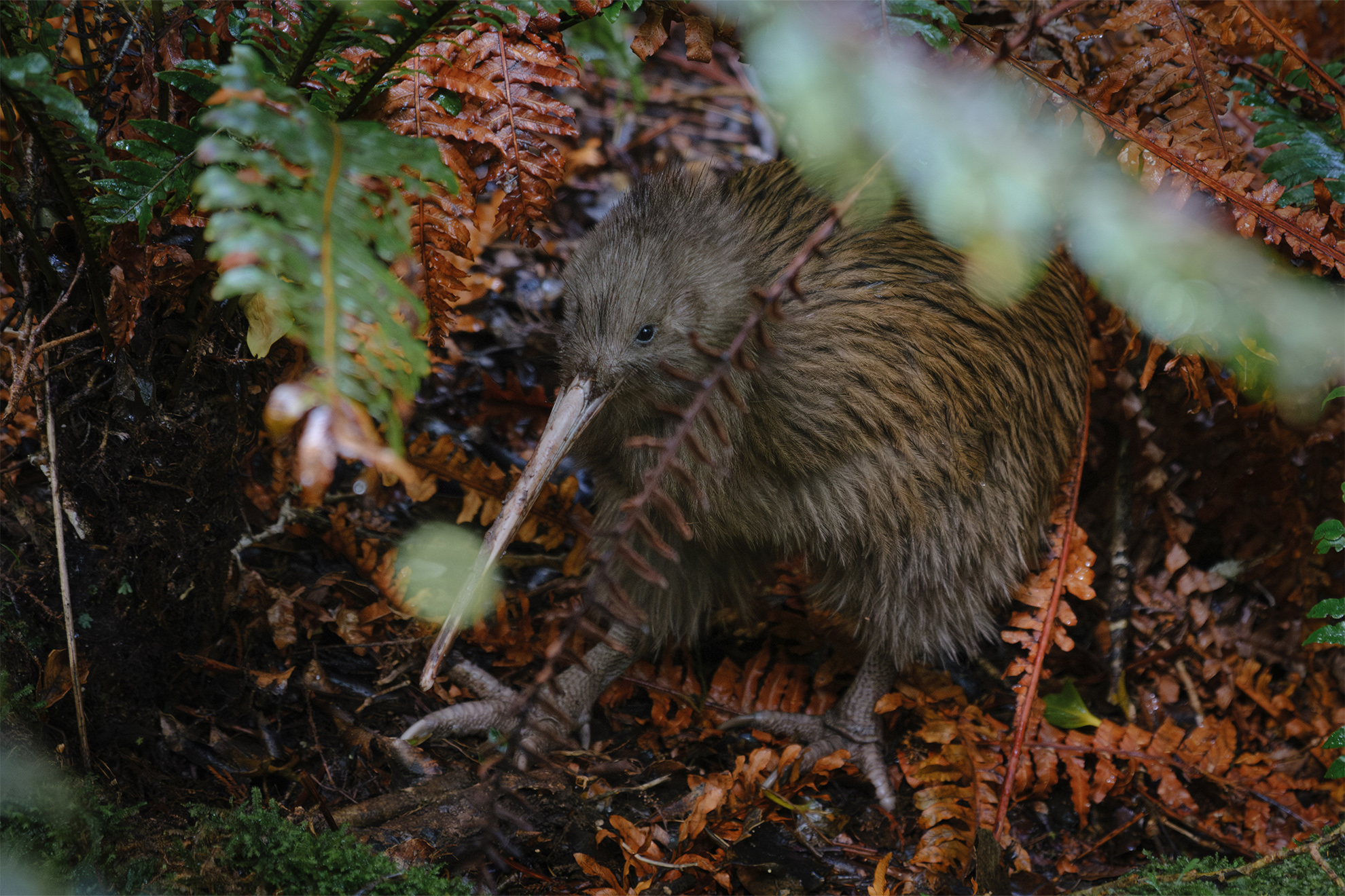
In the evening we donned headlamps and tried our luck. After just 15 minutes of quiet searching, a feathered basketball rolled at pace towards us, stopped at our feet, sniffed the air and continued down the track. It was too easy. We walked back, happy to tick off our first tokoeka, only to find another on the lawn of the hut. When it wandered behind the woodshed, we poked our noses into the foliage and saw it had found a mate. Three kiwi in 20 minutes.
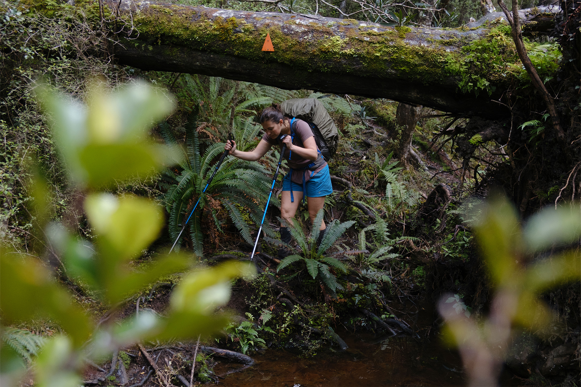
Next day, at low tide, we were out of the hut before first light, power walking Mason Bay beach in the bruised blue of dawn. We passed the high tide diversion and hit the pebbled northern section in good time to climb over Mason Head, our first real taste of Rakiura mud: the soul-sapping, boot-slurping variety.
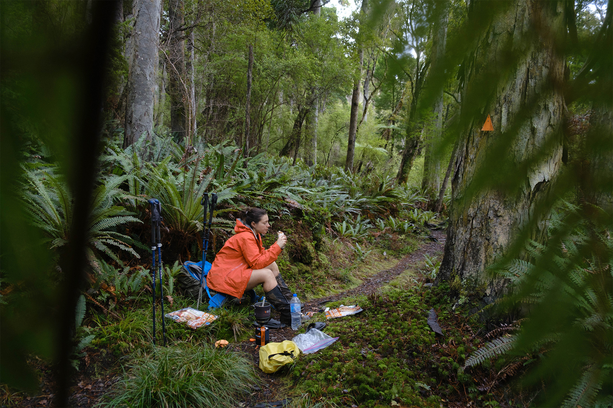
I scanned left and right for tokoeka, feeling sure I would encounter one at any moment. The suspense helped me keep sane on the more mundane sections of track. Playing A to Z categories was another way we passed the hours, listing bird species, rock bands, or adjectives to describe the track’s mud. G for gritty mud, porous, with a lighter hue; P for peripheral mud, reliably less sloppy than centre-bog.
Wind-driven rain kept us from lingering at Little Hellfire Beach, so it was back into the bush for the remainder of the day. White-outs hampered the high points in the afternoon, and we were dispirited by the time we reached our destination.
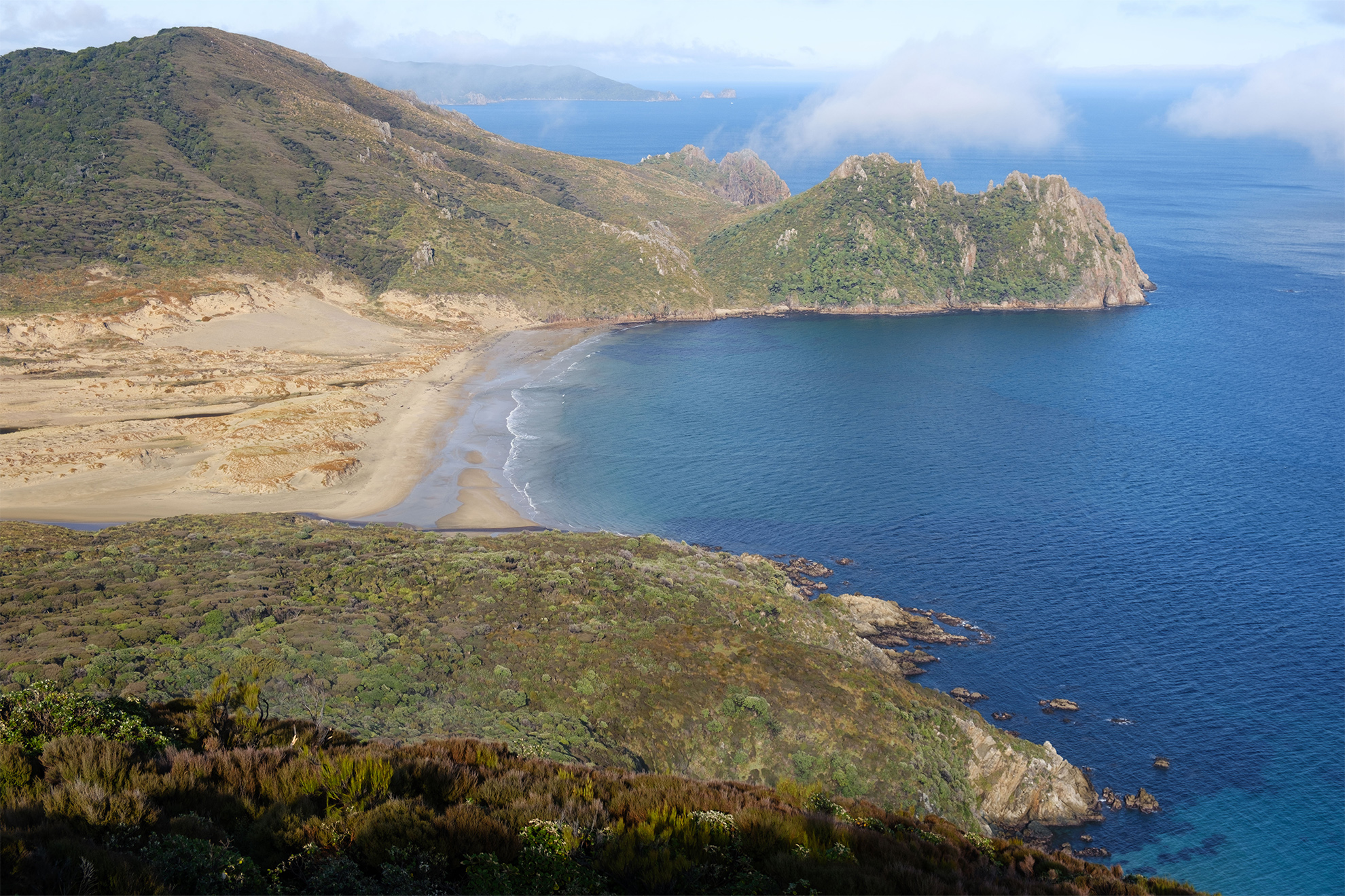
Big Hellfire Hut, with its doorstep dunes, is unlike anything I’ve seen. The hut sits in forest atop a 220m saddle, and not 50 paces from its back door a dune has climbed east, blown by hellfire up and over the saddle some 800m inland. From the saddle you can look down to the pounding ocean. It’s one of my favourite views of the circuit. To the north is the prominent Ruggedy Range, and to the east the vast Ruggedy Flat wetland, punctuated by glimmering lakes.
We awoke to drizzle that continued on and off all the next day. The track, a chaotic mix of moss-fringed delight and dastardly bog, toyed with our emotions. We encountered our first daytime tokoeka, minding its own business in the crown fern.
Waituna Bay, which on a fine day has spectacular views of the Ruggedy Range, was hemmed in, so we pressed on and met our first group of trampers. We traded a crossfire of questions about mud, weather and wildlife. Their assurance of the bogs left in their wake was enough to demoralise us completely. After the previous day’s slog, we felt battered and bruised, and struggled to imagine five more days of the same. O is for oppressive mud: bog so overwhelming it evokes curses and general despair.
West Ruggedy Beach was the turning point of our journey. The rain eased, the clag lifted, and for the first time we walked a beach without stepping over rubbish.
A sign at the base of the dune promised 30 minutes to East Ruggedy Hut, so 20 minutes later we started collecting firewood. With both hands full and my shorts gradually sliding down my arse, I stumbled on for another painstaking half an hour, expecting to see the hut around every bend. We finally reached the hut, dubbed ‘The Ritz’, only to find a sign pointing to where we had come from: ‘West Ruggedy Beach: 1hr’. Unbelievable.
We set out early next morning and tracked north to East Ruggedy Beach, removing our boots to wade across the estuary. Our boots were soggy, but not yet soaked, and DOC had warned of quicksand here. We hastily laced back up beneath clouds of thirsty namu and made our escape through tunnels of mānuka. A burst of nearby kiwi calls spurred us into the 200m climb, and moments later we spied the feathers of a handsome specimen.
A short detour here leads to perhaps the best viewpoint on the circuit, a rocky outcrop overlooking East Ruggedy Beach’s wandering dunes and the Rugged Islands offshore. We paused here to snack, address blistering heels and admire the morning light. Of all the days to get sunshine, this was it.
Our luck continued on the descent with another tokoeka encounter, and we emerged onto a boulder beach, which tested balance and stamina. We ate lunch at the eastern end and puffed over Cave Point Ridge towards Long Harry Bay. Disappointingly, the track skirts above the beach and not along its white sands, so we pushed on beneath chattering red-crowned kakariki. The sun, now fierce, frayed our resilience as we jarred up and down, from stream to stream, knees screaming. An outlook showed our destination: enticing Long Harry Hut, perched above emerald waters.
Nothing could suppress our smiles when we reached the hut. The afternoon, glorious and golden, sparkled over Foveaux Strait. Reminiscent of Northland’s Cape Brett Hut, Long Harry is a solar trap and promised our first night without the need of fire. Its ocean views are million dollar, so after hanging up our socks we headed for a dip.
The water clarity was spectacular and gentle waves rolled over a pebbled shore. If not for the sandflies, I could still be there.
Dusk painted pastel skies to end our first five-star day of the trip and we slept soundly, waking just once for a midnight pee to find a tokoeka at the bottom of the hut steps. Magic.
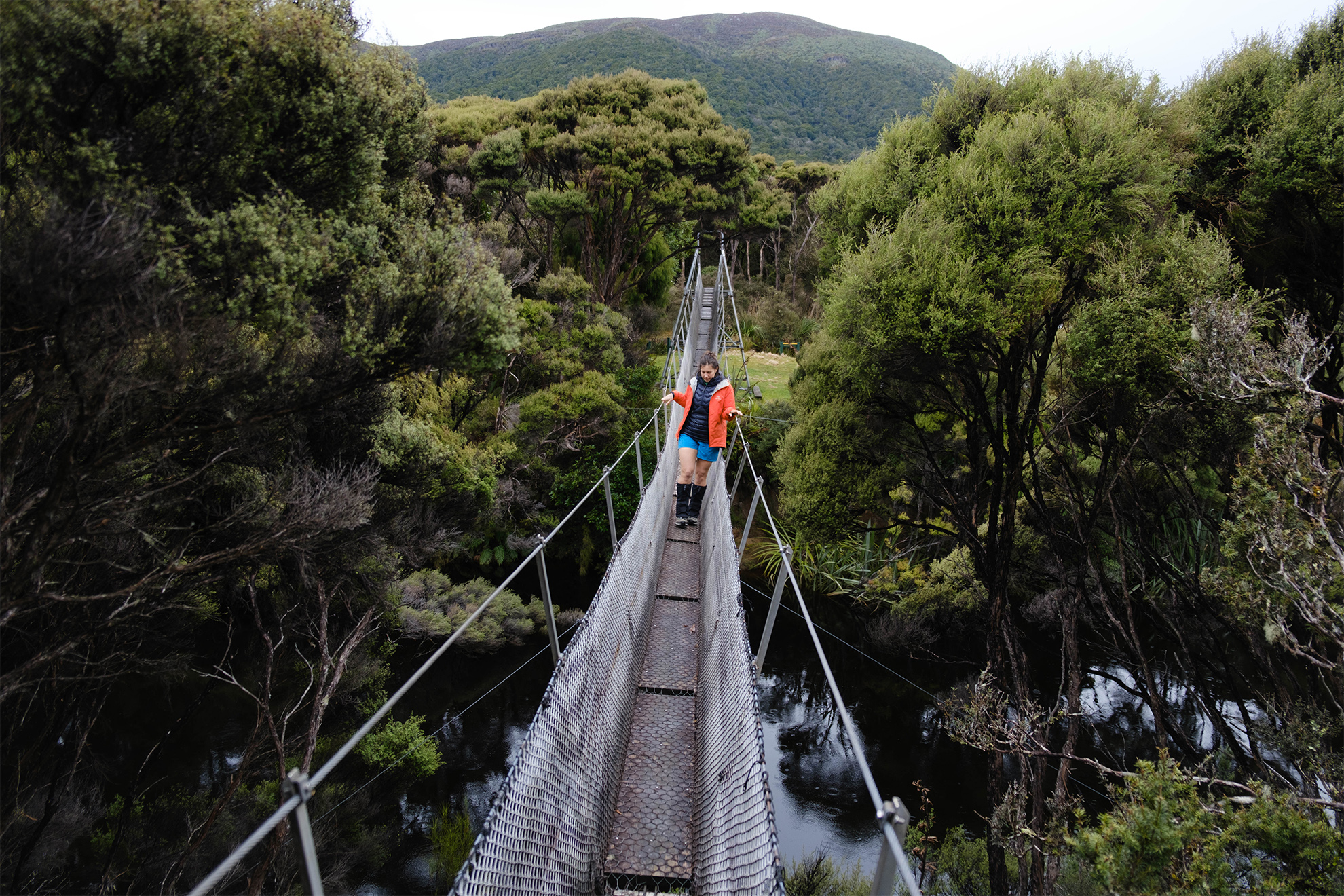
It was fine next morning, and we set out early for our shortest day to Yankee River Hut. DOC’s suggested four hours proved right on the money. The headland climb was relatively dry and civilised and we soon arrived at Smoky Beach. We were welcomed by a fury of sandflies, mirror reflections on the cola-coloured river, and a clear view of distant Fiordland tops, snow-tipped in the north.
We snacked on the go, sandflies in our slipstream as we walked east to the beach end and over the dunes to the bush edge, a punishing 260m climb followed, thankfully with views


