
My background is tramping and mountaineering, but the advantages of river rafting quickly became apparent. The biggie: no backpacks. All gear goes into watertight drums and bags, strapped in the centre of the raft to provide stability. With no concerns about weight, the standard of food (and wine) rises far above what I’ve become used to on my tramping trips.
And aside from creature comforts, travel at water level on a raft is a novel way to enjoy the surroundings. Constant downstream movement is possible even when sitting back and relaxing, which is possible frequently on the Waiau Toa’s calmer stretches.
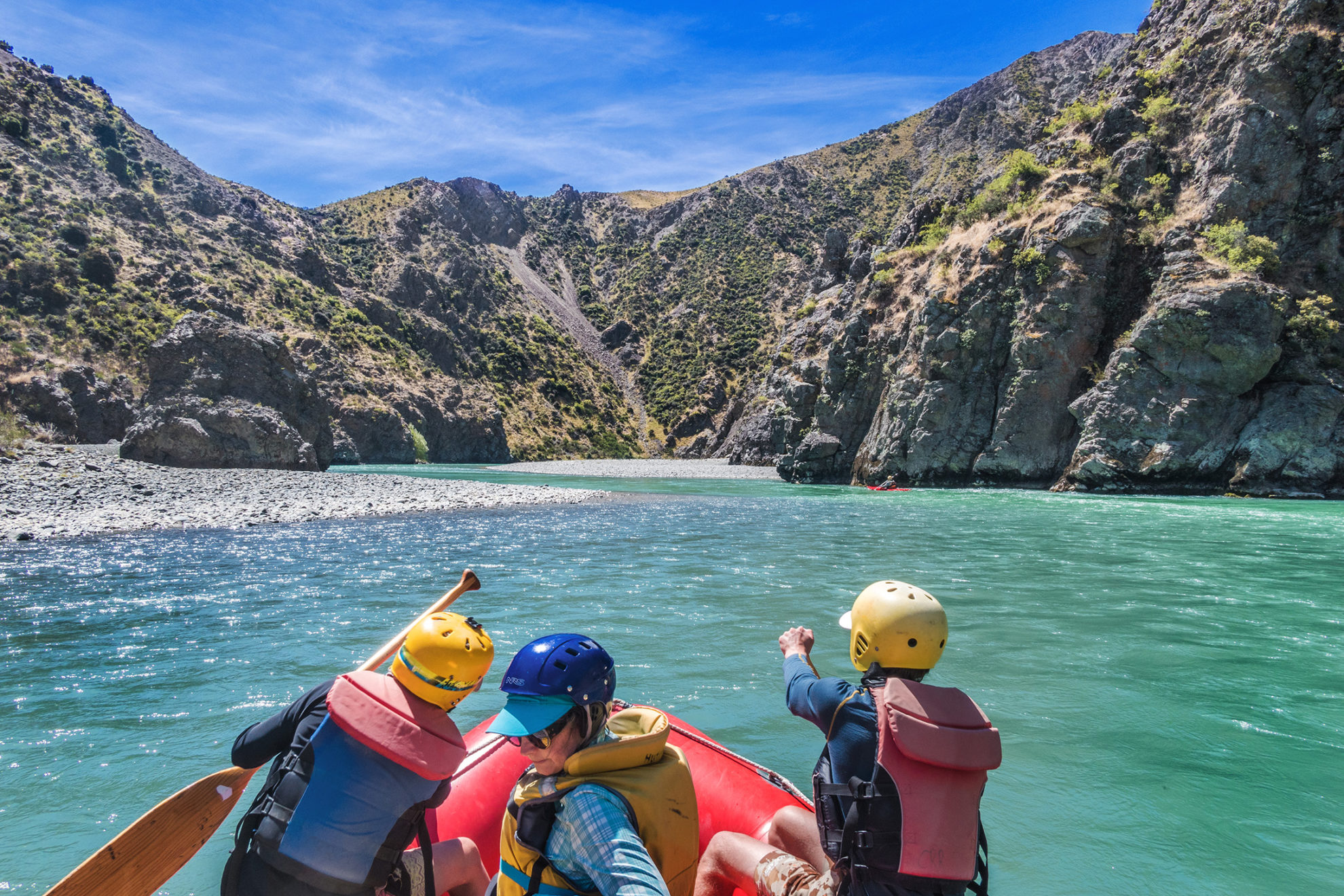
Rapids encountered are mostly moderate to easy, but there is plenty to keep paddlers alert. Countless right-angled corners demand bursts of paddling to avoid being forced against cliffs or into powerful eddies. Steeper narrower sections create choppy waves to bounce through and get soaked by. Shallow sections demand concentration to avoid being grounded. Boulders above or just beneath the waterline must be dodged to avoid being hung on, or tipped out by. And vigilance along the river-side is needed to avoid being ‘sieved’ by willows that reach out with long branches and gnarled root systems.
On calm sections, there’s impressive variety in the landscapes. At the confluence with the Acheron River, where the rafting journey begins, the landscape is alpine. River flats and tussock merge into mountain-scapes. At times, the river narrows, carving its way through high-walled gorges and bringing paddlers up close to astounding geology – sheer solid rock, layered and folded into tortured strata that speak of a dynamic planet and immense forces of nature.
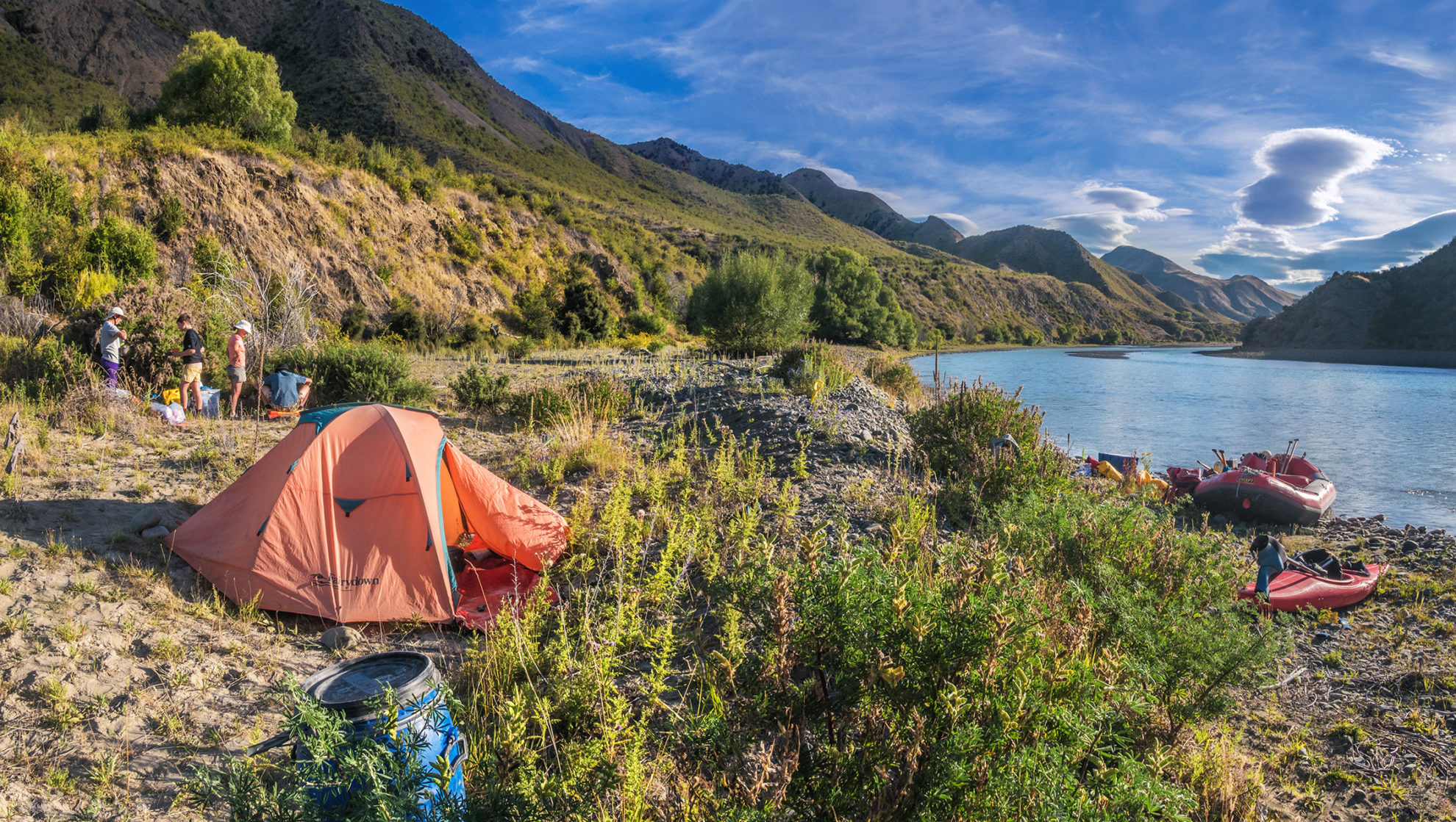
Given our short first day, to make up some distance, our second day was our longest on the river. There were several more gorges, punctuated by broad sections with impressive panoramic views. At a lunch stop at Palmer Hut, we met four packrafters from Waikato. Then, further downstream, some cows stared curiously at us from beneath steep cliffs. While they were surrounded by rubble with no grass in sight, they seemed unperturbed. After nine hours on the river, we pulled in at a bend south of Goose Flat Hut, again on the true right, to pitch our tents.
Here, the landscape had become even more spectacular. We were now well into the valley, hemmed in by the Seaward Kaikōura Range to the south, culminating in 2608m Manakau, and the Inland Kaikōura Range to the north, where a black pyramid catching the sunset’s red light, drew my eye to the distant skyline. This was 2885m Tapuae-o-Uenuku, New Zealand’s highest peak outside the Southern Alps. I’ve climbed Tappy via the classic Hodder River approach, so it was interesting to see it from this vantage point.
It wasn’t long before another aspect of rafting became apparent – the complete lack of shade. It was hot the next day, but there was a solution; simply flop overboard, fully clothed. Within 15 minutes of clambering back on board, clothes were fully dry. It took seven hours to reach our campsite near Snowgrass Hut. Again we were alone, privileged to enjoy the tranquillity.
But things soon got busier, both in terms of the many twists and turns the river makes to reach Cabbage Tree Hut and also in the number of other rafting parties. We’d set off later than usual that morning and had to work hard with our paddles to reach camp that afternoon due to a stiff headwind that apparently only picks up late in the day – a trap for the unwary. It was a harsh end to the day and sadly the remaining chardonnay, in our no longer chilly bin, was tepid. A first-world problem, granted.
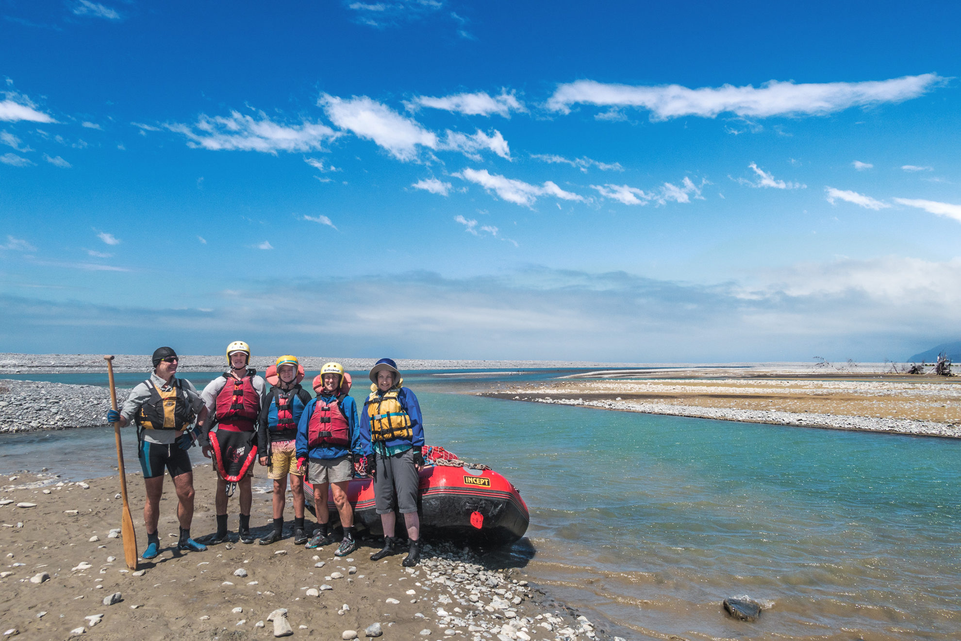
Our final day on the river was a surprise to me. With about four hours rafting until we reached the sea, some of which passed through farmland, I hadn’t expected the scenery to be so impressive. The river had bent back on itself so that we were now headed south, with beautiful views to the southern flanks of the Seaward Kaikōura Range. We also travelled through spectacular white rock formations that appeared to have been blasted about the landscape by some errant meteorite strike. And the broader river, with more flow, treated us to some of the best wave bounces of the entire journey.
It was good to finish this fine journey through a distinctively wonderful part of New Zealand in the same vein as we’d started.


