
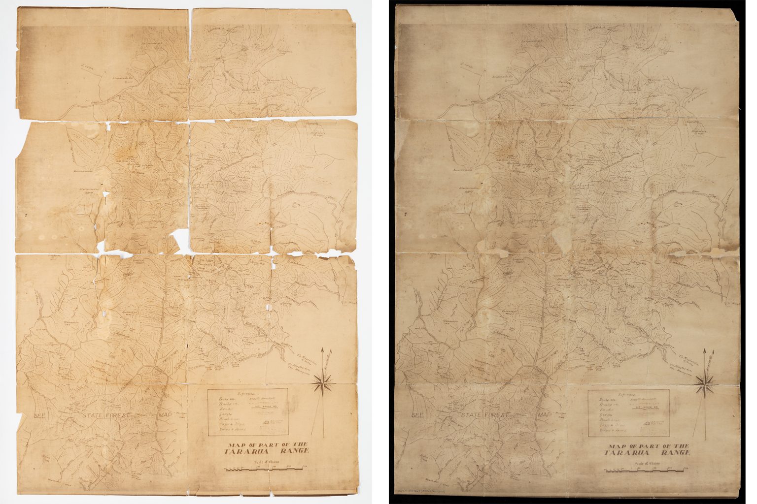
After spending 25 years under tramper Linden Eagles’ bed, Map of part of the Tararua Range has been acquired and restored by Alexander Turnbull Library – but its provenance remains largely unknown.
The gift
Linden Eagles worked at Wellington High School in the 1990s alongside geography teacher Don MacDonald, who had been at the school since the late 1970s.
“Don played the bagpipes and tramped a bit,” she said. “He was well liked by his students.”
“In the lead-up to his retirement, he was clearing out his storage room and came to the staffroom and said, ‘Linden, you do a bit of tramping: what say you take this’.” He gave her a folded map in a zip-lock bag.
Eagles initially thought she might be able to take it tramping. Then she looked at it. Map of part of the Tararua Range was old and well-used, falling apart along the folds. It was approximately A1 in size and appeared to be a print of a hand-drawn map. She put it between two sheets of cardboard for safekeeping and slipped it under her bed.
“Every time I brought it out, it got more brittle,” she said.
The map stayed there for almost 25 years, during which time MacDonald had since died.
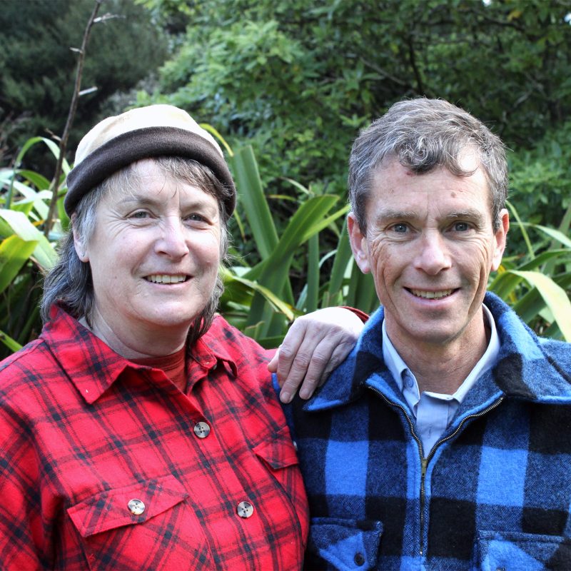
In 2021 Eagles offered the map to a colleague, Pete Stevens, who had tramped into every hut in the Tararua.
“I felt he would be in a better place to look after and enjoy it. I had no idea what to do with it, but knew it was special,” Eagles said.
Stevens thought the map too rare for him to keep.
There was no provenance and only scarce hints to authenticity. “The map didn’t have a date on it. I’ve never seen one like it,” he said.
He guessed it might have been from the 1950s because it has “see state forest map” written across one section – and the Tararua Range became a forest park in 1954.
Stevens did a bit of digging but couldn’t find reference to the map online or in books. So he contacted the Alexander Turnbull Library to see if they were interested in acquiring it.
“Initially, they were pretty sceptical because of its condition and perceived lack of scarcity value,” he said. “Several months later, they confirmed that they were keen on acquiring it and restoring it. Apparently, it is unique and previously did not exist on record.”
The acquisition
Stevens and Eagles gave the map to Igor Drecki, then curator of the Turnbull’s cartographic and geospatial collections. It was restored and lodged in the library’s collection, its provenance still largely unknown.
In May Stevens emailed Wilderness of the “great outcome”, so we could let readers know the map was available to view online.
I contacted the Turnbull curious to learn more. Sadly, Drecki and his wife had been killed in a car accident in 2023. Without his expertise, associate chief librarian research collections Anna Henry and research librarian cartography Rita Havell weren’t sure they could expand on the information in the catalogue.
The catalogue entry reads: “Monochrome general map circa 1950s showing part of the Tararua Range. A reference key indicates peaks, tracks, roads, gorges, bush line, cliffs, slips, ridges, and spurs, are depicted on the map. Rivers shown include Hutt, Ōhau, Ōtaki, Ruamahanga, and Waiohine. Also shows Levin, and Totara Flats. Note on map says ‘see State Forest map’.”
The librarians were able to tell the map had been printed from a photograph because of the marks and margins along the top and bottom.
“We’re calling it a blueprint, because it’s not an original map,” said Havell.
The original had been hand-drawn and it was impossible to know how many copies could have been made, or were still in existence.
Havell also said there was no indication the map adjoined others, but couldn’t rule it out.
After the library acquired the map, it had been stabilised to ensure it could be flattened out safely and photographed by the imaging team. A senior conservator had blotter-washed it. It had been repaired with wheat starch to fill in the missing areas and had been mounted on card.
I was told that Drecki would have looked through the collection and searched the catalogue to see if the Turnbull already had it. “Probably given resource constraints, he would have made the decision to acquire it and capture the information the donor had. That’s likely as far as he could take it,” Henry said.
The library’s cartographic collection has around 82,000 items, with 24,000 available online.
Often, over time, information about items expands.
Henry said that researchers and users are key to giving the library more information and filling in the gaps.
The mystery
After meeting with the librarians, I spent a few hours perusing the map for clues. Who might have made it, and what might it have been used for? Was it a tramping map?
Henry said the 80×56.5cm map had been folded into eighths.
“It was roughly folded into A4 size, so I can imagine it fitted into a folder or onto a clipboard that someone could potentially have taken out into the field,” she said. “It’s amazingly detailed.”
Could it have been a deer culling map?
“I think it’s a forestry map,” Eagles said. “Someone was trying to survey that area. Someone was trying to capture everything that was there.”
“There’s no mention of deer stalking at all,” said Havell. “There’s huts on it, but no mention of deer.”
Something about the typography made me wonder if it could be older than the 1950s. Nowhere on the map did it actually say ‘Tararua Forest Park’, meaning it might not have been drawn after the park’s creation in 1954. Then the climber in me got fascinated by a small hand-drawn cliff in the references box, labelled ‘Scrambled Egg Cliff’.
In a Wilderness article by Ricky French, long-time Tararua tramper John Rhodes said Scrambled Egg Cliff was an alternative name for Broken Axe Pinnacles “suggested by amateur mapmaker W.C. Duncan in the 1930s”. The name never stuck.
Could Duncan have drawn this map? Or could another mapmaker have used the name?
According to the National Library, Duncan was active from 1900–40. The library has two of Duncan’s maps in its collection. One is of the southern Tararua, dated 1900, compiled from Forestry and SO lithographs. The other is Tracks and Huts of the Tararua Range, dated 1928.
These maps have strikingly similar components to Map of part of the Tararua Range, including a distinctive loop on the tails of the letter ‘s’, the scale chart and the north star. However, Duncan signed both maps – and the map in question is unsigned.
“A signature by W.C. Duncan would have been helpful to confirm that he drew it,” said Havell, in response to my theory.
She located an article, Tramper’s Map Tararua Mountain system, published in the Wairarapa Age on January 14, 1937, about a map of the Tararua mountains published by the Lands & Survey Department. Further on in the article is a mention of two unpublished maps by W.C. Duncan.
Lands & Survey did publish a map in 1936; Havell sent me the link.
“Neither the Map of part of the Tararua Range or the Map of the Tararua Mountain system show Powell Hut, which was built in 1939,” she said.
Both maps were detailed, and I thought it unlikely Powell Hut would have been omitted after that date.
“Feedback from your readers may be able to shed more light on the map,” said Havell.
Well, readers, do you know anything about this map? If you have any information, let us know. In the meantime, view a high-resolution copy of the map here.


