
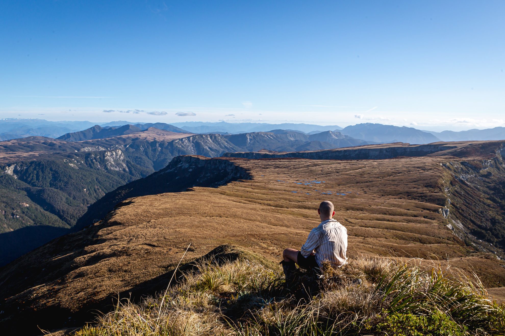
Regan hauled himself up between two rocks and pulled Ellen and me up behind him. From here, on trembling legs, we crossed the slope to the flat top of the spur. The route ahead seemed insurmountable. Some solace was gained due to a much better-looking way back down to the plateau should we need it. Now though, we decided hesitantly to investigate the route ahead. The rock of the first bluff was marginally sounder than WeetBix, and we crawled on hands and knees slowly upwards. Looking down gave us the reason to go up. Finally, the spur and The Haystack’s summit met and our ordeal ended. This is a mighty landscape, but formidable.
We dropped to the northeast from the summit, relatively easy going sidling along bluffs that plunged towards the Matiri River. The Haystack, though, was not finished with us. The trail disappeared over a bluff about 500m from the summit leaving no obvious route forward. The way south was obscured, and northwards a yawning chasm ran along the hillside. Regan investigated north and I investigated south where I found another deep ravine but with a route across to better ground, so the others joined me.
There was one awkward move towards the end of the route, but the going after Pt1377 is much easier, and we were soon making progress along the ridge and then down to the forest-cloaked saddle between Pt1333 and Pt1326. It is a pleasant goblin forest with views back to The Needle and The Haystack; the old Haystack Hut site was somewhere far below.
From Pt1326 where the route drops off the range, we could see two clearings in the bush below and Lake Jeanette in the distance. We descended to the first of these clearings and headed directly east before following the rounded spur to the south of the stream that drained the clearing. There was ample vegetation to cling to and at the bushline we skirted the edge of the trees to avoid a substantial bluff around the 1150m contour. Soon, however, there was nothing for it but a good old-fashioned bush bash. We took turns to forge a path through, at times, very dense undergrowth.
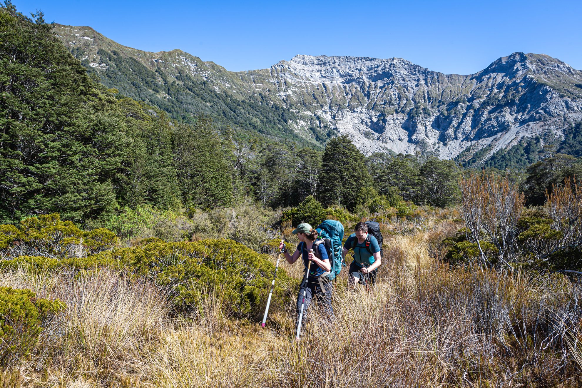
The map showed us tending southwest and we needed a correction, but the way was blocked by another bluff. Heading back to the south, we were on our bums more often than not. The gradient eventually softened, so we left the spur and turned northeast towards the clearing that we had seen from Pt1326. Across the clearing was more bush and Regan did well to navigate us down a poorly defined spur.
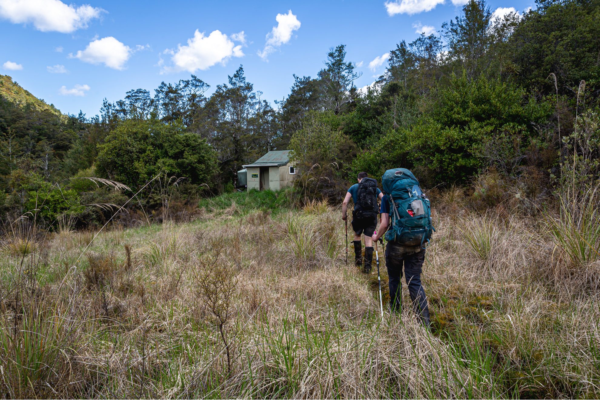
When we finally stumbled from the bush I was elated to see a waratah adorned with a faded orange triangle, and we were soon by the oasis of the Matiri River where it flows through beech forest. On weary legs we continued on the Matiri Valley Track in search of Hurricane Hut. The track wasn’t clear, but after a sweaty climb we emerged on the shore of Lake Jeanette, with Hurricane Hut tantalisingly close. Occasionally we lost the track through clearings, boulder fields and scrubby thickets, but finally, there it was, hallowed Hurricane Hut, where we collapsed under the weight of the day. We swam, ate, laughed and cried. A highlight that night was a date and orange dessert that we had been too full to eat the evening before. It had been quite a day.
What’s in a name:
From 1000 acres to 100 acre
The Thousand Acres Plateau was named by Murchison settlers, who called it ‘The Thousand Acres’. It was most likely a guesstimate: according to Toitū Te Whenua Land Information New Zealand, the plateau probably covers 2000 acres. It was used to graze sheep during summer in the early twentieth century.
To its north is the bluff-encircled 100 Acre Plateau, also known as the Devils Dining Table. Shaun Barnett wrote that it was known by other names too: Devils Napkin and Mount Misery Plateau. (Perhaps navigating it was once not so different from being in the lap of the gods?)
Describing features in the landscape as ‘devil’ is quite common. Ngā Pou Taunaha o Aotearoa New Zealand Geographic Board secretary Wendy Shaw said the features tend to be large, and “often difficult, tedious, or impassable for backcountry recreationalists”. Think hellish.
We retraced our steps the following morning and, at the clearing we turned around to see a huge cirque of broken rock beneath Pt1565. We followed the edge of a larger clearing before climbing steeply to a small ridge dividing us from the Matiri River. Travel was a treat, the way fairly open and free of windfall. Before the forest ran out to a scrubby slope, we had been amongst towering mountain tōtara and spindly dracophyllum. The route to the Matiri River was clear, although a mess of dead tutu and overhanging bushes.
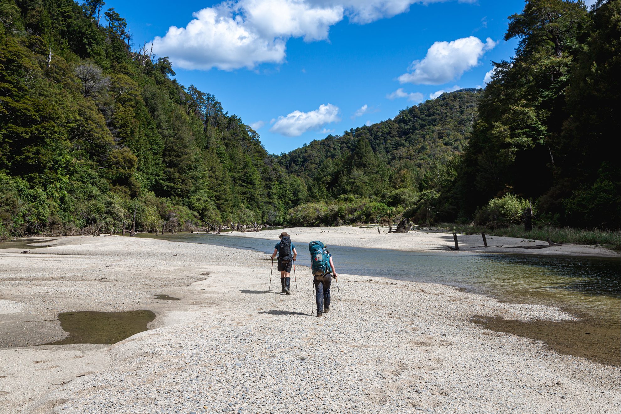
The track, along the true right of the Matiri, avoided deep sections of the river. There were few markers and often dense undergrowth. Twice we left the trail for the river, which was easier. Finding the track again when the river became impassable was less simple and involved some creative bush bashing. Finally though, we reached McConchies Hutt where we swam and retreated inside to avoid the sandflies.
Hut book tales of what to expect in the lower valley varied dramatically, from epic bush bashing to relative walks in the park, so we set off early next morning. The track went to the river and disappeared, only reappearing after 500m. This would be the theme for the rest of the day.
On the flats to the southeast we rounded a bend to a chaotic scene – trees strewn like pick-up sticks and the river running in a fresh channel, where it had obliterated the track. We picked our way down the side of the new channel, climbing over fallen beech trees.
And then, from the edge of the forest we walked to the shores of Lake Matiri among fields of flowers, with the hut visible across the water. We passed Lake Matiri Hut though and were soon reunited with Jane on the 4WD track on the way to the car.
It was an unforgettable trip, amidst some of the best wilderness in Kahurangi National Park.
Devils Armchair
This 1627m, blunt-faced peak overlooking the Ada Valley in Fiordland was named by nineteenth-century explorer Donald Sutherland. The Māori name is Te Nohoangao-Tu, literally the sitting place of Tuterangiwhanoa. The god Tu formed the fiords with his adze and rested here after his labours.
Devils Grip
A wicked section of gorge on the Buller River, christened by the Dashwood and Mitchell expedition of 1850. Stuff journalist Gerard Hindmarsh called it a ‘once dicey corner’ of the main access track along the river, where the dray road finished and the packhorse route began. Connecting them was a serious scramble around a crumbling rock face that necessitated a devil’s grip to negotiate. Today, there’s no sign on the Kawatiri – St Arnaud road of what was once such a treacherous ordeal.
The Devils Rampart
A towering wall of rock high above Devils Den Bivvy and Devilskin Saddle in Lake Sumner Forest Park. It’s a challenging scramble to reach the 1740m rampart. The bivvy is devilish by name but not by nature. After a bit of a grunt, it’s easily accessed from the Sylvia Tops.
Devils Staircase
Although not named on maps, Shaun Barnett wrote about this steep section of track that’s part of the route over the Silver Peaks to Jubilee Hut in Silver Peaks Scenic Reserve. ‘While steepish, the track is no more difficult than most tramping tracks, and hardly hellish.’ Two more devil’s staircases can be found in the South Island, one a hill on the rocky shores of Lake Wakatipu, the other at Pt740 overlooking North West Bay near Pelorus Sound. There’s also a devil’s staircase on the Tongariro Alpine Crossing in the North Island.


