
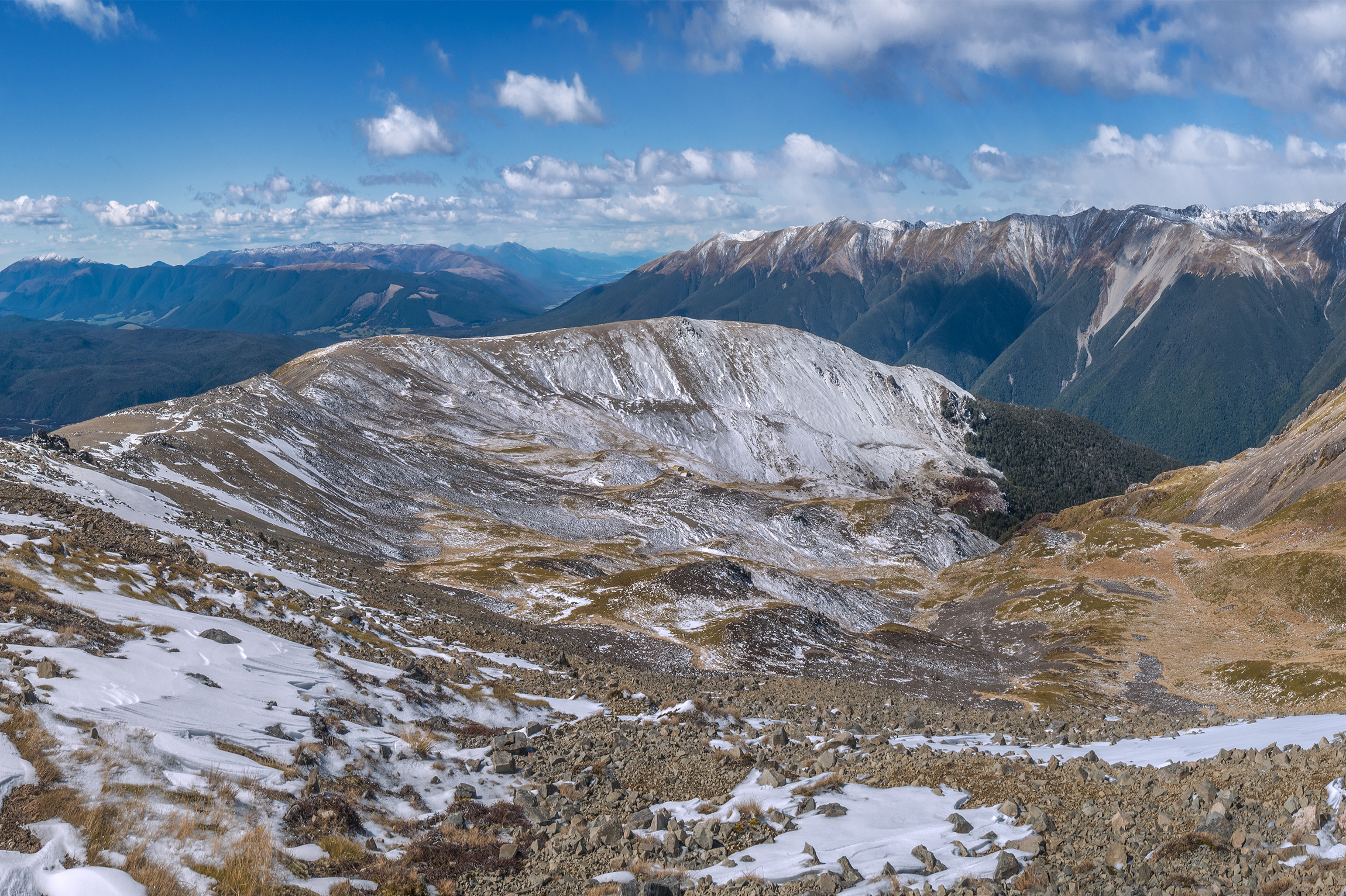
This route begins with a steep zigzag climb on the well-formed Pinchgut Track, gaining 600m quickly. This puts you on the tops with ever-expanding views for the rest of the route – a major reason for its popularity. But being on the tops also means exposure to whatever weather is present. Pinchgut Track becomes the poled Robert Ridge Route soon after passing Relax Shelter, and beyond Flagtop (1690m) it becomes more challenging. A small amount of moderate scrambling (where terrain demands the use of both hands) is required as you near Rotomaninitua Lake Angelus and the junction with the Speargrass Creek Route. There is no water along the route.
Distance 12.2km Time 5–7hr
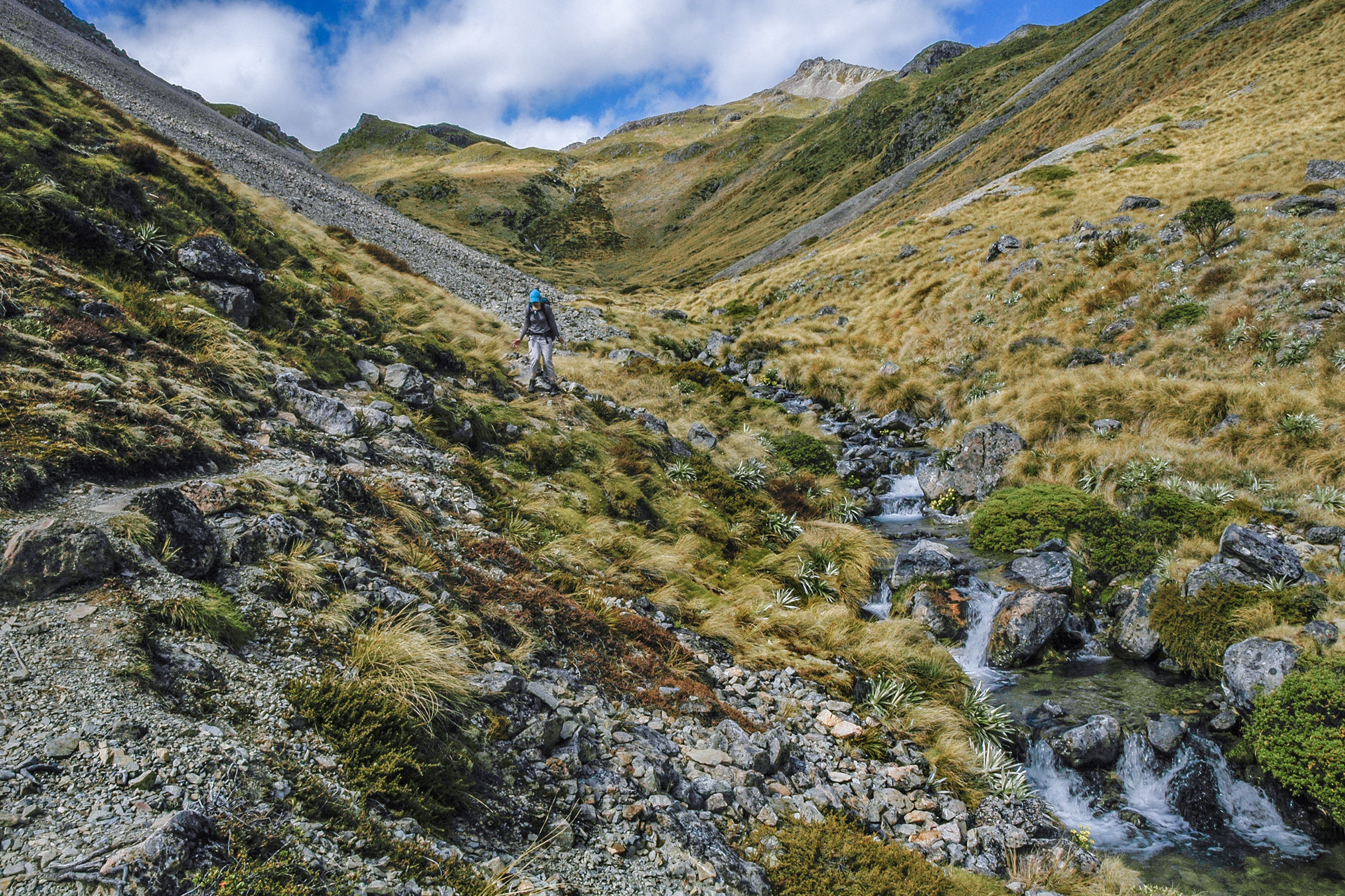
Although described here as a way to reach Rotomaninitua Lake Angelus, more commonly this is an exit route, particularly in bad weather, because it offers the easiest way to reach the shelter of the bushline. It is also the quickest way to return to Mt Robert Road car park. Speargrass Track gains less than 200m through beech forest and crosses seven tributary streams before reaching Speargrass Hut, just across Te Horowai Speargrass Stream. After this, the trail joins the Speargrass Creek Route and becomes a more challenging poled route through tussock beside the stream, then onto scree as you reach Robert Ridge.
Distance 11.2km Time 5–6hr
This option, extending beyond Speargrass Hut on the Sabine–Speargrass Track, is longer but offers nice views of Lake Rotoroa from Sabine Hut and spectacular views above the bushline on Mt Cedric Track and Mt Cedric Route.
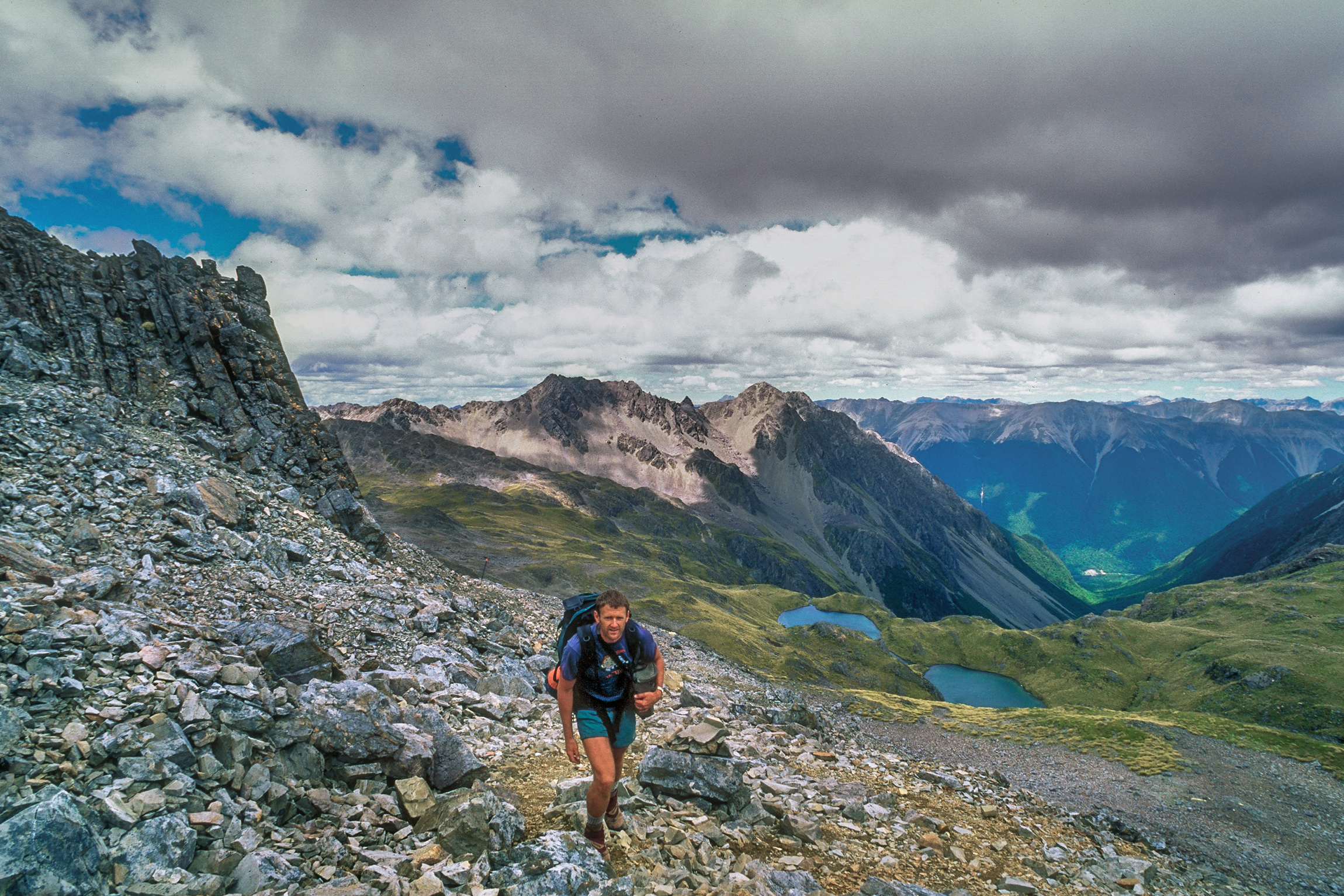
Beyond Speargrass Hut the track initially climbs 80m before dropping gradually to 700m through beech forest then more steeply to the lake shore and Sabine Hut at 450m. A night here is needed, because the climb the next day to Mt Cedric is a relentless ‘grunt’ for nearly 1000m, mostly through forest with no water sources. The gradient eases and continues on a poled and cairned route up to 1800m and magnificent views, followed by the descent to Rotomaninitua Lake Angelus.
Distance 18km Time 11–12hr
The initial approach on this route can be made easier by taking a water taxi to Lakehead Hut or Coldwater Hut. However, if you intend to return along Robert Ridge to avoid a 5km road-trudge back to St Arnaud, you can begin from Mt Robert Road at 700m, where the Lakeside Track begins, and follow this around to Coldwater Hut. It is about the same distance and time along the eastern side of the lake to Lakehead Hut.
From Coldwater Hut, the track to Hukere Stream junction with Travers River climbs just 30m on the well-formed Lower Travers Valley Track (note that the bridge over the Hukere Stream is removed from May to November due to avalanche risk). Cascade Track, beside Hukere Stream through beech forest, is also a pleasant amble up to nearly 1200m. From here it steepens significantly and beyond the treeline becomes a poled route. This hard slog is easier to climb than to descend.
Distance 18.6km Time 8–10hr (less 2.5hr if taking a water taxi to Coldwater Hut)
Of the five, this option involves the most complex terrain. The initial approach is via Coldwater Hut, continuing past Hukere Stream to the Travers Valley Track and then on to Hopeless Track. From there the track follows Hopeless Creek to Hopeless Hut, just 180m higher.
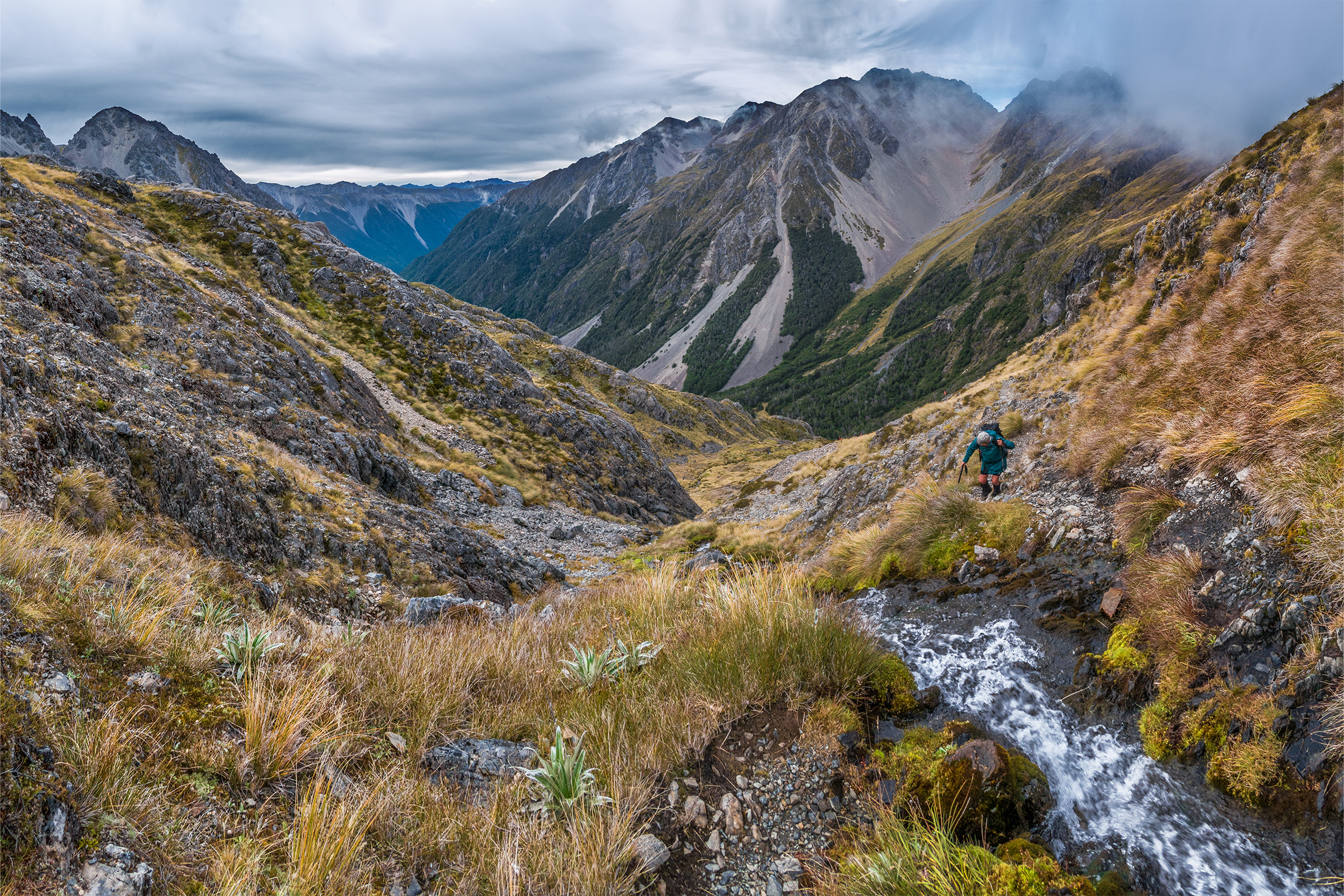
Beyond the hut another 200m of climbing on a well-trodden route through forest gives access to an impressive scree basin contained by precipitous bluffs. The route to Sunset Saddle initially picks a way through these bluffs. Beyond the scree there are frequent cairns along the route but no poles.
Initially, a steep climb up scree slopes on the true right of the waterfall at the head of the basin reaches about 1550m, where one stream is crossed as you follow another up, until it ends at a tarn at 1620m. Once here, you’ve put the most complex terrain behind you, but there is still some distance to cover to reach the saddle. Soon another tarn is passed to the east and the route climbs steadily towards the saddle, which comes into view at about 1750m. To the northeast loom the steep flanks of Maniniaro Angelus Peak.
The saddle offers views northward over Rotomaninitua Lake Angelus to Lake Rotoroa, and a steep 175m scramble up Maniniaro Angelus Peak will reward you with even more outstanding vistas.
The northwards descent from the saddle to Rotomaninitua is less challenging than the southern approach. Open terrain and more easily spotted cairns give access to tussock slopes, first passing a small tarn at 1820m (a lovely camping spot) then dropping to 1600m on the shore of much larger Hinapouri Tarn, before finally sidling back up to Rotomaninitua.
It’s possible to undertake the Sunset Saddle Route in both directions, but like Cascade Track, the ascent is easier than the descent.
If you’ve already been along Robert Ridge and are returning for something a bit more challenging, then coming in via the Sunset Saddle Route and exiting down Cascade Track is a memorable option. In this case, if your budget allows, you can treat yourself to water taxis to the start and finish.
Distance 23.3km Time 10–14hr (less 2.5hr if taking a water taxi to Coldwater Hut)


