
On the top of the bluffs, just west of the waterfall, we worked our way down a steep gully of rock and tussock, to where it eased onto an apron of boulders and sub-alpine scrub. Darryn led superbly through this maze, avoiding the worst of the speargrass. Lower down in the valley floor, prickly shield ferns sprouted prolifically, and the faint aromatic scent of common tree daisy (Olearia arborescens) wafted through the air. Profusely flowering bushes of it surrounded us as we rested.
Kay Creek Hut lies above the confluence with Death Valley, and our first indication of the hut was the long drop. Some humorist had posted a sign stating ‘heaven’ on the door, while another sign leading to it from the hut proclaimed ‘stairway to heaven’.
Set in a small, forested clearing, the hut proved rustic and appealing. Red, corrugated iron cladding, boulder-stone floor, open fire, beech-pole bunks and framing. While nothing indicated its history, we did read that members of Otago University’s Phys Ed School, led by Tussock Chapman, had ‘pimped it up’ in 2016. As Tussock was an old friend from my university days, it was a nice surprise to read this.
Lunch consumed, we made our way downstream, now on a marked bush track which offered reasonably good going. I was intrigued by a number of purple rocks strewn about in the riverbed, which seemed to be an unusual colour variant of schist.
We emerged into the Caples Valley past a small gorge and crossed on a swingbridge to reach Upper Caples Hut. Finding ourselves on the wide, manicured gravel track of the Caples Valley was a stark contrast to the valleys we had been tramping through.
When I’d last visited here, this was an open public hut, but since DOC constructed the large Mid Caples Hut down-valley, the Upper Caples has been managed by the New Zealand Deerstalkers’ Association and it’s kept locked. We camped on the flats beside it, amid a field of yellow-flowering ragwort and hordes of hungry namu.
Predator traps in the valleys form part of a DOC biodiversity programme in the Greenstone-Caples Area, and we enjoyed hearing a range of birds: kākāriki, korimako, toutouwai and titipounamu.
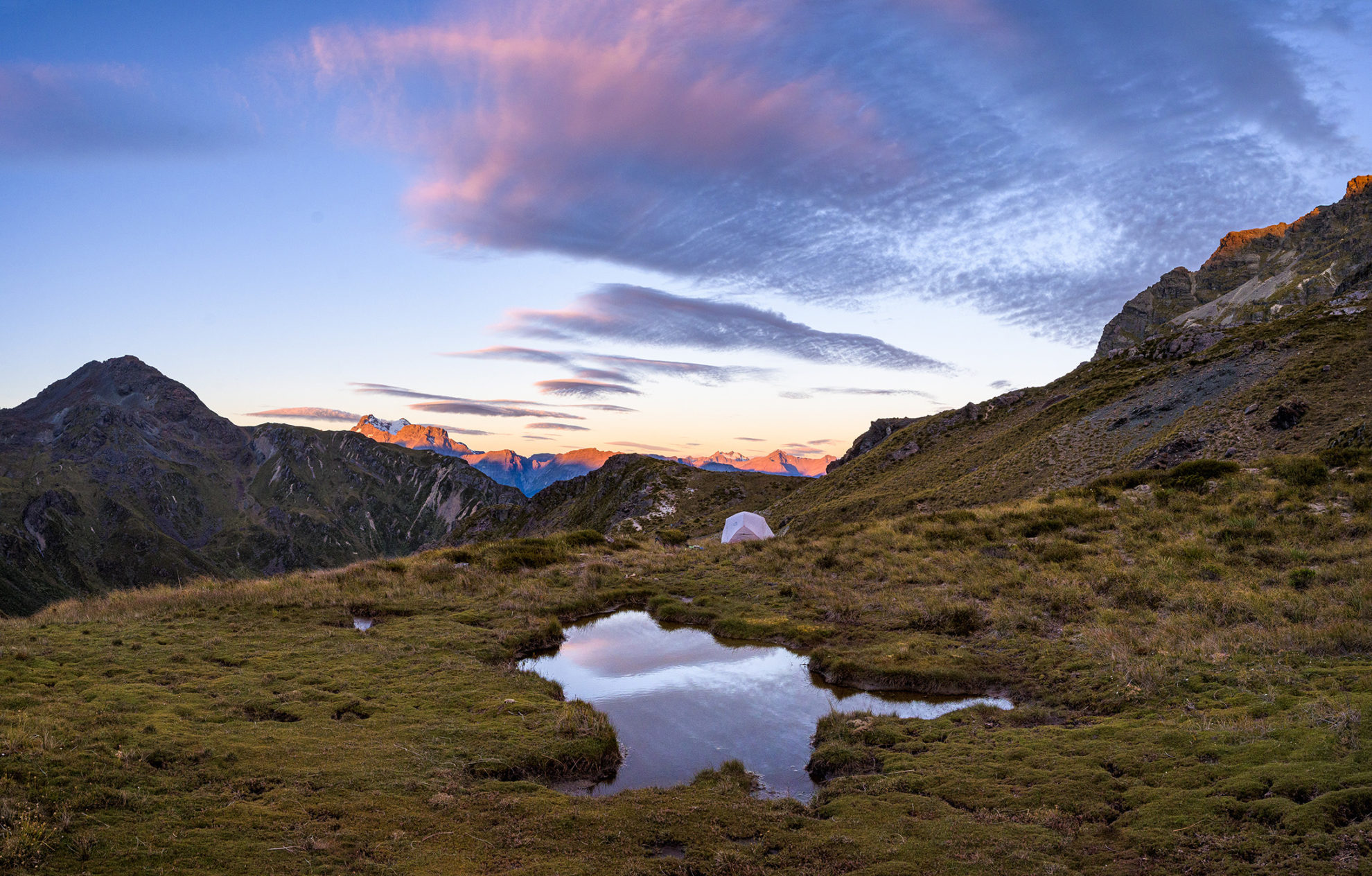
The predicted poor weather that had deterred us from our Main Divide tramp was now approaching and we watched the skies darken as the clouds gathered. Drizzle descended by dawn and promised worse to come. That, plus the ravening sandflies, seemed as good a reason as any for an early start, so at first light we dismantled the tents before they got too wet.
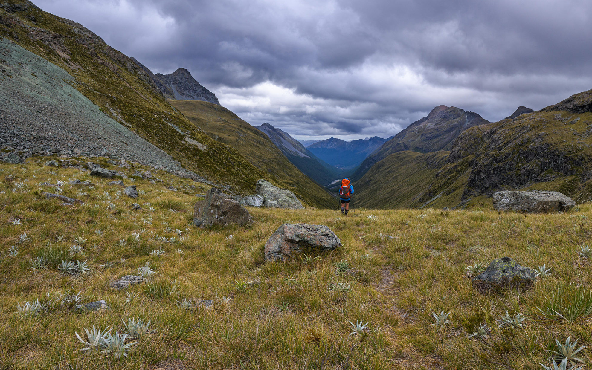
We followed the Caples Track downstream for a short distance before reaching the signposted Steele Creek Track. At first, this sidles and climbs on the lower forested flanks of the Aisla Range, before adopting a steeper incline. We’d already seen the neat curve of Steele Creek Saddle the day before and anticipated a straightforward crossing. It was our second and last pass and would usher us into more new terrain.
Happily, the rain eased and the skies brightened, giving good views back over the Caples Valley and the route we’d already traversed in Kay Creek. From here, our line through these mountains seemed such an obvious and direct one, but few trampers opt for it. We really were bisecting the Greenstone-Caples.
Poles lead us over a rocky shoulder before sidling along to the saddle itself, a place of delicate wetlands, small tarns and alpine flowers. Wind gusts of 50km/hr buffeted us as we crossed, but on the lee of the saddle, we found a large boulder to shelter behind whilst eating lunch. A gentle enough descent led into Steele Creek, following a reasonably well-marked route through scratchy sub-alpine scrub. Here we met a pair of trampers headed the other way, one of them barefoot. We wondered how he would cope with the speargrass.
Eyes glancing skyward, we bustled along hoping to reach the hut before the heavens opened. Kākā croaked on occasion and we saw one flying high above.
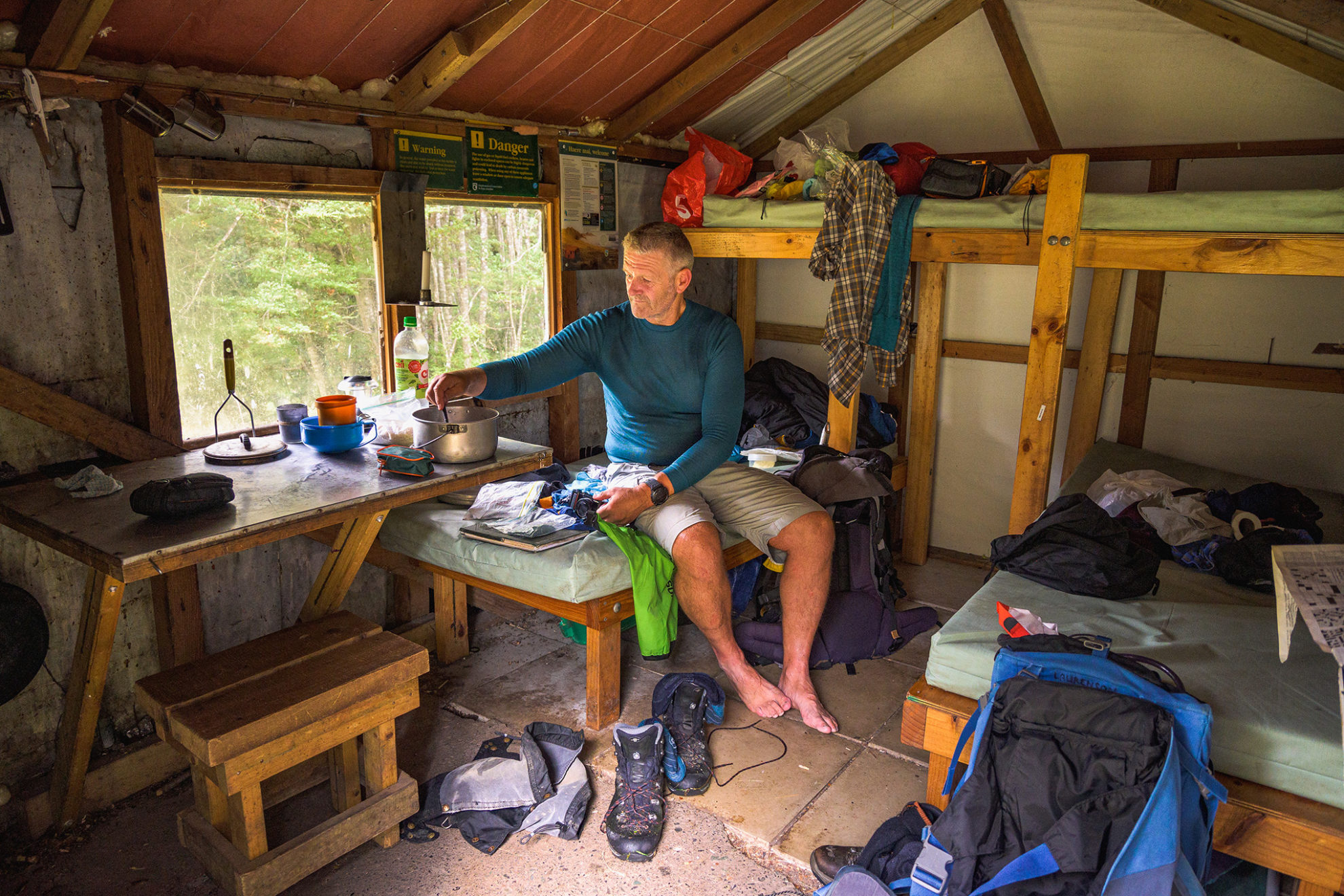
Steele Creek Hut was as pleasingly rustic as Kay Creek Hut; it had also benefitted from work in recent years. In 2014, Will McBeth of DOC Glenorchy flew in, removed all the lead from the hut (lead poses a poison risk for kea), and gave it a fresh coat of paint, using Dulux’s generous sponsorship deal; ‘Pioneer Red’ for the roof, ‘Khandallah’ for the walls, and ‘Claris’ for the door. Together, the colour variants created a nice effect. This effort was suitably commented on in the hut book, and we certainly appreciated the hut’s new mattresses. The hut gets regular use from the Otago Phys Ed students, and the occasional Te Araroa hiker wanting to escape the popular Greenstone.
Rain overnight eased to drizzle as we prepared to leave in the morning, but this did not matter too much now we were over our passes, and only had valley tra-vel ahead.
Travel down Steele Creek proved delightful; past a rushing, pretty stream, and through beech forest looking refreshed and vibrant from the rain. As we emerged into the Greenstone Valley, Darryn spotted a kārearea perched in a tree. We observed the falcon, its regal head a mixture of yellow and brown feathers, and its curved beak dripping with raindrops. It was a predator surveying its realm, indifferent to the weather; a prince of proud bearing. Eventually, it flew off and we moved on, too.
The Greenstone, while flanked with considerable mountains, is itself a gentle valley full of grassy flats. It’s the home of grazing Angus and Hereford cattle. Mist swirled in the mountain crags, and we strolled easily along the flats.
The 20-bunk Greenstone Hut, built by DOC in 2006, occupies a grassy ledge above a narrow gorge in the Greenstone River. The three tramping parties in residence were all Te Araroa hikers and, naturally, talk of the New Zealand trail dominated the conversation. On a mere five-day trip, we felt a bit like pretenders and decided to move on and keep with the theme of our tramp. No big occupied huts for us; we would camp or stay in a rough old shelter.
About an hour downstream of Greenstone Hut was the perfect place for the night: Slip Flat Hut. Tucked in the forest a wee way off the Greenstone Trail, and not signposted, this hut escapes undue attention. I knew about it from my last visit to the valley and since then, it too had been nicely done up.
With a door only about 1.5m high, it resembled a hobbit-hole and to get in we had to duck our heads like Gandalf. Flagstones on the floor, an open fireplace, three bunks, low ceilings, and a deer head beside the entrance completed the decor. We all appreciated that these huts meant lazy afternoons, reading and relaxing, shelter over our heads. It was a good reminder that taking your time on a trip means tramping can be a relaxing holiday.
During the fine, mild night, kākā whistled, ruru hooted their morepork calls and we slept the sleep of the contented.
Our last day was a short walk to the Greenstone Road end, using the well-graded valley track. While Peter decided to stretch his legs ahead of us, Darryn and I opted for a slower pace. We were surprised by the amount of tight pole beech on the valley sides and lots of loose, unstable rock in places. There were fewer mature trees than in Steele Creek, leading us to speculate whether the slopes were particularly unstable, meaning big beech had little chance of becoming established. So much of the ecology of the backcountry is a mystery, and it was fun making guesses about the forces that shaped it.
After crossing the Caples River on a sizeable footbridge, it was only 30 minutes to the road end, where we’d arranged a shuttle back to our car. By tailoring a trip that suited the forecast, we’d cut a line through the Greenstone-Caples, crossed two passes, and enjoyed the simplicity of rustic huts that had benefitted from just the right amount of maintenance.


