

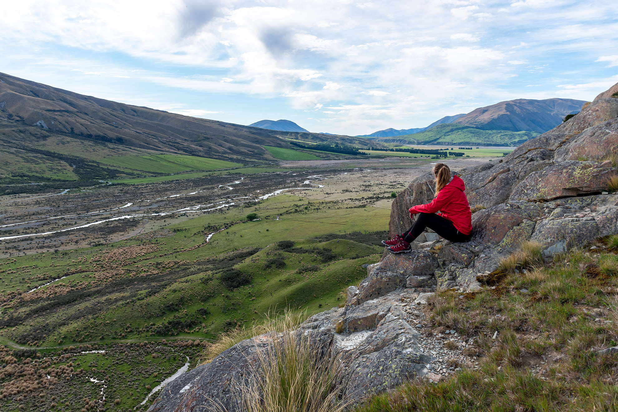
Mt Oakden
Lake Coleridge Station
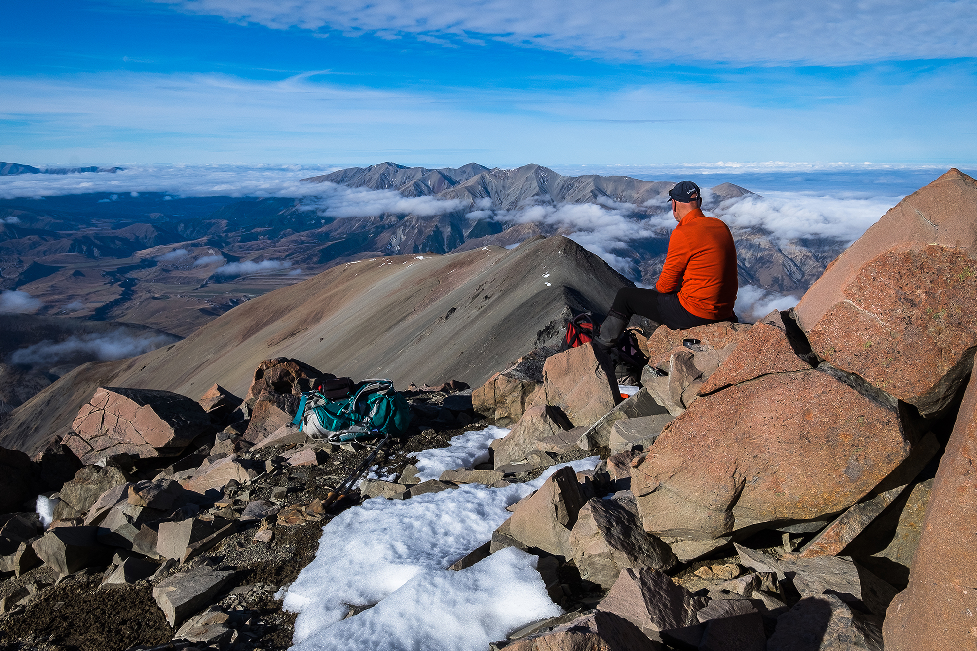
This requires a demanding 1100m climb, from the farmland flats at the head of Lake Coleridge to the summit (1633m). It’s unmarked, steep and rough and requires basic navigational skills. The best route is up a steep spur to the east of Lake Stream, which drains the shallow basin between the twin summits. The route is not technical but requires a good degree of fitness. There are outstanding views of Lake Coleridge and the vast expanse of the Wilberforce River flowing from the Southern Alps past the lower flanks of Mt Oakden. The two summits, 1590m and 1633m, stand about 800m apart and are separated by a broad but shallow saddle.
Contact Lake Coleridge Station for permission to climb the peak. This will most likely be declined during lambing season – mid-spring.
Access: The route begins at the head of Lake Coleridge after passing through the settlement and on through the campground beside the lakehead
Time: 6–7hr return
Grade: Difficult

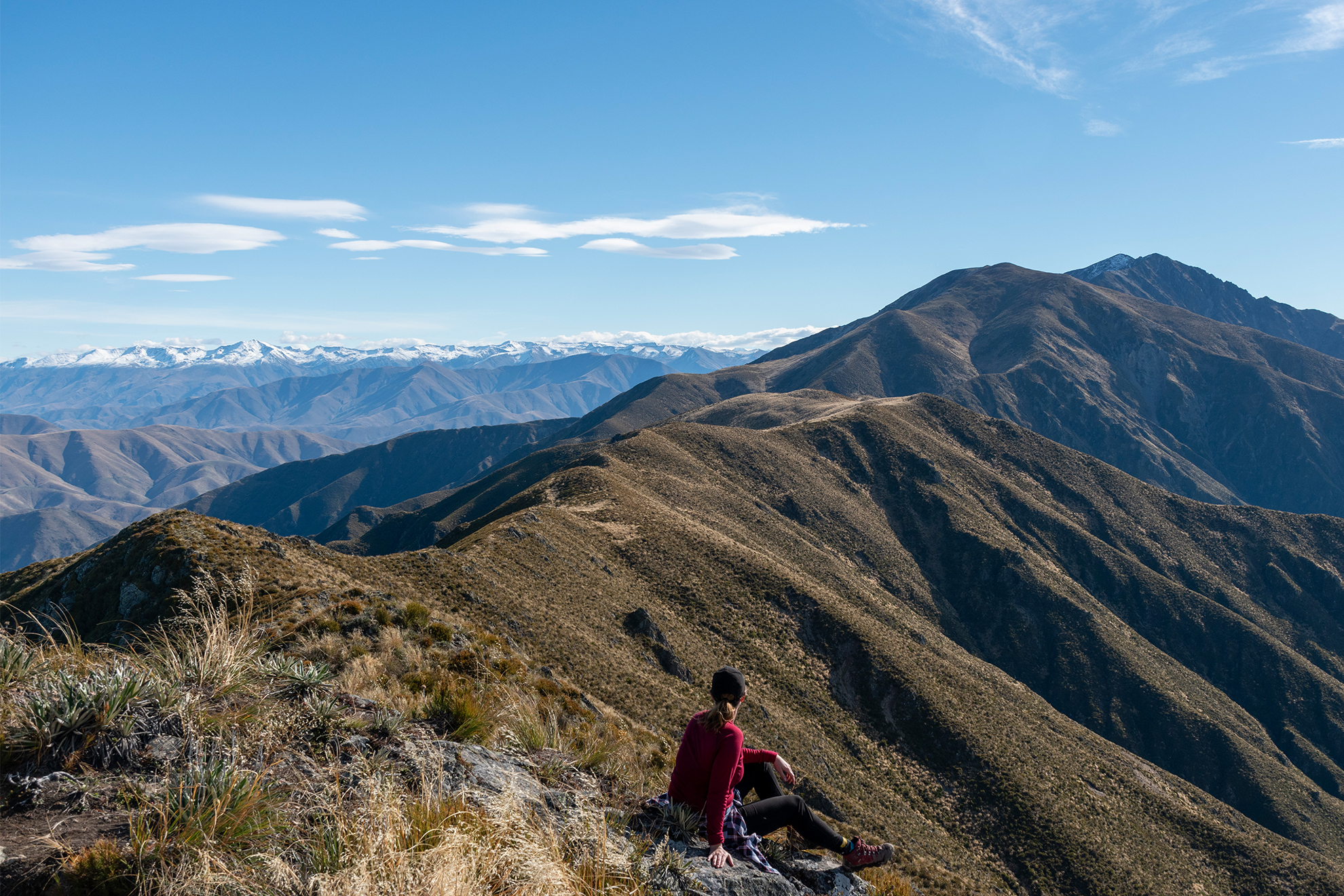
Foggy Peak – Castle Hill
Korowai Torlesse Tussocklands Park
Foggy Peak (1741m) is located directly north of Porters Pass. It’s among the region’s most popular short trips and can be achieved in a day from Christchurch. However, be prepared: the 800m ascent can be icy from early winter to late spring as well as being buffeted by strong nor’west gales. On a good day it’s a steady march uphill to an outstanding viewpoint of the Alps and the Canterbury Plains and reaching into the Arthur’s Pass mountains and the upper Rakaia watershed. From the summit, fitter individuals might like to strike out along the ridge crest to Castle Hill Peak (1998m), 3km and several sub-summits away. The final 200m ascent is steep and the views impressive. There’s no water on this ridgeline or on the way to Foggy Peak.
Access: From Porters Pass
Time: 4hr return to Foggy Peak (add 4hr to continue to Castle Hill Peak)
Grade: Moderate–difficult
Mt Enys
Craigieburn Forest Park
This turret-shaped summit (2194m) sits on the crest of the Craigieburn Range and is one of the highest foothills. From the top, you can see from the Alps to the ocean, including Arthur’s Pass National Park, the Wilberforce and Rakaia watersheds, the Puketeraki Range – even distant Aoraki on a clear day.
It’s a big climb – over 1400m – from SH73, entailing a long ascent over tortuous ridges and sub-summits, including Mt Cloudsley (2107m), and finishing with a 3km ridge march at over 2000m to reach the top. Don’t underestimate the effort involved and plan accordingly; the views and achievement are worth it.
Access: From Castle Hill Village. It can also be reached from the top of Porter Heights Ski Field by traversing the ridgeline north
Time: 9–10hr
Grade: Difficult
Red Hill
Korowai Torlesse Tussocklands Park
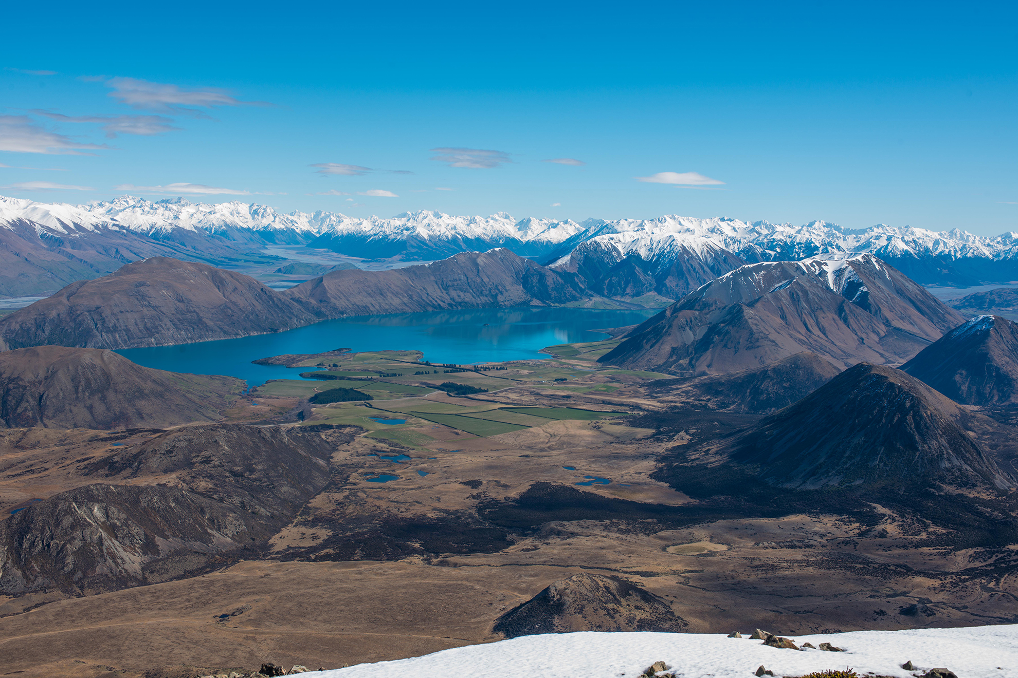
There’s a little excitement and exposure for experienced trampers on the way to this isolated summit, tucked away on the southern end of the Craigieburn Range. There are superb views of Lake Coleridge amidst a huge high-country landscape. There’s the feeling of being really in among the Alps. The unmarked route follows an easy mountain stream to the base of Coleridge Pass, from where a steep 500m ascent of the north ridge leads to the summit. An alternate route is possible from Lake Lyndon Road but involves permission from farmers. The northern approach is best done while the Porter Heights Ski Field Road is still open. In summer, take a mountain bike and ride this section.
Access: Porter Heights Ski Field road
Time: 4–5hr return
Grade: Moderate–difficult
Mt Grey
Mt Grey/Maukatere Conservation Area
Mt Grey (934m) is close to the ocean and has a different view to all the other foothill summits. It is easily climbed with a host of options for reaching the summit and descending, making a round trip a viable proposition. The lower slopes are covered in pine plantations, while the northern and western flanks are cloaked in native forest, mostly beech with some podocarp. The summit view is outstanding for such a modest hill.
Access: Lake Janet car park on Cramptons Bush Road
Time: 3–4hr return
Grade: Moderate
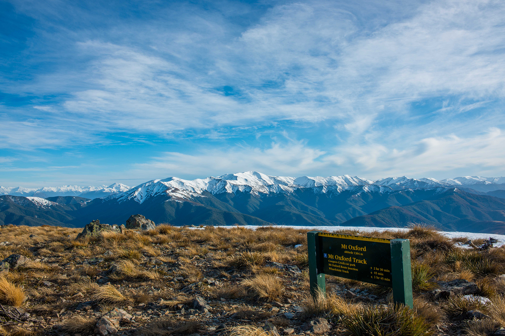
Mt Oxford
Oxford Forest Conservation Area
This one has a great view, a sheltered approach, a good track, a broad summit (sometimes a bit windswept) and lots of onwards options. The forest on the lower slopes has reasonable numbers of native birds as well as a diversity of flora. It is easily reached from Christchurch and is often used as a substitute summit when the weather precludes trips further west. It’s an agreeable day trip in magnificent surroundings and a good workout with a 1000m ascent.
Access: Mountain Road, northwest of Oxford township
Time: 5–6hr return
Grade: Moderate
Mt Sunday
Hakatere Conservation Park
Mt Sunday is the site of Edoras of the LOTR films trilogy, where the breathtaking scenery of the upper Rangitātā was the perfect backdrop. Day trippers can take an easy walk over the wide expanses of the Rangitātā before there’s a short climb to the top. The summit offers views and is a top spot for lunch.
Access: A marked car park on Hakatere Potts Road
Time: 2hr return
Grade: Easy
Little Mt Peel
Peel Forest Park Scenic Reserve
Mt Peel and Peel Forest Park, in the southwest of the Canterbury Plains, offer everything from short walks to see ancient trees to full-on tramps to the open tops. Little Mt Peel (1311m) is one of the latter and entails a full-day walk to the open ridge tops high above the Rangitātā River on a well-formed and marked track. The track climbs steadily through remnant forest to open tussock grasslands. Then there’s a longish ridge to several small knobs to the small summit and a day shelter on the southeastern face. It’s a superb location with a grand view to the north over the many summits of the foothills and east to the Pacific Ocean.
Access: Blandswoo Road
Time: 5–6 hours return
Grade: Moderate
Trig M
Korowai Torlesse Tussocklands Park
Trig M (1251m) is reached following an easy jaunt into rolling tussock-clad hills above Lake Lyndon. The well-marked and poled track ascends moderately from SH73 to gain the tops before heading southwest, above the lake, to the broad summit. There are views of the Craigieburn Range, Lake Coleridge and the Lake Lyndon basin, which is below the ridge, for much of the walk, and there’s lots of wide-open space stretching toward distant summits. The ridge can be traversed southwards all the way to Rabbit Hill.
Access: 1km west of Porters Pass
Time: 3hr return
Grade: Easy


