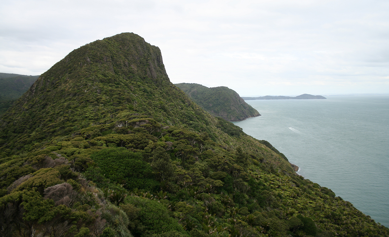
At the south-western tip of the Waitakere Ranges, at the mouth of the Manukau Harbour, lies the much weather- and ocean-beaten Whatipu.
This beach is a great example of how quickly the coastline can change with rough seas on its doorstep. An image close to the present-day beach shows how dramatically the shoreline has changed in recent years.
It’s remarkable that knobbly cliffs, more than a kilometre from the water, were once pounded by waves.
The entrance to Manukau Harbour was also the scene of the worst maritime disaster in New Zealand’s history when 189 people aboard HMS Orpheus lost their lives in 1863.
Head away from the beach, along the gravel road. After crossing a bridge climb left over a stile and stay to the right of a clearing.
A narrow muddy path and one or two orange arrows leads through a gate into the forest. Continue alongside Whatipu Stream.
The next 1500m easy – the only slight worry being the need to cross the stream four times in quick succession. A short climb leads away from the water, then there’s a final grunt up the valley side to a junction of footpaths, shortly before reaching the road.
Turn left along Puriri Ridge Track. This is a straightforward backcountry track with the odd steep sections which are slippery in places. Without warning an unexpected clearing allows a brief glimpse back down the valley and the impressive ‘lumps’ over which you later climb on the return leg.
Continue along the ridge until eventually joining Donald McLean Track to the road end. From here, a very well graded track spirals clockwise to the top of Mt Donald McLean, named after a colonialist who was head of the Native Land Purchase Department when the crown bought the Waitaks.
Retrace your steps to the junction of Puriri Ridge and Kura tracks and cross the road to the start of Omanawanui Track. The track heads through bush and brushes the road one more time before descending through forest and climbing the first of the bumps mentioned earlier – Pt241. Though steep, it doesn’t take as long to climb as you’d expect and the scant, low-level bush towards the top allows frequent views towards South Head and a good excuse to stop for a breather.
From here, the track descends sharply before climbing a second, smaller bump which allows a better view out to sea. It’s only a 15-minute descent to the car park from here.


34 years of inspiring New Zealanders to explore the outdoors. Don’t miss out — subscribe today.

Questions? Contact us