Find roots, mud and solitude in the hinterland of Abel Tasman National Park.
Often ignored in favour of its idyllic coastal counterpart, or the ‘real’ mountains of Kahurangi National Park, Abel Tasman Inland Track has its own rugged charm.
Shun the popular Harwoods Hole Track, and instead take the Moa Park Track at the very end of the road. This track heads north-east to Pages Saddle and around the base of Pisgah Hill to grassy Wainui Saddle.
From the saddle, the real fun begins with a short, sharp climb eastward through mixed bush. Underfoot is a network of gnarly roots and bog with a slippery carpet of dracophyllum leaves – a far cry from the footpaths usually associated with Abel Tasman National Park.
After 1km, the junction with Evans Ridge and the Inland Track is reached. Veer right on the Inland Track, which leads south to Moa Park Shelter. A scrawled note on a sign at the edge of Moa Park indicates the start of the unmarked route up Mt Evans, the highest point in the park at 1156m and a popular trip for local tramping clubs.
Downgraded from a hut in 2004, the bed-less Moa Park Shelter is gloomy and uninviting, but there are several good tent sites tucked into the scrub.
Ten minutes past the shelter is a short detour to a lookout over the tussock basin of Moa Park and the Burnett Range across Golden Bay. Moa Park is unique in that it is the only area of tussock in the whole of Abel Tasman National Park. Around the next corner is the longer side track to Porter Rock. Boasting views south and east to Mārahau, Motueka and the Richmond Range, Porter Rock is a worthy destination for a day trip.
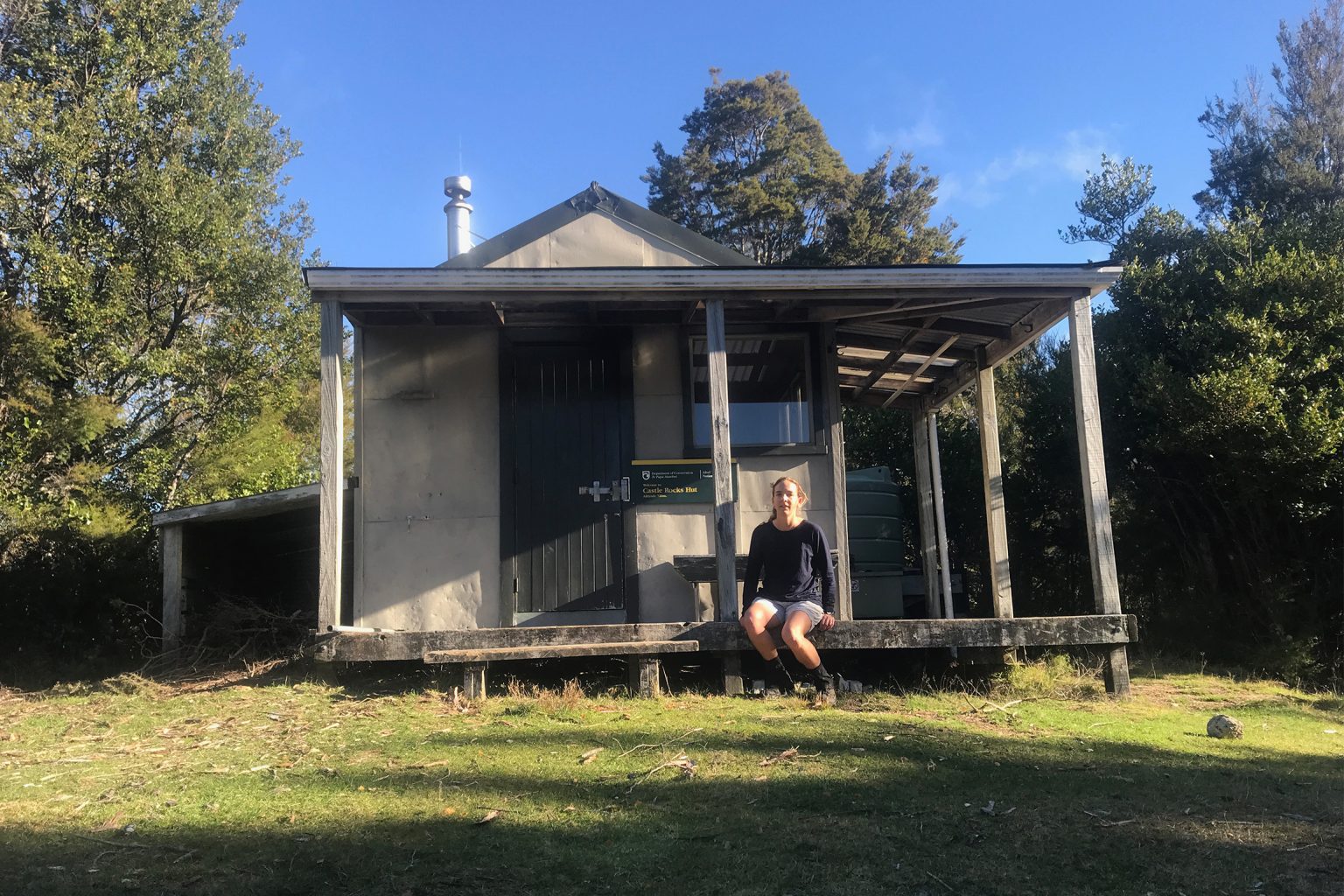
From the junction with Porter Rock, the trail begins to descend the ridge gently, lulling you into a false sense of security, before dropping steeply down some rooty sections. This mix of gentle strolling and rough scrambling continues for 3km to Castle Rock Hut.
The hut is situated in a sunny, sheltered clearing with plenty of camping but no views. Ten minutes of clambering brings you to Castle Rocks: jumbles of rocky outcrops atop the ridge, from whence the bush drops away steeply to the south to the Mārahau Valley. A quick flick through the hut book indicates that the eight-bunk hut is rarely full, even in summer.
It’s a 6.6km sidle from Castle Rock Hut down to Holyoake Clearing Shelter through lush bush which is more reminiscent of North Island tramping than the typical South Island beech forest. You know Holyoake Clearing Shelter is just around the corner when you suddenly find yourself on a benched clay track. Unlike Moa Park Shelter, the refurbished Holyoake Clearing Shelter retained two bunks when it was declassified as a hut, and it has vistas across Tasman Bay.
Continuing eastward, the easy track undulates through stands of kānuka to the turnoff to The Anchorage, after which it drops steeply down the southeastern end of the ridge toward Tinline Bay and campsite. Merging with the Abel Tasman Coast Track for the final 3km, the Inland Track, with its roots, mud and solitude, is exchanged for the Great Walk highway out to Mārahau.