
In front loomed Mad Dog Hill (1631m). The headwind was still fierce, resisting every movement. Near the summit, a sudden gust picked me up. I reached out instinctively to arrest my fall and landed awkwardly, a rock taking a chunk of flesh from my wrist. It was too cold to stop, and 10 minutes passed before we came across a spot sheltered enough to apply a field dressing.
From Mad Dog the terrain became more mellow. The views had disappeared into mist and atop Kāweka J we stumbled upon the junction with the track down the south spur to Back Ridge Hut. It wasn’t easy navigating this in fog. We eventually saw the hut, but rather than dropping to it, the track continued into the forest, descending to Sterns Saddle before doubling back, at which point the hut came back into view. That brought the day’s achievements to two huts bagged and some severe wind burn. I’d call that productive.
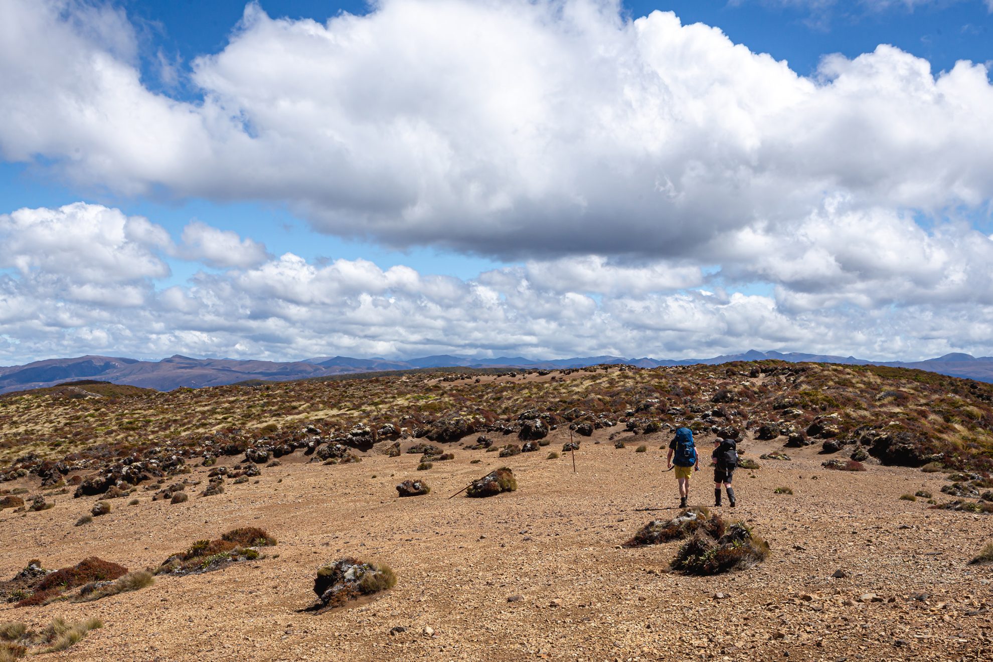
Around 7am the following morning we began climbing the steep hill behind the hut. Thankfully, the direct ascent relaxed once we gained the spur leading back to the ridgeline. We followed this and, near the spine of the range, ascended into cloud. The wind soon rose to a crescendo equal to the day before. A sign marking the junction to Whetū materialised out of the mist and we took a sharp left turn along the rolling tops towards North Kāweka (1707m). Despite the open ground, our paths were erratic as we leaned into the wind at absurd angles. Passing North Kāweka, huge gusts of wind were launching us into the air. It might have been hilarious if this wasn’t such a pivotal moment in the trip.
“Are we okay to continue?” I yelled to the others. I got reluctant nods of approval. Stumbling onward, I made a mental note of potential bail-out routes. None looked fantastic, and I crossed my fingers that they wouldn’t be needed. Finally, as we started to descend to the saddle southeast of Pt1668, the wind began to relent. We soon reached the wider tops that led to a peak called Whetū (1650m), where we found a sign that signalled the route along the ridge to the junction with the trail to Ballard Hut. With hot tea and shelter in mind, we made quick progress down the heavily eroded track.
Ballard Hut was beautiful, a cosy cocoon out of the wind. We hung up our dripping coats and put a billy on to boil.
Only after lunch and several cups of tea could we bring ourselves to leave, and as we climbed the clouds parted, revealing for a moment the full majesty of the Kāweka Range.
Once at the junction again we headed west along the ridge towards the bushline. There was a small skirmish with scrub before we reached the shelter of the beech forest. From the bush edge the track descended steeply, then took a lazier path between moss-covered trees.
This pleasant walking continued for several kilometres until the steep climb to Venison Top. Rain was pelting down by the time we ducked under the veranda of Venison Tops Hut (Tira Lodge), our shelter for the night. Another two huts for the tally!
Next morning, all signs of rain had cleared. Cloud swirled in the valleys and we enjoyed the novelty of sunshine along the tops. Our time out of the bush was pleasant but short, however: after less than a kilometre we were back in the thick of it, beginning a steep descent to Rocks Ahead Hut. Over 700 vertical metres later we reached the three-wire bridge over Rocks Ahead Stream. The hut could be seen perched on the far bank above the bridge, a truly glorious location with the river glistening below under the lush canopy of the forest.

I was becoming a little apprehensive of the river, as the track to Manson Country lay on the far side of that fast-flowing water. The map showed a cableway spanning the river, but would it be usable?
Climbing from the hut, we caught sight of the cableway. One question lingered: who would go first?
Hugh volunteered, saying, “I’m the heaviest. If I make it across, you should be fine.” He somehow fitted himself and his pack snugly into the small cart and gave me the thumbs up. I wished him luck before letting go.
The result was anticlimactic. The cart slowly rolled partway across the river and came to a halt. Now I had to work. Using every ounce of my strength I struggled to push the crank handle over the top of its rotation. Hugh dangled for some time at the edge of the far bank, contemplating his life choices until, with one final effort, I managed a last turn, moving the cart just close enough to the bank for him to alight.
That turned out to be the worst of it. Aimee and I made it across easily.
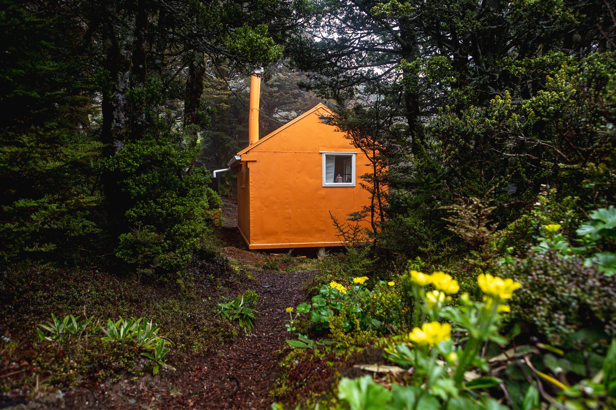
We set off up the hill and quickly reached Rocks Ahead Bivvy, a cheerful orange building in a large grassy clearing. From there we began a sharp climb to the tops. It was a blessing to reach the edge of the bushline, and for the first time on the trip we were thankful for a cool breeze.
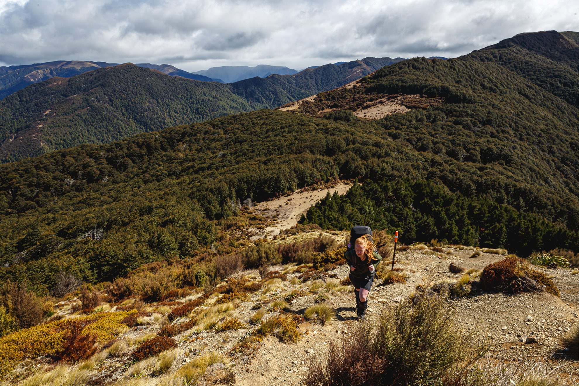
Our introduction to Manson Country was a climb over a series of rocky knolls at the upper end of Spion Kop. The rugged country soon gave way to rolling tops of eroded volcanic debris. Travel here was simple, and we quickly completed the easy climb to the weathered peak of Manson (1448m) from where there were stunning views of the surrounding tablelands and the rugged peaks of the main range.
The track from Manson descended gently above the headwaters of Tapahiwhenua Stream. Along the ridgeline we could see Manson Hut shining in the distance. Our route followed the ridge down to a saddle before traversing to the hut under mountain beech.
After a quick lunch we dropped our packs and followed a path that led to an old rabbiter’s refuge. After what seemed an impossibly long descent we stumbled into the open next to the historic Old Manson Hut. It seemed habitable, although weeds were growing through the floor beneath the information boards that hung on its ancient walls.
We climbed back to the newer hut and our packs just as a new front of showers rolled in. From Manson Hut we pottered on, traversing the easy tops past Pt1311. This marked the end of Manson Country, and our path dropped away with the landscape.
Tops gave way to mānuka regrowth, with the occasional clay pan to cross. These required careful attention – the danger wasn’t great, but dignity was on the line. The track descended to the saddle northwest of Pt692 (not quite aligned with where it was shown on the map), then doubled back on itself, covering rough swampy ground to deposit us at the foot of the swingbridge over Ngaruroro River.
Once on the far side we made our way upriver to Kiwi Mouth Hut, where we collapsed in a heap, happy that our big walk was over. Unfortunately, the day’s mahi was not yet over: as the hut was full for the long weekend, we had to pitch our tent before we could have a long-anticipated swim. Another five huts for the tally.
The next morning we followed Kiwi Creek upstream, which proved to be a delight. A worn track alternated between the left and right banks and we made quick progress. After an hour we began the 300m climb to the spur that would lead us to Kiwi Saddle Hut. Although short, it was brutally steep. At the spur, the going became more pleasant and we were soon climbing through the enchanted beech forest that cloaks the saddle. The hut chimney was happily puffing away when we arrived around 10am and we stopped in for a snack.
When we set off again it was into the wicked land of contorta, not the lovely beech we had been enjoying. The wind blew savagely as we made our way up the Smith Russell Track, but at least we could stay on our feet this time. Where the contorta hadn’t taken hold we were treated to great views over the lower catchment of the Ngaruroro and back to Manson Country.
Crossing Pt1359 before descending to Kuripapango, we detoured left to ensure we would emerge at The Lakes car park. The track began a swift descent. Finally, with trembling knees, we stumbled into the car park. Another memorable adventure for the books, with 10 huts tallied. Not bad, if you ask me.


