Take on the Karioi Crossing – a dramatic day trip that’s doable in any season.
Karioi Track starts opposite Te Toto Gorge. The gorge is an ancient amphitheatre over the Tasman Sea that’s well worth a look. Remnants of 18th century Māori gardens and karaka groves are to be found here.
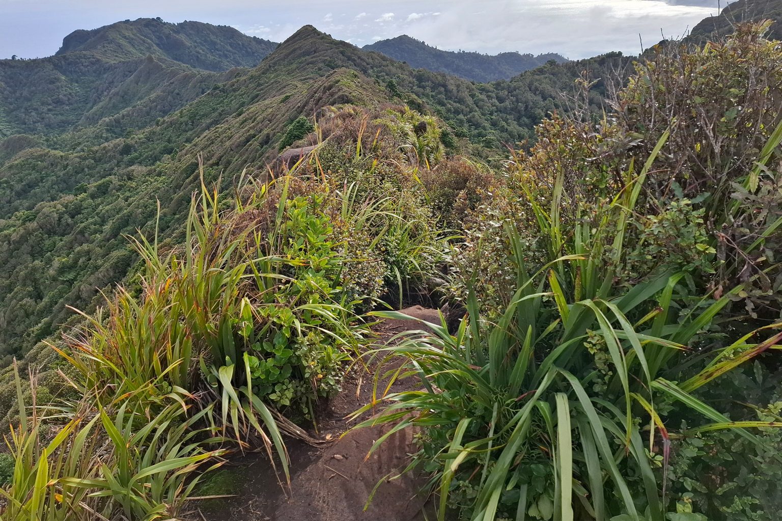
The track follows a reasonably steep fenceline up to bush that marks the end of the farmland. This boundary also signals your entering Pirongia Forest Park. Now, the fun begins as you pick your way over Karioi’s ancient basalt spurs. Ladders – then chains – add to the antics as you climb higher. You’re on Karioi’s ramparts, take ‘em in your stride!
After 2km and no more than 90 minutes, a side track at Pt706 leads to a lookout. You’re now nearly 500m above Whaanga Road and the lookout offers fine views over Whaingaroa and the Waikato coast. Many people make do with the trip to the lookout and you’ll likely pass casual walkers or mountain runners on any day.
The main track beyond the lookout is less travelled. It follows Karioi’s dress circle for 1.5km, through moss-covered trees and scary volcanic bluffs, undulating over rugged crests with glimpses to Whaingaroa and Kawhia. It can be moist, muddy and misty up here – unsurprising given Karioi juts into the Tasman Sea.
From the lookout it’s 1.5km to a rock face requiring attention, before scuttling up a ladder onto Karioi’s 756m summit. Pause to admire panoramic views where the complex and mesmerising ridges of this long-gone stratovolcano reveal themselves. A nearby helipad opens up the views over Aotea Harbour and to Pirongia – an amazing spot to kick back for a moment.
Another ladder off the helipad takes you quickly back to bush and onto Wairake Track, which ushers a smooth 2km run to the bushline and farm boundary. Carry on along the 4WD track through the paddocks. The track ends at the private Karioi Road. Continue walking another 1km to the public car park just off Ruapuke Road.
The Karioi crossing can be walked in either direction. You will need to arrange transport, retrace your steps, or face the 16km walk along the road back to Te Toto Gorge.
Distance
8.1km
Total Ascent
603m
Grade
Easy
Time
4–5hr each way
Access
Te Toto Gorge car park at Whaanga Road, and Ruapuke Road
Your device does not support GPX files. Please try a different device.
About the author
Lachlan McKenzie
Lachlan McKenzie began tramping as an adult and hopes to inspire others to do the same. He most enjoys tramping in small groups and alone, and his list of ‘must do’ trips only seems to get longer. Lachlan is a communications professional and holds tertiary qualifications in marketing and music. He also loves orienteering and is keen to extend himself in basic mountaineering.
Harris Saddle and Routeburn Falls Hut, Mount Aspiring National Park
Upgrading to ultralight without replacing everything
Walk1200km in 2026
Subscribe!
Each issue of Wilderness celebrates Aotearoa’s great outdoors — written and photographed with care, not algorithms.Subscribe and help keep our wild stories alive.