An easy(ish) walk up the Cameron River to visit the hut with the famous purple door.
To access the track to this hut, drive 4.5km past Mt Arrowsmith Station on the Hakatere-Heron Road and look out for a gravel /4WD road on the left just before a gate. Drive down this for 1.5km to the track start.
Sign the intentions book, as the track goes over private land and the runholders like to monitor access over their property.
It begins as a wide 4WD track as it meanders along the flats to join the Cameron River, just before Big Gully on the true right. The track stays on the true right of the river the whole way to the hut, and it is possible to avoid wet feet – aside from the occasional stream crossing, and boggy sections exacerbated by farm animals.
Follow the markers as the track shifts back and forth between the riverside and terraced flats, where there are sections of scratchy matagouri. In low flows, it is possible to cross the river to avoid these prickly sections. The marked sections of track are essentially flood routes, and some will provide easier walking than in the river, but it’s a gamble as to which will offer better travel.
After 7.5km of easy, flat walking, Highland Home (a private hut) is visible on the true left of the Cameron River. Strone Stream tumbles down to join the Cameron River just beyond hut on the true left.
Near the 10km mark, it’s essential to locate the track again, which runs on a terrace just above the river. It’s marked and a stone arrow and cairn indicate where to begin ascending 150m through tussock to avoid a trickier, more gorged section of the river below. Here, speargrass joins matagouri in an effort to stab you. Gaiters are essential.
After two kilometres, the route again descends to the river. Finding markers down the last one or two contour lines can be tricky but they are not strictly essential, and upon reaching the river, it’s easy to spot the track as it flattens out again.
From here, the topo map indicates a track continuing up the true right on terraces, then leaving the river to gain 200m and curl around to the hut. This is fine if you prefer a more challenging route, but it is easier to follow the river sections, which are unimpeded by spiky things and high tussock. A large orange marker sits at the confluence of two watercourses south and 120m vertically below the hut – this is the spot to aim for, then follow the obvious cairns and occasional orange pole up the watercourse on the looker’s left. Ignore the topo track altogether. Just after the 15km mark the track swings up and east to reach the hut.
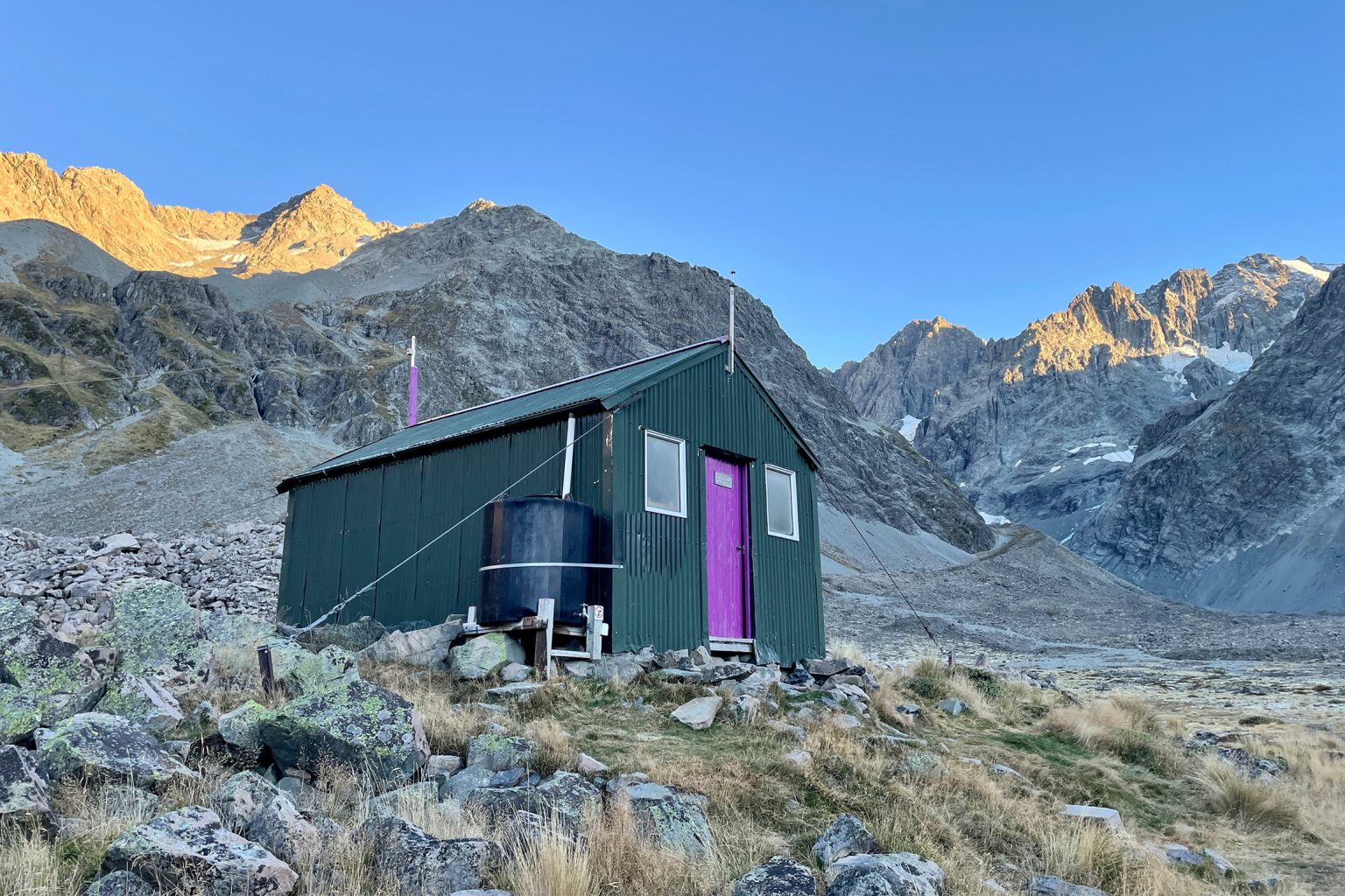
The hut was built by the Canterbury Mountaineering Club in 1952 with materials carried in by club members, then rebuilt in 1982.
It’s popular as a base for climbing Mt Arrowsmith, and for ski tourers accessing the slopes towards Peg Col. The iconic purple door gives it a jaunty, cheerful look, standing out as a spurt of colour against the grey landscape.