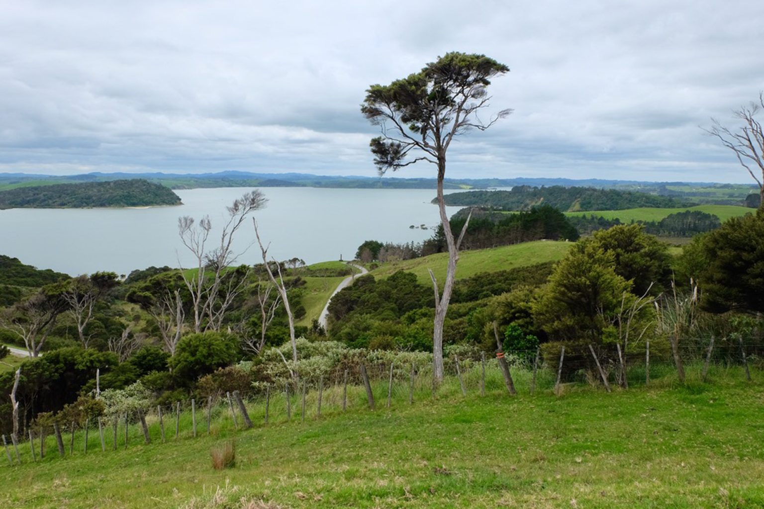
This ‘grand tour’ offers views across tidal Ōruawharo River to Kaipara Harbour.
The 843ha Ātiu Creek Regional Park was gifted to the people of Auckland by Pierre and Jackie Chatelanat and opened in 2008. It’s a mixture of undulating pasture, native and exotic forest, wetlands and mangrove habitats. Horses and bikes are permitted on many of the tracks and you can even camp overnight with a horse.
Humans have occupied this area for centuries, and the Ōruawharo River remains a source of kaimoana for mana whenua Te Uri o Hau and Ngāti Whatua. Historic pā sites are clearly visible, located to defend the Ōpou portage in particular, where waka were carried overland to the southern arm of the Kaipara Harbour.
From the park’s car park, take the Ōruawharo River Trail (red marker posts) coastward along the farm road. On interpretive panels are brief stories of those who worked the land. Elsewhere, panels describe the park’s history, its role as a working farm, the birdlife and natural environment.
Descend for 1km to the woolshed, then leave the Ōruawharo River Trail, go through the gate and veer left. Take the cross-country Kauri Point Track (orange marker posts) and, at 1.65km, the side track down to the jetty on Takahe Creek. Return and continue along Kauri Point Track, which tucks in and out of fenced forest blocks. Views of the estuary can be had at a bench at Ātiu Creek East (3.77km).
At 5km, turn right back onto the Ōruawharo River Trail and walk up the road to the gate that leads to the campground and Ti Tree Point. Straight ahead, almost within sight, is another gate that leads to the point. Cross the paddocks to the lookout where a plaque commemorates the opening of the park (6.5km). Return to the intersection and turn right onto the road towards Solomons Bay and the campground (8km).
Descend to the bay – a good spot for a rest, though swimming is not advisable anywhere as the river is tidal, the shore muddy and the current can be strong. Continue along the road to Ōweka Tapu Pou, one of many cultural sites in the park.
The road now heads inland and uphill, passing a Remembrance Forest that recognises those who served in the NZ Defence Force. It then becomes a wide track that leads to Solomon’s Pā (9.8km). Turn left and follow the grassy track to the start of the Reservoir Walk (11km, yellow marker posts), which leads downhill through mature pine forest.
Turn right at the fence and head along the 4WD track to reach the reservoir, partially obscured by vegetation. Emerge and cross the paddock, turn right at the road and follow the yellow markers round the bend. Walk up the hill to rejoin the Ōruawharo River Trail, past the Kaitiaki Pou (12.7km) and back to the car park.


