
Chasing facts
I was on the fence about Te Tatau Pounamu being a wilderness area or a remote experience zone, but those who know more than I do tell me it’s the former. It was gazetted as a wilderness area in 1962. I’d gleaned this from an old New Zealand Alpine Club journal, which held the only information I was initially able to find about the area. FMC had a section for Te Tatau Pounamu on their website, but all it had was a picture of Oturere Hut, which is just outside the area. I’d read that Les Molloy was sort of the godfather of wilderness areas in New Zealand, so I chased him up through FMC.
Molloy had been on the edges of the area, circumnavigating the Te Maari craters (pre-2012 eruptions), but pointed out that most of the former Lands and Survey staff who would’ve been involved in gazetting it were long gone.
“Te Tatau Pounamu Wilderness Area was gazetted long before the Wilderness Policy (describing minimum size) was written – both of Tongariro National Park’s wilderness areas [the other is Hauhungatahi] are less than 10,000ha,” Molloy says. “When I was on the Tongariro / Taupō Conservation Board in the mid-2000s, as part of the review of the Tongariro National Park management plan, DOC suggested downgrading both of the park’s wilderness areas to ‘remote experience zones’ because they don’t fit the criteria – but some of us on the board resisted and they remained legal wilderness areas.”
I found a 2001 document, The State of Wilderness in New Zealand, with a caption stating that nearby Hauhungatahi was rezoned to ‘remote experience’ in 1990. However, it also mis-spelt Te Tatau Pounamu as ‘Te Tatua-Pounamu’. Information continued to elude me.
Traversing Te Tatau Pounamu
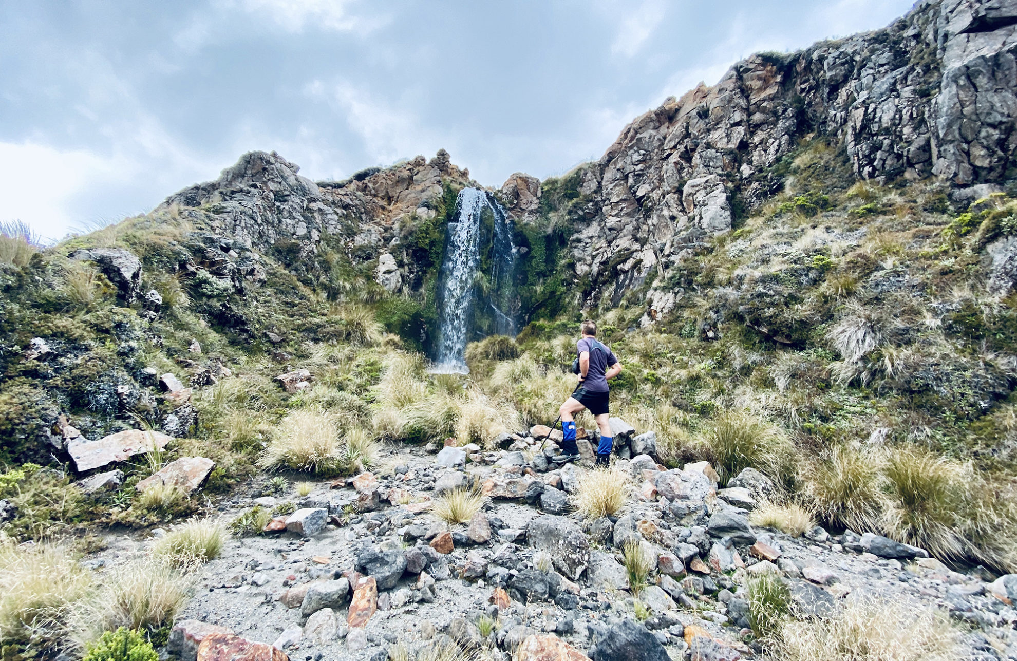
The next day was equally misty as we headed south to gain a small ridge. From there we dropped into a craggy branch of the Mangahouhounui headwaters, passing another sulphur cliff with potential campsites and sidling around to visit an 18m waterfall.
There was no sign of human activity, only deer. Lots of deer. Big deer. A hunter’s paradise.
There simply wasn’t time to travel up and down the Mangahouhounui Stream but we could see the scrub and forest lower down and a zigzag stream chopping a course through the landscape.
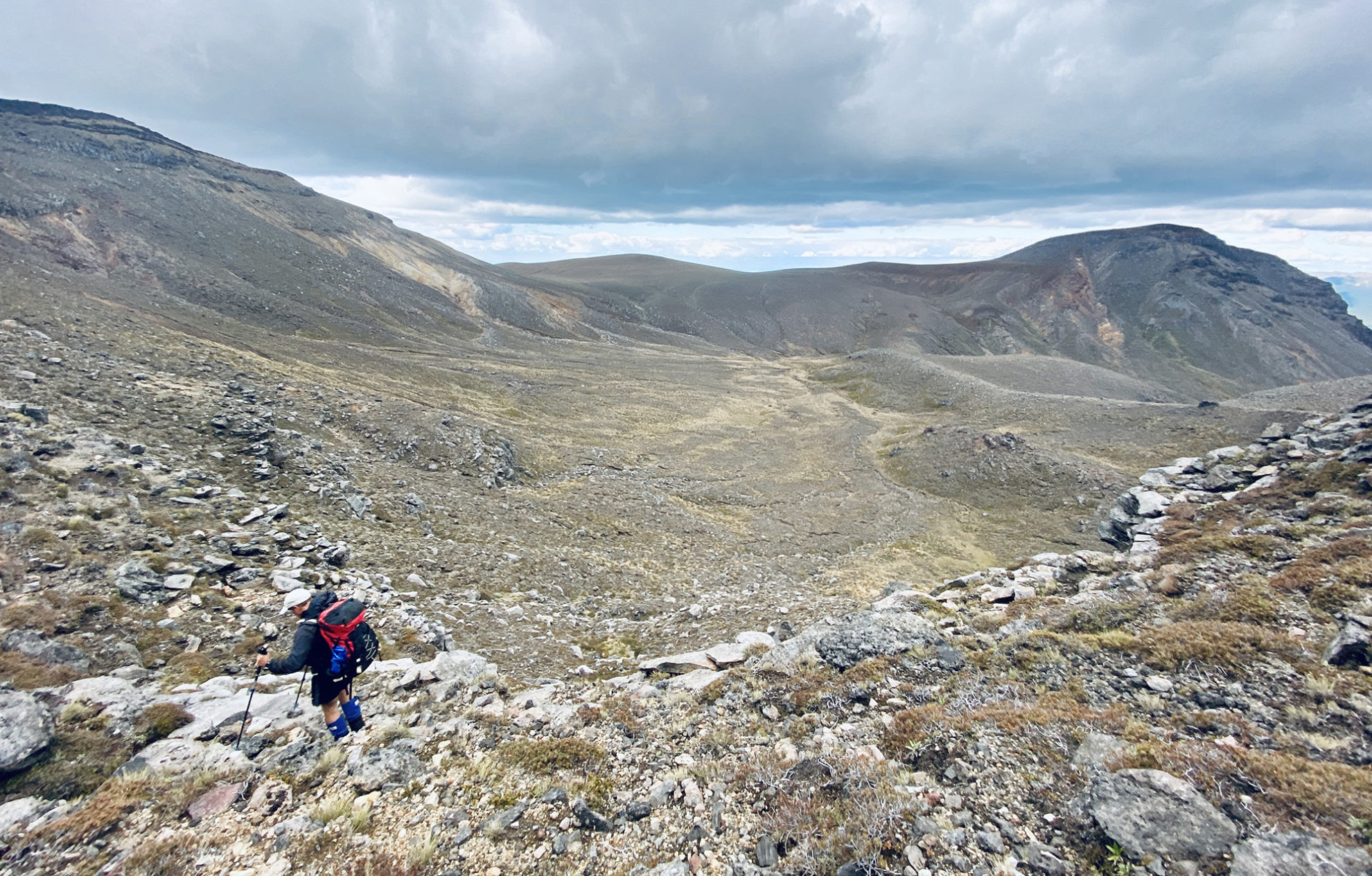
We followed a water course towards a suspected saddle (suspected because it’s a wilderness area, so who would know?) just west of Pt1673. Despite a lot of loose rock, it went easily and gave entry to a flatter, rolling landscape on the other side. From there it was a case of picking the easiest line towards Oturere Hut. I was hoping to see a series of waterfalls at the top of the Mangatawai Stream, but the terrain was bigger than anticipated and we had to keep angling south to re-enter the national park.
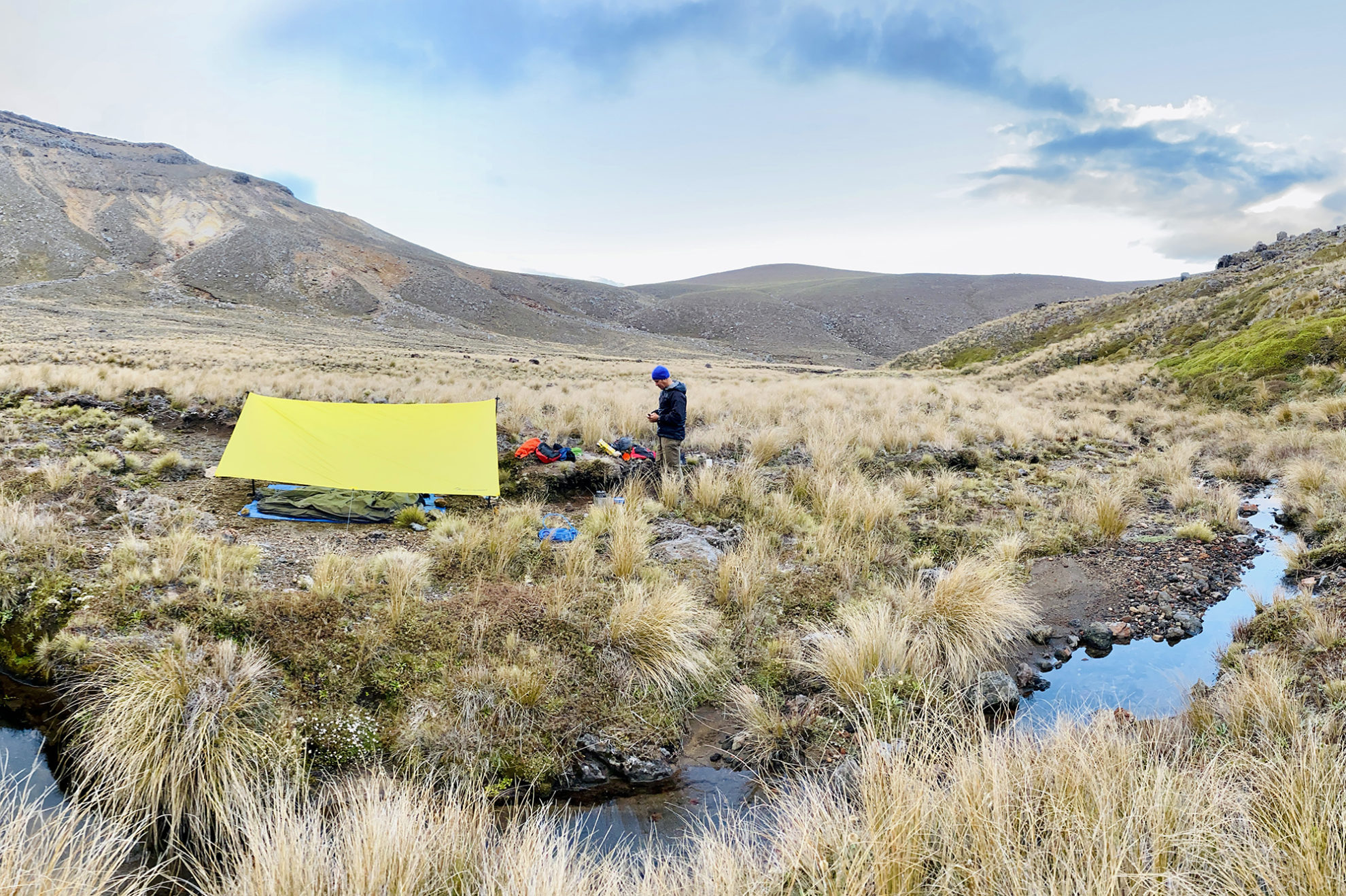
Popping out of the wilderness area at Oturere Hut (Oturere Stream being the border) we met too much humanity, all asking in which direction we were doing the Northern Circuit. After much explaining about a wilderness area just over the back fence, we decided to continue avoiding humans and moved off for campsite number two, briefly using the Great Walk track heading south. We dropped off a ridge late in the day and into the Waihohonu catchment, found the Waihohonu Springs (which are not where they are marked on most topo maps but rather at Pt1212) and set up the fly just before it rained.
Mist and mystery
I was still chasing my tail on Te Tatau Pounamu. Molloy put me in touch with a few people who’d worked in the area for decades. Everyone agreed that nobody really went there.
A media request to DOC helped. The Tongariro National Park Management Plan 2006–2016 refers to Te Tatau Pounamu and Hauhungatahi as wilderness areas and notes that they have been ‘retained as formal park management zones in recognition of their remoteness and visitor opportunity in a park that is easily accessible …both areas embody the criteria and values of remoteness, challenge, solitude, self-reliance and discovery’. I wholeheartedly agree with the latter statement.
I contacted Land Information New Zealand, who wanted credit card payment and a street address (?). I then turned it into an Official Information Act request to be forwarded to Ministerial Services. My request was bumped to DOC, who had probably had enough of me by now (after reading this, they certainly will have). Subsequent requests to Archives New Zealand and the National Library turned up almost nothing, as did searching several newspaper archives.
Te Tatau Pounamu seemed to be Tongariro’s Bermuda Triangle. The great unknown.
Off track but in bounds
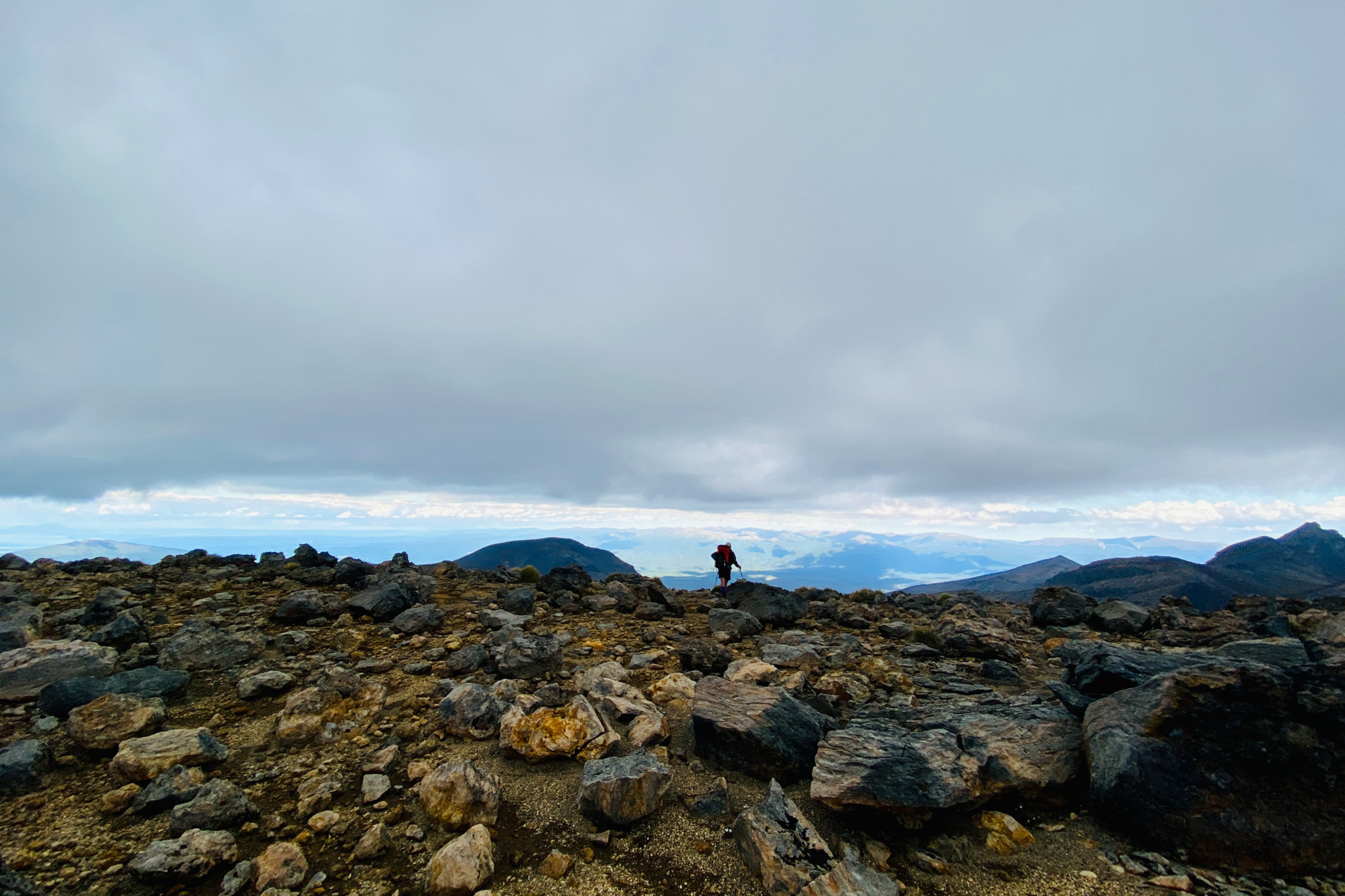
On day three at Waihohonu Springs we broke camp early, wary of incoming bad weather. Picking up a track through the scrub on Pt1212 just above the springs allowed us to keep our feet dry (ha! a limited proposition) and we followed a dry streambed north-northwest towards Ngāuruhoe and around the back of Tama Lakes and Pt1562. It’s off-track terrain but it was well-trodden, particularly compared with the untouched landscape of the remote experience zone. We popped out at a (dry) tarn marked on the map above Upper Tama Lake, then gained a ridge to skirt around on the eastern side to link up with the Upper Tama Lakes Track.
From there we were almost back in civilisation, although we were the only ones out in the howling weather. I was cold but amazed at how restorative scoffing Peanut Slabs can be. The howling abated somewhat as we came to the end of our explorations on the hard-packed gravel path of the Taranaki Falls Track.
Solitude and self-reliance
Later, I was put in touch with Wilderness roving editor Shaun Barnett, who had tramped in the area and also wrote a chapter on wilderness areas for a 2011 book Wild Heart: The Possibility of Wilderness in New Zealand. Barnett says Te Tatau Pounamu and Hauhungatahi were tentative attempts by the Department of Lands and Survey to honour the concept of wilderness areas with no tracks and huts in a popular national park.
“It was a brave step in the right direction, although now hardly anyone seems to recognise the areas, and they seem to have dropped off the radar – hence why you can’t find much online,” Barnett says. “These areas are important examples of early attempts to form wilderness, and are valuable, especially in such an otherwise busy and developed national park.”
In the book, Barnett tells of spending a night at Ketetahi Hut groaning with people. Then he simply dropped off the track at Blue Lake and was ‘utterly alone’. The transition took about 20 minutes, he writes. ‘By simply stepping off the track, you can go from an environment of crowding into one of solitude.’
I recommend seeking out a copy of Wild Heart, especially if, like me, your imagination is captivated by the unknownness of these wild spaces. More information can be found about New Zealand’s wilderness areas on the FMC website.
I’ll leave the last word to the Tongariro management plan: ‘In a park such as Tongariro, where the pressure for development, commercialisation and inappropriate use – both from within and outside the park – is high, it is imperative that some very significant areas receive protection from development.’


