The Aotea Track is the way to explore Great Barrier Island, taking in kauri, the island’s tallest peak, hot springs, and one of the country’s best huts.
From the pass on the Whangaparapara Road, the track heads north on Forest Road Track for 2km and then turns west, skirting a spur coming off The Hogs Back.
At the Junction with Pack Track, you continue west over a small stream and climb to a low saddle beneath Maungapiko. A short detour to the 280m summit leads to a rocky outcrop requiring some scrambling. Panoramic views over the western side of the island and out to Little Barrier Island are the reward. The track carries on to the north-west, descending to cross another stream before climbing again.
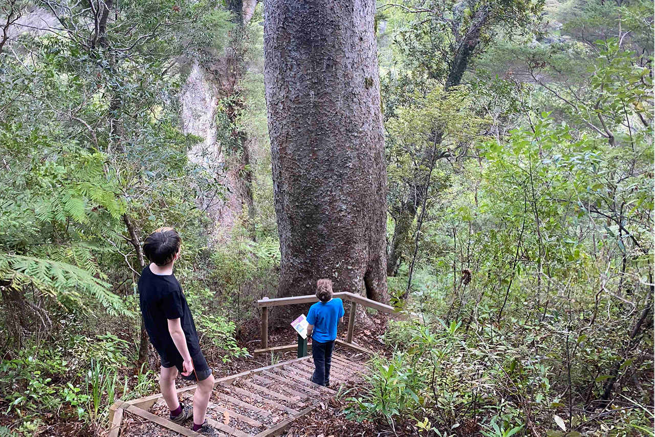
About 5km before Kaiaraara Hut along the Forest Road Track, a five-minute detour leads along a short, steep descent to a majestic pair of kauri trees.
The main track then descends to another stream before climbing the western flanks of Mt Young and turning north towards Kaiarara Bay, passing by the Line W Track to the west and the South Fork Track to the east.
It drops to Kaiaraara Hut, located in a tropical setting of nikau palms, silver ferns, and near the small Kaiaraara Stream. Banded rail can be seen near the hut, and kākā can also be seen and heard flying up the valley.
From the hut, the trail crosses the stream on a swingbridge and turns right on the Kaiaraara Track. It leads upstream, passing several large puriri trees. Views of the stream and towering rock faces on the far side are stunning and relieve some of the effort climbing to Mt Hobson.
A few bridge crossings and short ascents later, the first of two old kauri dam sites is seen. The trail steepens after the second of these, becoming a narrow, wooden staircase with great views down the Kaiarara Stream.
Many stairs later is the junction with Palmers Track, coming in from Windy Canyon. Continuing up, more stairs are climbed to a windy viewing platform on the summit of Mt Hobson.
About five minutes down from the summit, the South Fork Track leads south on a steep descent to the saddle between Mt Heale and Mt Hobson and then around to Mt Heale Hut. Watching the sunset over the landscape and sea from the hut’s deck is a stunning way to end the day.
On the final day, after a few minutes along the South Fork Track, the trail turns left onto the Peach Tree Track and descends through scrub to the Tramline Track North. It then continues in a southerly direction through more mānuka and kānuka bush.
Shortly after turning west, the Kaitoke Hot Springs Track is reached. This climbs a small rise and drops to the hot springs where trampers can soak aching muscles and sore legs.
From the hot springs, a short flat walk edges around Kaitoke Swamp back to Whangaparapara Road.
Note, the route described here is reverse to that recommended by DOC and has a different starting point. Many variations are possible thanks to other connecting tracks and possible starting/finishing points.
- Time
- 2-3 days. Whangaparapara Road to Kaiaraara Hut, 5hr; To Mt Heale Hut, 3.5hr; To Whangaparapara Road via Kaitoke Hot Springs, 4hr
- Accom.
- Kaiaraara Hut ($15, 28 bunks), Mt Heale Hut ($15, 20 bunks)
- Access
- From the saddle near Pt170 on Whangaparapara Road