

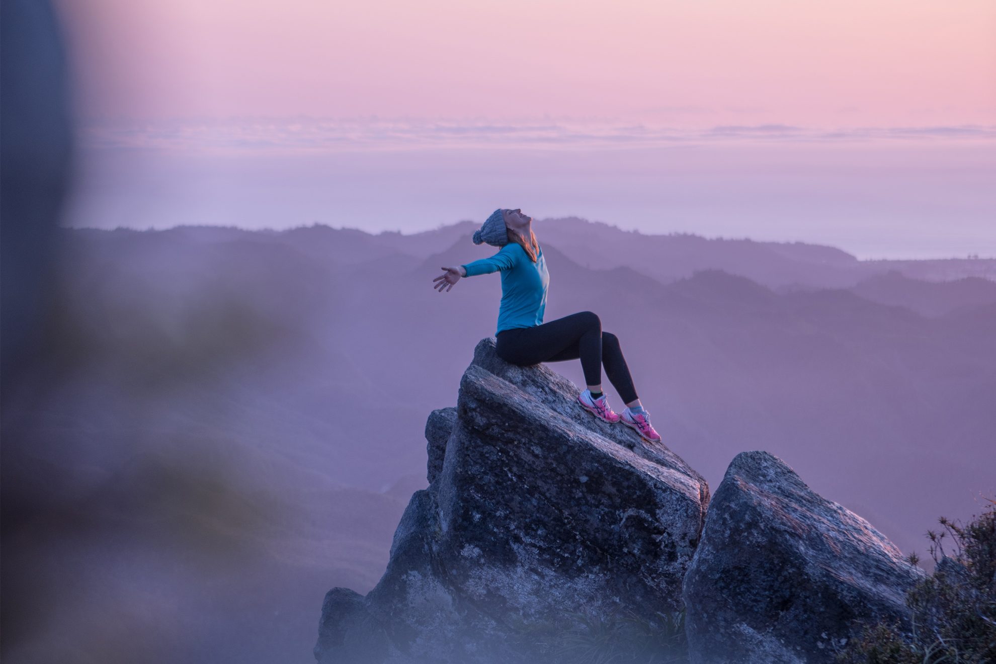
Coromandel Forest Park
The Pinnacles is an all-ages destination. From Pinnacles Hut, it’s a 45min hike to the lookout up countless steps on what must once have been a scary, exposed scramble.
Time 6hr Grade Easy
Raukumara Forest Park, Gisborne
Hikurangi is the highest non-volcanic mountain in the North Island. From Hikurangi Hut, a poled route sidles around the mountain’s western flanks to a tarn. A steep but not technical scramble up a rocky chute leads to the wooden trig. Permission from Te Runanganui o Ngati Porou is required to use the farm road.
Time 8–11hr Grade Moderate
Te Uku, Waikato
Mt Karioi’s eroded remains form a commanding backdrop to Raglan. The Karioi Track is the most direct route to the summit and has ladders and chains on the steeper sections.
Time 6-7hr Grade Moderate
Pirongia Forest Park
Tirohanga Track bypasses great rocky tors and is the most popular route up Pirongia Mountain. Mahaukura Track provides a good return trip. Pahautea Hut (20 bunks) sits close to the summit.
Time 5hr to summit Grade Moderate
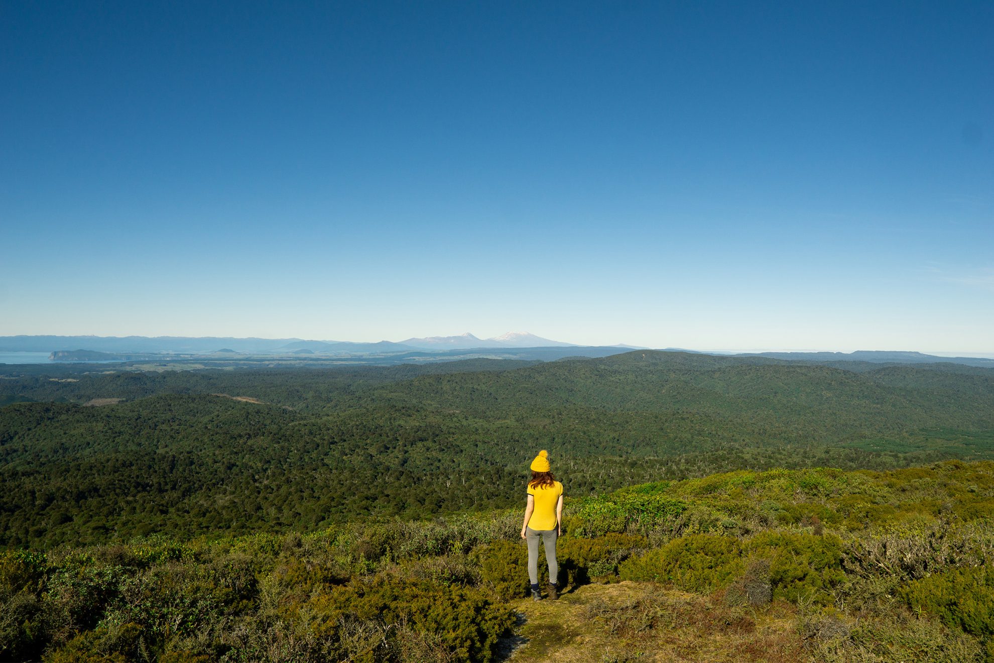
Pureora Forest Park, Waikato
Of the numerous marked tracks to Pureora, the shortest is just 3km long. Bog Inn Hut, south of the summit, provides basic accommodation for those planning to extend their journey. From the summit there are excellent views of Lake Taupō and the Central Plateau
Time 4-5hr Grade Easy
Te Urewera, Hawke’s Bay
Manuoha holds its head higher than any other peak in Te Urewera. The marked track begins from Waikaremoana Road and follows an undulating ridgeline for 8km to the summit trig. An alternative exit drops through beech forest to Sandy Bay Hut on the shores of Lake Waikareiti.
Time 6-7hr Grade Moderate
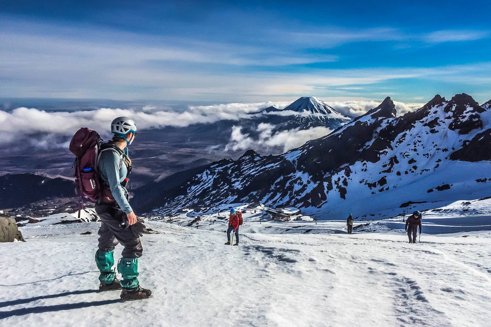
Tongariro National Park, Manawatu–Whanganui
Although Ruapehu can be climbed in any season, winter is the most exciting. The easiest route is to take Whakapapa’s gondola, which ends at 2000m, and climb to the summit from there – the line is obvious. In summer it’s a scramble; in winter crampons and ice axes will be required.
Time 3–4hr to Summit Plateau; 1hr return to Crater Lake Grade Moderate
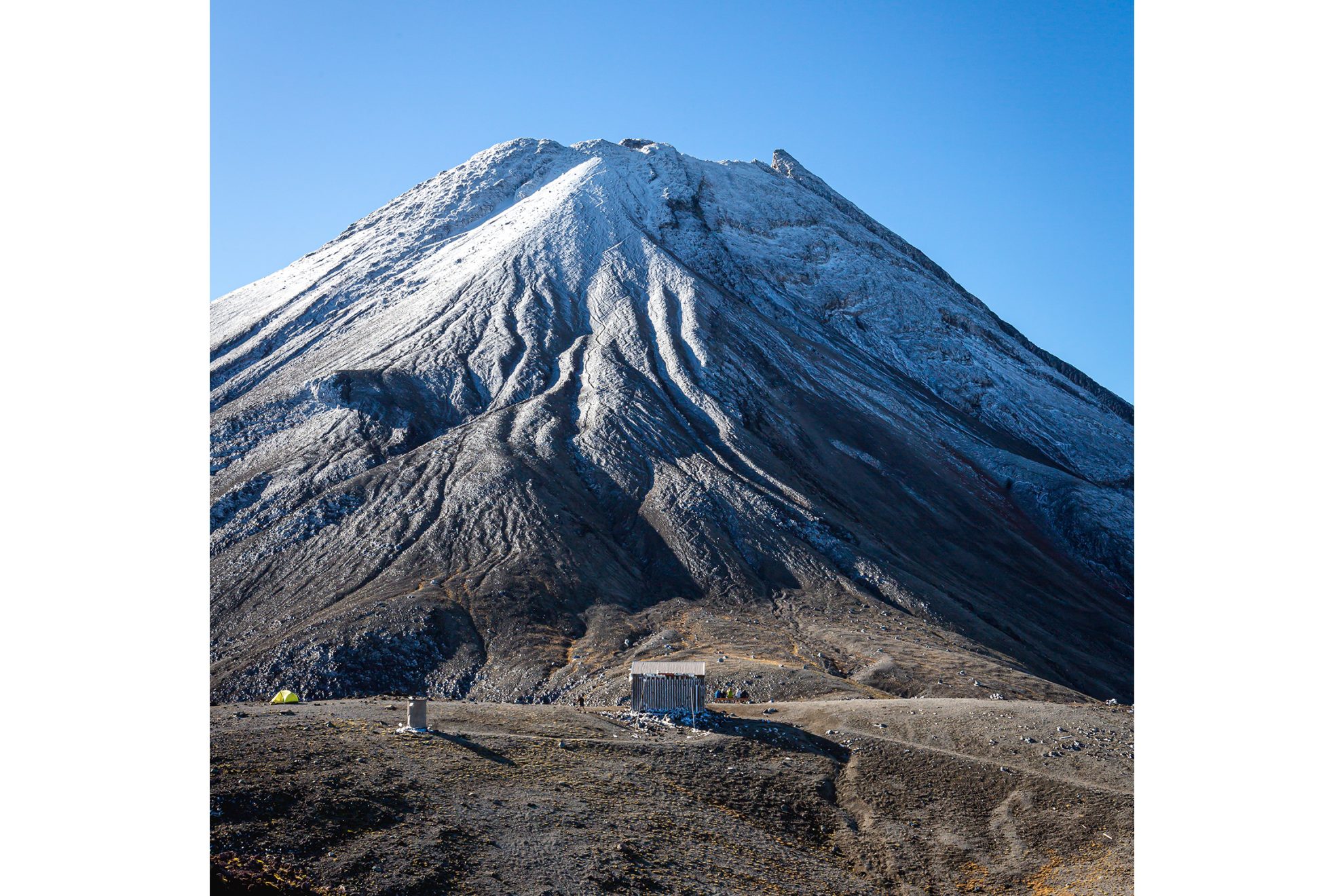
Te Papa-Kura-o-Taranaki, Taranaki
This peak with spectacular views of Taranaki Maunga is accessible year-round. It can be climbed as a day walk, an overnighter or as part of the Pouākai Circuit.
Time 6-7hr Grade Moderate
Te Papa-Kura-o-Taranaki, Taranaki
Taranaki Maunga towers above New Plymouth and is the second-highest mountain in the North Island. A climb via the most popular North Ridge route can be made in as little as three hours in calm summer conditions, but care must be taken: poor weather and winter conditions have claimed over 80 lives.
Time 6–10hr depending on season Grade Moderate–difficult
Te Papa-Kura-o-Taranaki, Taranaki
Panitahi, on the southern flank of Taranaki Maunga, is a secondary cone of the main volcano and last erupted around 3000 years ago. Don’t let the ‘secondary’ status fool you, however: at 1933m it is one of the North Island’s highest peaks. Panitahi is home to 10-bunk Syme Hut, arguably one of the best overnighting spots in the national park (it’s popular, so bring a tent in summer).
The name Panitahi was officially restored in 2025 following the signing of the Taranaki Maunga Treaty settlement. It was previously known as Fanthams Peak, the name honouring Frances ‘Fanny’ Fantham who, in 1887, was the first woman to climb the peak.
Panitahi is a lot easier to reach today than it was in Fanny’s day. From Dawson Falls the track climbs steadily through lush native bush past the Lake Dive Track and Hooker Shelter. Around 1400m there is a turnoff to the private Kapuni Lodge. From here the track becomes a lot steeper, first on stairs and then on loose scoria following poles to the summit. In winter the route is often covered in ice and snow and requires an ice axe and crampons.
Time 6–8hr Grade Moderate
Whanganui National Park, Whanganui
Whakaihuwaka Mt Humphries (732m) isn’t tall by national standards, but relative to the low foothills of Whanganui National Park it’s lofty. It offers panoramic views of Taranaki Maunga, Mt Hikurangi and the peaks of the Central Plateau.
Time 1–2 days Grade Moderate
Kaimanawa Forest Park, Central North Island
The highest peak in the Kaimanawa Ranges is remote and rarely climbed. It is on private land and you will need to gain permission through Helisika. From the Mangamaire River, climb through bush onto the tops to summit Te Wetenga (1666m). Travel south for 500m over an unnamed knob. From this vantage point Makorako appears menacing, but don’t be intimidated. Climbing the gentle gradient of the north face involves a short scramble up scree. Some parties approach from the west via Island Range.
Time 4hr Grade Difficult
Kaweka Forest Park, Central North Island
Once part of historic Ngāmatea Station, Manson is now in the remote hinterland of Kaweka Forest Park. Reaching it requires a tramp of several days over the Kaweka Range, not an easy undertaking.
Time 3–4 days Grade Moderate
Kaweka Forest Park, Hawke’s Bay
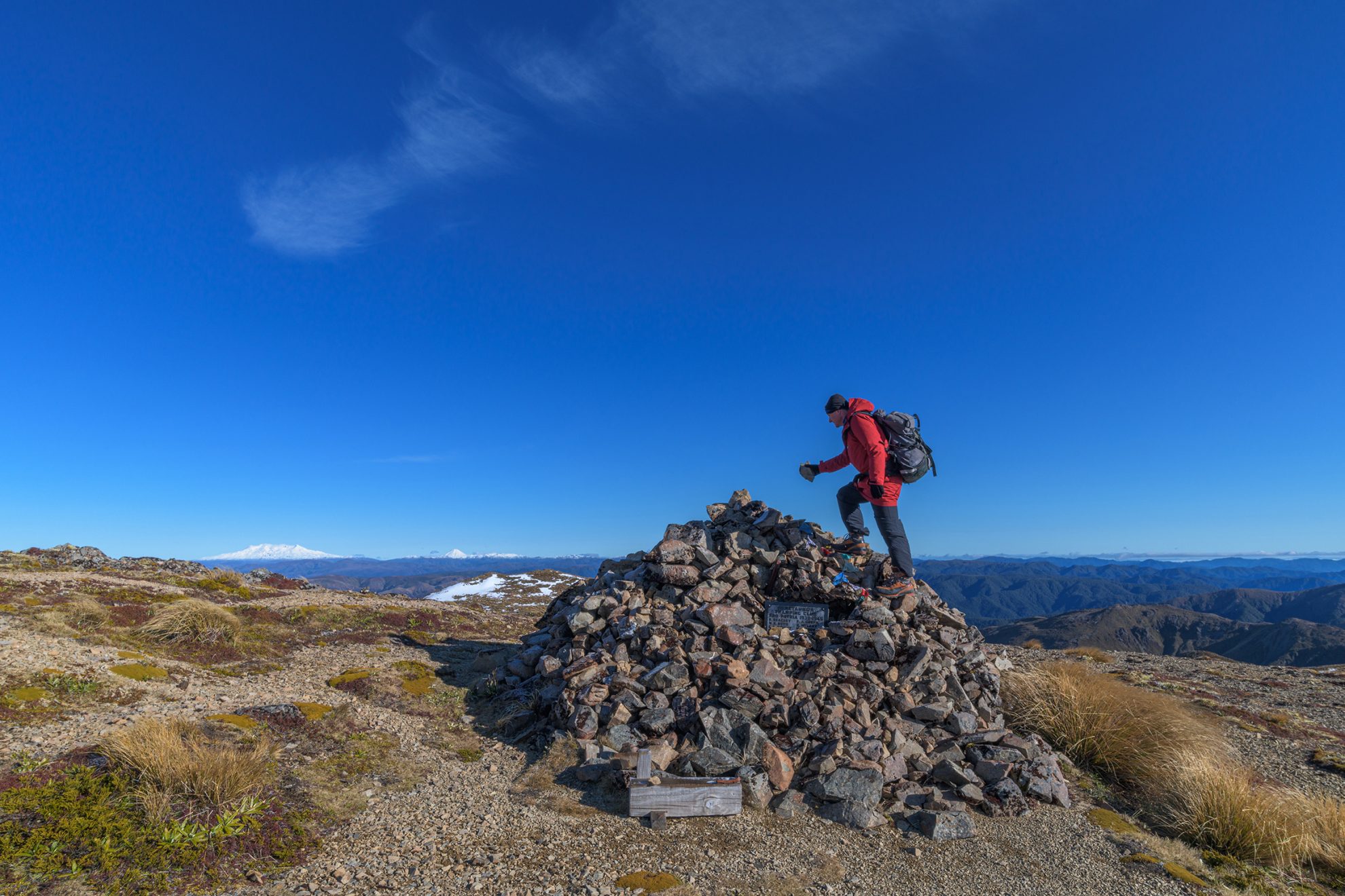
Of the eight highest peaks in the North Island, Kaweka J is the easiest to climb. From Makahu Saddle, a short walk leads to Makahu Saddle Hut. From here there are two routes: Makahu Spur, which involves scrambling up loose rock, and Trials Spur, which includes switchbacks. After an hour’s exertion, both spurs converge near the turnoff to Dominie Biv.
The steep incline gradually eases onto the expansive shingle tops of the main range. At a signposted junction, turn left and walk past the war memorial cairn to the collapsed trig station.
The 360-degree vista from Kaweka J is fantastic, particularly at night, when Hastings and Napier shimmer in the distance.
Time 5–8hr Grade Moderate
Ruahine Forest Park, Manawatu
Te Atuaoparapara is a significant summit on the main spine of the Ruahine Range. The peak is easily traversed on its western slopes and makes a good destination for a weekend round trip for those carrying on to Sunrise Hut.
Time North Block Road to Te Atuaoparapara summit via Waipawa Saddle, 4–5hr; to North Block Road via Sunrise Hut, 4–5hr Grade Moderate
Ruahine Forest Park, Manawatu
Mangaweka is the highest point of the Ruahine Range. Although the broad, rounded peak might appear underwhelming, the views northwest to Ruapehu and east to three other Ruahine 1700ers are magnificent. Mangaweka’s summit offers great camping too.
The most common way to the peak is from Mangakukeke Road and across private farmland that requires access permission. Beginning at about 600m, a steep 300m climb up a grassy spur leads to Purity Hut. From there, in summer it’s a slog through tussock to Wooden Peg, then Iron Peg at 1703m and a gradual climb to the summit. This can be reached in about 6hr, but allow longer in winter.
Time 8–10hr Grade Moderate
Ruahine Forest Park, Hawke’s Bay
Approaching Ohuinga via Sawtooth Ridge is a classic trip. While not easy in bad weather or winter, in summer it’s reasonably straightforward. The steepest section is the approach to the summit of Ohuinga from Black Ridge – anyone nervous of the exposure should do this in an uphill direction.
Time Via Black Ridge, 6–8hr; via Sawtooth Ridge, 6–9hr Grade Moderate–difficult
Tararua Forest Park, Wellington
A challenging peak with a steep and craggy summit. The section between it and Waingawa requires a cool head for heights. Many parties use a rope to haul or lower packs on this section.
Time 3–5 days Grade Moderate
Tararua Forest Park, Wellington
The highest peak in the Tararua can be reached via Mitre Flats Hut. Climb through beech and podocarp forest to the bushline, then scramble up a rocky slope to Peggy’s Peak and on to Pukeamoamo/Mitre.
Time 12hr Grade Moderate
Tararua Forest Park, Wellington
Though numerous other peaks in the Tararua Range are taller than Holdsworth, its prominence and relatively easyaccess make it one of the most popular destinations.
Following the Gentle Annie and then Mt Holdsworth tracks, the 1000m climb to 32-bunk Powell Hut can be made in 3–4hr. Another 45min of climbing brings you to Mt Holdsworth and fabulous views to the Wairarapa, north over Jumbo and west to closer peaks of the main range.
Mt Holdsworth is the highest point of the Holdsworth–Jumbo Circuit – a rewarding but realistic fair-weather tramp for families and those newer to tramping.
Time 10hr Grade Moderate
Tararua Forest Park, Wellington
This thrilling double peak is steep and jagged and requires a good head for heights. At one point a metal ladder is provided; at another a rope helps you around Tuiti. Anyone who enjoys climbing fun, rocky terrain will enjoy this.
Time 2–3 days Grade Moderate
Tararua Forest Park, Wellington
Iconic Mt Hector, with its memorial cross to Wellington Tramping Club members killed during the two World Wars, is most easily accessed via historic Field Hut and Kime Hut.
Time 1–3 days Grade Moderate
Remutaka Forest Park, Wellington
As the tallest peak in the Remutaka Range and visible from Wellington, Mt Matthews is an enticing climb. The most common route is from Ōrongorongo Valley via the steep track from Matthews Stream. Fit parties can be in and out in a day; others can stay a night in one of the valley’s many huts.
Time 11–12hr Grade Moderate
Kahurangi National Park, Golden Bay
Mt Gibbs is readily climbed from Fenella Hut (4hr from trail head). About 10min past the hut is a small tarn. Clamber onto the ridge behind this and head south for 600m to Pt1186. From the saddle, look for a ground trail or cairns that lead under the imposing face of Xenicus Peak. Traverse north along a rocky ledge system above the 1200m contour to find a small stream at the first of three grassy basins. Travel is straightforward up these rock gardens to reach the summit, from where a glorious panorama of the remote Tasman Wilderness Area is revealed.
A worthwhile round trip can be made by dropping sharply down a narrow ridge, then battling through dense scrub to Round Lake, past Lake Cobb and back to the main track.
Time 14hr Grade Moderate
Kahurangi National Park, Golden Bay
Mt Peel is the highest point at the southern end of the Peel Range. Climb the Lake Peel Track through bush onto tussocky tops and then traverse beneath bluffs to picturesque Lake Peel. From there, gain the broad ridge to the summit.
Time 6–8hr Grade Moderate
Kahurangi National Park, Tasman
From Cobb Reservoir, climb to Sylvester Hut and onto the tops to Iron Lake. Search for a safe passage through rocky ramparts above the lake outlet, onto the eastern shoulder.
Time 8–10hr Grade Moderate
Kahurangi National Park, Tasman
From the Graham Valley car park it’s an easy stroll to Mt Arthur Hut. The trail then follows the northeast ridge, skirting sinkholes. A steep finale leads to the summit ridge.
Time 7hr Grade Moderate
Kahurangi National Park, Tasman
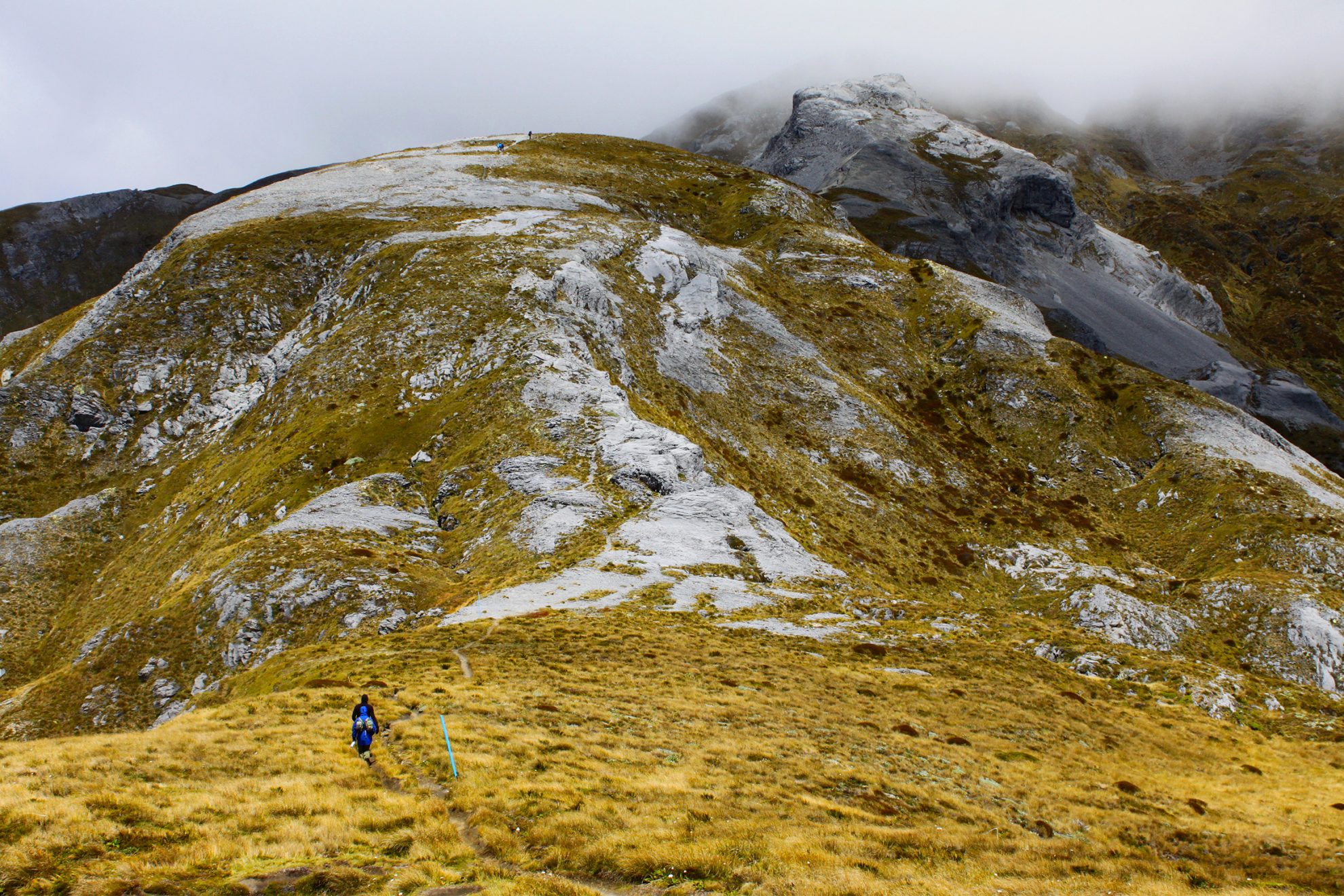
Climbing Kahurangi’s highest summit is a unique experience due to the unusual karst landscape, and involves tramping over giant slabs and leaping rock crevasses. Many climbers from the northern side stay at Granity Pass Hut, from where it’s 3hr to the summit.
Time 2–3 days Grade Easy
Nelson Lakes National Park, Tasman
A worthy destination for an afternoon’s scramble from Angelus Hut. Take the poled Mt Cedric Track, then branch off towards Sunset Saddle on a straightforward, cairned scramble to the summit.
Time Two days Grade Moderate
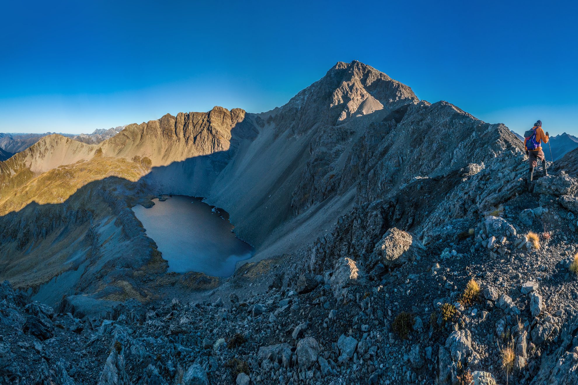
Nelson Lakes National Park, Tasman
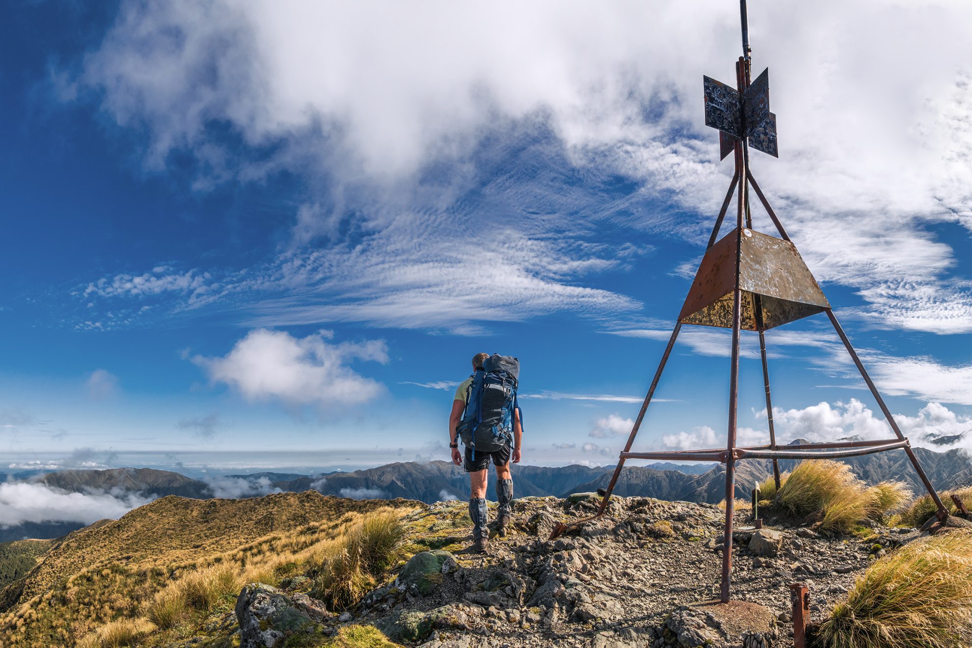
The highest tramper-accessible peak in the park and a wonderful climb, either as part of the Travers–Sabine circuit or as a return trip from St Arnaud, staying at John Tait Hut. The most accessible route is from the Upper Travers Track, following Summit Creek up the northern face. It’s steep with loose scree and rock, but manageable. Scramble to the summit ridge.
Time 3–4 days Grade Difficult
Mt Richmond Forest Park, Nelson
The highest point on Porters Ridge is most easily climbed from Porters Creek Hut, up the spur that leads to Pt1635 and the range crest. This is part of the spectacular Red Hill ultramafic rock zone.
Time Two days Grade Moderate–difficult
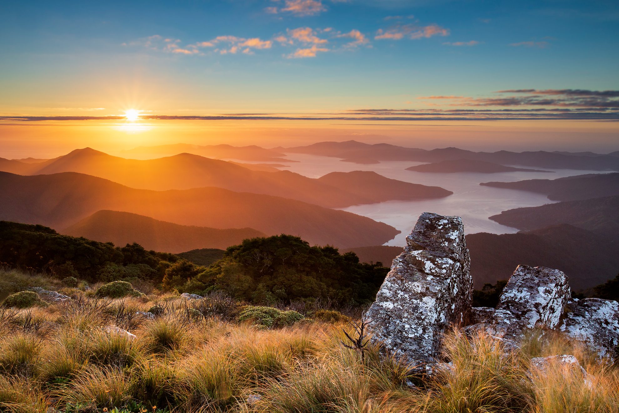
Marlborough Sounds
The loftiest hill in the Marlborough Sounds is modest but has a good track to the top. On a bluebird day, commanding views are offered in all directions.
Time 6–7hr Grade Easy–moderate
Mt Robertson Scenic Reserve, Marlborough
A bushy summit accessed via two tracks from Port Underwood Road. Both tracks lead to the summit ridge and spectacular views of Picton and the Marlborough Sounds.
Time 6hr Grade Moderate
Mt Richmond Forest Park, Marlborough
Haul yourself up a vertiginous spur track, tip-toe along a rocky spine and cross a giant scree towards Fishtail Hut. From the obvious low point above the hut, the route heads southeast along unstable rock to the summit.
Time 4–5hr climb Grade Moderate
Mt Richmond Forest Park, Marlborough
From the trackhead, clamber up a steep spur and along a knife-edge ridgeline to Richmond Saddle Hut. Above the bushline, it’s an unnerving scramble across 40-degree scree slopes. The slow grind to the summit takes an hour, and the views are breathtaking.
Time 4–6hr Grade Moderate
Isolation Creek Reserve, Marlborough
Marlborough’s highest coastal summit promises outstanding views. It is best climbed from Isolation Hut where the Napoleon Route offers access to the west ridge.
Time Two days Grade Moderate–difficult
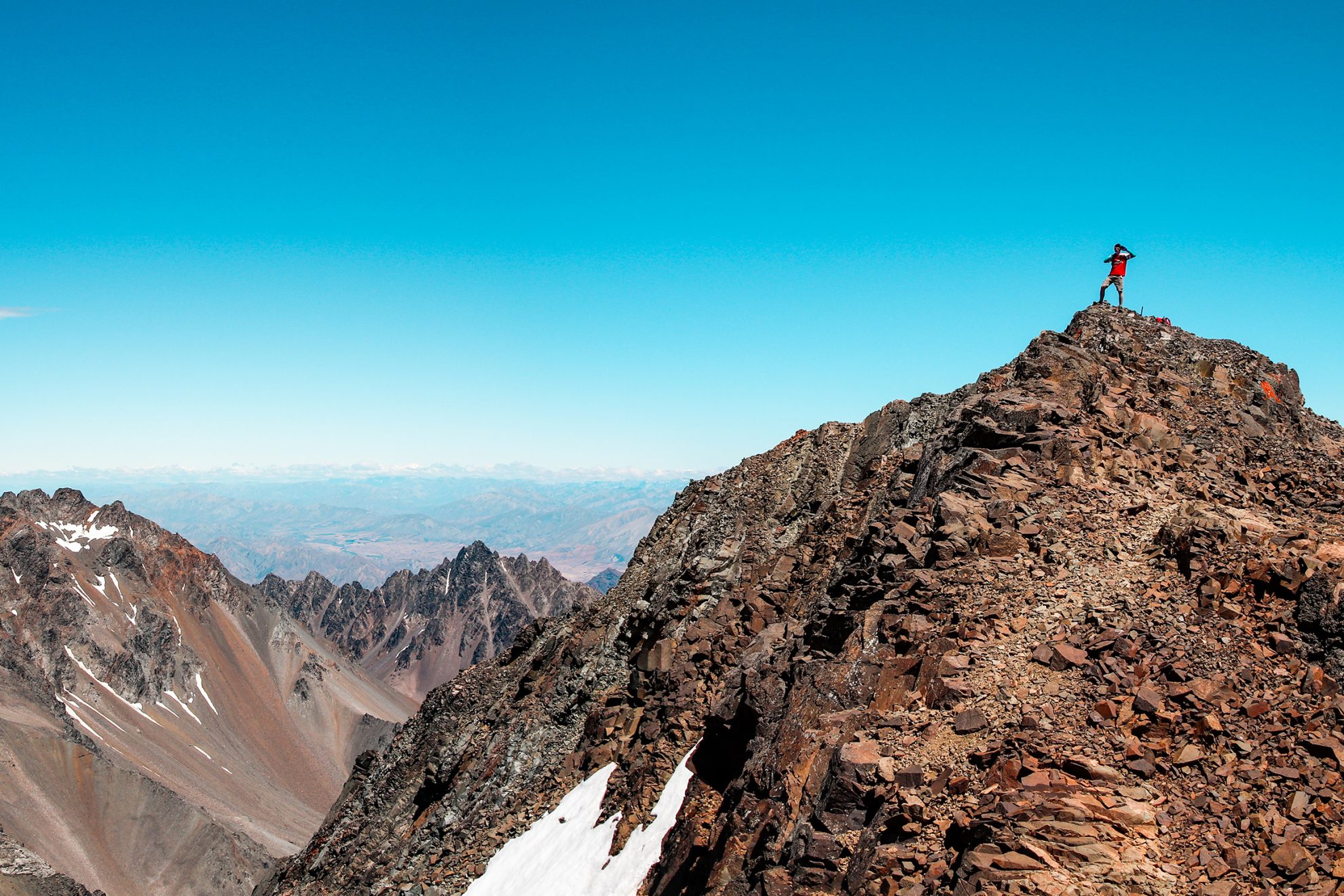
Tapuae-o-Uenuku Scenic Reserve, Canterbury
Tapuae-o-Uenuku is the highest mountain outside the Southern Alps. In summer the top is attainable by those with basic ice axe andcrampon skills and good route-finding ability. Winter requires a greater degree of experience.
Time 2–3 days Grade Moderate
St James Conservation Area, Marlborough
Azure Lake Tennyson provides a stunning backdrop to this high, bare summit. From the campsite south of the lake, take the western ridge to Pt1619 and the summit. A round trip could be made down to a saddle north of the summit.
Time 4–5hr Grade Moderate
St James Conservation Area, Canterbury
The easiest approach to Mt Princess is from Maling Pass. A well-trodden path leads to Pt1572 then north to Pt1906. The summit can be reached by scrambling up the broken southwest ridge or up the scree above Princess Stream to the southeast ridge. An ice axe and crampons may be required.
Time Two days Grade Moderate–difficult
St James Conservation Area, Canterbury
The south approach of Gloriana Peak is particularly interesting as it involves climbing to tarns and over a 2000m col. The summit view encompasses Nelson Lakes National Park. An ice axe and sometimes crampons will be required.
Time Two days Grade Difficult
Lake Sumner Forest Park, Canterbury
There are multiple routes up this craggy monolith, all requiring a head for heights. The West Ridge begins near The Apprentice and has proper scrambling at about grade 8–10. An easier route off the summit ridge descends a scree gully on the Lucretia side. If you have any doubts about your ability, it’s best to ascend the scree route.
Time 8–12hr Grade Difficult
Hanmer Forest Park, Canterbury
Located well to the west of Jacks Pass Road, by which it is accessed, Mt Charon is a significant challenge as a day trip. It involves a long, high ridge traverse to reach the summit and return. There is little water on this route and it is exposed to the weather.
Time 8–9hr Grade Difficult
Arthur’s Pass National Park, Canterbury
Standing steeply above Sudden Valley Stream, Mt Scott and the Polar Range have much easier slopes rising from Edwards Valley.
Time Two days Grade Moderate–difficult
Arthur’s Pass National Park, Canterbury
Three to four hours’ hard graft up Avalanche Peak Track leads to a narrow ridgeline then pops you out on the summit. Descend via the longer but easier Scotts Track.
Time 8hr Grade Moderate
Torlesse-Korowai Tussockland Park, Canterbury
From Porters Pass, climb to Foggy Peak (1741m) then meander along the Torlesse Range, dipping into two saddles, to Castle Hill Peak.
Time 7–10hr Grade Moderate
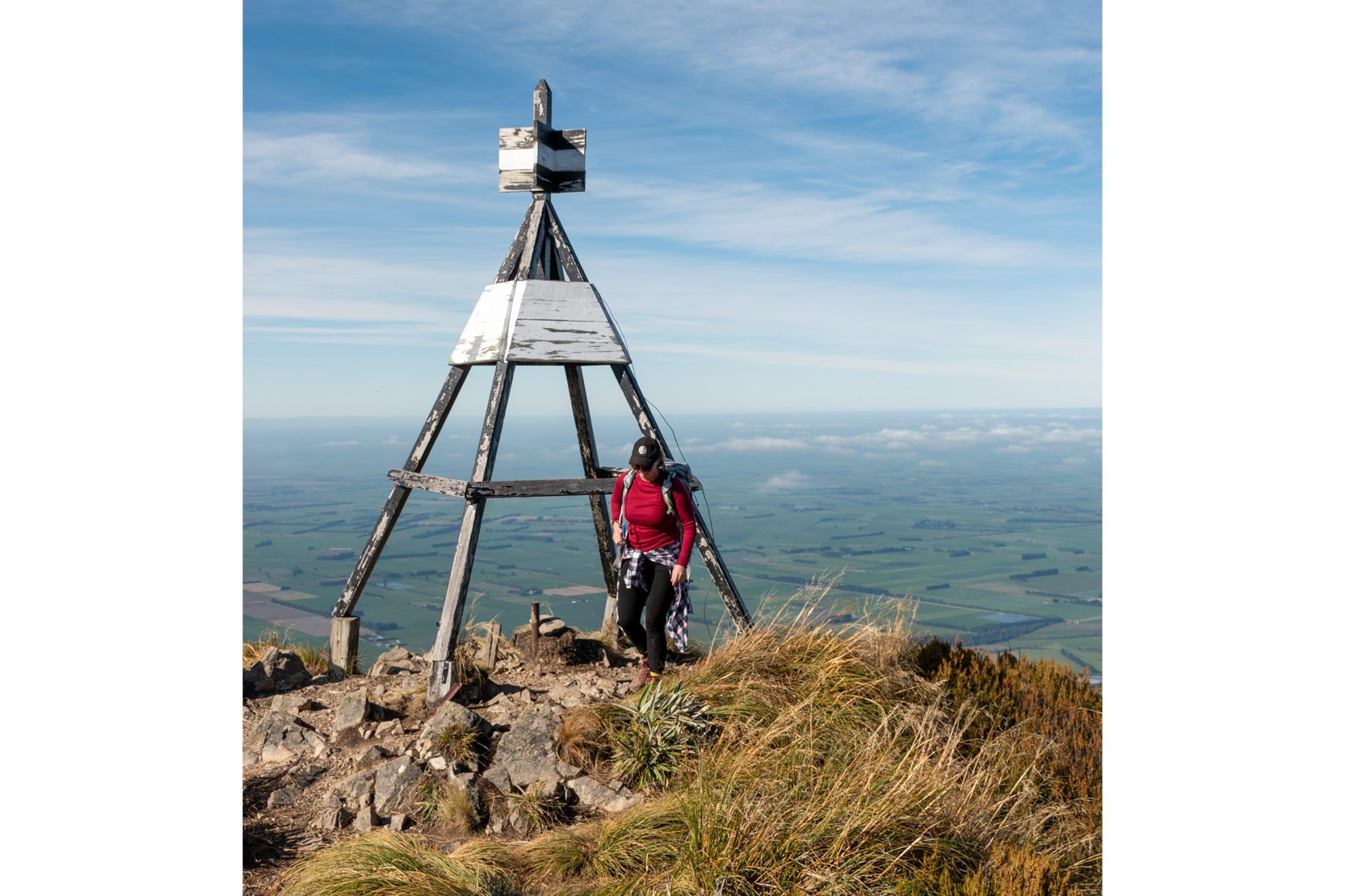
Hakatere Conservation Park, Canterbury
Mt Taylor is the highest of the Canterbury foothills and is located in a stark landscape, home to a surprising variety of flora and fauna. The west ridge is a straightforward, long day climb involving more than 1600m of height gain. From Lake Heron car park, walk or bike the 10km Swin River Track to Double Hut. Beyond the hut, head up the Swin River South Branch to an obvious fork. Take the right branch and head upriver for 50m to gain easy access to the west ridge, which leads to the summit.
Time 7–10hr Grade Moderate
Hakatere Conservation Park and Mt Somers Conservation Area, Canterbury
Mt Somers is volcanic in origin, which makes for some interesting geological features. There are three approaches to the summit: the South Face Track (which can require an ice axe and crampons into early summer), the Mt Somers Walkway, or Rhyolite Ridge.
Time 7hr Grade Moderate
Peel Forest Park, Canterbury
A peak of three parts – Little, Middle and Big. The climb to Little Mt Peel is tracked, and though the route from there is unmarked, the path to Mt Peel along the Tara Haoa Range is non-technical and easy to follow.
Time 9–10hr Grade Moderate
Aoraki Mt Cook National Park, Canterbury
Mt Wakefield is a substantial climb but not technically difficult. Start on Tasman Valley Road at the bridge over the Hooker River. After an hour you will pop out on the rocky ridge. After a few false summits you’ll see some small tarns below the ridge, where you can camp (1680m). The summit is one hour from there.
Time 7–9hr Grade Moderate–difficult
Paparoa National Park, West Coast
Follow a 4WD road to where a steep track climbs through forest and scrub to Buckland Peaks Hut. Continue up the unmarked ridgeline to an assortment of granite peaks. Grand views to the south include the Kawatiri Buller River mouth and Aoraki Mt Cook on the horizon.
Time 12hr Grade Moderate–difficult
Victoria Forest Park, West Coast
A steep pyramid rising from dense forest, Mt Haast is an imposing spectacle from any vantage. The Mt Haast Route climbs to the bushline from near Rahu Saddle, and a steep scramble accesses the rocky summit.
Time 5–6hr Grade Moderate–difficult
Paparoa Wilderness Area, West Coast
A beautiful granite peak located in the heart of the Paparoa Wilderness Area, Mt Euclid has a number of possible access routes, the shortest being from the Little Totara River logging roads to gain a lightly marked track that climbs to the bush edge on Mt Fleming, just to the northwest of Mt Euclid. The ridgeline is then followed to reach the summit. High camps are possible at one of the two tarns located north and south of the summit.
The range can be followed north and south of the summit, albeit with difficulty. This is wild and remote country and parties need to be prepared and experienced at off-track travel.
Time 12hr Grade Difficult
Otira-Kopara Forest Conservation Area, West Coast
From Lake Brunner Road a good track leads to Camp Creek Hut and continues steeply to the tussock at around 1300m. Beyond, the ridge climbs and narrows to more exposed terrain and the summit.
Time 2–3 days (6–7hr to tarns; 4hr to summit) Grade Moderate
Arthur’s Pass National Park, West Coast
Located in a wonderful isolated corner of Westland wilderness, Mt Pfeifer is best approached from the Deception Swingbridge over the Ōtira and climbing up Paratu Stream to Waharoa Saddle. Cross east over the range at about 1480m and sidle across pleasant basins to Pfeifer Bivvy and up to the top.
Time Two days Grade Moderate
Adams Wilderness Area, West Coast
The understated yet engaging Mt Barron offers a rewarding experience. Starting just south of Ōtira, follow the marked Mt Barron Route through thick forest before gaining mellow tussock slopes and open country. Continue over Pt1569m and scramble up easy rock steps to the summit. The large basin at the head of Goat Creek offers scenic campsites.
Time One or two days Grade Moderate
Adams Wilderness Area, West Coast
Mt Adams stands more than two vertical kilometres above the starting point on SH6, so you can be assured of a long hard push. An ice axe and crampons are essential in any season, as you will need to traverse the small ice-cap glacier to gain the high peak. Putting in a camp at around 1600m is a good option.
Time Two days Grade Difficult
Westland Tai Poutini National Park, West Coast
A steep forested ascent leads to Mt Fox, but the climbing isn’t done yet. The exceptional view of the Southern Alps, Fox Glacier and the Tasman Sea is gained from Pt1345, a kilometre further on.
Time 8hr Grade Moderate
Mt Aspiring National Park, West Coast
The 1700m climb from road to summit on the Brewster Track is a bit of a grunt and follows a long spur which, though steep, is never too demanding.
Time 1–2 days Grade Moderate
Mount Aspiring National Park, Otago
What seems little more than a blip on a ridgeline is actually a rewarding ascent with spectacular views, especially of Tititea Mt Aspiring. Sisyphus Peak is accessed via the Matukituki River East Branch then Kitchener River and Rainbow Stream. At the head of Rainbow, traverse up and right under Fastness Peak to Wilmot Saddle. From there it’s an easy scramble to the summit.
Time Two days Grade Moderate–difficult
Hāwea Conservation Park, Otago
Located above The Neck between lakes Hāwea and Wānaka, this is a reasonably demanding climb with several kilometres of ridgetop travel and a final scramble to the summit.
Time 1–2 days Grade Moderate
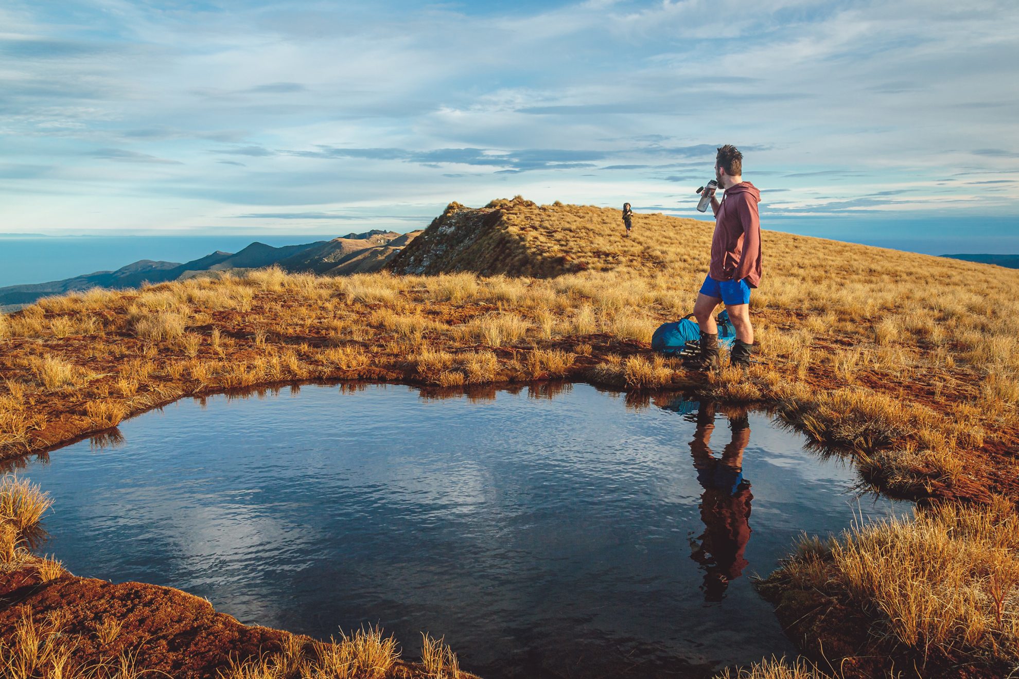
The Stack Conservation Area, Otago
A classic day trip along a well-graded track with mesmerising views over Lake Wānaka and the peaks of Mt Aspiring National Park. Closed for lambing between October 1 and November 10.
Time 5–6hr Grade Moderate
Mt Aspiring National Park, Otago
Photogenic Mt Xenicus rises to the north of Lake Harris on the Routeburn Track. The mountain’s southwest ridge can be completed in a long day from the Routeburn road. Approach the mountain from the southern end of Lake Harris and climb up grassy slopes, following a rough track at first, until past Pt1455m. Head towards a wide scree-filled gut that angles between steep rocky outcrops to reach the upper portion of the ridge. From the top of the gut it is a short but exposed scramble to the summit.
Time 8–10hr Grade Moderate–difficult
Mt Aspiring National Park, Otago
From the road, an unrelenting 2000m climb to the summit of Black Peak will result in a stupendous view of the Matukituki Valley and Tititea Mt Aspiring. Access is required from Matukituki Station. Some route finding is necessary.
Time 10–12hr Grade Difficult
Queenstown, Otago
Climb Ben Lomond from Queenstown, or skip the first 450m by taking the gondola. A final steep surge from the saddle to the summit gives views back to Lake Wakatipu and Queenstown.
Time 6–8hr Grade Moderate
Queenstown, Otago
Williamson Spur from Lake Moke leads directly to this rocky summit, but take care as it is not marked and involves some scrambling in places on steep, exposed sections of the spur.
Time 8–9hr Grade Moderate–difficult
Queenstown, Otago
This strenuous day trip starts 4km past Rat Point on the Queenstown–Glenorchy road. Follow a 4WD track for 10min, then climb steeply up a poled route southwest of the mountain. From about 1400m, traverse northeast to Mt Crichton’s west face.
Time 5–8hr Grade Moderate
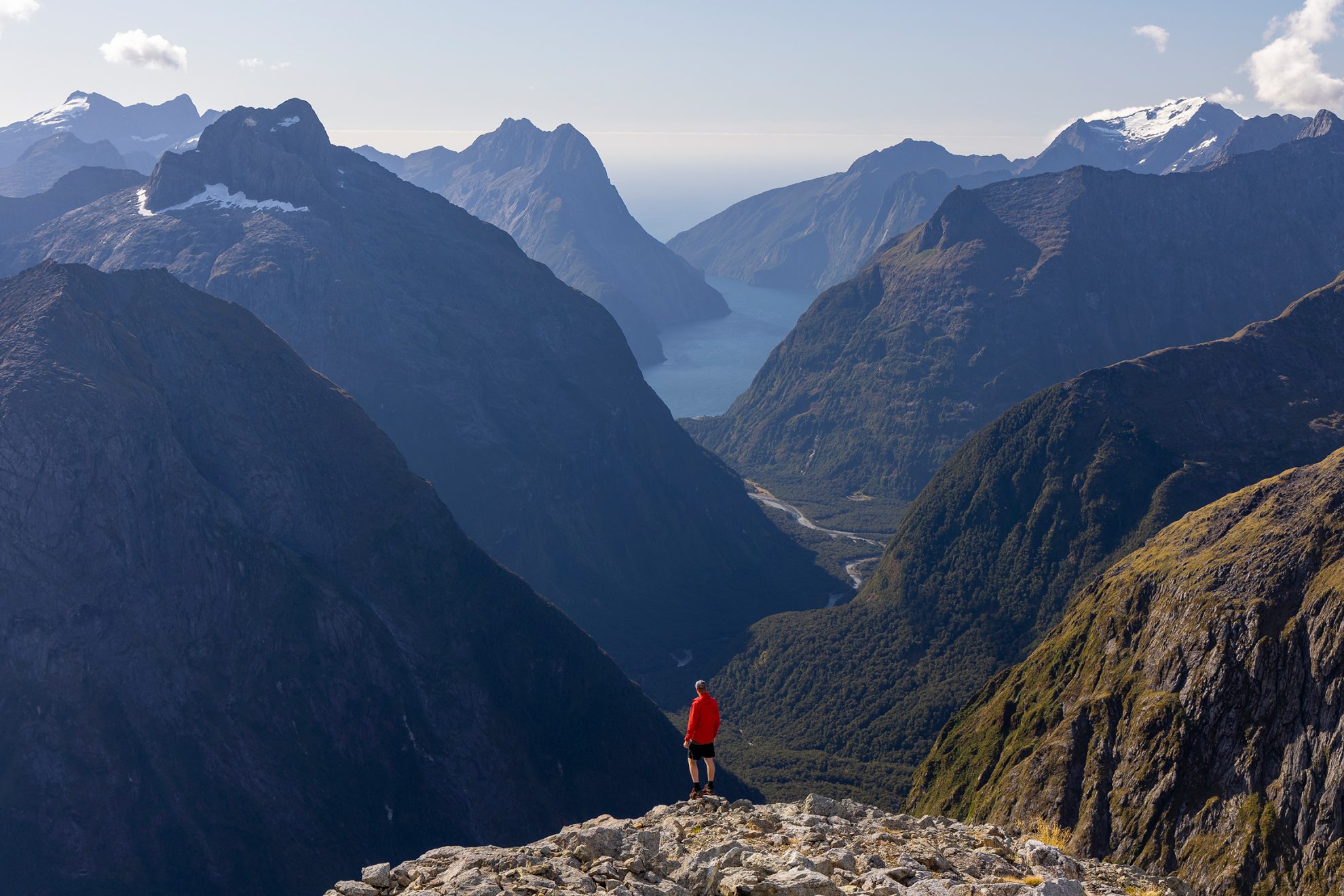
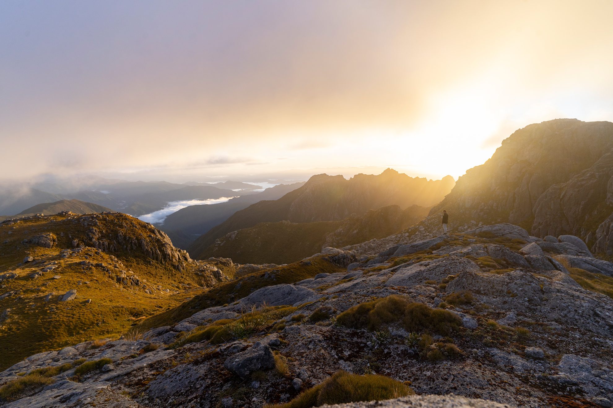
Darran Mountains, Southland
The Darran Mountains are known for their spectacularly sheer mountain vistas and vertigo-inducing terrain. One of the most accessible ways to gain a taste of this is the climb to Barrier Knob from the car park near Homer Hut.
The initial amble on the Gertrude Valley Track is dominated by vertical walls. At the northern end the track morphs into steep scrambling on rocky slabs beside waterfalls to Black Lake at 1300m. Another 100m of climbing leads to Gertrude Saddle, where the view of distant Milford Sound is reward enough for the three-plus hours of climbing.
Beyond the saddle, another hour or so of steep climbing to the east, up rock and scree, or snow and ice in winter, will have you on Barrier Knob, surrounded by vertiginous drops everywhere except along the eastern knife-edge ridge to Barrier Peak.
Time 6–8hr (longer in winter) Grade Moderate–difficult
Fiordland National Park, Southland
A short diversion from the Kepler Track, Mt Luxmore is one of a series of summits at a similar altitude along the crest of the range and is barely 100m higher than the track’s highest point.
Time 7–8hr Grade Moderate
Fiordland National Park, Southland
On Mt Titiroa, alpine scrub gives way to coarse white sand – the reason for the peak’s reflective glint in sunlight – and monumental granite boulders. It’s a stark contrast to the dense rainforest typical of Fiordland.
Time Two days Grade Difficult
Fiordland National Park, Southland
Tamatea Peak stands tall over the glistening tarns and lakes of Furket Pass, one of the alpine crossings on the Dusky Track. Lake Roe Hut is nearby, making Tamatea an achievable and worthwhile side trip for those tackling the multi-day tramp.
Time 3–4 day Grade Difficult
Fiordland National Park, Southland
New Zealand’s newest Great Walk takes its name from The Hump, but few ever tread this summit. The easiest route is along the South Coast Track to Waikoko Stream. From there, old forestry roads climb a spur and ultimately lead to the summit. The expansive view includes the wild waters of Foveaux Strait and the hills of Rakiura.
Time 11–12hr Grade Difficult
Rakiura National Park, Rakiura Stewart Island
Rakiura’s highest point is only 980m, it’s a long hike from sea level and can get muddy. Most make the climb from Christmas Village Hut.
Time 4–5 days Grade Easy


