The anatomy of a pā is similar wherever you go. Sites were chosen atop hills or on headlands, the obvious advantage being an early sighting of approaching foes allowed time to prepare for combat.
This selection of the most spectacularly-located and best-preserved sites not only gives the walker magnificent views but also a human dimension to the landscape.
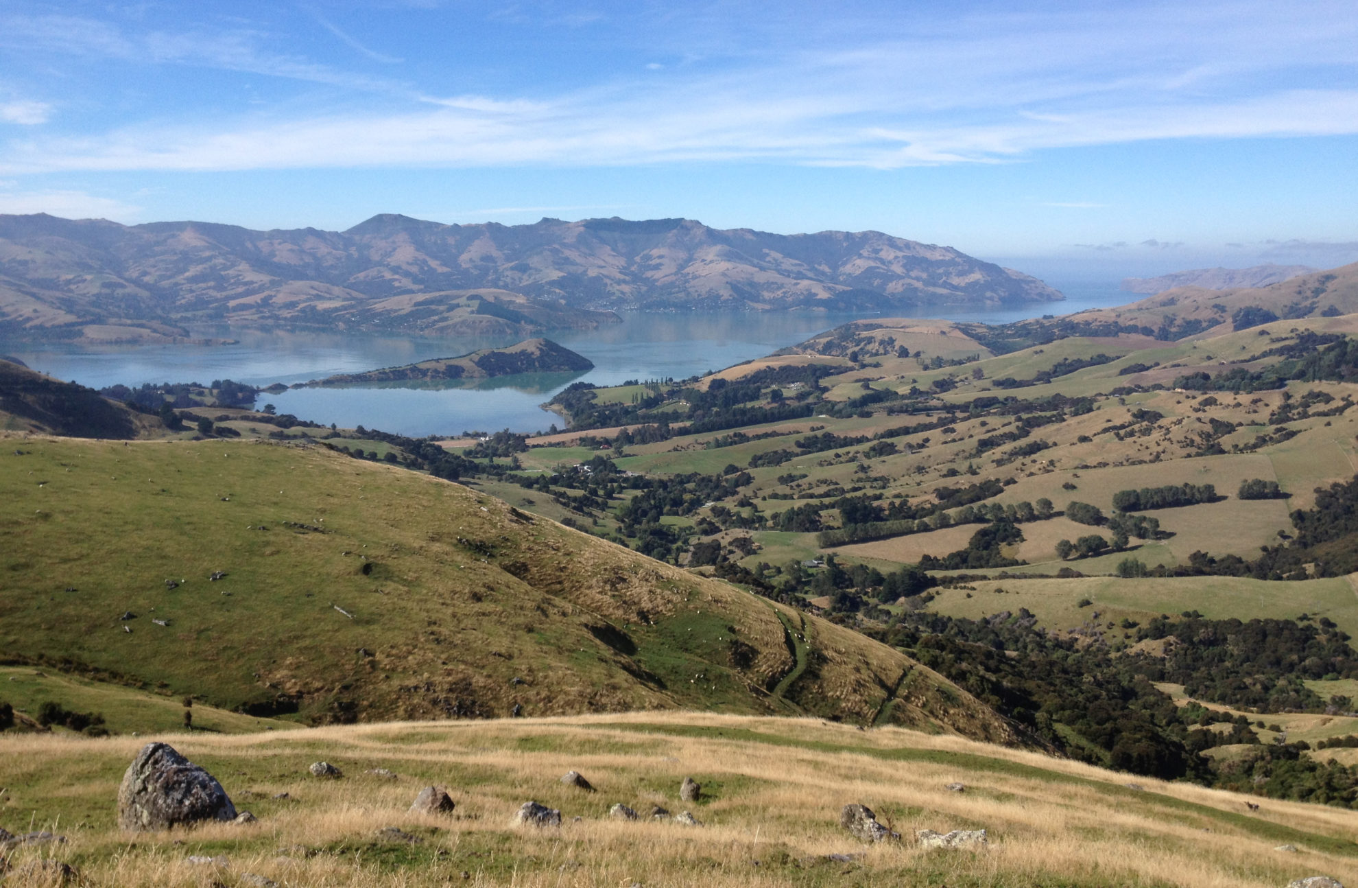
Ruapekapeka Pā, Northland
Easy / 20min
Ruapekapeka Pā was the last stronghold in the alliance between Ngapuhi chiefs Hone Heke and Kawiti.
The pā took 600 people two months to build and was the most formidable and sophisticated ever constructed. Today it has been thoughtfully preserved and lavishly interpreted with a series of explanatory panels, detailing the mechanics of the 1845 battle between forces of Governor Grey and Kawiti.
Follow the suggested route over the first British forward position and through the puriri forest, as this direction follows the flow of the information panels. Entering the pā site, a mock palisade and carving lead to the earthworks. Hillocks, mounds, holes and ditches mottle the hilltop.
Some excavations are over a metre deep and the labyrinthine remains boggle the mind with the construction efforts required. The double defensive ditch is decipherable on the northern side of the pā.
Mt Eden, Auckland
Easy, 1hr return
Mount Eden/Maungawhau is the highest of Auckland’s volcanic cones and commands 360-degree views of the city and harbours. The elevated location made it a preferred site for settlement of the Auckland region with Te Wai-o-Hua making it their principal pā.
Extensive gardens of taro, kumara and yams lead to a series of cut-and-fill terraces. The pā had a water source, marae, dwellings, rua (food storage pits) and a tihi on the summit plateau.
A network of well-maintained tracks explores the site.
Whitianga Rock Walk, Coromandel
Coromandel, Easy, 20min
Whitianga pā was situated atop this 24m-high rock that guards the entrance to Whitianga Estuary. This easily defendable settlement was populated by Ngati Hei, the tangata whenua. The ditch near the information board was excavated to provide protection from attack. Postholes in the rock, which once supported a wooden platform, are still in evidence. Captain Cook was treated to a meal here in 1769 when he visited Mercury Bay.
Kohi Point Walkway, Bay of Plenty
Easy-moderate, 3hr one way
The track runs through the Taumata Kahawai Pā, the largest of the pā on Kohi Point. The defensive ditch is over 250m-long and rendered the pā virtually impregnable. The steep slopes of the headland and unencumbered views allowed easy retreat to a central high point if needed.
The track weaves through coastal forest and scrub on its way to Otarawairere Bay, where rocks at the northern end are not negotiable around high-tide. The track continues to West End Road in Ohope.
Oven stones found on terraces here indicate human occupation prior to 1350AD.
Opapaka Pā Walk,
Waikato, Easy, 40min
There are few better places than Opapaka Pā to discover the anatomy of a Māori fortified site.
The metalled and stepped track climbs through the forest. At the fenceline, follow the orange triangles to the top of the hill where an information board explains life at the pā. Terraces, ditches, earthworks and kumara pits are still clearly visible.
Opapaka Pā was occupied in the late 18th century by Ngati Hia. A recorded battle took place with Taane Tinorau. Peace was offered by their chief laying down his dog skin cloak.
Otatara Pā Historic Reserve Walk,
Hawke’s Bay, Easy, 90min
From the top of the hill it’s easy to understand why this site was chosen for a pā. From the coast to the Ruahine Range, there are views in all directions.
Not only was the site protected by sheer walls, acting like ramparts, but it also lay in close proximity to the Tutaekuri River and Te Whanganui a Orotu, the large lagoon that formerly occupied the area before the 1931 Nelson earthquake. The pā was the largest and most historically significant of the area.
The track climbs to the reconstructed palisade and pouwhenua, then climbs the southern ridge to Hikurangi Pā. The descent follows the northern ridge, passing terraces used for cultivation.
The pā was inhabited since the late 1400s by several tribes. Current kaitiaki are the Waiohiki Marae, associated with Ngati Kahungunu.
Pukerangiora Historic Reserve, Taranaki
Easy, 30min
These are some of the most impressive pā remains in Taranaki and are especially interesting for the military sap near the lower end of the pā. A network of informal tracks explores the site.
A lookout over the high banks of the Waitara River shows how the site would have been impregnable from an attack on this front.
By the 1860s, the old Waikato and Taranaki foes had joined forces against the British. Under the command of General Pratt, who was trying to take Pukerangiora, the soldiers used a military technique known as sapping. By digging a deep trench towards the pā, protected by a series of eight earth redoubts, their hope was to protect themselves from enemy fire until close enough to the palisade to throw mines or bombs. The weeks-long offensive was abandoned when a truce was called and the Waikato tribes headed home at the end of the First Taranaki War.
Lake Papaitonga Scenic Reserve Walks, Manawatu
Easy, 20min
Māori used the waterways between Lake Papaitonga, Lake Horowhenua and other smaller lakes as communication routes. Papaitonga was a sacred place and the Muaupoko built pā on the lake’s two islands, Papaitonga and Papawharangi, where up to 400 people lived.
The lake became infamous for a bloody massacre by the notorious Ngati Toa chief, Te Rauparaha, who used his muskets to slaughter over 600 Muaupoko.
A track passes through the forested sections and travels over boardwalks through the flax swamps at the lake edge.
Kapiti Island, Wellington
Easy-moderate, 3hr
Although best known as a safe haven for avian residents, the Māori occupation of Kapiti dates from around 1150.
In 1821, Te Rauparaha and his allies descended from Kawhia in search of land, trade and guns. He set his sights on Kapiti as a strategic location from which to command the coast and overcame resident Ngati Apa and Muaupoko.
A visit to Kapiti is incomplete without a walk to the summit. The recommended route is to climb via the steeper Trig Track and descend on the Wilkinson Track. There are other tracks at the northern end of the island, but these may be closed during springtime nesting periods.