


- Area
- Waitakere Ranges Regional Park
- Distance
- 11.3km
- Time
- 5-6hr
- Grade
- Moderate
- Access
- From Titirangi, follow Huia Rd to Huia, cross bridge and turn right on to Huia Dam Rd. Park when you reach locked gate
- Map
- BB31
- GPX File
- Te Toiokawharu (gpx, yo 14 KB)
- Your device does not support GPX files. Please try a different device.
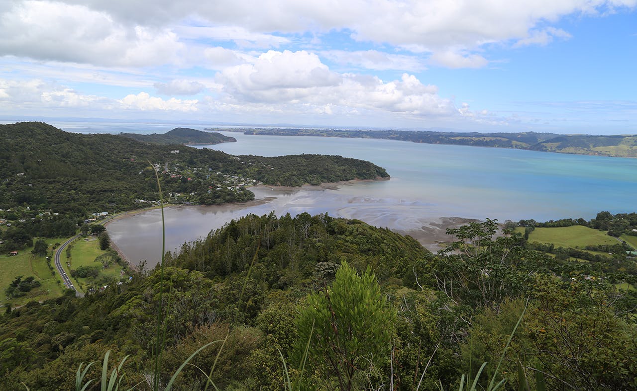
The southern end of the Waitakere Ranges provides the highest hills in the region. It also provides views of sheer rock cliffs among otherwise forest-covered hills.
The hills are steep and offer wide views over Manukau Harbour and back towards the distant city of Auckland.
Huia Bay is sedate to say the least. The small tidal river running from the nearby reservoir flows ever-so gently under the small bridge and out to sea. It,’ a beautiful setting from which to begin the tramp.
The route is basically a loop around Karamatura Stream and begins with a steep and often muddy ascent of Twin Peaks Track on the northern side of the stream. The climb is steep in places but the track is a good clear backcountry route. Every so often, a clearance in the trees gives the chance to look back over the bay towards the city and across the valley to the rock faces on the hills opposite.
The enormous Tom Thumb kauri greets walkers at the foot of the track to Goat Hill. The tree’s unusual trunk shape made it unsuitable for logging and it is the largest tree on the walk, making a good resting spot.
The short side trip up Goat Hill is worth it, as it’s the only vantage point for looking north towards Lower Huia Reservoir.
Twin Peaks Track continues to rise over the unnamed twin peaks before the final, somewhat gentle assault of 474m Te Toiokawharu. However, there is no sense of elevation – there’s no view and the surrounding forest is as lush and varied as at sea level. *
At the junction after the summit, following Huia Ridge Track towards Karamatura Forks. Much of the track is covered in boardwalk and any rises and dips are minimal.
Reaching Karamatura Forks, there is a short section of beech forest. Heading left, following the sign towards the car park, join Karamatura Track, which is part of the Hillary Trail and in excellent condition. A gradual descent turns into a steep section leading to Karamatura Stream.
Continue towards the car park. Just after reaching the kauri dieback boot-cleaning station, a path forks left. Keep following the Hillary Trail markers over the stream and across one campsite, then up a hill to a gate close to the campsite toilet, then over several paddocks to a second campsite, enjoying views of the hills to your left.
Walk through the gate to the left of the barn and follow the track down to the road, turn left and after about 200m you’ll see your vehicle.
