


Adventure across the Ailsa
The Greenstone – Caples Circuit is a well-known classic due to its easy-flowing trail amid grand mountain scenery. However, the Ailsa Mountains that separate these two lush river valleys offer a more rugged backcountry experience that is worth the effort.
A friend had described an appealing route that he had followed from the Caples Valley to Steele Creek via the tops.
Our group of four set off early in the morning, surrounded by hills blanketed in a light dusting of snow. We crossed the bridge to the true right of the Caples River and continued up the easy grassland to Birchdale Homestead. Built in 1880 for the Birchdale Run, the homestead looked a little worse for wear with collapsed walls and roof.
We followed a track behind the ruins and across a terrace to make good headway along Reids Creek, before splitting off into dense mānuka forest. Here, the trail begins to go uphill and pushing through this bush was hard work.
Approaching the 1000m contour, the topography flattens and the bush transitions back to beech before giving way to tussock slopes. Sitting at around 1020m, the recently renovated Home Hill Hut allows impressive views across the Caples Valley and the Ailsa Mountains. No one knows exactly when the hut was built, but the best guess is around 1950. It was for Birchdale Run stockmen. We stopped here for lunch, mentally preparing ourselves for the rest of the climb.
From the hut, it’s a sidle west along the slope before climbing up the easy gut below Pt1388.
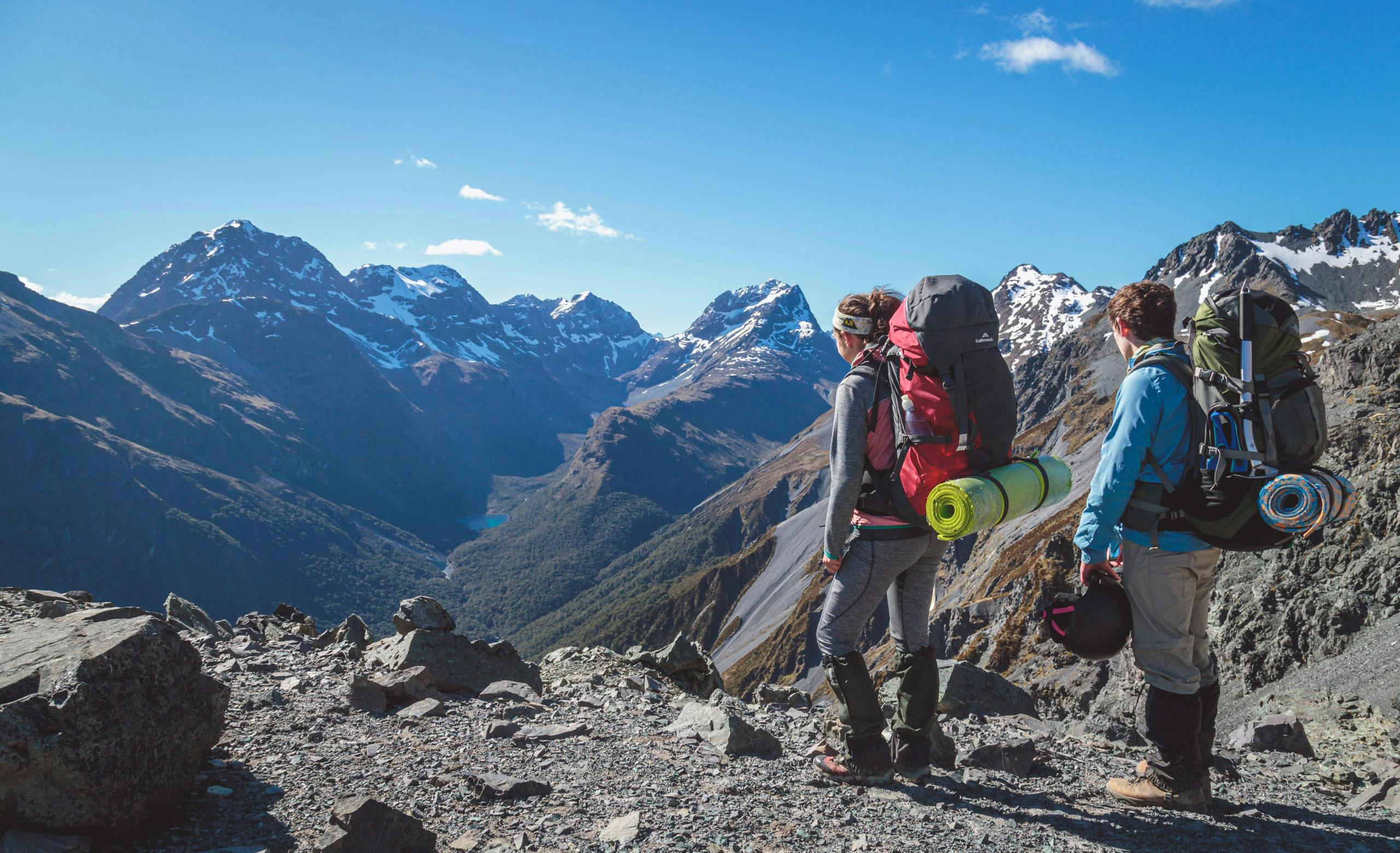
From here, there’s a view of the first pass to cross which, although unmarked on the topo map, was described in the Home Hill Hut book as Bumble Bee Pass.
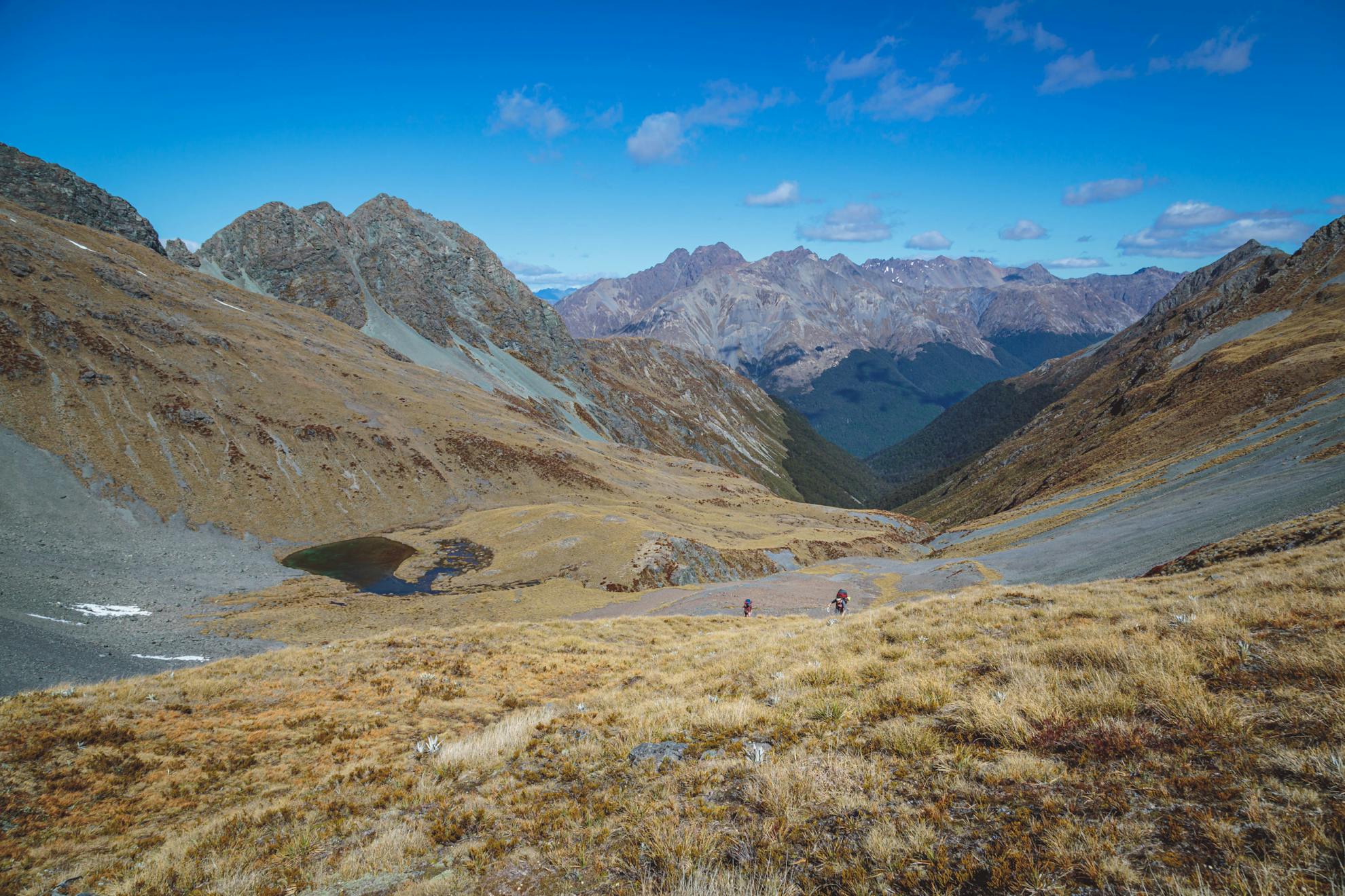
We crossed a relatively flat tussock basin which is interwoven by babbling creeks. Approaching the pass, between Pt1700 and Pt1649, the gradient steepened with the tussock giving way to loose scree for the last 30m to the saddle. It was hard work, but on the other side of the pass, another steep scree slope led to a bright blue tarn that is unmarked on the map. This made for good scree running and soon we were sidling to the larger tarn by Pt1395. With plenty of flat ground and water, this tarn would make for an excellent campsite but we had left our tents at home.
It is a gradual but steady climb up to the final pass, a rolling saddle between Pt1548 and Pt1800, that leads into the Steele Valley. From here, there are magnificent views of the upper Steele Creek and its west branch which flows out of a sapphire lake nestled below Tongue Spur.
After another scree slope descent from the pass until about the 1100m contour, a scrubby gut leads into the forest. At around the 900m contour, a stream flows into Steele Creek and after crossing that waterway the Steele Creek Track is reached. From here, there’s another half hour to reach the cosy four bunk Steele Creek Hut.
The following day, we headed back upstream, past the point where we had dropped off the Ailsa Mountains. It gradually ascends the valley until crossing in front of the base of Tongue Spur and then climbing steadily all the way to the pass at the head of the valley.
Once out of the bush, the track crisscrosses the creek, making its way through some rather dense patches of scrub. At the pass, though are worthy views over the Steele, Caples, Fraser and Kay Valleys – ample reward for the work required to reach this point.
From the pass it’s a slippery sidle to reach the spur leading down from Pt1611.
The descent through the bush is knee-jarring but is over quickly and you’re soon at the track junction beside Upper Caples Hut.
From here, it is about four hours of easy walking down the Caples Valley, with the possibility of a stop halfway at Mid Caples Hut. This was too tempting to resist, as the swimming-hole on the far side of the canyon, is divine.
The trip over the Ailsa Mountains is hard work in parts, but rewarding. There are also many options to tailor the trip, with overnight camping/hutting possible at the Birchdale Homestead, Home Hill Hut, and the tarn at Pt1395. Alternate routes out include the track south to the Greenstone or to continue North from the Caples Valley over Kay Saddle.
– Sam Harrison
- Distance
- 43.1km
- Total Ascent
- 3041m
- Grade
- Difficult
- Time
- Car park to Home Hill Hut 4hr; To Pt1395, 4hr; To Steele Creek Hut, 4hr; To Caples Junction, 6hr, To Mid Caples Hut, 2hr To Car park, 2hr
- Accom.
- Home Hill Hut (free, two bunks), Steele Creek Hut (free, four bunks), Mid Caples Hut ($15, 24 bunks)
- Access
- From the Greenstone-Caples car park at the end of Greenstone Station Road
- Map
- CB09, CB10
GPX File
- steele creek hut via Ailsa (gpx, 29 KB)
GPX File
- Your device does not support GPX files. Please try a different device.
