


- Area
- Whanganui National Park
- Distance
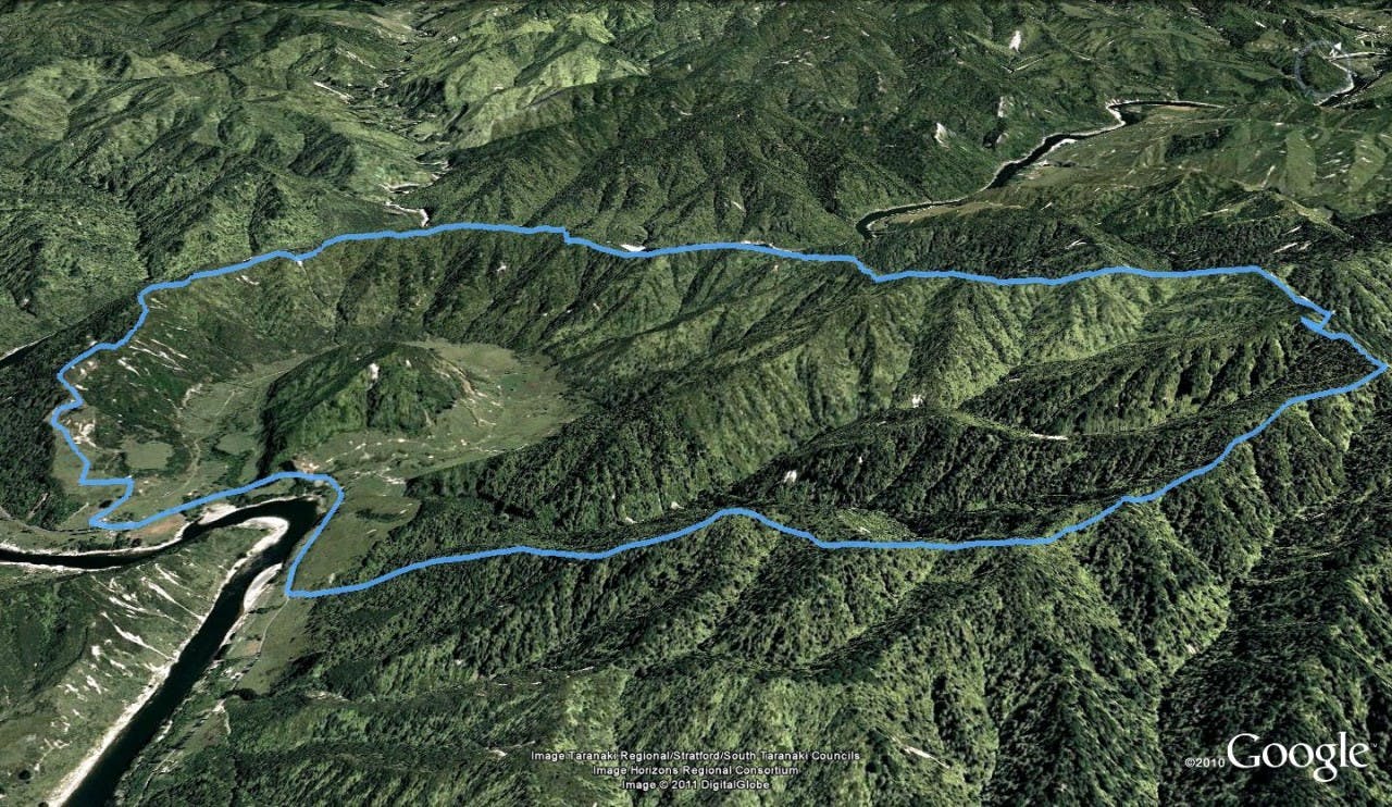
- 13.8km
- Time
- 5-7hr
- Grade
- Moderate
- Access
- From Whanganui, take SH4 north-east, turning left onto Whanganui River Road. The loop track starts a few hundred metres after the one-way bridge over Taupiri Stream.
- Map
- BK33
- GPX File
- Skyline Track (gpx, yo 10 KB)
- Your device does not support GPX files. Please try a different device.
Climbing steeply from the road through lowland forest to a height of 572m, Skyline Track circles Puketapu Hill which was once a fortified hill-top pa.
Puketapu translates to scared hill. A gently graded roadline meanders along the ridge to a clearing that is the unofficial halfway point where DOC provides a campsite with water, a shelter and a toilet.
Shortly afterwards the highest point on the track is reached with the Taumata Trig at 572m.
A steep descent brings you down to the roadend via sandstone bluffs and Taupiri Trig. Keen photographers will relish the views of the mountains of the Central Plateau and the tributaries of the Whanganui River.
