


- Area
- Pehitawa Forest Reserve
- Distance
- 11.2km
- Time
- 5-6hr
- Grade
- Moderate
- Access
- 1km along Fullerton Road, off Te Anga Road just before Waitomo Village or from the southern end at Brook Park, off SH3 north of Te Kuiti
- Map
- BF23
- GPX File
- Pehitawa Track (gpx, yo 8 KB)
- Your device does not support GPX files. Please try a different device.
Pehitawa runs from Waitomo Village to Te Kuiti and has gained significance as part of the Te Araroa Trail. It is a walk of contrasts: town and country vistas, forest and farmland habitats, public and private land, native and exotic flora and fauna, historic and contemporary features, urban bustle and rural serenity.
Leaving the northern end, drop into an open pasture basin beneath the somewhat obtrusive power pylons.
A sudden swing to the left will have you grunting up a grainy goat track grasping gorse, then down to a picturesque pond complete with maimai. This is the first of three steep bush-covered hills which periodically afford panoramic views.
The track continues over along a ridgeline and then drops to a deep ditch that leads to a level farm race before reaching the small suspension bridge over the Mangapu River, a sluggish channel with steep banks.
At this point, the track enters the 18.5ha Pehitawa Forest Reserve, which is Queen Elizabeth II Trust-covenanted land (purchased in 2001) and one of the finest remaining remnants of mature pole stand kahikatea trees in the North Island, some aged around 120 years.
Although small, it is self-sustaining and in near virgin condition.
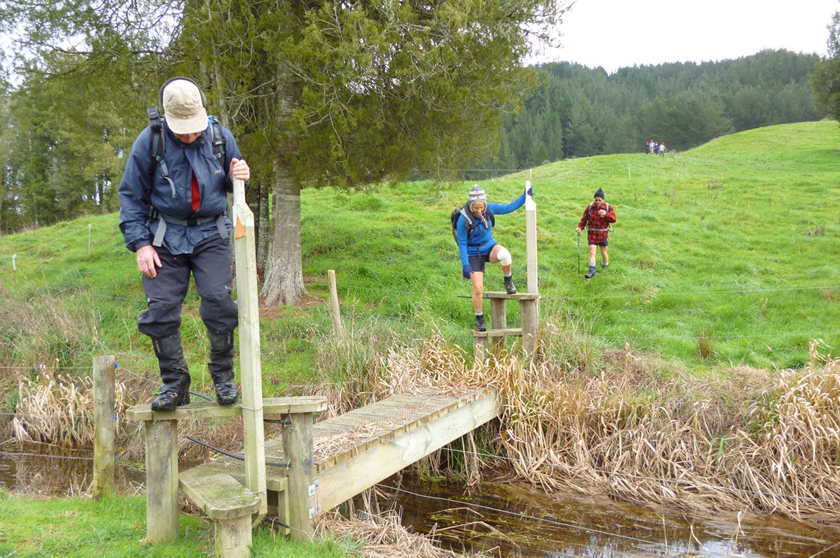
Once out of the woods, the rocky outcrop of Oparure pa comes into view and makes an ideal lunch-stop. Cross the sealed road (of the same name) and climb briefly to two stiles. A short distance from here are two old trees, a British holly and a pohutukawa, standing as symbols of a fascinating story of utu, shrewd politics and even humour: namely, Te Kooti’s rescue of a survey party kidnapped by Maori chief Mahuki in 1883. The rescue was a ploy to curry favour with the government for his pardon.
From the two trees, it is just 3km to the finish – through paddocks, across Gadsby Road, then over undulating terrain and a rather roundabout rising route to trig point 263 overlooking Te Kuiti. The trig marks the site of Motakiora, a fortified pa constructed in the 17th century by Rora, a son of Maniapoto. Continuing beyond the trig, scramble through a pine plantation to the exit on SH3 at the northern outskirts of Te Kuiti.
