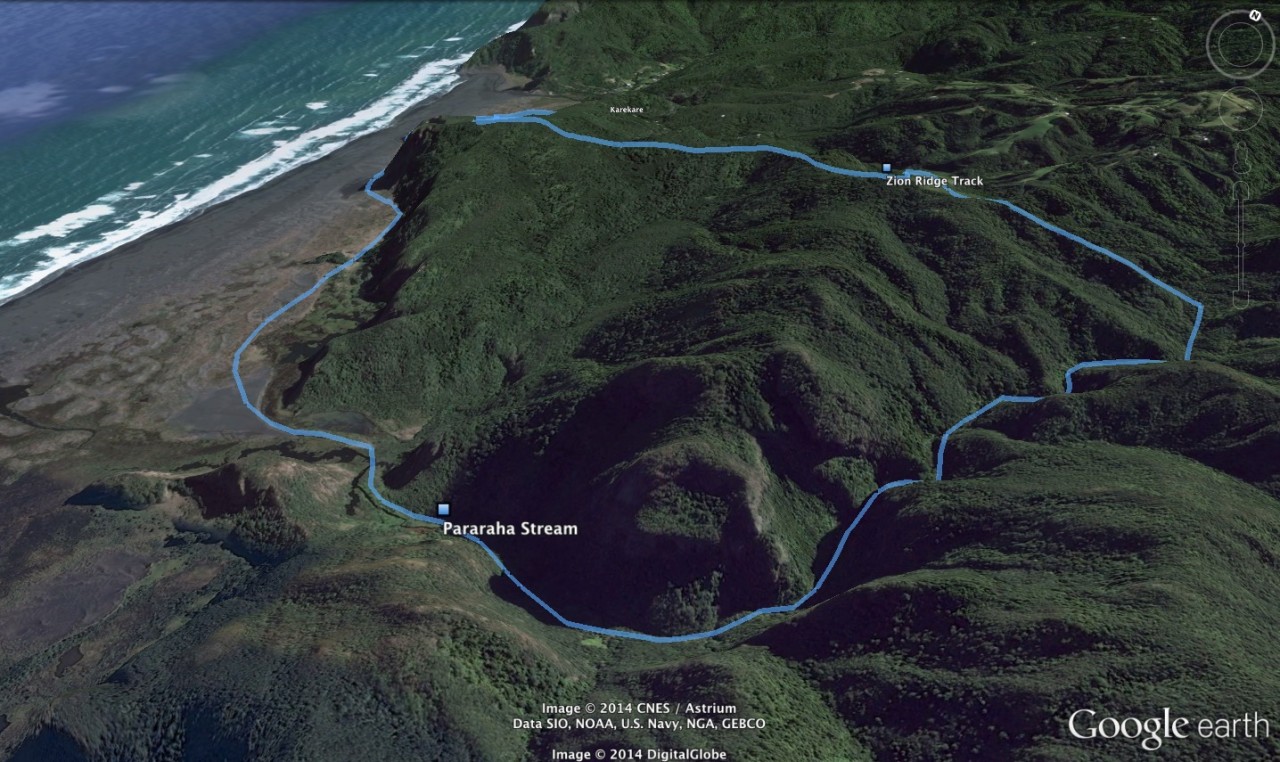
Set off through the pohutukawa glade and step out onto the dark sand of Karekare.
Head south along the beach, with cliffs looming to your left and the sea on the right. After Cowan Point the track turns inland, over sand dunes and patches of flax and toetoe.
Walk through the old railway tunnel at Tunnel Point and continue along a scenic stretch of coastal wetland, passing small lakes fringed with raupo and cabbage trees and following the boardwalks across the mangroves to the shelter beside the Pararaha campground.
Head straight up the Pararaha Stream, rock hopping through the shallows. Further upstream the boulders become bigger, the gorge deeper and the stream higher – up to your shoulders. Continue upstream, sometimes on the banks, sometimes in the stream itself, often clambering up the sides of the gorge.
It’s thrilling, if a little nerve-racking in places. Scramble up the side of several waterfalls, after which the stream becomes shallower, and continue to the junction with the Odlin Timber Track.
Follow it for about 15min to Lone Kauri Road then turn onto the Buck Taylor Track, which leads to the pohutukawa glade once more.


34 years of inspiring New Zealanders to explore the outdoors. Don’t miss out — subscribe today.

Questions? Contact us


