


- Area
- Fiordland National Park
- Distance
- 9.55km
- Time
- 6-7hr
- Grade
- Easy/Moderate
- Access
- From the Blackmount/Clifton Road turn-off go towards Monowai but go straight ahead to the Borland Lodge. The Borland Road climbs gradually on a good gravel surface from Borland Lodge to the Borland Saddle where there is a car park and toilet
- Map
- CE09
- Notes & Map
- Mt Burns, Fiordland National Park (pdf, 1 MB)
- GPX File
- Mt Burns (gpx, yo 9 KB)
- Your device does not support GPX files. Please try a different device.
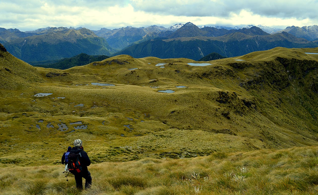
From Borland Saddle climb the narrow track that goes south over a mesh of stout roots and windfall to the tree line.
Head up the ridge on a poled route to a basin of beautiful reflective tarns mirroring the surrounding peaks.
The view to the west takes in the Grebe Valley with its extensive wetlands upstream of Shallow Lake and the snaking Grebe River which heads south to its source.
With open tops ahead, continue south east up the ridge line, dodging the occasional Spaniard. At the high point (1476m) at the south end of this ridge are expansive views of Island Lake and Green Lake.
Both could easily be accessed from an adjacent ridge that wanders in their direction a little further along from the high point.
Continue west, circling around to Mt Burns. A spectacular vertical drop plummets down to a long narrow unnamed lake that feeds Pig Creek. Join the spur leading to Mt Burns, 1645m, and the high point of the trip.
More great views can be had from the summit: the Hope Arm of Lake Manapouri, the Shag Point end of Lake Monowai, the Takatimu Mountains and farm country from Tuapapere to Te Anau.
Once you,ve had your fill of the views, retrace your steps or drop below the peak to check out a series of hanging tarns and their resident icebergs. If you do this, you’ll still be able to back track to the car park.
