


- Area
- Pisa Conservation Area
- Distance
- 23.6km
- Time
- 2 days
- Grade
- Easy/Moderate
- Accom.
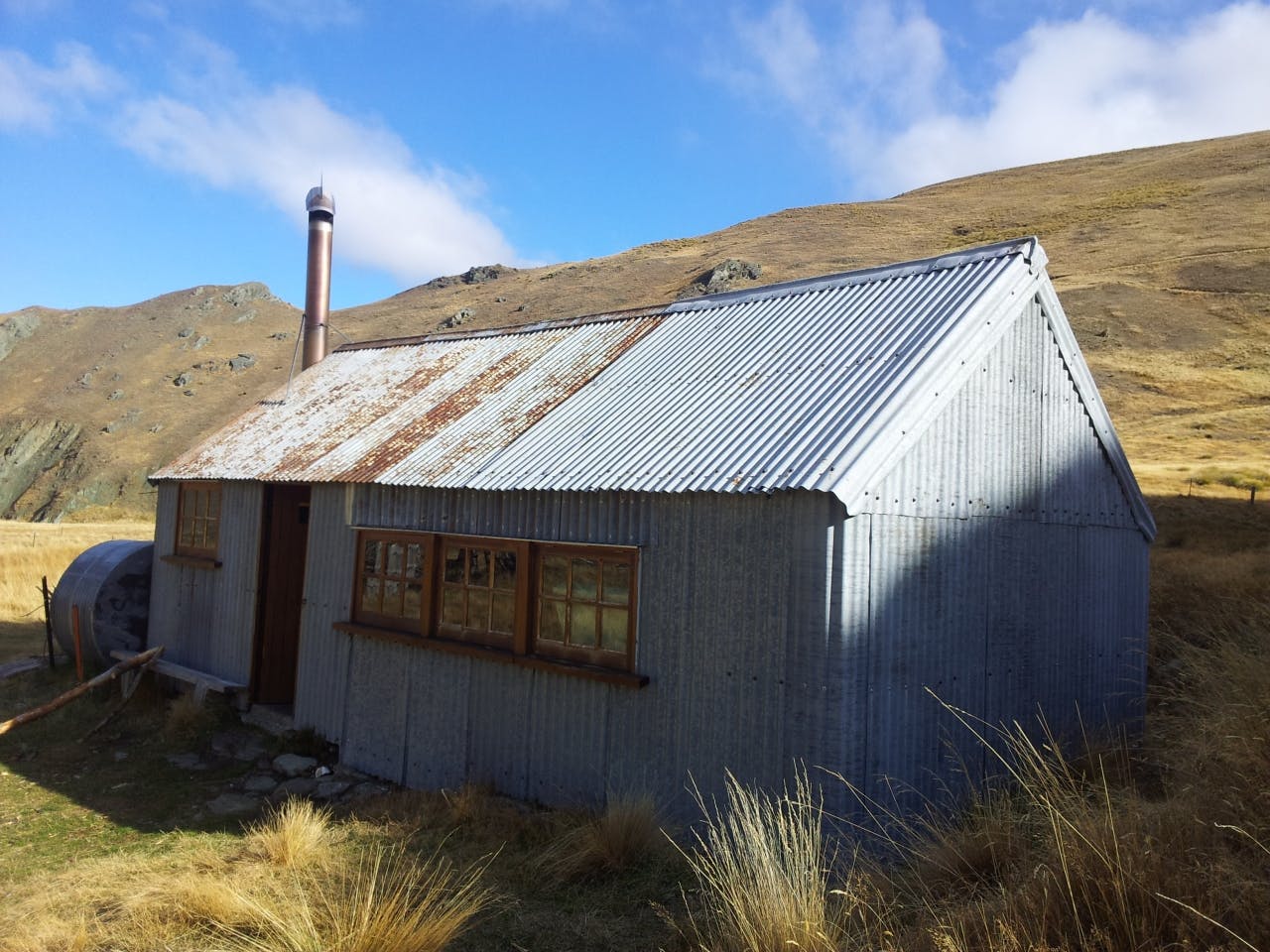
- Meg Hut (standard, eight bunks)
- Access
- Signposted at Swann Rd Lowburn, SH89 Cardrona and SH6 Kawarau Gorge
- Map
- CB12
- GPX File
- Meg Hut (gpx, yo 38 KB)
- Your device does not support GPX files. Please try a different device.
A small DOC sign marks the start of the track up Packspur Gully. Originally a miners, track, it’s now a farm road. Altitude is gained steadily and the views become more expansive as you climb.
The gradient eases off at the summit plateau and more views can be enjoyed of The Remarkables, Hector Mountains and Garvies. Continue pass the sign indicating a route to Mt Pisa – a long detour on this trip – before dropping into the head of the east branch of the Roaring Meg.
Pass the old musterer’s hut and journey along the ground trail worn down by miners in the 1860s. Climb past a water race and meander across broad ridges and in and out of gullies. The occasional orange-topped waratahs help with navigation when the track becomes a little vague. Finding your way could be challenging in foggy conditions or in snow. The track drops nearly 500m into the main Roaring Meg Valley to reach Meg Hut.
The hut was built for musterers in 1958 and has been nicely renovated by DOC. The concrete floor could be a bit cold, but there,s compensation in a ready supply of firewood – not something you expect in the barren hills of Central Otago.
From the hut a there is a 200m ascent to Tuohy Saddle. A sign indicates a route to the south-west, over Queensbury Hill and Rock Peak to the high point on the Crown Range Road. (The terminal of this track is another place for leaving a second car.) ** Head down Tuohy’s Gully to your car parked near the bottom of the Waiorau Snow Farm road.
An alternative route descends the Roaring Meg to SH6 from either the hut or the saddle.
