


Walk an old logging trail used by millers and gold miners to reach Kennedy Bay. By Nikki Addison
A five-minute stroll through Waikawau Bay’s Pump Paddock leads to the start of the Matamataharakeke Track, clearly marked by a DOC sign. This is followed by a comprehensive cleaning station complete with spray and brushes to prevent the spread of kauri dieback.
The trail, originally used by loggers and gold miners making their way from Waikawau to Kennedy Bay, begins by winding alongside a gentle stream and through native bush. The track is well-defined but narrow and riddled with tree roots. There is no gravel, leading to mud in winter, and fallen trees blocking the track may have to be navigated around.
During the first 20-minutes, there are multiple stream crossings, all helped by a number of ‘crossing’ rocks. The streams are fairly shallow, but the rocks are neither flat nor stable and can be slippery.
The sound of running water accompanies walkers as they leave the stream behind and the trail begins to climb, becoming slightly overgrown for a short time. A bush-lined gully is passed with the stream hidden beneath.
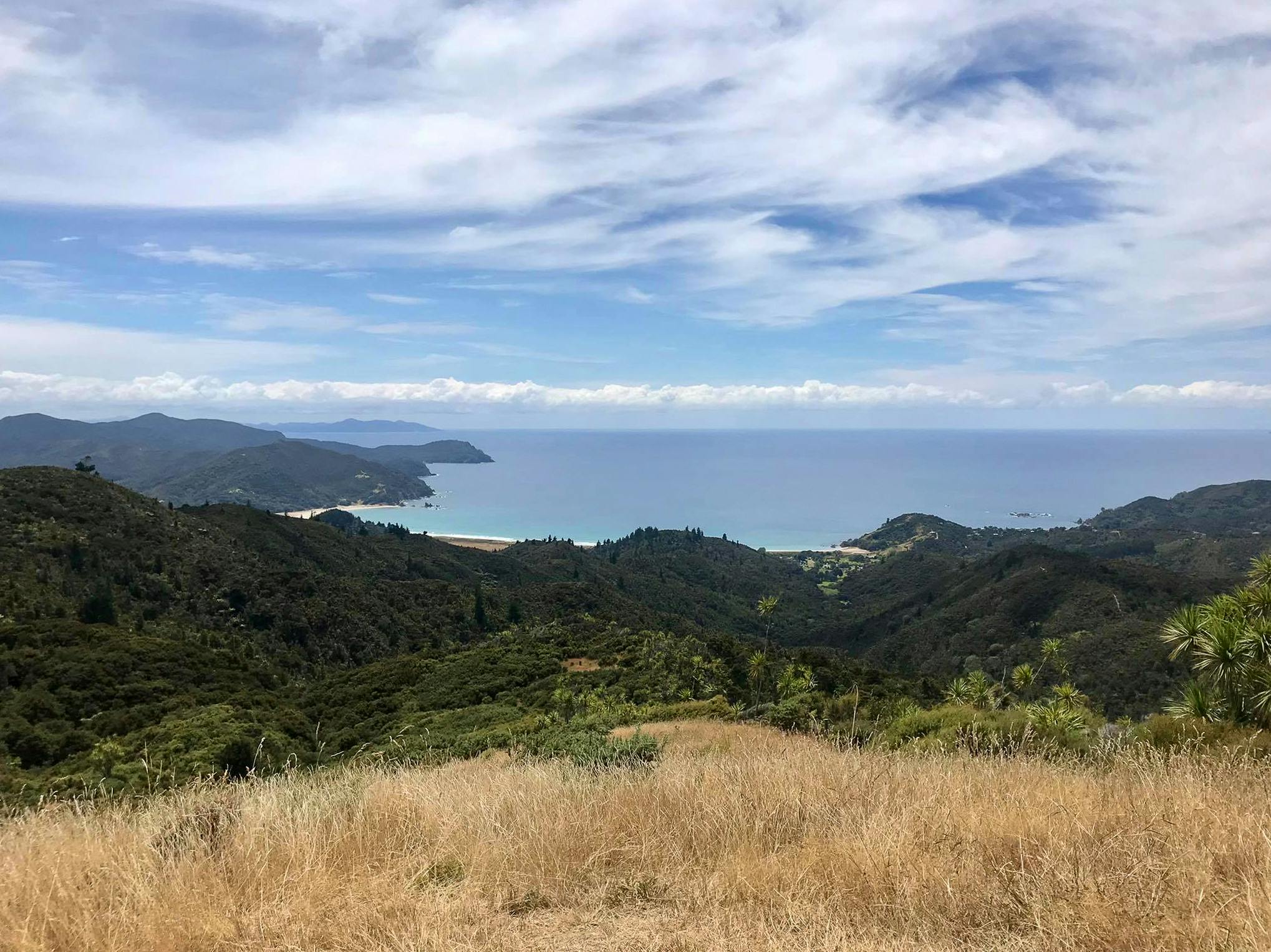
Thick shade lessens to partial coverage as the climb continues and the trail widens. Beautiful glimpses of Kennedy Bay are caught to the right.
Climbing steadily, a ‘Lookouts’ sign indicates the summit is near. This is soon followed by a second sign signalling the ‘Ridge Return’ home to the right, and a five-minute detour to a 344m summit ahead. Press on and ascend a long series of wide steps. These end at a metal gate, which opens to a grassy paddock offering broad views over Waikawau Bay, the surrounding bush and rolling farmland. Great Barrier Island can be seen on a clear day. A large pile of rocks provides a scenic spot to rest and eat lunch while taking in the stunning scenery.
Return to the base of the detour and follow the ridge track down a series of steep stairs. The track is wide enough here for two people to walk side-by-side, and is smooth underfoot, with fewer roots and stones. There are incredible views of the Pacific Ocean during the descent, which is broken by a few small rises.
After approximately forty minutes, the track widens further and the native bush gives way to pines and then mānuka. A final stream crossing returns walkers to the beginning of the track and the cleaning station.
- Distance
- 7.75km
- Total Ascent
- 476m
- Grade
- Easy / Moderate
- Time
- 2hr
- Access
- From the back of the Pump Paddock at Waikawau Bay Campground
- Map
- BA34
GPX File
- Matamataharakeke Track (gpx, 7 KB)
GPX File
- Your device does not support GPX files. Please try a different device.
