


- Area
- Mt Aspiring National Park
- Time
- 4 days
- Grade
- Moderate/Difficult
- Accom.
- Aspiring Hut, 38 bunks; Dart Hut, 32 bunks; Daleys Flat Hut, 20 bunks
- Access
- Raspberry Creek car park, Matukituki Valley
- Map
- CA11, CA10, CB10
- GPX File
- Dart Track via Cascade Saddle (gpx, yo 75 KB)
- Your device does not support GPX files. Please try a different device.
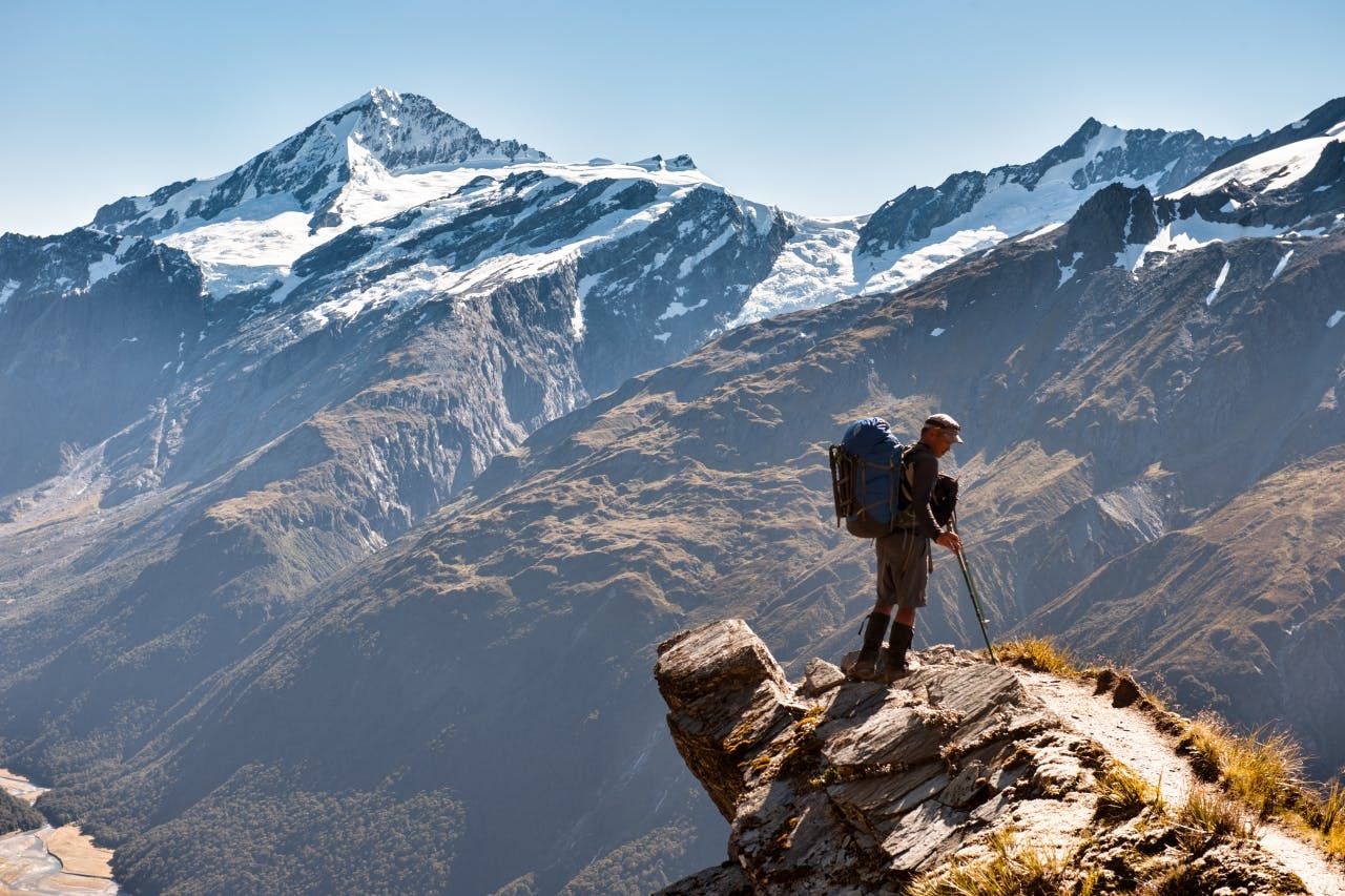
From Raspberry Creek car park, it is a pleasant nine-kilometre walk along the valley floor to the stone-clad Aspiring Hut. The hut is reached in two hours, so if you’ve started early in the day you may want to push on to camp near the saddle if you have a tent.
From the hut, the track heads straight up on a five hour climb to Cascade Saddle with a further five hours to the nearest hut – Dart Hut.
About 2.5hr into the climb, the bushline is reached and staggering views of mountains and glaciers can be appreciated. Far below is the Matukituki Valley below.
Signs warn of the danger of the route – not to be underestimated, especially in the wet. Many people have fallen to their deaths here. It is a further 1.5hr to reach Cascade Pylon, a good place to rest and eat lunch surrounded by glaciers.
Continue up to the saddle and then the head of the Dart Valley. The track here is marked by a series of rock cairns and follows the glacial waters to Dart Hut. Gradually, the harsh barren landscape of the upper Dart Valley gives way to beech forest. The Dart Track is, for the most part, an intermediate track. It follows the river to Daleys Flat and its hut.
The section from Daleys Flat Hut to Chinamans Bluff is along new tracks cut early in 2014 after a huge land slip blocked the Dart River, flooding the forests and many sections of the old track. It is rough going and will add to your planned walking time. For this reason, as of publication of this trip (July 2014) the GPX file of this trip is approximate only. The actual route will differ.
