


Despite what you may have heard, the North Island section of the Te Araroa Trail isn’t just mud and road walks, discovers Katrina Megget
“I’m being fleeced, and I don’t like being fleeced,” Scott the American complained to me as we sat in Orewa Beach Holiday Park North of Auckland while holiday-makers sunbathed and blue waves kissed the golden sand beach just metres away.
“I came to New Zealand to hike,” he continued. “I didn’t come to walk poorly maintained trails and through knee-high mud and along roads, and then be funnelled through private campsites where I have to spend money I don’t want to spend.”
He looked at me, his moustache quivering with indignation. “This isn’t hiking. This was not what I was expecting from the Te Araroa Trail.”
To be honest, I couldn’t fault him. For the past month we had walked 540km from Cape Reinga along the Te Araroa Trail and had endured more mud, pavement pounding and bushwhacking than any sane human being would want. But that’s Te Araroa for you.
The next day, Scott announced he was bailing on the North Island. He’d had enough. Instead, he was going to try his chances in the South Island where proper mountains and wilderness called, where hiking was part of the land and part of the lifestyle, where road walking wasn’t off the scale and where one could pitch one’s tent almost anywhere.
As I continued south through the urban jungle of Auckland, the grassy plains of the Waikato, zigzagging down to Wellington and over to the South Island, this was a story I heard time and again: walkers missing huge chunks of the trail, avoiding the road walks, side-stepping the muddy forests or skipping the whole North Island entirely; walkers complaining about the un-trail-like nature of the North Island section; and the anticipation and desire to get to the South Island where the “real” mountains began and hiking was what it “should be”.
I was surprised and disappointed by this, when I considered what a stunningly beautiful and geographically diverse country New Zealand was. And it’s exactly that which makes the North Island section of the Te Araroa so unique and special, says Mark Weatherall, chief executive of the Te Araroa Trust.
“The North Island offers the walker a diverse experience – from major cities, like Auckland, to the coast and forests, to the challenge of the Tararuas,” Weatherall told me. “It’s that diversity that sets the Te Araroa apart from any other trail in the world.”
Despite the constant muddy boots, the monotonous and oftentimes dangerous road walking, the frequent pockets of civilisation and lack of proper mountains in the North Island, I still walked some magic miles. For all the North Island’s warts, there were also beauty spots – something which seemed all too easily forgotten.
Indeed, by the time Scott and I had reached Orewa, we had ticked off several tramping highlights. Right from the start, with Ninety Mile Beach, the North Island wooed me. For five days, miles of golden sand stretched out both in front and behind, as I savoured my first taste of New Zealand wilderness. The view of sand, sea and dunes may have stayed the same each day, but it didn’t detract from the rawness and beauty of the wild, wind-whipped waves and utter sense of isolation (apart from the occasional passing tourist bus). By day, I felt like I was walking along the edge of the world, while each night promised a stunning sunset. It was no mountain, but it was remote and wild and still physically and mentally taxing. Even Scott admitted Ninety Mile Beach was special.
A week or so later came the next highlight: Russell Forest and walking upstream through the cool, clear waters of the Papakauri Stream. There is no right of access for the public through this section and it was only through negotiations with landowners that Te Araroa was granted the privilege to step into one of New Zealand’s most pristine native forest environments. For 4km, I felt the refreshing waters cool my blistered feet as I waded across shoals and boulders, marvelling at the clarity of the water, the greenness of the ferns, and the majesty of the native trees towering above. It was a land that time forgot, pure and unblemished by humans.
On the days before reaching Orewa, there were beach walks and native forests galore, and then there was Tane Moana. This giant kauri tree on the Tutukaka Coast just outside Ngunguru – the largest remaining kauri on Northland’s east coast – eclipsed all kauris I’d seen up to this point. It was huge, measuring more than 11m in circumference and soaring tens of metres into the sky. And it was old – believed to be more than 1000 years. To stand before such stature and beauty was so humbling that it brought tears to my eyes.
As I trudged south through Auckland and into the Waikato towards Hamilton, a stretch of the Te Araroa that many walkers chose to bypass – claiming it to be both flat and dull – I heard from Scott. He’d made it to the South Island and he was having a ball.
I was glad of his new-found mountain freedom but I couldn’t help think he’d bailed on the North Island too early; that he was missing out on some of the best landscapes and experiences New Zealand had to offer.
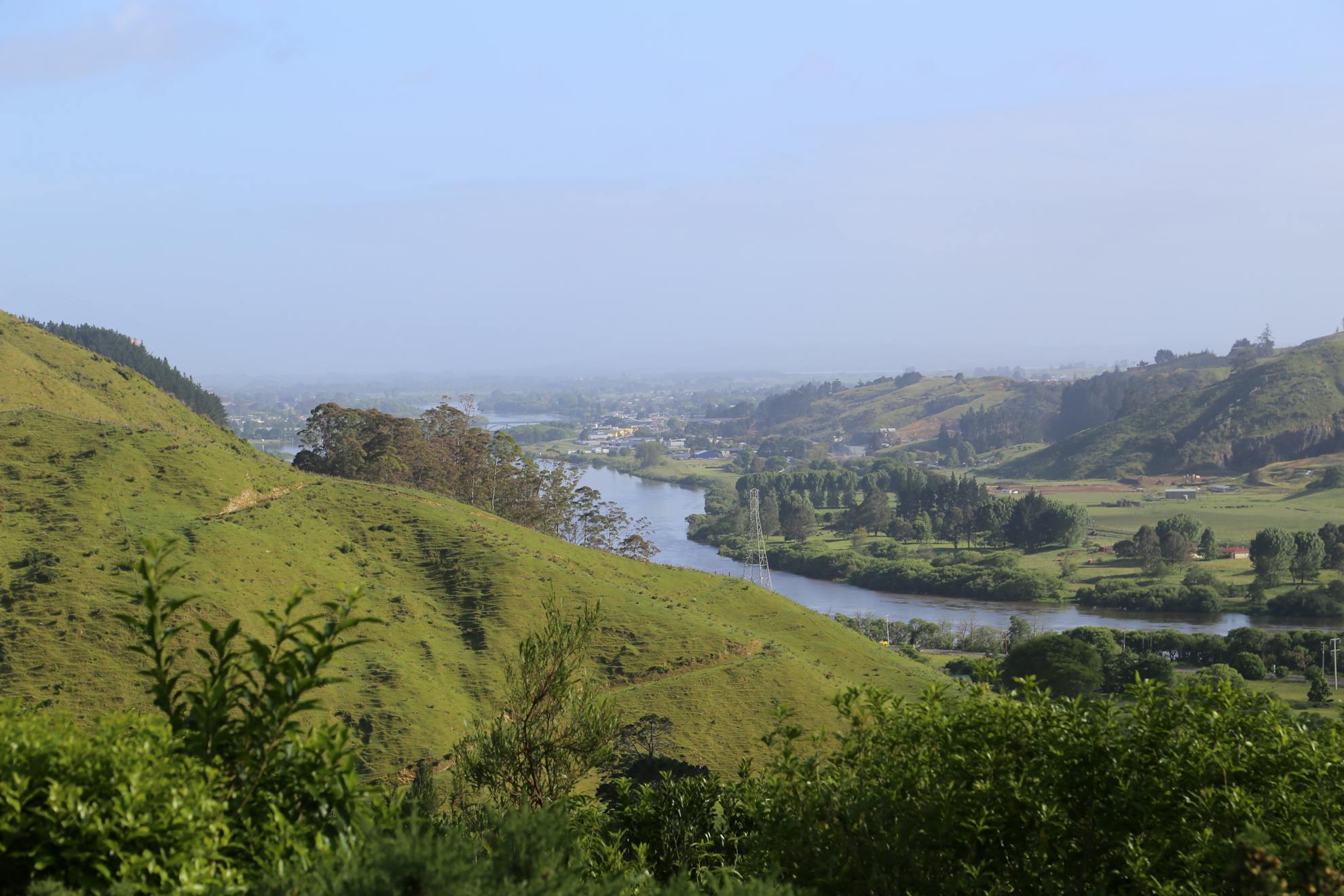
Not even a fortnight after Scott had jetted off to the South Island, I was revelling in North Island gems. For several days I was graced by the beauty of the Waikato River as I tracked its course south. It gleamed in the sunlight and brooded when the sky was grey. I walked its dusty clay banks passing rich farmland, dodging hardened pockmarks left from cattle hooves, and along a trail where native bush overflowed at the water’s edge.
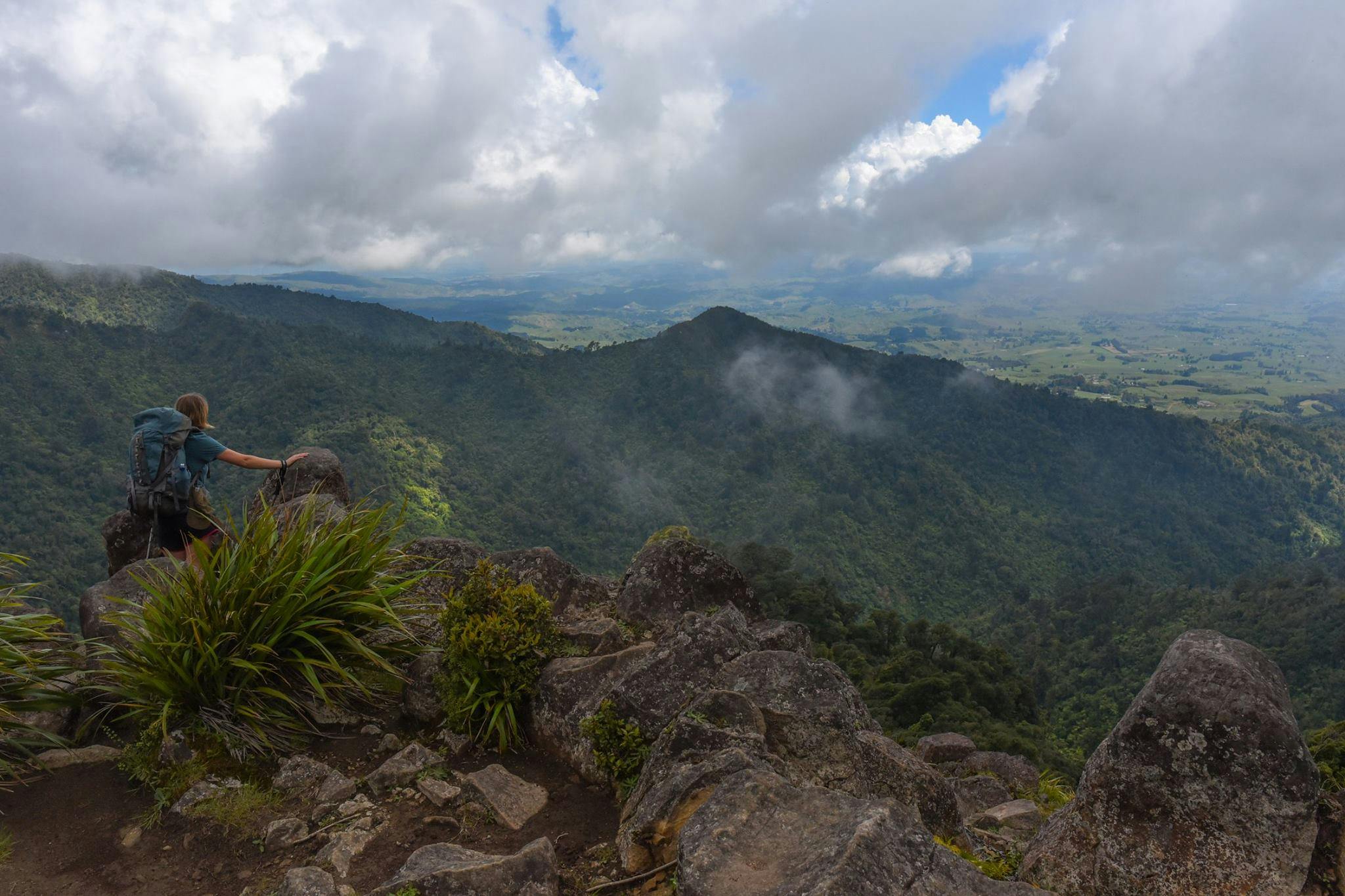
After Huntly, the flat trail took to the hills along the Hakarimata Range to Ngaruawahia. For 12km, I snaked along the undulating ridgeline past rimu, ponga and nikau palms, over gnarly tree roots and through mud puddles. Gorse made itself known, as did the newly acquired skill of bushwhacking. But the physical demands were put to shame by the views that appeared through the trees and which opened up from the clearings, including the 374m-high summit. There a slash of the Waikato River’s blue waters, there a row of forested mountain tops, there the farming plains stretching out. By this point, I’d had my fair share of mud and forests but the Hakarimata Walkway showed how mud and forests should be done and it was a fine example.
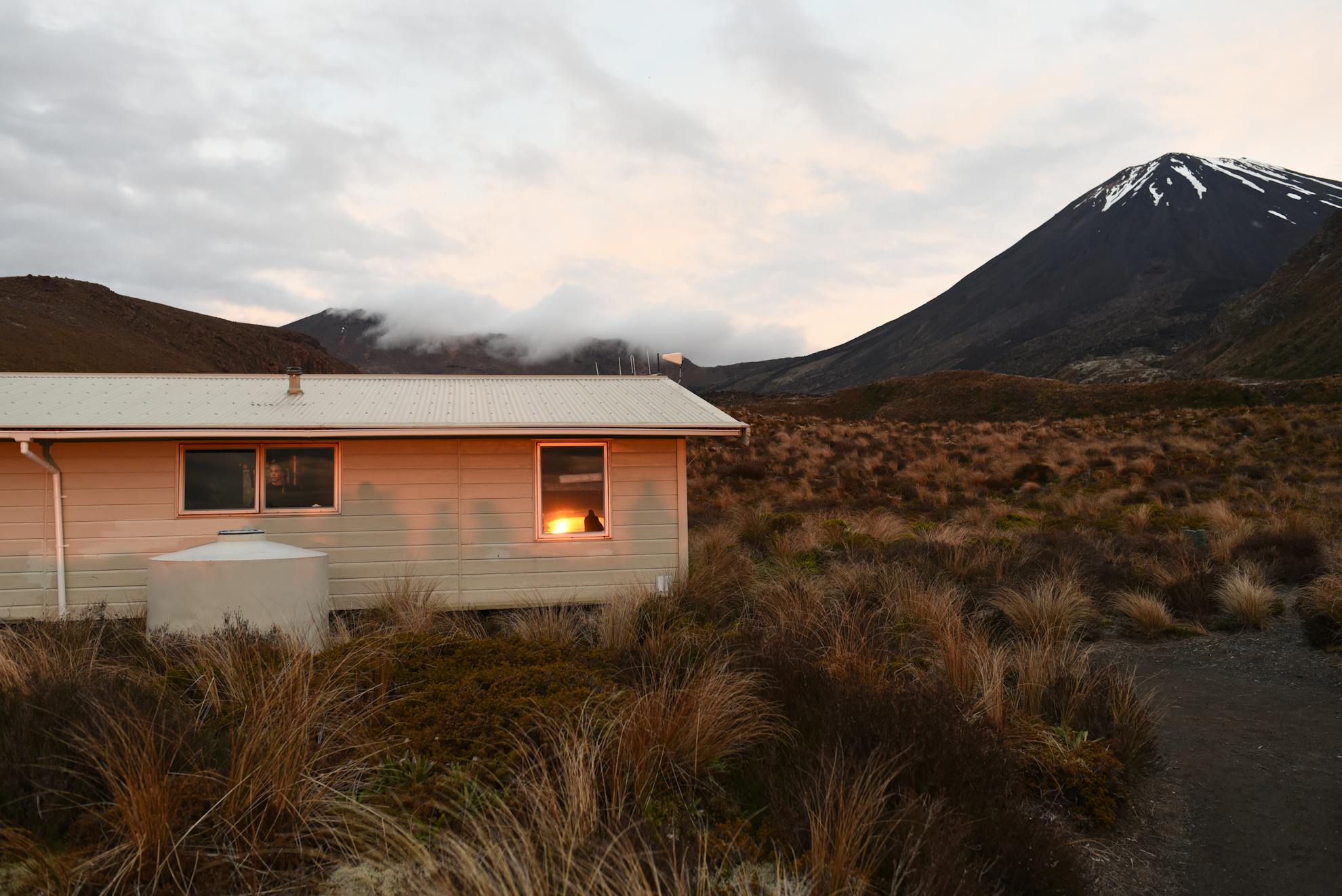
But the mud and forests weren’t over yet. After Hamilton, I delved into the depths of the wild and muddy Pirongia Forest Park and hiked to the top of 959m Pirongia Mountain, an ancient volcano. The summit and view from the glamorous 20-bunk Pahautea Hut left visions of muddy trails in its wake. Mountain tops and distant lands fought for attention, but it was the sunset and sunrise that took the winner’s prize. As dusk approached, fluorescent orange rivers ran across the sky like lava flows and in the morning, I awoke to a cloud inversion and technicolour display with the distant peaks of Ngauruhoe and Ruapehu hovering on the horizon.
The two volcanic peaks were closer still from the 1165m-high shrubby summit of Pureora, reached several days later by a slight detour off the 85km Timber Trail. On a clear day, Pureora boasts views across Lake Taupo, the Mamaku Ranges and Mt Taranaki but all I could see was the glinting snowy white atop Mt Ruapehu.
Pureora came at a time when I needed a chill pill and the Timber Trail with its blissful wide and flat path, calming ancient native forest and eight spectacular yet vertigo-inducing suspension bridges delivered. For four days I strolled the cycle trail through long, dark avenues of trees and out in the blinking sunlight. I listened to crickets chirping and birds singing, while flies played leapfrog at my feet and toetoe and bright pink snapdragons stood to attention as I passed. The Timber Trail is often described by Te Araroa walkers as a highlight and I could see why – for what seemed like the first time, I stopped looking at my feet, for there was no mud and tree roots to dodge, and I was able to really enjoy the natural moments.
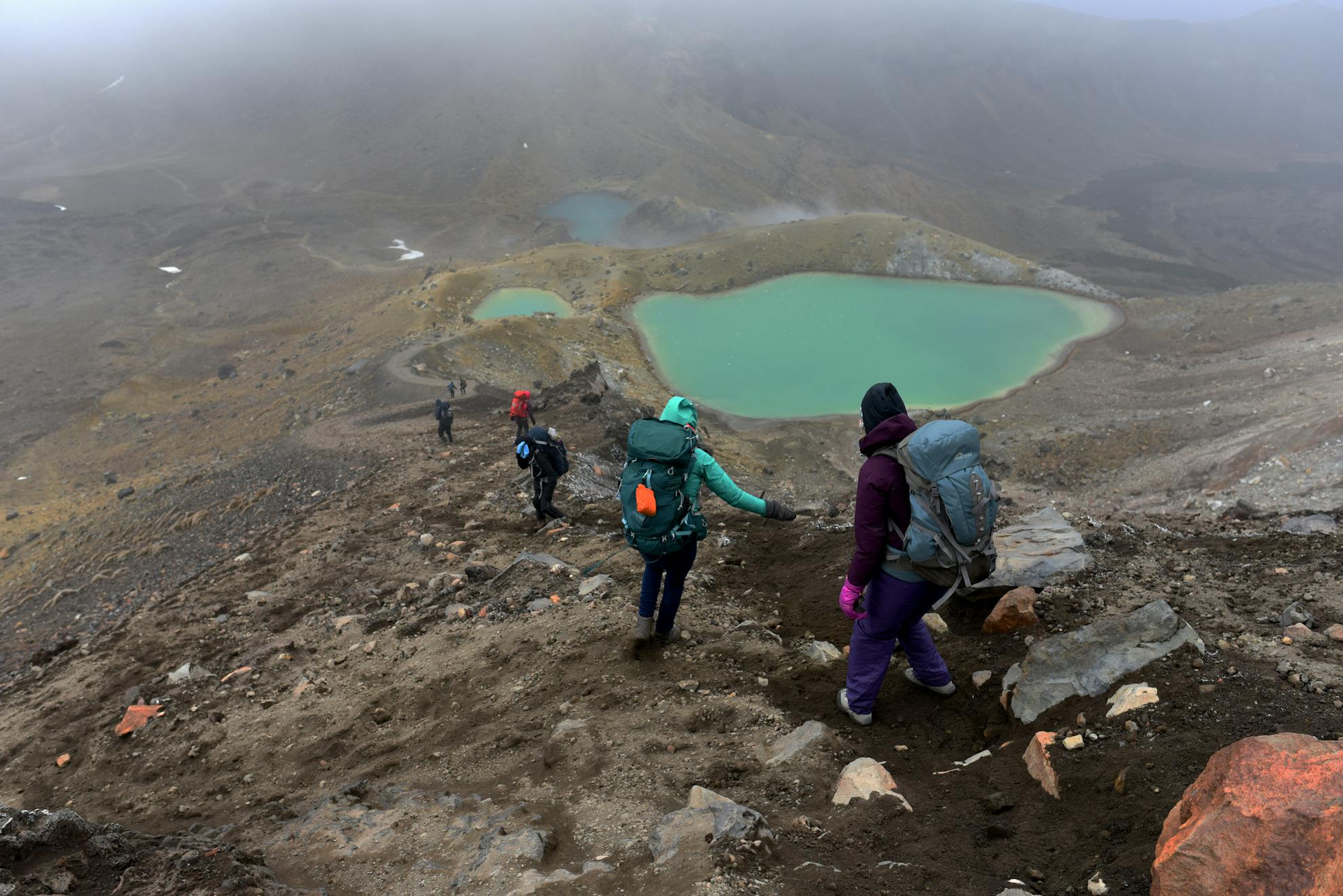
And the North Island pearlers kept coming. Next up was the Tongariro Alpine Crossing. With its Mars-like volcanic landscape, views stretching to infinity and stunning jewelled lakes, the crossing can’t fail to impress. Although its weather left much to be desired as I hobbled towards Red Crater in teeming rain and 110km/hr wind gusts only to be forced to retreat 300m from the summit when I realised the elements were clearly winning. I had walked the crossing twice before so I knew its delights. It may be dubbed New Zealand’s best one-day walk but by this point in the Te Araroa, I felt it had some stiff competition.
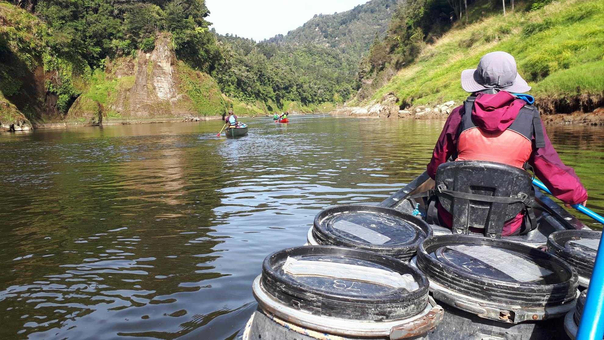
The Whanganui River, for example, was a real contender for best Te Araroa experience.
With virtually zilch canoeing experience and a fear of capsizing, this ‘Great Walk’ tested me. But what a surprising exhilaration it was: racing through wild rapids with my heart in my mouth willing the canoe not to capsize; powering downstream with screaming muscles in the meanest headwinds; and drinking in the gorgeous gorges with their green-coated, towering cliffs that disappeared into the calm oil-like waters below. On the sixth day, we woke at 4am to catch the outgoing tide into Whanganui. Warm mist floated over the water’s slick surface as birds woke to a new day and the sun slowly rose, its beams searching out the cracks between hilltops. Drifting silently through the dawn was beyond magical.
Then, it was four days of monotonous and painful pavement-pounding from Whanganui to Palmerston North and the early Tararuas. Two long days later brought me to the start of the proper Tararua Ranges section. By now I was lean and fit, but I was scared by the prospect of the Tararuas – a mixture of forest and alpine terrain, notorious for extreme conditions and weather that can deteriorate rapidly. This was real New Zealand tramping and an experience many saw as a taster of what was to come in the South Island.
To say I enjoyed the Tararuas would be a lie. It was physically and mentally demanding. The steep ascents were ridiculously steep while the steep descents were horrendously precipitous. The mud was a nightmare, the trail navigation haphazard, the huts decrepit, and the bruises I gained made my body look like a painter’s palette. But the views along the exposed sawtooth ridgeline stole my breath. The brush-covered Tararuas jutted in all directions, while the river valleys ran deep. The sea sparkled to the east, dancing around Kapiti Island, and in the distance I could just make out the peaks of the South Island. Out of the exposed ridgeline, I was swallowed by goblin forest where deformed trees dressed in green moss: J R R Tolkien’s fantasy land came to life.
The day finished at Nichols Hut with an apricot pink slash across the horizon, silhouetting one of the most remote and wild landscapes in New Zealand.
As I wandered along the stunning Kapiti Coast, towards Wellington and Te Araroa’s southern point on the North Island, I briefly thought of Scott. He’d certainly missed a beaut; the North Island section of Te Araroa had delivered. The South Island might be internationally-renowned for its mountains but the North Island could be New Zealand’s best kept tramping secret.
A whirlwind tour of North Island Te Araroa highlights
Ninety Mile Beach
Starting from Cape Reinga, this 100km walk begins at Te Werahi Beach and on to Ninety Mile Beach down to Ahipara. It’s four to five days (depending on your definition of torture) of playing cat and mouse with the tide and walking alternatively on soft dry sand or wetter, firmer sand, with a couple of rocky points thrown in for good measure, as well as plenty of remote and wild sea views.
Hakarimata Walkway
Taking around six to seven hours, this track, which starts almost 5km south of Huntly, follows the Hakarimata Range ridgeline, up steps and along an oftentimes muddy path littered with tree roots to the Hakarimata Trig (374m) before descending 1349 leg-crunching steps to Ngaruawahia.
Pirongia Mountain
There are several tracks that take the hiker to the summit of 959m Pirongia Mountain but Te Araroa follows the Tahuanui Track, which climbs through tawa trees to Pahautea Hut. From the hut, the TA takes the muddy Hihikiwi Track down but not before the stunning Noel Sandford boardwalk to the Hihikiwi lookout.
Timber Trail
This cycle/walking trail along historic bush tramways, old bulldozer and haul roads is a well-graded path through podocarp forests, with a delightful detour on the first day to the summit of Pureora. The 85km track starts south of Barryville on SH30 and generally takes four easy days but it’s possible, if you’re fit, to walk it in two. The track crosses 35 bridges, including eight suspension bridges, and also the historic Ongarue Spiral, an engineering feat.
Tongariro National Park
The Te Araroa Trail follows first the Tongariro Alpine Crossing to Mangatepopo Hut, then part of the Tongariro Northern Circuit Great Walk to Whakapapa Village and finally the Whakapapaiti Mangahui Track to the Mangahui campsite on SH47, just outside National Park Village. Taking two to three days, this section has some of the best views on offer – if the weather’s right.
Whanganui River
The Whanganui River Journey is a TA highlight – both for the scenery and for a change from walking (and not having to carry a backpack). The options are to start in Taumarunui, from Whakahoro or a more expensive arrangement from Mangapurua Landing, and then to canoe all the way into Whanganui, taking four to six days.
