


- Distance
- 32km
- Total Ascent
- 1994m
- Time
- Car park to Scott Creek forks, 3-4hr; Forks to head of Death Valley, 5-6hr; Death Valley to Caples Hut 8.5hr; Caples Hut to Greenstone Track car park, 3hr;
- Grade
- Moderate/Difficult
- Accom.
- Camping at Scott Creek forks and Death Valley Tarn, Kay Creek Hut (4 bunks), Mid Caples Hut (24 bunks)
- Access
- Signposted beside Scott Creek Bridge on Routeburn Road
- Map
- CB09, CB10
- GPX File
- scott-creek-to-caples-valley (gpx, yo 93 KB)
- Your device does not support GPX files. Please try a different device.
To test your navigation skills beyond marked tracks and routes, head out on the Scott Creek to Kay Creek crossing between the Routeburn and Caples valleys.
Even though the Scott Creek Track is described by DOC as a possible day walk, you might have to weave your way through dense bracken at the start, keeping an eye out for markers hidden in the growth. Negotiate patches of windfall further upstream, with the biggest detour adding about 30 minutes. Camp can be made at the delightful Scott Creek forks, fringed by mountains and forest.
Climb steadily beside an ever-diminishing Scott Creek to the pass linking with Kay Creek. The odd cairn marks the way, with an abundant variety of flora and changing colour of the rocks underfoot – greens, reds and purples. Rest stops reveal impressive views of Mt Earnslaw to the north, and the Ailsa and Darran mountains to the south.
Instead of aiming straight for Kay Creek, veer north-west to an unnamed pass between Pt1960 and Pt1710. This leads to Death Valley.
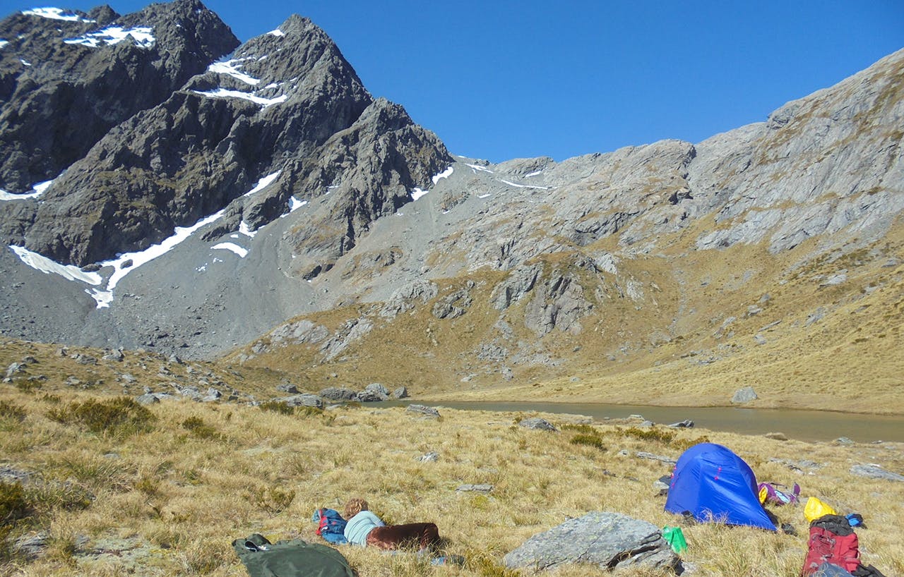
The entrance to the valley drops steeply away and a magical lake with a vertical moss-covered rock garden slowly dripping into it lies beneath the pass.
With no more cairns for guidance, pick a solid route over the pass to the tarn.
Keep your eyes on the map to stay on a safe decent, which with any luck will lead to a perfect campsite beside a the tarn.
Carry on down the open sweep of Death Valley; cairns begin to appear just before the bushline, above the rather decrepit Kay Creek Hut.
From there it is back to a well-marked track down the forested Kay Creek, crossing the creek a few times, then on to the comparative highway of the Caples Track.
