


- Distance
- 9.07km
- Total Ascent
- 743m
- Time
- 5.5hr
- Grade
- Moderate
- Accom.
- Ashton Hut (free, four bunks)
- Access
- From Oreti Bridge on Mt Nicholas Rd, 50km from Mossburn
- GPX File
- Ashton Hut.Eyre Mountains (gpx, yo 17 KB)
- Your device does not support GPX files. Please try a different device.
A trip to Ashton Hut in the Eyre Mountains takes a bit of effort, but as such means it is rarely visited.
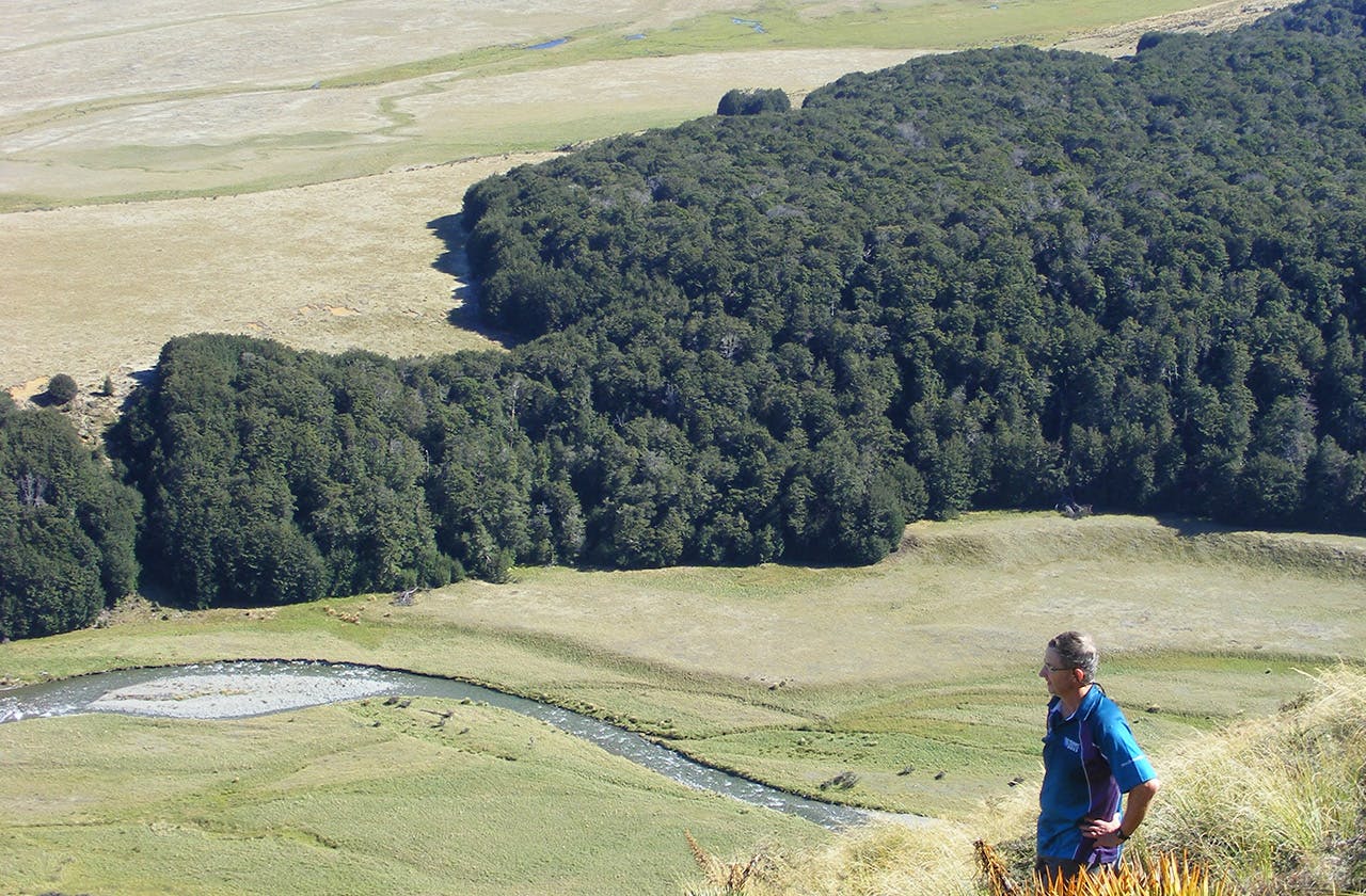
After a night camping at nearby South Mavora Lake, one could set off from the road bridge over the Oreti River. There’s a 4WD track down the broad valley, which after an hour leads to the crossing of the Ashton Burn.
Then, there’s 700m of an unrelenting, untracked grunt to climb the large ‘hill’ that is Pt1330.
There’s a controversial proposal for the Round the Mountains national cycleway to go down the stretch of the Oreti River below. The local council wants to route it down the river, taking it off-road after 40km on the dusty road from Lake Wakatipu. Fish and Game say doing that would ruin an internationally significant wilderness fishery. The Environment Court will decide if it goes ahead or not.
If the weather doesn’t put you off tackling the summit, you could sidle its northern aspect.
The descent into the next catchment is steep; finding a route into and out from Ashton Stream requires care.
A slither through a patch of beech leads to a comfortable crossing, and then a short climb out of the trees on the other side soon arrives at the hut.
Ashton Hut is a Forest Service four-bunk model, in good condition. The hut book, which is half full, dates back to 2001.
A few entries in the hut book mention heading out over a 1506m peak – essentially traversing the headwaters of the stream; a route that would involve a couple of extra hours of walking. The other option is to retrace your steps.
