


The Coppermine Trail (formerly known as the Dun Mountain cycle trail) traverses the route of New Zealand’s first railway.
New Zealand’s first railway, the Dun Mountain Railway, was built from Nelson to Coppermine Saddle in 1861.
The narrow gauge railway not only provided access to the chromite and copper in Nelson’s stark and barren mineral belt but also public transport from town to port. Mining only lasted until 1866 as returns didn’t match expenditure and the investors pulled the plug.
While the tracks and sleepers were lifted and recycled by 1872, much still remains – including a superbly-benched track, evocative cuttings, steep slopes with commanding views and plenty of rusty old relics amongst beautiful Nelson bush.
Brook Street to Third House
On Brook Street, the Dun Mountain Walkway starts opposite Number 130 – adjacent to a large interpretive sign that conveys the history of the trail. The track climbs gradually below a large forestry block where a myriad of short bike trails has been built in Codgers MTB Park. The main trail joins Tantragee Road and crosses Glenn Creek and Bullock Spur.
The track then curls around the forestry contours and into the regenerating native bush of Cummins Creek. Below Cummins Spur and along the base of Fringe Hill, the track remains shaded but is airy and light.
Cummins Spur eventually leads to Wairoa Saddle and Third House at 660m, where a two-storey stable once housed the horses used on the railway and as part of the mining operation. The clearing around Third House Shelter proves a sunny spot to refuel and enjoy the vista and wildlife, but, alas, no stable or railway relics remain.
Distance 10km Grade 2
Third House to Coppermine Saddle
From Third House, it’s back into the bush with the track rolling over some superb original embankments with walls of cleverly-stacked rock bridging gullies and slips, keeping the railway line on an even keel.
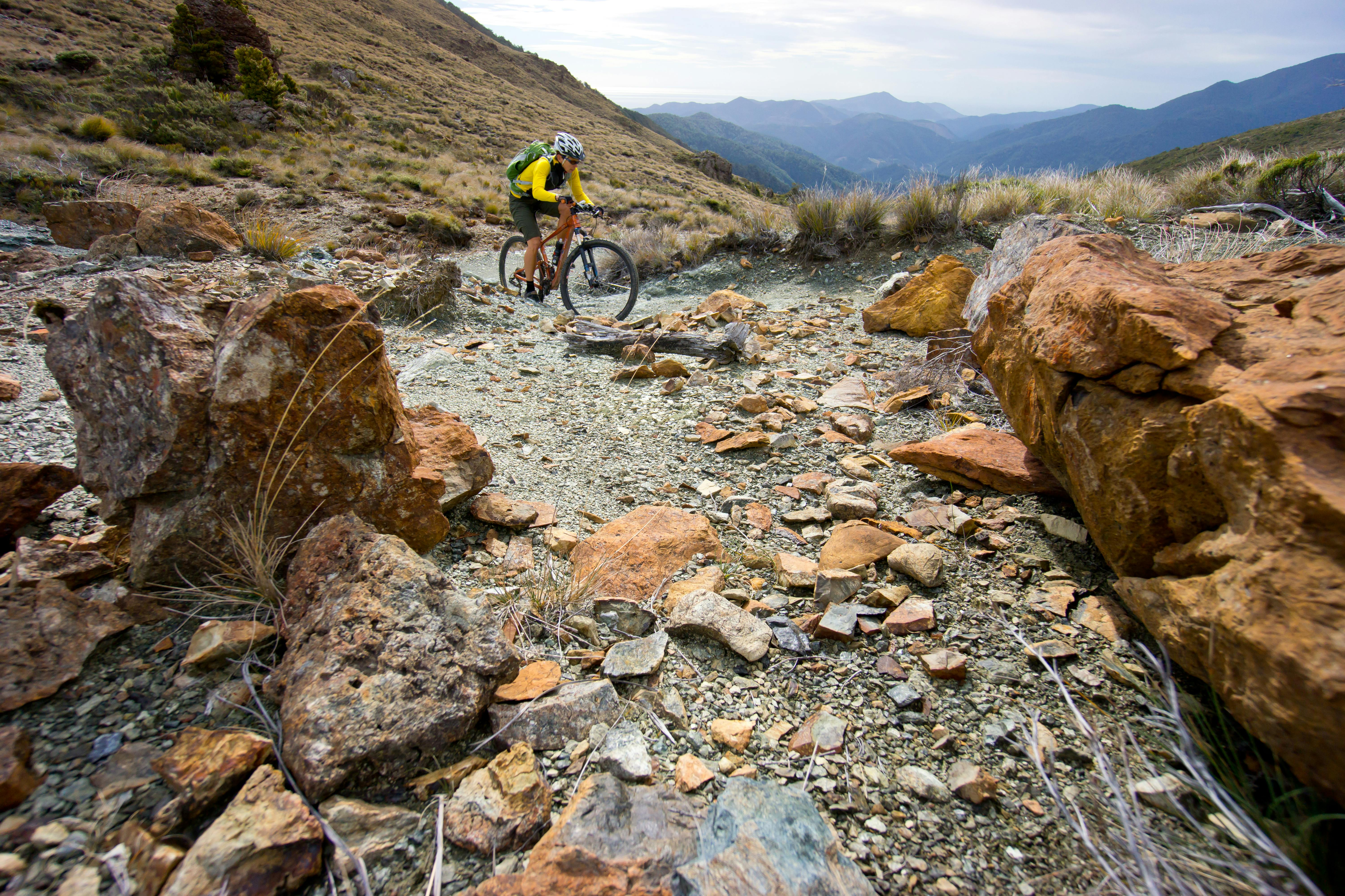
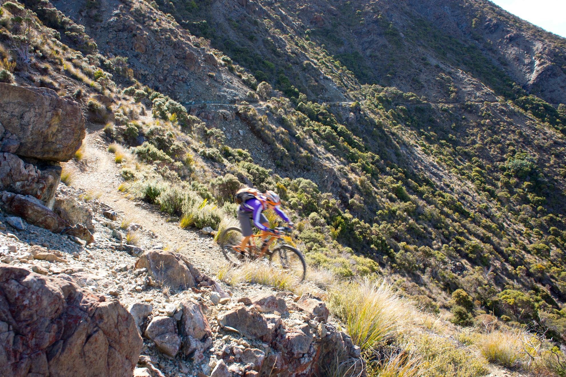
On the slopes below Wooded Peak, the landscape transforms from forest to stunted bush and then to bands of mineral rock. The track narrows somewhat and becomes a little steeper and rockier to boot.
Beyond Codes Creek, the trail enters the open Nelson mineral belt where the surrounding valleys and hills are devoid of anything other than ground-hugging plants. Remnants of the railway line appear here and there, embedded in the coarse shingle and rocky track surface, sleepers and short bits of track corroding into dust. Wind and water have accelerated this process.
At the 878m Coppermine Saddle, tailings are all that remain of the mining activity.
Here, excellent views across the Richmond Range and down the Maitai Valley are revealed. This is an ideal spot for lunch.
Distance 7km Grade 2+
Coppermine Saddle to Maitai Dam
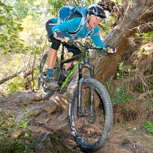
Put your downhill hat on and enjoy sweeping switchbacks as the trail descends the western ridge of Dun Mountain.
From the top of Windtrap Gully, the descent becomes rougher and rockier with a cascade of tight switchbacks down to the confluence of Windtrap Gully Creek and the Maitai River South Branch. As the gradient levels, leaf-litter singletrack rolls endlessly below a high canopy of beech and rimu before eventually bottoming out on an old forestry road near Beecham Creek.
At the lower Maitai River ford, head along the pipeline single-track to a point opposite the bottom of the Maitai Dam.
Distance 10km Grade 3
Maitai Dam to Brook Street
Climb onto the trail parallel to Nelson’s water pipeline. It winds its way down a benched track sandwiched between the large concrete pipe and a steep slope on the true left of the Maitai River. Where the pipeline ends, the trail continues around the ridge and through a stand of regenerating bush to eventually join the Maitai Valley Road.
Just after the Maitai Reserve Camp, a forestry road climbs to Tantragee Saddle to close the loop. Or you could cruise into Nelson East and back up Brook Street, stopping for ice-cream at one of the corner dairies.
Distance 10km Grade 2-3
- Distance
- 33km
- Total Ascent
- 2680m
- Grade
- Moderate
- Time
- 4-5 hours
- Access
- Brook Street, Nelson
- Map
- BQ26
GPX File
- Dun Mountain Cycle trail (gpx, 20 KB)
GPX File
- Your device does not support GPX files. Please try a different device.
