


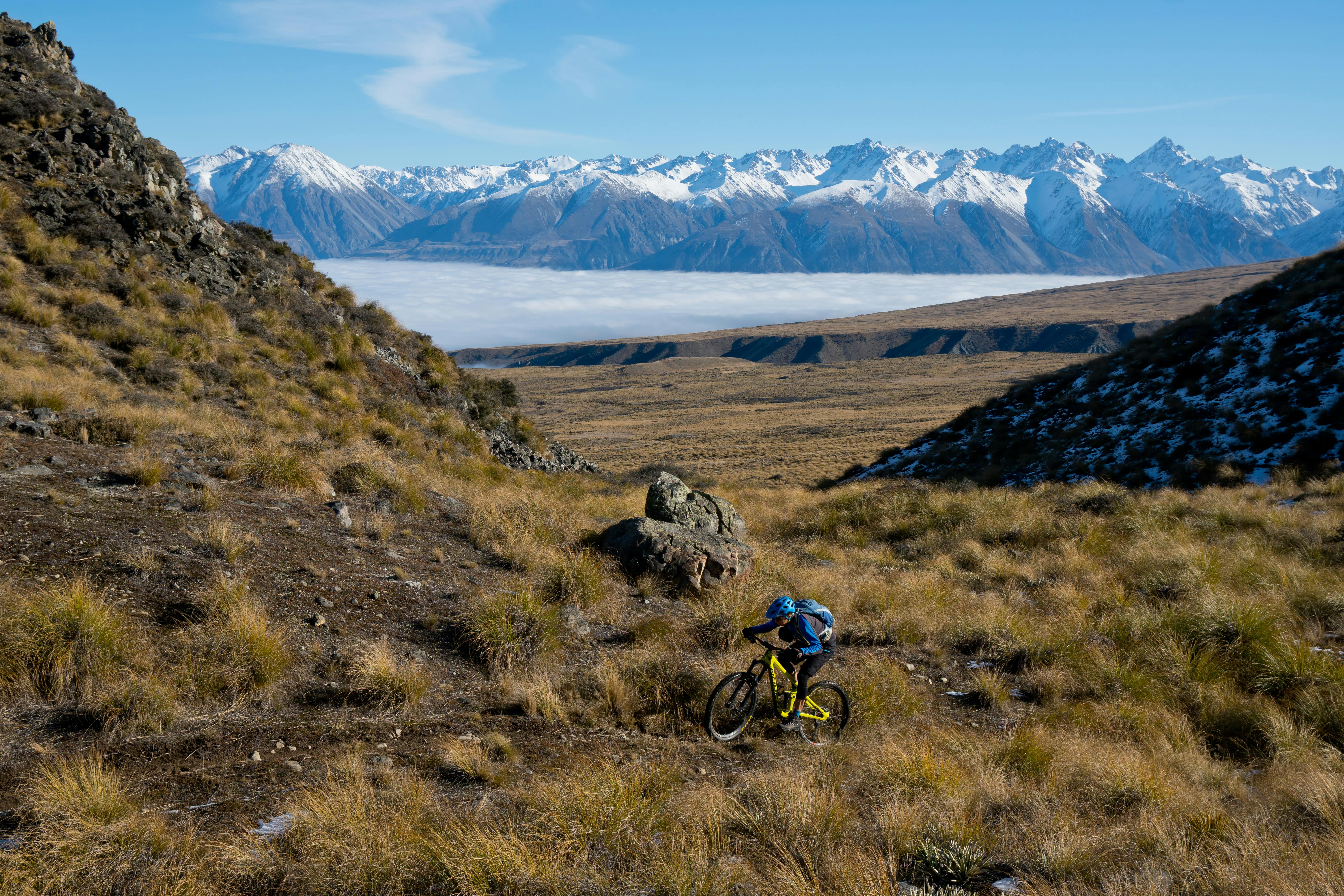
Hakatere Conservation Park offers an unrivalled network of river valley and tops tracks
Sandwiched between the headwaters of the Rakaia and Rangitata Rivers, Hakatere Conservation Park is a vast area of open tussock country, rolling foothills, mountains, rivers and lakes below the stunning snow-capped Arrowsmith, Sibbald, Two Thumb, Old Man, Taylor and Palmer ranges. It’s centred around the historic settlement of Hakatere at the crossroads to Lakes Clearwater and Lake Heron.
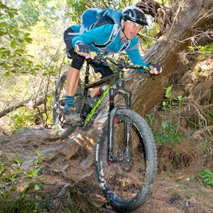
Old farm 4WD tracks and single track connect a long list of lakes and tarns in the river valleys and along the open tops, creating a network with endless possibilities for both trampers and mountain bikers.
For those visiting for a weekend of adventure, there is good camping adjacent to Lake Clearwater settlement, at Lake Camp and beside Lake Heron.
Lake Emma loop
This ride is suitable for all ages and abilities. From Lake Camp’s south-east corner, follow a marked trail that crosses Balmacaan Stream and heads to the base of Mt Harper/Mahaanui. For those wanting a challenging diversion, a rough sidetrack climbs to just short of Balmacaan Saddle.
It’s a short walk from there to the saddle which offers excellent views across the Rangitata River to Mesopotamia and Ben McLeod stations and the massive Two Thumb Range.
To carry on around Lake Emma, follow the 4WD track to the southern edge and the historic Lake Emma Hut, built in the late 1800s. The track then circumnavigates Lake Emma, peeling off to Lake Roundabout and on to the Hakatere Potts Road for a 3km return ride back to Camp.
Distance 15km Time 2hr Grade One (Balmacaan Saddle, three)
(Download the route notes and maps for the Lake Emma Loop)
Around Lake Clearwater
Opposite the north-east entrance to Lake Camp, a single gate directly accesses the eastern end of Lake Clearwater. After crossing Lambies Stream, a 4WD track roams west along a series of convoluted terraces and stream fords with excellent views up and down the lake. At the far end of the lake, cross a substantial wetland on boardwalk before heading back to the Lake Clearwater settlement on excellent singletrack.
Distance 11km Time 1.5-2hr Grade Two
(Download the route notes and maps for the Around Lake Clearwater trip)
Mystery Lake Track
The Mystery Lake Track begins from the wetlands at the western end of Lake Clearwater and heads towards the Potts River, where it climbs steeply up its high eastern terrace. It crosses the 1100m contour just below the Dogs Range and sidles east towards Mystery Lake.
The lake is well hidden and only reveals itself at the last moment. It’s worth the effort – the lake is one of the most beautiful places in the park.
From the lake, follow the poled route and rollercoaster fenceline descent to a small tarn between Pt945 and Mt Guy. An amazing switchback descent starts from this tarn and links up with the Lake Clearwater Circuit Track for more downhill and singletrack to Lake Clearwater.
Distance 27km Time 3-4hr Grade Three
(Download the route notes and maps for the Mystery Lake Track)
Paddle Hill Creek and Boundary Hut
A short distance from Haketere on the road to Lake Heron, a 4WD track heads up a vast river terrace to eventually ford Paddle Hill Creek. The track sneaks between Mt Guy and the Dogs Range and then follows the creek all the way to a low saddle, which overlooks the South Ashburton River.
There is a clay descent to the six-bunk Boundary Creek Hut, which is tucked nicely into a sheltered spot beside Boundary Creek and provides a great place for lunch.
Distance 24km return Time 2-3hr Grade Two
Potts Hut Track
A gnarly extension to the trip to Boundary Creek Hut is to climb to the Dogs Range from the hut on the Potts Hut Track. Ride north along the undulating track to a series of zigzags to descend to the large tarn that is the source of Boundary Creek.
A final rocky descent ends at the doorstep of the very historic eight-bunk Potts Hut (built before 1899) perched above the energetic Potts River. The return ride is especially challenging and rewarding. A good option is to stay the night.
Distance 32km return Time 5-6hr Grade Four
(Download the route notes and maps for the Potts Hut Track)
Lake Heron to Barrosa Station
From the parking area at the south end of Lake Heron, a 4WD track leads around the bottom of the lake and up terraces between the Mellish and Swin Streams. The track then heads south across a rough wide shingle fan and squeezes between the Mt Somers and Longman ranges.
The track drops down to Seagull Lake before climbing up and over Finger Stream to Manuka Lake. A short side trip up the Stour River reveals the six bunk Manuka Hut, a good spot for lunch.
Now beneath the Manuka Range, the track fords the Stour River and leads down a tight valley to vast open tussock flats.
The track picks up speed, fording and re-fording the west branch of the Stour River. It turns south hugging the true right bank of the Stour below rocky cliffs and gullies of native broadleaf, manuka and the odd patch of beech forest. A final section of flowing trail leads to the car park adjacent to the Ashburton Gorge Road.
Distance 32km Time 4-5hr Grade Two-three
(Download the route notes and maps for the Lake Heron to Barrosa Station trip)
