


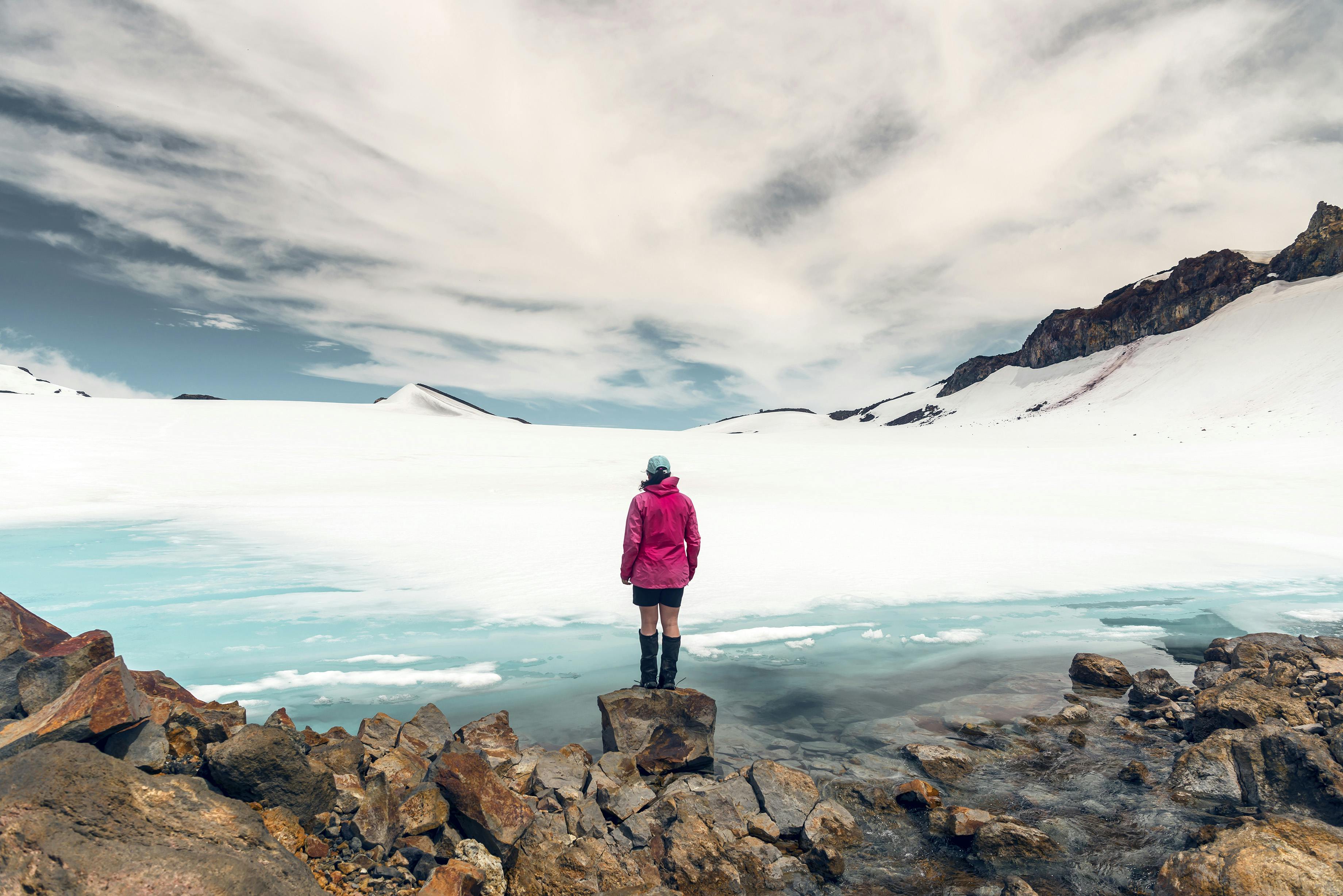

Hazel Phillips stands on the shore of a meltwater lake high on the slopes of Mt Ruapehu
Things I learned recently about Ruapehu: A plane crashed on the Mangatoetoenui Glacier in 1952, and took 31 years to reappear, 600m from its crash site; the aforementioned Mangatoetoenui Glacier used to be known as the Waikato Glacier, because it’s considered to be the highest beginnings of the Waikato River and one of its principal sources; and three, if you climb to the intersection of the Summit Plateau and the Mangatoetoenui Glacier in summer, you’ll have the chance to see a small meltwater lake, bright blue and mesmerising.
Local mountain guide and photographer Zhi Yuen Yap shared images of the lake on Instagram. “The hot summer so far has resulted in the early formation of this glacier meltwater lake on Mt Ruapehu,” he wrote. “At around 2600m above sea level, this is currently the highest headwater of the Waikato River. Thanks to the freeze-thaw cycles, there are numerous intricate ice formations, some of which are like the corals in the tropical seas.”
I had to see it for myself and brought along Wellington photographer Mike Heydon to help me properly document the day.
The weather for our chosen day was looking doable, and armed with cautions about potential sinkholes on the top of Ruapehu, we geared up with sharps and snacks, and headed up directly from the Manawatu Tramping and Skiing Club lodge on Whakapapa, where we had spent the night. The main part of the ski area was closed due to the installation of a new gondola, a piece of infrastructure that will apparently increase summer tourism. Or something involving ‘business-class luxury’ and wifi in the cabins, if you bother to read the press release.
The blue sky deceived us and a gusty wind was inconvenient, but not cold enough to turn us back. We cut a line up the skier’s right of the Amphitheatre, not crossing over the West Quad lift line, then scrambled up from the NZAC hut at Delta Corner straight onto Restful Ridge (the ridge that separates the Knoll T-bar area from the ‘west’ area of the ski field). Snow was only patchy until the upper parts of the ridge, but we didn’t need axe or crampons to ascend.
“We’re probably the highest people in the North Island right now,” Mike mused as we neared the top. But no: we saw one or two other stragglers higher up, just on the Whakapapa Glacier ridge, and later encountered two Dutch trekkers who embodied all the usual stereotypes of clueless tourists.
Arriving at the entrance to the Summit Plateau, we struck patches of ice and donned crampons. The residual snow patches were mixed, dirty, and not to be trusted, as every step encountered a different type of snowpack.
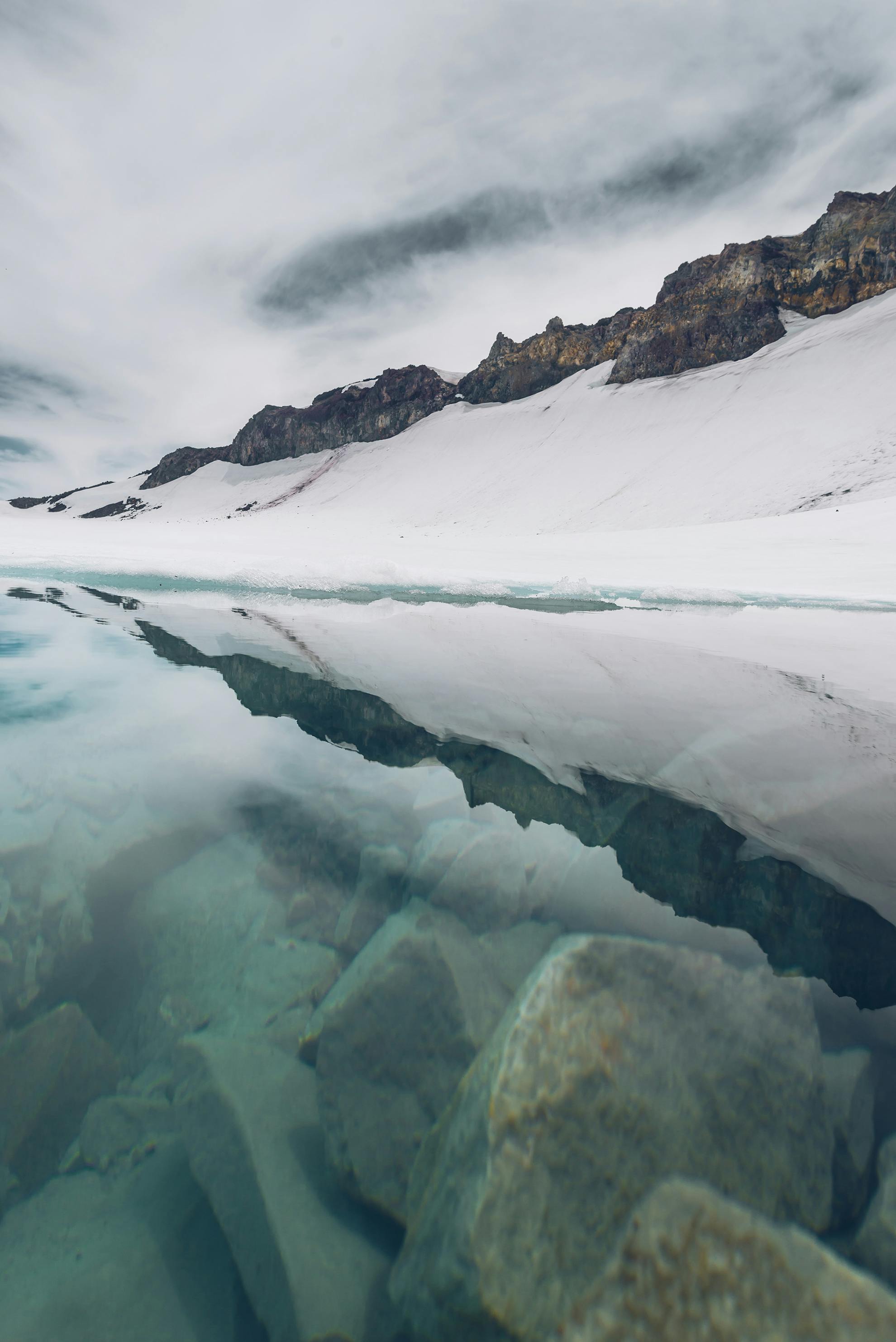
Striking out across the Summit Plateau, after a short section of plodding and gaining a contour line, suddenly a bright blue patch came into view. From the photos we’d seen on Instagram, the lake had looked substantial, and I’d seen similar snowmelt lakelets on Google Earth; however, this lake was miniature, not even big enough to swim in.
Mike took a plethora of photos at the lake, which we dubbed Lake Madness – but I’m sure we could find a much more suitable and mellifluous name in te reo – and we spent a good hour there, being astounded by it. Watching the meltwater tumble out of the ice and down the hill, snaking beneath the Mangatoetoenui Glacier, was mesmerising. It was hard to look away.
Zhi Yuen Yap later told us he had photographed it just in time. He went back shortly after our trip and deemed the lake to have shrunk in height by 80cm, simply by dint of the ice terraces having collapsed and melted. Another friend of mine went up a couple of days after my outing, and thanks to a day of snow/rain and low temperatures, the lake was almost completely frozen over again.
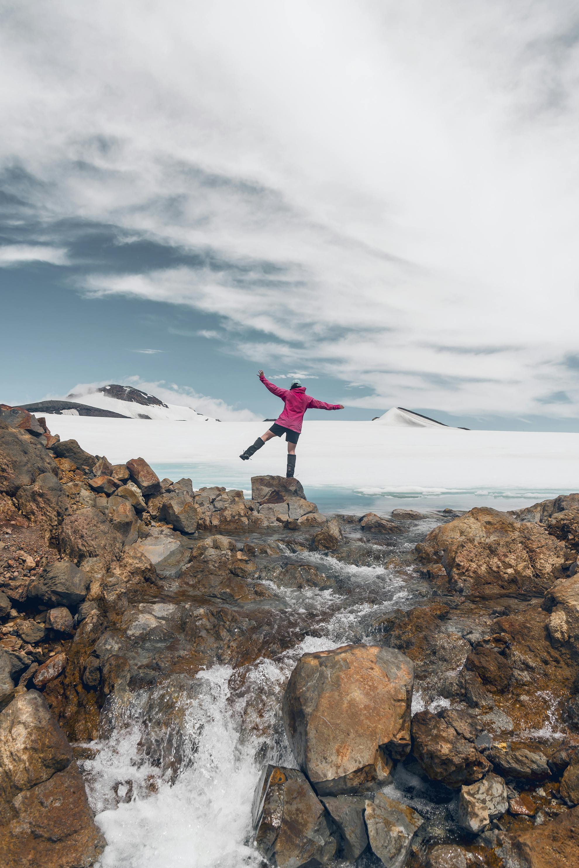
We eventually tore ourselves away from Lake Madness, recognising that clouds were coming in and the clock was marching on. We retraced our steps back across the Summit Plateau and half-slid, half-glissaded back down off
Restful Ridge and through the Gut near the Knoll T-bar. An abundance of rock fall, including several sizeable boulders, cautioned us to keep trucking, and mind as you go. The last part of our retreat involved crossing a tumbling stream down the Delta area near the NZAC hut, and picking up a well-worn track to descend on the skier’s right of the Amphitheatre, and back to MTSC lodge.
I spent most of that evening researching the Waikato Glacier. A piece on the Waikato River in the New Zealand Herald, in March 1928, really went to town on describing the river, including its high sources: ‘It is practically impossible to describe the Waikato in comprehensive terms. It must be dealt with in sections. First of all is that portion that flows between its primary sources and Lake Taupo. This is only a short section of between 30 and 40 miles, but how wonderful it is! On its left bank here rise three huge old volcanoes, Ruapehu, Ngauruhoe and Tongariro, and from their steep slopes tumble innumerable tributaries, some from the high snow fields.’
So, if the river’s source was recognised as coming from the glacier as far back as 1928, is the melt lake a marker of climate change, or has it simply been a regular feature for some time? Just as Zhi Yuen Yap visited it several times and has tracked it over time, even back in the 1950s locals were keeping a close eye on ablation on Ruapehu’s snow fields. Whanganui man Mr L. O. Krenek wrote in 1955: ‘The glaciers of Ruapehu are simply collapsing. Hundreds of crevasses have opened up and the area is so badly crevassed that it is difficult to find a route to the Crater Lake. I have never seen anything like it. I really think the development is quite unique, because it came so suddenly.’
Only time will tell. I’m intending to track it myself – not only is it interesting, it’s also excellent exercise ascending 1000m to reach it. I’ll go back in late summer or early autumn this year to see what state it’s in.
‘The Mangatoetoenui Glacier is one of the highest, and most spectacular, sources of the [Waikato] River,’ wrote Sue Miles in the 1984 book The River: The Story of the Waikato. ‘Stand here, amid the snow and ice, looking out across the dark, treeless wasteland that stretches across to the edge of the distant Kaimanawa Ranges and it is not difficult to understand why the Māori regarded this land with awe and terror.’
