


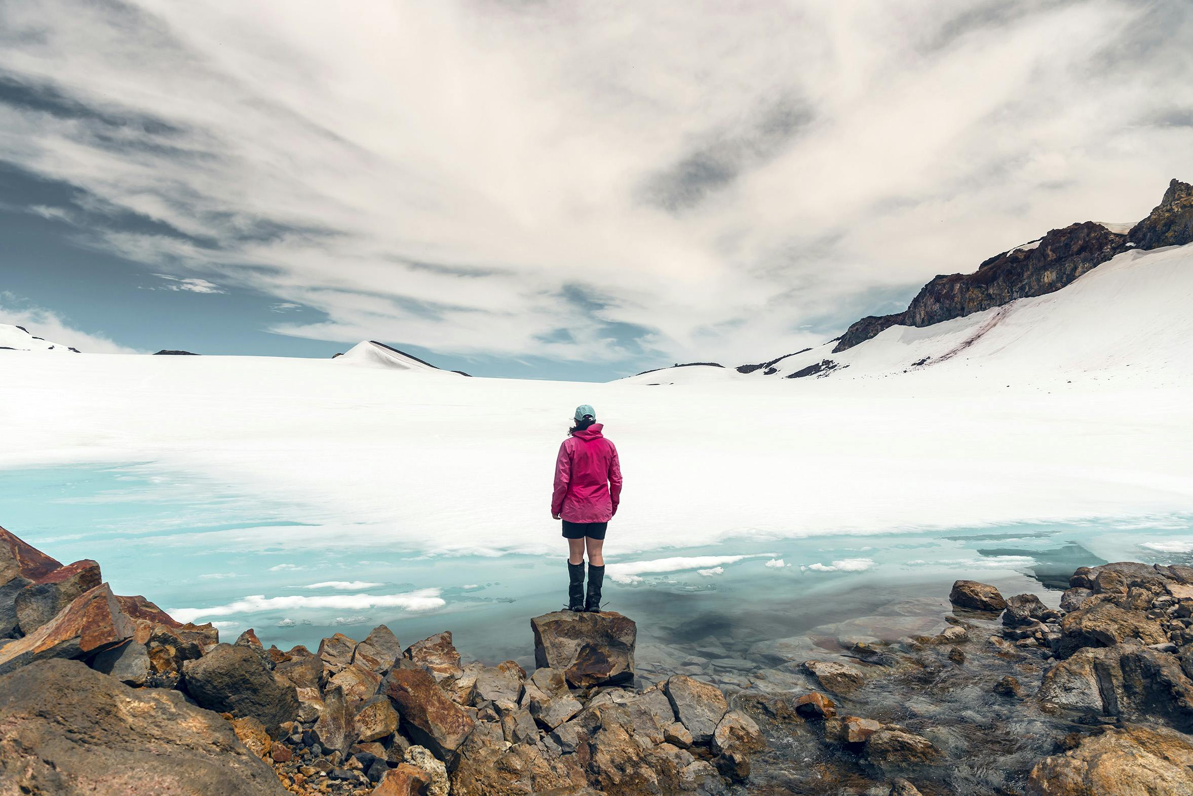

A meltwater lake at 2600m on Mt Ruapehu is a sign of a changing climate
A meltwater lake on Mt Ruapehu that usually appears in February has arrived early.
Local mountain guide and photographer Zhi Yap shared images of the lake on Instagram. “The hot summer so far has resulted in the early formation of this glacier meltwater lake on Mt Ruapehu,” he wrote. “At around 2600m above sea level, this is currently the highest headwater of the Waikato River. Thanks to the freeze-thaw cycles, there are numerous intricate ice formations, some of which are like the corals in the tropical seas.”
That prompted Wilderness contributor Hazel Phillips to set off to see the lake for herself with photographer Mike Heydon. The lake is found on the Mangatoetoenui Gklacier, on Ruapehu’s eastern side.
“Watching the meltwater tumble out of the ice and down the hill, snaking beneath the Mangatoetoenui Glacier, was mesmerising,” Phillips said. “It was hard to look away.”
Just a few days after Phillips and Heydon visited the lake, Zhi Yap returned and said it had shrunk in height by 80cm, simply by dint of the ice terraces having collapsed and melted. Another friend of Phillips’s went up a couple of days after her outing to find the lake almost completely frozen over again.
The full story about Mt Ruapehu’s meltwater lake aong with more photos will run in the March 2019 issue, due out on February 21.
