


Mt Heale Hut, Aotea Conservation Park
Lying 90km from Auckland as the kākā flies, Great Barrier Island/Aotea might seem like a logical destination for local trampers. But few venture there.
The main barrier to visiting seems to be that most North Island trampers think if they have to fly or boat to their destination, it may as well be to the South Island.
That’s a shame because Aotea boasts excellent birdlife (the island has never had possums or stoats), some fascinating history, good tracks and also this modern, comfortable hut.
Trampers can reach Mt Heale Hut on a variety of tracks, but the Palmer Track provides the best approach because it has the advantage of beginning at 320m on Aotea Road. The well-graded track soon leads to a boot-cleaning station (used to avoid spreading kauri dieback disease), then through the volcanic defile known as Windy Canyon.
Steadily climbing, the track passes through regenerating kauri forest, healing after the depredations of early 20th-century logging, before reaching the island’s only virgin kauri forest surrounding the summit of Hirakimata/Mt Hobson. Boardwalks protect the nesting sites for black petrels, and a viewing platform at the summit trig offers panoramic views over the island and expanse of the Hauraki Gulf. At 627m, it’s the island’s highest summit.
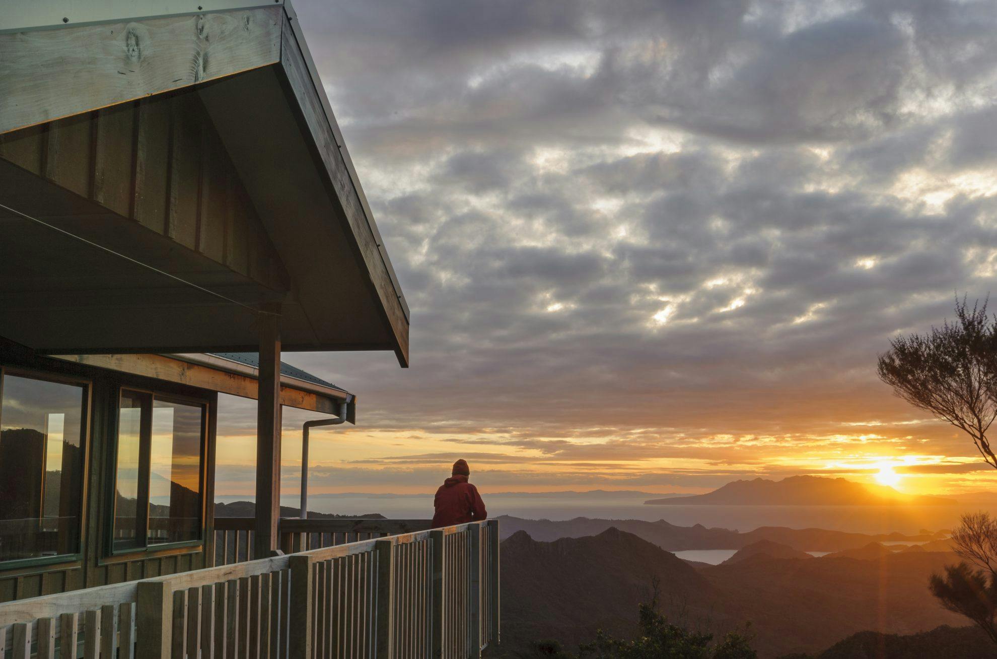
More stairs and boardwalks lead to Mt Heale Hut, passing its namesake rhyolitic spire. Built in 2010, the 28-bunk hut offers sensational sunset views to Te Hauturu-o-Toi/Little Barrier Island.
The Peach Tree Track offers an excellent way to finish your tramp, perhaps with a soak in the Kaitoke Hot Springs along the way.
- Distance
- 4.08km
- Total Ascent
- 486m
- Time
- Aotea Road to Mt Heale Hut, 3-3.5hr; to Whangaparapara Rd via Peach Tree and Kaitoke Hot Springs Tracks, 3.5-4hr
- Accom.
- Mt Heale Hut
- Access
- From Aotea Road. Regular flights from Auckland land at Claris. Ferry services operate to Port Fitzroy and Tryphena
- Map
- AY34
GPX File
- Mt Heale Hut via Palmers Track (gpx, 14 KB)
GPX File
- Your device does not support GPX files. Please try a different device.
