


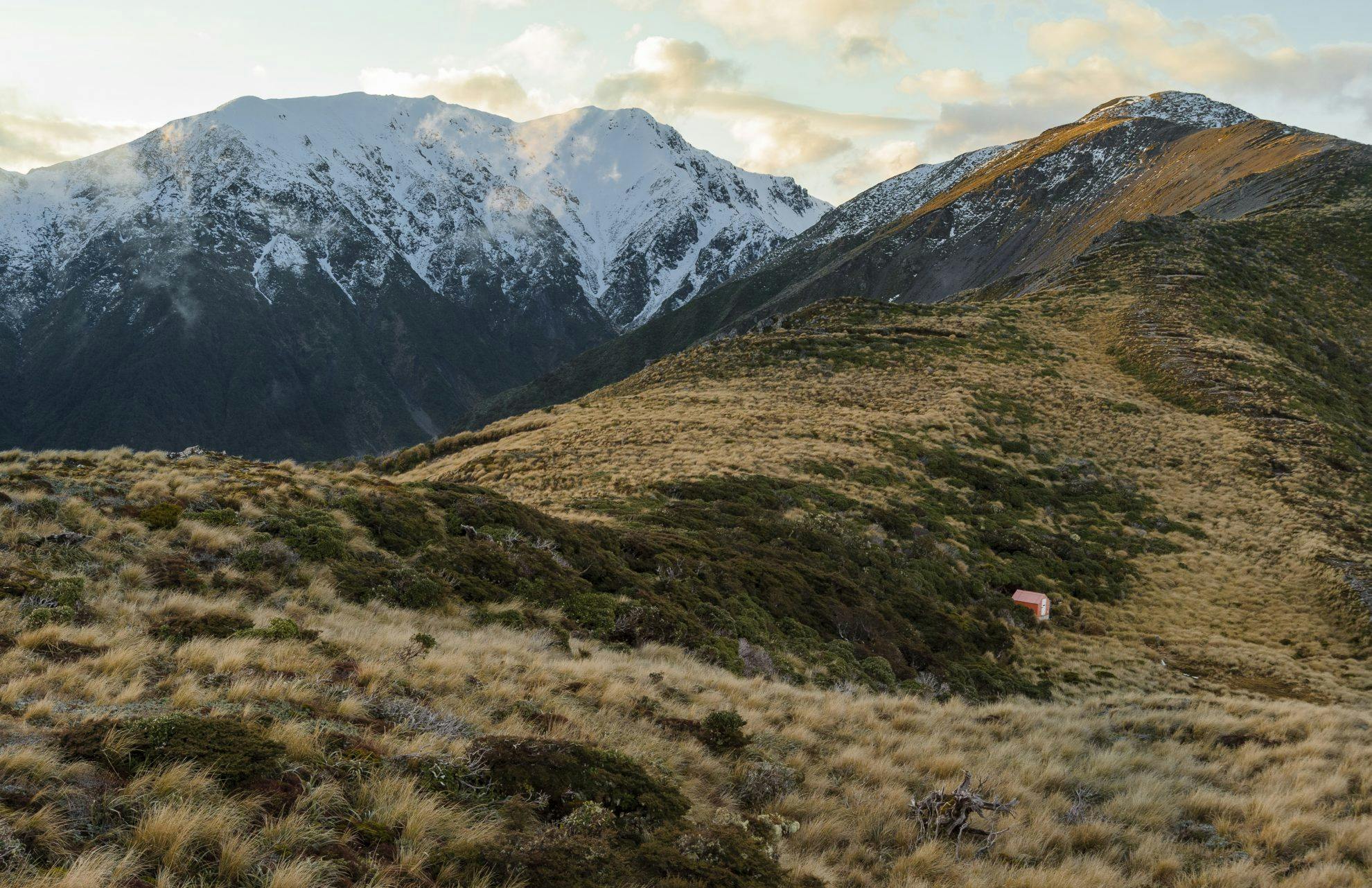

Tarn Bivouac, Ruahine Forest Park
By the time you’ve reached Tarn Bivouac, having either clambered up the cold, bouldery confines of the Tukituki River and Rosvalls Track, or traversed over the Sawtooth Ridge, you’ll probably be grateful for any sort of shelter – even a tiny two-bunk dogbox-style biv. The diminutive hut lies in a partially-sheltered dip on Black Ridge, a long spur that descends from its high point at Ohuinga (1686m).
The ridge crest above offers a grand profile of the notched Sawtooth Ridge to the west, and the shadowy headwaters of the Tukituki below, as well as the gentler foothills of Hawke’s Bay, lying crumpled to the east.
The bivouac takes its name from sizeable tarns located further along the ridge. It was built in 1960 by the Forest Service. Small but practical, these bivouacs form an important part of our backcountry hut heritage and continue to provide shelter more than a half-century after they were originally constructed for deer cullers. The bivouac originally had no toilet, but DOC later installed an open-air thunderbox, which, while providing little privacy, offers excellent ventilation.
Tarn Bivouac from Mill Road:
Tarn Bivouac via Daphne Hut:
- Distance
- 6.38km from Mill Road, 9.1km from Kashmir Road
- Total Ascent
- 995m from Mill Road, 1342m from Kashmir Road
- Grade
- Moderate / Difficult
- Time
- Mill Road to Tarn Bivouac, 4hr; From Kashmir Road, 4-5hr
- Accom.
- arn Bivouac (free, two bunks); Daphne Hut ($5, 12 bunks)
- Access
- From Mill Road, public access across farmland leads to the Tukituki River, which is followed upstream to Rosvalls Track. From Kashmir Road, a track leads to the Tukituki below Daphne Hut and Black Ridge
- Map
- BL36
- Links/Files
-
